
Where Flight Simulation Enthusiasts Gather from Around the World!
AVSIM Library - Search Results

| Category: Flight Simulator 2004 - Scenery | |
| Indian Creek Farm Field CF07 near Ottawa in Ontario, Canada |

|
Images related to this file:
File Description:
Indian Creek farm field (Re-upload WITH THE MISSING TEXTURES!) is in Ontario and southeast of Ottawa, less than two miles east of two other real-life farm fields I have already posted (Russell Farm, and Russellette Strip). The creek is just north of the runway in the trees, though it doesn't show in FS with or without Ultimate Terrain.
There is a grass runway 08/26 that is 2,100 feet long and has lights; the grass could be better (I mean there could be more of it) but the drainage is good. There is a large hangar that is right by the house and is heated (wow!); this is for the owner. There are also eight other hangars which are slightly basic and without doors, which means boxes over the wheels so the tires don't get chewed by the wild life and canvas hangar fronts for the winter. All the hangar buildings are modeled specifically for this scenery. The runway has been there for 22 years, and before that (though with a large gap between) there was a military grass strip as a relief field for nearby Pendleton .
| Filename: | Indian_Creek_Farm_Field_CF07_near_Ottawa_in_Ontari.zip |
| License: | Freeware, limited distribution |
| Added: | 8th February 2010, 09:45:16 |
| Downloads: | 443 |
| Author: | Roger Wensley |
| Size: | 11.35 MB |
| Category: Flight Simulator 2004 - Scenery | |
| Los Angeles VTerminal (KLAX) 2009 V2 |
|
File Description:
UPDATE: After reports of people not getting the complete file, I have re-uploaded it. The problem was my program that I was using to zip the file. I have since changed programs and fixed the problem. Sorry for the inconvenience.
The LAX Vterminal was originally released to a select few virtual airlines and can now be yours. These were West Express, Atlantic Sun, Empora Virtual, City Bird, Arizona Pacific, and Family Virtual Airlines. The terminal contains three concourses, forty-three (43) gates, and eight overflow parking spots. Parking assignments have not been assigned to any of the gates, so you will need to go through and do so. The terminal was created by Michael Wood and Nick O'Dell. It was designed to fit the needs of virtual airlines, in order to return parking spots in the main terminal to their real world owners. This scenery is frame rate friendly, and will not take up a lot of space on your hard drive. Included in this file are AFCAD's for the default and OceanFlight scenery. Enjoy our scenery, and look for more scenery projects coming in the near future.
| Filename: | Los_Angeles_VTerminal_KLAX_2009_V2.zip |
| License: | Freeware, limited distribution |
| Added: | 16th March 2009, 11:13:46 |
| Downloads: | 1,807 |
| Author: | Nick O'Dell, Michael Wood |
| Size: | 231.75 KB |
| Category: Flight Simulator 2004 - Scenery | |
| HEMM Mersa Matruh, Egypt |
|
File Description:
Googly scenery for HEMM Mersa Matruh - a large Air Base near the north coast of
Egypt. Marsa Matruh, as the town should be spelt, is a seaport 150 miles west of
Alexandria but its main function today is that of a holiday resort for the
residents of Cairo. It does not have an airport of its own, but uses a small
corner of the Air Base for civilian flights. Microsoft Flight Simulator has
made no provision for any traffic at this airport and this scenery seeks to
redress the situation.
Scheduled flights are operated by Egyptair Express using Embraer 170 jets,
but other airlines call here from time to time, such as Air Sinai and Midwest
Airlines.
The scenery does not purport to be ultra-accurate. Based on high quality
satellite imagery from Google Earth, the layout is proportionally correct but the
added airport features, such as buildings, are built from default Microsoft objects
and add-on libraries so will not look exactly like the real thing.
You are not obliged to download and install any additional scenery libraries,
but to enjoy this scenery in its entirety, you may wish to. It will work fine,
with or without.
| Filename: | HEMM_Mersa_Matruh_Egypt.zip |
| License: | Freeware |
| Added: | 18th February 2008, 17:32:10 |
| Downloads: | 1,993 |
| Author: | John Hinson |
| Size: | 114.6 KB |
| Category: Flight Simulator 2004 - Scenery | |
| FNGI N'giva/Ondjiva Pereira, Angola |
|
File Description:
Googly scenery for N'giva - Ondjiva Pereira (ICAO: FNGI, IATA: NGV), an airport
serving Ondjiva, one of Angola's larger cities. Until relatively recently it
possessed little more than a dirt runway but recent expansion has seen the
commissioning of a longer asphalt runway and a terminal area. Today, the airport
sees passenger and cargo flights from airlines such as Air Gemini, Angola
Airlines, Savanair and Sonair utilising a variety of aircraft from the little
Let 410 turboprop through to Boeing 737 jets.
Microsoft have only provided the dirt runway at this airport in Flight Simulator
2004 and this scenery seeks to redress the situation so that you and your
"AI" traffic can use the airport realistically.
The scenery does not purport to be ultra-accurate. Based on high quality
satellite imagery from Google Earth, the layout is proportionally correct but the
added airport features, such as buildings, are built from default Microsoft objects
and add-on libraries so will not look exactly like the real thing.
You are not obliged to download and install any additional scenery libraries,
but to enjoy this scenery in its entirety, you may wish to. It will work fine,
with or without.
| Filename: | FNGI_NgivaOndjiva_Pereira_Angola.zip |
| License: | Freeware |
| Added: | 15th October 2008, 12:40:17 |
| Downloads: | 1,610 |
| Author: | John Hinson |
| Size: | 73.94 KB |
| Category: Flight Simulator 2004 - Scenery | |
| CYCQ - Chetwynd - British Columbia, Canada |
|
Images related to this file:
File Description:
The town of Chetwynd (population around 2,600) is on the east side of the Rocky Mountains, the first town to be encountered when descending from the Rockies on highway 97. Previously known as Little Prairie, the town name was changed in 1962. The main occupations of the town are linked to forestry, fossil fuels, and transportation; there are railway lines north to Fort St John, east to Dawson Creek, and south to Prince George. The airport is on the southern side of the town, with one runway aligned 05-23, asphalted in 1975 and just under 4,500 feet long. There are no scheduled services, although a new terminal building was constructed in 2008, and the helicopter operations by at least two companies (oil and gas and medical evacuation flights) are the primary operations from the field. These are included in the AI, incorporating helicopter modifications made by Holger Sandmann so that they function properly as AI at an airfield. As an aside, landing like a plane and using the runway and taxiways is in fact exactly what a helicopter does at a normal airfield in real life; everyone does the same thing so that guessing is unneccesary.
| Filename: | CYCQ__Chetwynd__British_Columbia_Canada.zip |
| License: | Freeware, limited distribution |
| Added: | 28th March 2016, 21:36:33 |
| Downloads: | 301 |
| Author: | Roger Wensley |
| Size: | 18.84 MB |
| Category: Flight Simulator 2004 - Scenery | |
| Mackenzie River close to Tulita CZFN in Northwest Territories Canada |
|
Images related to this file:
File Description:
I discovered, while testing another airfield near the Mackenzie River, that along the side of the Mackenzie adjacent to Tulita, and for a considerable distance, there was a cliff of water. I have no idea if my version of Ultimate Terrain has developed a fault or if this has been caused by the installation of a terrain mesh that now argues with UT for some unknown reason. Whatever, it was impossible to leave it as it was. I have included a screenshot of the cliff further upstream. To avoid the cliff of water I have flattened that area of the Mackenzie River and the adjacent river banks and both the town and the airfield to a height above sea level of 400 feet. This does not reflect the real life situation but is the lesser of two optical evils. I have included a screenshot of the flattened area. If you do not have a problem then you do not need this. If you too have a cliff of water then you might want to try this. It does not completely get rid of the problem, but it does get rid of it in the area visible when landing or taking off at Tulita.
| Filename: | Mackenzie_River_close_to_Tulita_CZFN_in_Northwest_.zip |
| License: | Freeware, limited distribution |
| Added: | 1st August 2021, 22:27:01 |
| Downloads: | 75 |
| Author: | Roger Wensley |
| Size: | 573.48 KB |
| Category: Flight Simulator 2004 - Scenery | |
| SSJA Joaçaba, Brazil |
|
Images related to this file:
File Description:
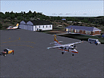
Googly scenery for SSJA Joaçaba - a small domestic airport
in the state of Santa Caterina, Brazil, that is poorly provided for in Flight
Simulator 2004. These scenery files add taxiways, aprons, buildings and other
airport features, so that you and your "AI" traffic can land, taxi, park and
take off in a realistic manner.
The small but prosperous city of Joaçaba was originally established in 1917 as
Cruzeiro and later known as Limeira and Cruzeiro do Sol, but in 1943 adopted
the current name following the introduction of legislation prohibiting cities
in Brazil using the same name - not a bad idea really. Joaçaba has a high
quality medical centre serving the state of Santa Caterina and a renowned
university which both bring traffic to the airport which is served by mainly
by LET410 aircraft of local airline NHT Linhas Aéreas.
The scenery does not purport to be ultra-accurate. Based on high-detail satellite
imagery from Google Earth, the layout is proportionally correct but the added
airport features, such as buildings, are built from default Microsoft objects
and add-on libraries so will not look exactly like the real thing.
[File re-uploaded at request of AVSIM]
| Filename: | SSJA_Joaccedilaba_Brazil.zip |
| License: | Freeware |
| Added: | 14th May 2010, 04:47:22 |
| Downloads: | 1,263 |
| Author: | John Hinson |
| Size: | 65.83 KB |
| Category: Flight Simulator 2004 - Scenery | |
| HCMI Berbera, Somalia |
|
Images related to this file:
File Description:
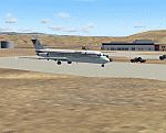
Googly scenery for HCMI Berbera, Somalia - an airport largely overlooked in
Flight Simulator 2004 with just a runway and tower provided at what is actually
the country's largest airport. At one time it had two active runways and a
strong military presence but today activity is limited to occasional
civilian flights. These scenery files add taxiways, aprons, buildings and
other airport features (and remove the non-existent tower that Microsoft
put there) so that you and your "AI" traffic can land, taxi, park and take
off in a realistic manner. This desert-surrounded airport is served three times per week by Douglas DC-9 jets of Kenyan airline African Express Airways.
The scenery does not purport to be ultra-accurate. Based on high-detail satellite
imagery from Google Earth, the layout is proportionally correct but the added
airport features, such as buildings, are built from default Microsoft objects
and add-on libraries so will not look like the real thing.
You are not obliged to download and install any additional scenery libraries,
but to enjoy this scenery in its entirety, you may wish to. It will work fine,
with or without. [File re-uploaded at request of AVSIM]
| Filename: | HCMI_Berbera_Somalia.zip |
| License: | Freeware |
| Added: | 29th May 2010, 09:26:33 |
| Downloads: | 1,317 |
| Author: | John Hinson |
| Size: | 62.07 KB |
| Category: Flight Simulator 2004 - Scenery | |
| Lac des Plages grass strip in Quebec Canada |
|
Images related to this file:
File Description:
Lac des Plages is in Quebec on the north shore of the lake (and village) of the same name, some 55 miles northeast of Ottawa. It is an old grass strip and next to a tourist trailer park ("caravan" to the English). The runway is almost north-south and 2,200 feet long, and I went there to see if it is still in use. It is in good condition but there was nobody to ask (in early April) if it is still used and nobody turned up see if a plane had landed. I doubt if it is used regularly as there are no "wear" marks that show up on a grass strip, and the flare pots (actually old wheel rims with charcoal in them?) beside the runway could have been lit three months ago or three years ago, there was no way to tell. The single hangar is obviously no longer in use as a hangar, and the lack of a fence between the trailers and the grass strip would be a danger to pilot and strolling pedestrian alike. However, the runway still exists and here it is and as in real life the northern end slopes unevenly up.
| Filename: | Lac_des_Plages_grass_strip_in_Quebec_Canada.zip |
| License: | Freeware, limited distribution |
| Added: | 10th May 2010, 16:03:42 |
| Downloads: | 284 |
| Author: | Roger Wensley |
| Size: | 1.33 MB |
| Category: Flight Simulator 2004 - Scenery | |
| WIKD/WIOD Tanjung Pandan/Buluh Tumbang/H.A.S. Hanandjoeddin, Indonesia |
|
File Description:
Googly scenery for WIKD/WIOD Tanjung Pandan/Buluh Tumbang/H.A.S. Hanandjoeddin,
Indonesia, based on Google Earth satellite data. It is a small domestic airport
serving the island of Belitung, located about 17 miles from the main town of the
island - Tandjungpandan. The island produces mainly tin and pepper but there are
some beaches that are generating tourist traffic too.
Flight Simulator 2004 has made no provision for any traffic at this airport and
this scenery seeks to redress the situation. The airport sees daily scheduled
traffic operated by Batavia Air and Sriwijaya Air.
The scenery does not purport to be ultra-accurate. Based on poor quality
satellite imagery from Google Earth, the layout is proportionally correct but the
added airport features, such as buildings, are built from default Microsoft objects
and add-on libraries so will not look exactly like the real thing.
You are not obliged to download and install any additional scenery libraries,
but to enjoy this scenery in its entirety, you may wish to. It will work fine,
with or without.
The ICAO code for this airport has recently changed from WIKD to WIOD. The included
files allow you to either retain the old code or optionally change the airport to
use the new one.
| Filename: | WIKDWIOD_Tanjung_PandanBuluh_TumbangHAS_Hanandjoed.zip |
| License: | Freeware |
| Added: | 22nd February 2008, 09:19:27 |
| Downloads: | 1,774 |
| Author: | John Hinson |
| Size: | 64.96 KB |


© 2001-2026 AVSIM Online
All Rights Reserved
Privacy Policy |