
Where Flight Simulation Enthusiasts Gather from Around the World!
AVSIM Library - Search Results

| Category: Flight Simulator 2004 - Scenery | |
| Mesa Verde National Park, Cortez (KCEZ), Colorado, Photo-Scenery (FS9 & FSX) |

|
Images related to this file:
File Description:
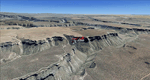
Mesa Verde National Park is famed for its numerous ruins of cliff dwellings built in the 12th century by ancient Pueblo people called Anasazi. Cliff dwellings are highly defensible stone villages situated under alcoves (rock overhangs) along the canyon walls. The largest cliff dwelling in the park is Cliff Palace, which is the largest cliff dwelling in North America. Cliff Palace contained 150 rooms and housed approximately 100 people. Unfortunately you won't see the cliff dwellings from the air, because they are under the cliffs but you will see everything else like all roads, trails and facilities. Very little is known about the Anasazis and the reason for their sudden departure at the end of the 13th century remains a mystery. Theories range from crop failures due to droughts to an intrusion of foreign tribes from the North. The name "Mesa Verde" stems from Spanish explorers seeking for a route from Sante Fe to California. They named the region Mesa Verde (spanish for green table) because of its high, tree-covered plateaus. High resolution versions of this scenery for FS9 and FSX (much sharper, but larger and multiple downloads)
are available at www.blueskyscenery.com/GNB_West2.html . The screenies are taken from the high-res versions, so expect this version to be slightly more blurry. Thanks to Joop Mak for providing custom AFCADs that correct airport layouts so that they align with the photo-textures! They are available at www.blueskyscenery.com/AFCADs.html . YourDonation@Work: Dedicated to David.
| Filename: | Mesa_Verde_National_Park_Cortez_KCEZ_Colorado_Phot.zip |
| License: | Freeware, limited distribution |
| Added: | 1st May 2010, 03:55:31 |
| Downloads: | 1,469 |
| Author: | Gottfried Razek - blueskyscenery.com |
| Size: | 92.87 MB |
| Category: Flight Simulator 2004 - Scenery | |
| St. George (KSGU) / Mesquite (67L), Utah/Nevada, Photo-Scenery (FS9 & FSX) |
|
Images related to this file:
File Description:
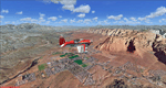
Covers the area between St. George, Utah and Mesquite, Nevada. To the north of St. George
the Pine Valley Mountains with their foothills of scenic red sandstone loom over the city.
St. George Municipal Airport (KSGU) is mostly used for general aviation but is also served by SkyWest Airlines
on behalf of Delta Connection. Because of it's location on a mesa this airport can't be expanded and so a new
airport is currently being built southeast of the city at the site of an abandoned airfield. The opening
is expected in 2011. To the south of the city make sure, you don't miss the Virgin River Gorge where the
Virgin River winds thru a long winding canyon in the transition zone between the red rocks of southern Utahs
Colorado Plateau and Nevadas Mojave Desert. Shortly afterwards you reach Mesquite which is situated just
west of the Arizona stateline. Like nearly all Nevada cities near the stateline Mesquite is home to several
Casinos. Mesquite Airport (67L) lies just north of the city.
High resolution versions of this scenery for FS9 and FSX (much sharper, but larger and multiple downloads)
are available at www.blueskyscenery.com/CNY_South3West6.html . The screenies are taken from the high-res versions,
so expect this version to be slightly more blurry. Thanks to Joop Mak for providing custom AFCADs that
correct airport layouts so that they align with the photo-textures! They are available at www.blueskyscenery.com/AFCADs.html .
YourDonation@Work: Dedicated to Werner, Ralf-Peter and Nels.
| Filename: | St_George_KSGU__Mesquite_67L_UtahNevada_PhotoScene.zip |
| License: | Freeware, limited distribution |
| Added: | 24th March 2010, 19:41:43 |
| Downloads: | 1,656 |
| Author: | Gottfried Razek - blueskyscenery.com |
| Size: | 95.58 MB |
| Category: Flight Simulator 2004 - Scenery | |
| Canyonlands National Park South, Monticello (U43), Utah, Photo-Scenery (FSX too) |
|
Images related to this file:
File Description:
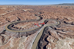
This scenery covers the southern part of Canyonlands National Park (Needles District) in Utah. The colorful layers of sand- and limestone that you can see today built over hundreds of millions years by advancing and retreating oceans as well as rivers that deposited huge amounts of sediment. About 15 million years ago these layers began to rise due to a colliding movement of plates in the earth's crust, forming what is today called the Colorado Plateau. As the land rose higher, erosion accelerated, resulting in countless canyons, mesas and buttes. The uplifting land caused the rivers to carve in even faster, resulting in the deep canyons of the Colorado and Green Rivers. The needles and fins in the Needles District have yet another story: First uplifts and later slides created a system of perpendicular cracks. Then he resulting crosshatched pattern of "joints" widened by erosion until only thin fins and needles of rock remained. The scenery extends my Arches National Park scenery to the south and brings you another 3.500 sq km in 4.7m/pix quality. To explore the scenery depart from Monticello (U43) and head north. YourDonation@Work: Dedicated to Nels, David and Michael. Thanks!
| Filename: | Canyonlands_National_Park_South_Monticello_U43_Uta.zip |
| License: | Freeware, limited distribution |
| Added: | 30th December 2009, 21:44:56 |
| Downloads: | 1,528 |
| Author: | Gottfried Razek - blueskyscenery.com |
| Size: | 95.76 MB |
| Category: Flight Simulator 2004 - Scenery | |
| Canyonlands National Park, The Maze-North, Utah, Photo-Scenery (FSX too) |
|
Images related to this file:
File Description:
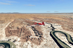
This is a re-upload of a package that was corrupted during the crash of the AVSIM library. The Maze is the wildest and least accessible district of Canyonlands National Park. It is a perplexing jumble of canyons that has been described as a '30 sq miles puzzle in sandstone'. The Maze covers the area west of the Green River and north of the Colorado River. Getting to most locations requires multiple hours of 4WD road driving. Hiking trails usually require multi day backpack trips.
Too strenous? Let's go flying! Checking out the area from an eagles perspective is certainly a stunning experience. The colors are awesome and the landforms are of breathtaking beauty. The scenery extends my Arches National Park scenery to the west and brings you another 3.500 sq km in 4.7m/pix quality. YourDonation@Work: Dedicated to Frans, Francois and James. Thanks!
| Filename: | Canyonlands_National_Park_The_MazeNorth_Utah_Photo.zip |
| License: | Freeware, limited distribution |
| Added: | 31st December 2009, 11:01:39 |
| Downloads: | 2,373 |
| Author: | Gottfried Razek - blueskyscenery.com |
| Size: | 92.88 MB |
| Category: Flight Simulator 2004 - Scenery | |
| Canyonlands National Park, The Maze-South, Utah, Photo-Scenery (FSX too) |
|
Images related to this file:
File Description:
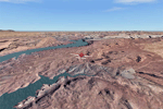
This is a re-upload of a package that was corrupted during the crash of the AVSIM library. This is the fourth package of the Arches/Canyonlands area. It covers the area southwest and including the confluence of the Colorado and Green Rivers. From there you can fly down Cataract Canyon which is famed for its premium whitewater rafting oportunities. Or explore the Maze (the area west of the Green and north of the Colorado River) with it's labyrinth of canyons and colorful sandstone formations. The scenery extends west to Hite (UT03) on Lake Powell. Brings the total Southern Utah coverage to 14.000 sq km in 4.7m/pix quality. YourDonation@Work: Dedicated to Patrick, Hideyuki and Art. Thanks!
| Filename: | Canyonlands_National_Park_The_MazeSouth_Utah_Photo.zip |
| License: | Freeware, limited distribution |
| Added: | 31st December 2009, 22:33:46 |
| Downloads: | 2,085 |
| Author: | Gottfried Razek - blueskyscenery.com |
| Size: | 95.67 MB |
| Category: Flight Simulator 2004 - Scenery | |
| Page (KPGA), Lake Powell West, Utah/Arizona, Photo-Scenery (FS9 & FSX) |
|
Images related to this file:
File Description:
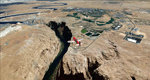
This scenery covers the western part of Lake Powell, the city of Page (KPGA), the Vermillion Cliffs, Glenn Canyon just south of Glenn Canyon Dam, the northern part of Marble Canyon, Paria Canyon, Cockscomb, etc, etc. Spectacular! To explore the scenery depart from Page Municipal Airport (KPGA). High resolution versions of this scenery for FS9 and FSX (much sharper, but larger and multiple downloads) are available at www.blueskyscenery.com/CNY_South3West3.html . The screenies are taken from the high-res versions, so expect this version to be slightly more blurry. YourDonation@Work: Dedicated to William, Veit and Michele.
| Filename: | Page_KPGA_Lake_Powell_West_UtahArizona_PhotoScener.zip |
| License: | Freeware, limited distribution |
| Added: | 3rd March 2010, 21:26:32 |
| Downloads: | 1,821 |
| Author: | Gottfried Razek - blueskyscenery.com |
| Size: | 92.41 MB |
| Category: Flight Simulator 2004 - Scenery | |
| Eagle County (KEGE), Glenwood Springs (KGWS), Colorado, Photo-Scenery (FS9 & FSX) |
|
Images related to this file:
File Description:
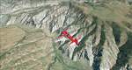
To explore this region depart from Eagle County Regional Airport (KEGE) which is a popular regional airport used in winter to transport skiers to nearby Vail. Northwest of the airport you can see the pit gypsum mine of American Gypsum which produces a variety of wallboard products. When you fly to the west and along the Eagle River, you soon pass its confluence with the Colorado River. Further west you can fly along Glennwood Canyon and finally reach Glennwood Springs where the Colorado meets the Roaring Fork River. Here you can turn south and fly direct Glenwood Springs Airport (KGWS) which lies south of the city. This scenery brings you another 3.500 sq km of beautiful Colorado in 4.7m/pix quality.
High resolution versions of this scenery for FS9 and FSX (much sharper, but larger and multiple downloads) are available at www.blueskyscenery.com/GNB_SouthWest2.html . The screenies are taken from the high-res versions, so expect this version to be slightly more blurry. YourDonation@Work: Dedicated to Alain and James.
| Filename: | Eagle_County_KEGE_Glenwood_Springs_KGWS_Colorado_P.zip |
| License: | Freeware, limited distribution |
| Added: | 30th January 2010, 17:01:49 |
| Downloads: | 2,710 |
| Author: | Gottfried Razek - blueskyscenery.com |
| Size: | 93.8 MB |
| Category: Flight Simulator 2004 - Scenery | |
| Lake Powell, Navajo Mountain (04UT), Utah/Arizona, Photo-Scenery (FS9 & FSX) |
|
Images related to this file:
File Description:
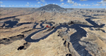
This package contains the center of Lake Powell and the Navajo Nation around Navajo Mountain. It contains remote areas of stunning beauty. Wonderful sandstone formations in bright shades of red and pink. Contains landmarks like the Rainbow Bridge National Monument and the confluence of the Colorado and San Juan Rivers. Extends my Monument Valley scenery to the west and brings you another 3.500 sq km in 4.7m/pix quality. To explore the scenery depart from Navajo Mountain dirt strip (04UT). High resolution versions of this scenery for FS9 and FSX (much sharper, but larger and multiple downloads) are available at www.blueskyscenery.com/CNY_South3West2.html . The screenies are taken from the high-res versions, so expect this version to be slightly more blurry. YourDonation@Work: Joaquin, Donald and Scott.
| Filename: | Lake_Powell_Navajo_Mountain_04UT_UtahArizona_Photo.zip |
| License: | Freeware, limited distribution |
| Added: | 23rd January 2010, 23:06:49 |
| Downloads: | 1,790 |
| Author: | Gottfried Razek - blueskyscenery.com |
| Size: | 91.43 MB |
| Category: Flight Simulator 2004 - Scenery | |
| Cook Airfield, Derby, Kansas |
|
File Description:
Here is a small airfield in my hometown of Derby, Kansas, just outside of Wichita...I hope you enjoy flying in and out of Cook Field...Made with EZ-Scenery using aerial photo for building placement...Extensive "Readme" file included.
| Filename: | Cook_Airfield_Derby_Kansas.zip |
| License: | Freeware |
| Added: | 23rd December 2005, 03:16:52 |
| Downloads: | 625 |
| Author: | Steve Ziegler |
| Size: | 101.54 KB |
| Category: Flight Simulator 2004 - Scenery | |
| Gatineau- Ottawa, Quebec (CYND) Airport, V1.0 |
|
File Description:
Ottawa/Gatineau (CYND) airport built with GMAX.
Highly detailed and accurate rendition with photo-realistic building textures.
Comes with custom design terminal, hangars , fuel tank, fuel truck, gates
fire hydrant, fences, windsocks and signs.
An AFCAD file is also included.
| Filename: | Gatineau_Ottawa_Quebec_CYND_Airport_V10.zip |
| License: | Freeware |
| Added: | 10th September 2005, 04:12:42 |
| Downloads: | 4,826 |
| Author: | Pierre Gallant |
| Size: | 2.97 MB |


© 2001-2026 AVSIM Online
All Rights Reserved
Privacy Policy |