
Where Flight Simulation Enthusiasts Gather from Around the World!
AVSIM Library - Search Results

| Category: Flight Simulator 2004 - Scenery | |
| Boulder (KBDU) / Longmont / Loveland, Colorado, Photo-Scenery (FS9 & FSX) |

|
Images related to this file:
File Description:

Boulder is situated where the Rocky Mountains meet the Great Plains. Just west of the city are imposing slabs of sedimentary stone tilted up on the foothills, known as Flatirons. Located at the base of the foothills is Boulder's main campus of the University of Colarado which is clearly visible from the sky. Longmont is home of the Denver ARTCC (Air Route Traffic Control Center) which controls all flights in the upper airspace of most of Colorado and parts of adjoining states. To explore the scenery depart from Boulder (KBDU) and head northeast. Extends my Rocky Mountain Park scenery to the east and my Denver scenery to the north. Provides another 3.500 sq km in 4.7m/pix quality. High resolution versions for FS9 and FSX (much sharper, but larger and multiple downloads) are available at www.blueskyscenery.com/GNB_East.html . The screenies are taken from the high-res versions, so expect this version to be slightly more blurry. YourDonation@Work: Dedicated to Senges and Eric.
| Filename: | Boulder_KBDU__Longmont__Loveland_Colorado_PhotoSce.zip |
| License: | Freeware, limited distribution |
| Added: | 28th December 2009, 20:14:09 |
| Downloads: | 2,388 |
| Author: | Gottfried Razek - blueskyscenery.com |
| Size: | 94.26 MB |
| Category: Flight Simulator 2004 - Scenery | |
| Leadville (KLXV), Mt. Elbert, Colorado, Photo-Scenery (FS9 & FSX) |
|
Images related to this file:
File Description:
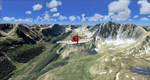
Extends my Aspen scenery to the east and contains more gorgeous Continental Divide area of the Rocky Mountains. Covers Leadville Lake County Airport (KLXV), which is the highest airport in North America (9.927 ft) and Mt. Elbert, which is the highest peak in the Rocky Mountains (14.443 ft). Aircraft performance deteriorates
with altitude, so many companies use the Leadville Airport as a base for high altitude performance testing. This scenery brings you another 3.500 sq km of beautiful Colorado in 4.7m/pix quality.
High resolution versions of this scenery for FS9 and FSX (much sharper, but larger and multiple downloads) are available at www.blueskyscenery.com/GNB_South2West.html . The screenies are taken from the high-res versions, so expect this version to be slightly more blurry. YourDonation@Work: Dedicated to Daniel, Art and Rotui.
| Filename: | Leadville_KLXV_Mt_Elbert_Colorado_PhotoScenery_FS9.zip |
| License: | Freeware |
| Added: | 1st February 2010, 19:06:58 |
| Downloads: | 1,712 |
| Author: | Gottfried Razek - blueskyscenery.com |
| Size: | 94.68 MB |
| Category: Flight Simulator 2004 - Scenery | |
| FAGR Graaff Reinet Airport, South Africa |
|
File Description:
Graaff Reinet Airport (FAGR), South Africa.
Detailed airport scenery, containing photo realistic hangars and buildings.
| Filename: | FAGR_Graaff_Reinet_Airport_South_Africa.zip |
| License: | Freeware, limited distribution |
| Added: | 26th December 2012, 19:20:50 |
| Downloads: | 830 |
| Author: | Johan van Wyk, Aeroworx |
| Size: | 2.82 MB |
| Category: Flight Simulator 2004 - Scenery | |
| Project Mexico Real LOD9 File 4 of 4 |
|
Images related to this file:
File Description:
File 4th of 4 of a Terrain Mesh that covers the entirety of Mexican Territory and related bordering U.S., Guatemala and Belice areas, part of the "Proyecto M�©xico Real" project, compiled at LOD9 (2.48 arcseconds in latitude and 3.3 arcseconds in longitude) resolution from INEGI data. Intended to enhance the virtual flying experience with the more detailed LOD10 version and complement the LOD8 version compiled from the same data. Compatible backwards with Flight Simulator 2000, Flight Simulator 2002 and Combat Flight Simulator 2. Refer to the file contents about the cover area to this compressed file. (Re-upload due to AVSIM hack)
| Filename: | Project_Mexico_Real_LOD9_File_4_of_4.zip |
| License: | Check within download |
| Added: | 6th June 2010, 08:50:44 |
| Downloads: | 2,727 |
| Author: | Juan Jose Galvan Bautista |
| Size: | 54.82 MB |
| Category: Flight Simulator 2004 - Scenery | |
| Project Mexico Real LOD10 File 2 of 11 |
|
Images related to this file:
File Description:
File 2nd of 11 of a Terrain Mesh that covers the entirety of Mexican Territory and related bordering U.S., Guatemala and Belice areas, part of the "Proyecto M�©xico Real" project, compiled at LOD10 (1.24 arcseconds in latitude and 1.65 arcseconds in longitude) resolution from INEGI data. Intended to enhance the virtual flying experience complementing the LOD8 and LOD9 versions compiled from the same data. Compatible backwards with Flight Simulator 2000, Flight Simulator 2002 and Combat Flight Simulator 2. Refer to the file contents about the cover area to this compressed file. (Re-upload due to AVSIM hack)
| Filename: | Project_Mexico_Real_LOD10_File_2_of_11.zip |
| License: | Check within download |
| Added: | 7th June 2010, 08:52:32 |
| Downloads: | 3,317 |
| Author: | Juan Jose Galvan Bautista |
| Size: | 76.38 MB |
| Category: Flight Simulator 2004 - Scenery | |
| Project Mexico Real LOD10 File 1 of 11 |
|
Images related to this file:
File Description:
File 1st of 11 of a Terrain Mesh that covers the entirety of Mexican Territory and related bordering U.S., Guatemala and Belice areas, part of the "Proyecto Mexico Real" project, compiled at LOD10 (1.24 arcseconds in latitude and 1.65 arcseconds in longitude) resolution from INEGI data. Intended to enhance the virtual flying experience complementing the LOD8 and LOD9 versions compiled from the same data. Compatible backwards with Flight Simulator 2000, Flight Simulator 2002 and Combat Flight Simulator 2. Refer to the file contents about the cover area to this compressed file. (Re-upload due to AVSIM hack)
| Filename: | Project_Mexico_Real_LOD10_File_1_of_11.zip |
| License: | Check within download |
| Added: | 6th June 2010, 09:05:59 |
| Downloads: | 4,165 |
| Author: | Juan Jose Galvan Bautista |
| Size: | 73.44 MB |
| Category: Flight Simulator 2004 - Scenery | |
| Project Mexico Real LOD10 File 7 of 11 |
|
Images related to this file:
File Description:
File 7th of 11 of a Terrain Mesh that covers the entirety of Mexican Territory and related bordering U.S., Guatemala and Belice areas, part of the "Proyecto Mexico Real" project, compiled at LOD10 (1.24 arcseconds in latitude and 1.65 arcseconds in longitude) resolution from INEGI data. Intended to enhance the virtual flying experience complementing the LOD8 and LOD9 versions compiled from the same data. Compatible backwards with Flight Simulator 2000, Flight Simulator 2002 and Combat Flight Simulator 2. Refer to the file contents about the cover area to this compressed file. (Re-upload due to AVSIM hack)
| Filename: | Project_Mexico_Real_LOD10_File_7_of_11.zip |
| License: | Check within download |
| Added: | 23rd August 2010, 00:40:35 |
| Downloads: | 2,866 |
| Author: | Juan Jose Galvan Bautista |
| Size: | 74.25 MB |
| Category: Flight Simulator 2004 - Scenery | |
| Project Mexico Real LOD10 File 9 of 11 |
|
Images related to this file:
File Description:
File 9th of 11 of a Terrain Mesh that covers the entirety of Mexican Territory and related bordering U.S., Guatemala and Belice areas, part of the "Proyecto Mexico Real" project, compiled at LOD10 (1.24 arcseconds in latitude and 1.65 arcseconds in longitude) resolution from INEGI data. Intended to enhance the virtual flying experience complementing the LOD8 and LOD9 versions compiled from the same data. Compatible backwards with Flight Simulator 2000, Flight Simulator 2002 and Combat Flight Simulator 2. Refer to the file contents about the cover area to this compressed file. (Re-upload due to AVSIM hack)
| Filename: | Project_Mexico_Real_LOD10_File_9_of_11.zip |
| License: | Check within download |
| Added: | 29th August 2010, 23:24:57 |
| Downloads: | 1,197 |
| Author: | Juan Jose Galvan Bautista |
| Size: | 76.35 MB |
| Category: Flight Simulator 2004 - Scenery | |
| Project Mexico Real LOD10 File 10 of 11 |
|
Images related to this file:
File Description:
Re-upload. File 10th of 11 of a Terrain Mesh that covers the entirety of Mexican Territory and related bordering U.S., Guatemala and Belice areas, part of the "Proyecto Mexico Real" project, compiled at LOD10 (1.24 arcseconds in latitude and 1.65 arcseconds in longitude) resolution from INEGI data. Intended to enhance the virtual flying experience complementing the LOD8 and LOD9 versions compiled from the same data. Compatible backwards with Flight Simulator 2000, Flight Simulator 2002 and Combat Flight Simulator 2. Refer to the file contents about the cover area to this compressed file.
| Filename: | Project_Mexico_Real_LOD10_File_10_of_11.zip |
| License: | Check within download |
| Added: | 5th September 2010, 20:55:05 |
| Downloads: | 3,062 |
| Author: | Juan Jose Galvan Bautista |
| Size: | 70.54 MB |
| Category: Flight Simulator 2004 - Scenery | |
| Project Mexico Real LOD10 File 3 of 11 |
|
Images related to this file:
File Description:
Re-upload. File 3rd of 11 of a Terrain Mesh that covers the entirety of Mexican Territory and related bordering U.S., Guatemala and Belice areas, part of the "Proyecto Mexico Real" project, compiled at LOD10 (1.24 arcseconds in latitude and 1.65 arcseconds in longitude) resolution from INEGI data. Intended to enhance the virtual flying experience complementing the LOD8 and LOD9 versions compiled from the same data. Compatible backwards with Flight Simulator 2000, Flight Simulator 2002 and Combat Flight Simulator 2. Refer to the file contents about the cover area to this compressed file.
| Filename: | Project_Mexico_Real_LOD10_File_3_of_11.zip |
| License: | Check within download |
| Added: | 8th June 2010, 03:17:03 |
| Downloads: | 3,255 |
| Author: | Juan Jose Galvan Bautista |
| Size: | 73.67 MB |


© 2001-2026 AVSIM Online
All Rights Reserved
Privacy Policy |