
Where Flight Simulation Enthusiasts Gather from Around the World!
AVSIM Library - Search Results

| Category: Flight Simulator 2004 - Scenery | |
| Tok Junction 6K8 in Alaska, USA |

|
Images related to this file:
File Description:
Tok Junction is a village, or small town, on the Alaska Highway some 180 miles east of Fairbanks and 60 miles west of the Alaska-Canada border. The town is spread over a wide area on the flat terrain and barely registers among the trees, and as such is not shown in FS9 except as a grid of roads as there is no town terrain texture like it used in FS9. The airfield is at the eastern end of the town and adjacent to the Alaska Highway and I have included some surrounding houses, workshops, shops, lodges, etc. The single runway is 3,000 feet of 50 feet wide asphalt aligned 07-25 and lit. There is a small airline based on the airfield called 40-Mile Air. Their hangar is red and the name written large and 100LL fuel is available beside it at all times. Jet A-1 is available by a telephoned pre-arangement. They are, I believe, no longer flying scheduled flights but they do still function as an air taxi and they have a contract to deliver mail to surrounding villages that are not served by all-weather roads. The airfield now has a new icao "PFTO" but in FS9 it remains as the original FAA LID, 6K8. The FS9 roads are not accurately placed, and the grass airfield background is not really appropriate as the reality is more like gravel mixed with earth; it is however difficult to replicate this with the available textures and still prevent bushes or trees appearing. But, in the winter and with snow on the ground it looks as it should. A note here about my scenery making. There will not be many more to follow this as I am almost at the end of the photos I either took or found for scenery purposes, plus I expect to move on from FS9 at some point during next year.
| Filename: | Tok_Junction_6K8_in_Alaska_USA.zip |
| License: | Freeware, limited distribution |
| Added: | 14th January 2020, 17:49:21 |
| Downloads: | 176 |
| Author: | Roger Wensley |
| Size: | 25.47 MB |
| Category: Flight Simulator 2004 - Scenery | |
| CYKF - Kitchener, Regional Muni of Waterloo - Ontario Canada |
|
Images related to this file:
File Description:
The town of Kitchener is in southern Ontario, 40 miles southwest of Toronto. The population is just over half a million, including the adjoining Cambridge and Waterloo which are known locally as the Tri Cities. The Kitchener name was adopted in 1916, replacing the former "City of Berlin".
The airport is on the northeastern side of the town, with the main runway aligned 08-26 and just over 7,000 feet of asphalt 150 feet wide, lit, with PAPI at both ends and approach lighting and ILS on 26. The second runway is aligned 14-32 and is 4,100 feet long, lit and with PAPI at both ends; right hand circuits for 32. The airport is being steadily enlarged and improved, with new hangars for rental, operators, and maintenance companies. The largest and most visible presence is the training operation located just off the southwest end of taxiway A, where there are 14 Cessna 172, 2 Cessna 152, 2 Piper Seminole, and others. These are represented in the AI. There are morning and evening scheduled flights by Westjet to Calgary and American Eagle to Chicago, also in the AI. To the southwest, past taxiway C, there is GA parking; request taxi to what is named here "southwest parking" where there are spaces on both grass and asphalt. To the southeast, along a taxiway off the southeast corner of the main apron, are mainly operators and maintenance facilities. This version of CYKF includes the new(ish) terminal, the first of the new central rental hangars alongside the new taxiway and access road, and the very new large hangar off taxiway C, but not the new airport services building (fire and snow clearance) that is off to the southeast of taxiway A, and not the new car park to the south of the airport access road. So an uncertain and possibly historically innacurate date, but with the correct taxiway lighting and signage, and building textures from photographs.
| Filename: | CYKF__Kitchener_Regional_Muni_of_Waterloo__Ontario.zip |
| License: | Freeware, limited distribution |
| Added: | 7th May 2016, 21:13:28 |
| Downloads: | 548 |
| Author: | Roger Wensley |
| Size: | 28.69 MB |
| Category: Flight Simulator 2004 - Scenery | |
| CNZ3 - Chatham-Kent - Ontario, Canada V1 |
|
Images related to this file:
File Description:
This is partly part of the Small Ontario Fields series. The airport ICAO was changed from CNZ3 to CYCK in November 2012; I have left it as it was. The runway too remains as it was a few years ago. Chatham is located 50 miles east of Detroit and 150 miles southwest of Toronto, between Lake St. Clair and Lake Erie, and the airfield is southeast of the town. There is a single asphalt runway 5,000 feet long and 75 feet wide, aligned 05/23 in FS9 but in fact in real life now 06/24 due to the wandering magnetic north. The apron is on the northern side of the runway at the eastern end, with added taxiways to cater for newer hangars wearing identical colour schemes. There is fuel, runway lighting, some taxiway lights, visitor parking on the grass, and plane maintenance in the large hangar beside the small terminal building on the north side of the apron. There is a train station in the middle of the town, and no scheduled flights to the airport that is 8 miles away; these two facts may be connected. Ditches along the road and around much of the airfield provide separation, which is why the fences are not continuous. If you are on the runway and find your path to the apron blocked by another plane that is stationary at the hold short, continue past the first turnoff to the threshold markers and turn off the runway and wait. The AI plane will then taxi out and you will have a clear path.
| Filename: | CNZ3__ChathamKent__Ontario_Canada_V1.zip |
| License: | Freeware, limited distribution |
| Added: | 27th August 2015, 21:02:59 |
| Downloads: | 341 |
| Author: | Roger Wensley |
| Size: | 9.89 MB |
| Category: Flight Simulator 2004 - Scenery | |
| CYVQ - Norman Wells - Northwest Territories, Canada |
|
Images related to this file:
File Description:
Norman Wells is the last of a series of airfields that are along (or close to) the Mackenzie River and in the Northwest Territories. It is 290 miles southeast of Inuvik and just 40 miles northwest of Tulita. The town growth was accelerated by the discovery of oil in the 1930's and the building of a small refinery in 1937, which is included here; there are now around 840 folks living in the town. The airport is adjacent to the town and has just under 6,000 feet of asphalt runway. North Wright Airways is headquartered there and this is reflected in the AI, which is for all of the newly-posted Mackenzie River postings. There is also helicopter AI, Canadian North, First Air, and there are GA flights. There is a mandatory frequency and the Norman Wells tower is manned 24 hours a day so you will follow atc instructions. In real life the terminal is on two levels; this steep change in terrain level is not possible to achieve in FS9 so although I made it as a two level terminal (ready for the FSX version?) it is here modified into a single level building. There are several "taxiways" which lead to the runway but are without hold short markings. These have been shown but are not included as AI routes. The helicopters presumably hover-taxi to the runway across grass (and snow) in real life; the AI helicopter will taxi on wheels. Note that at mixed-use airports planes and helicopters all follow the same rules of procedure.
| Filename: | CYVQ__Norman_Wells__Northwest_Territories_Canada.zip |
| License: | Freeware, limited distribution |
| Added: | 12th July 2014, 11:22:10 |
| Downloads: | 473 |
| Author: | Roger Wensley |
| Size: | 14.57 MB |
| Category: Flight Simulator 2004 - Scenery | |
| Dixie A05 Forest Service airfield in Idaho USA |
|
Images related to this file:
File Description:
This airfield is in the mountains of Idaho, the first in a series. There are not many mountain airfields that can be succesfully modelled in FS9 because the FS9 terrain does not always match reality; no creek for instance, or the valley too small. There are others where the grass strip is all there is, so there is nothing to model apart from resizing the cleared area. Some are well known, well maintained, have clean shower facilities, and are well used for a weekend by small planes with two people and a tent on board, for instance Johnson Creek. Others are less well known but still in good condition, such as Dixie or Big Creek. And there are also some with cabin rental facilities, such as Sulphur Creek Ranch. Other names come to mind, such as Flying B and Pistol Creek, but unfortunately for one reason or another these could not be made. The other difficulty involving hills is succesful AI landings and take offs. At Johnson Creek, for instance, the wind should be from the south to make AI landings more likely to succeed. Dixie is south of the village of the same name, and not to be confused with the dirt strip that is just beside the village. The runway is at 5,148 feet ASL, just over 4,000 feet long and aligned 18-36, and the parking area is at the northern end, opposite the Forest Service buildings. There is a chart of the area included, and to the south of Dixie is the next in the series, Big Creek U60.
| Filename: | Dixie_A05_Forest_Service_airfield_in_Idaho_USA.zip |
| License: | Freeware, limited distribution |
| Added: | 25th May 2017, 17:53:48 |
| Downloads: | 154 |
| Author: | Roger Wensley |
| Size: | 8.69 MB |
| Category: Flight Simulator 2004 - Scenery | |
| Dawson Creek CYDQ in British Columbia, Canada UPDATED |
|
Images related to this file:
File Description:
This is a revised version of Dawson Creek CYDQ and the floats base CBD3, made primarily to provide one of the parked planes with it's textures but also to improve the apron markings and the AI. The float AI now includes Beavers and I also removed two planes that were not properly showing their textures in my current FS9 installation. The Beavers were included in my post of Nimpo Lake CAF8 and will need to be installed to show up here. This version is complete in itself and can be installed as-is if you do not have the original scenery. Dawson Creek is at 2,148 feet asl just east of the Rocky Mountains, less than 10 miles west of the BC/Alberta border and where the Rockies are at their narrowest. The population grew when the Northern Alberta Railway was extended to Dawsons Creek in 1932, and grew even more more when the Alaska Highway was built in 1942, starting from Dawsons Creek. In the 1950's the town was linked through the Rockies by a railway and a road to the BC interior, and the town grew again. Now it is static at just under 12,000 and once again has become a farming centre, with Fort St John and Grand Prairie winning out for new industry and commerce. The airport is just to the east of the town. The runway is 5,000 feet of wide asphalt (150 feet) aligned 06/24, lit, and with PAPI and approach lights. There is also a water runway for float planes, separately designated as Dawson Creek CBD3. The two effectively operate as one; traffic for both use the mandatory frequency of 122.2 and talk to one controller in one control tower. However, in FS9 the ATC for two separately designated airfields (or float fields) operates as if they are nowhere near each other and takes no notice of near misses between the two lots of planes. As a result I have put them both in un-manned tower mode so you will announce your position and intentions and select your own parking spots, either next to one of the hangars or on the grass. The aprons vary from asphalt, to concrete, onwards to gravel, and then further onwards to some gravel amid the bare dirt; I have replicated this variation as far as FS9 permits.
| Filename: | Dawson_Creek_CYDQ_in_British_Columbia_Canada_UPDAT.zip |
| License: | Freeware, limited distribution |
| Added: | 17th December 2018, 17:50:08 |
| Downloads: | 208 |
| Author: | Roger Wensley |
| Size: | 26.71 MB |
| Category: Flight Simulator 2004 - Scenery | |
| Fort Simpson Island CET4 - Northwest Territories, Canada |
|
Images related to this file:
File Description:
Fort Simpson Island is the fifth in a series of airfields that follow (approximately) in a southward direction the Mackenzie River. At the far northern end of the river there is Tuktoyaktuk, then Inuvik, Fort McPherson, Fort Good Hope, Deline, and then Wrigley, all posted. Fort Simpson Island is at 405 feet asl and on the west bank of the the Mackenzie, around 110 miles south of Wrigley at the junction of the Mackenzie and the Liard rivers. The town of Fort Simpson is on an island, and has a population of 1,250 or so folks. The Hudson Bay trading post was established here in 1822. The airport is right next to the town, and has 3,000 feet of gravel runway, though with a displaced threshold of 1,000 feet at each end (unmarked, on gravel) this is effectively 2,000 feet for landing. The Canada Flight Supplement lists the runway as being 100 feet wide; the gravel is definitely far less and the 100 refers to the width in the winter when you are landing on snow and don't care if there is gravel or grass underneath. There are no scheduled flights as these go to the nearby Fort Simpson CYFS. There is a mandatory radio frequency which is for both CYFS and CET4 and in this case I have set the "tower" to "manned" so you will report position and obey instructions. Runway 13 has right hand circuits. I have modified the Ultimate Terrain route for the Mackenzie Highway so that it remains on the west side of the river and does not wander randomly from one side to the other north of Fort Simpson.
| Filename: | Fort_Simpson_Island_CET4__Northwest_Territories_Ca.zip |
| License: | Freeware, limited distribution |
| Added: | 6th July 2014, 02:56:05 |
| Downloads: | 208 |
| Author: | Roger Wensley |
| Size: | 2.46 MB |
| Category: Flight Simulator 2004 - Scenery | |
| Airstrips of Scandinavia and the Baltic States |
|
Images related to this file:
File Description:
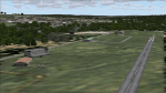
Effectively an extension of my "Airstrips of Western Europe" project for FS2004, around 140 sceneries of small airfields in Scandinavia and the Baltic states, each enhanced with buildings, taxiways, parking spaces and aprons as appropriate, to further facilitate the generation of lightweight AI traffic in the area, without overloading the more major airfields.
Given the available comprehensive coverage of both Norway and Finland by other authors, and much of Denmark by myself in my earlier "Airstrips of North-West Europe" upload, this selection comprises mostly small Swedish and Baltic State airfields.
Unfortunately, due to the very nature of much of the area, some of these airstrips are just that, a grass/dirt runway on a flattened/mown area in the landscape with just an associated building or two. Nevertheless, they do perform the required function of providing sources for AI traffic. The very existence of those airstrips not included in FS2004 is referred to in various on-line databases.
Again, there's no photo-realism here, just a selection of basic 'generic' buildings, more or less accurately sized and placed to reflect the airfield layout as seen on on-line satellite imagery and aerial photography. These buildings have minimal effect on frame-rates, so are ideal for this kind of job. The airfields are aligned as well as possible with the roads etc. in UT Europe (where applicable) and the Genesis Europe mesh, but should mostly be fine in a default installation or other configuration.
Please read the rest of this "blurb" in the included text file. There may be some details of note or interest.
| Filename: | Airstrips_of_Scandinavia_and_the_Baltic_States.zip |
| License: | Freeware |
| Added: | 11th November 2024, 17:25:16 |
| Downloads: | 116 |
| Author: | Chris Eve |
| Size: | 2.52 MB |
| Category: Flight Simulator 2004 - Scenery | |
| Bethel: Yukon Area |
|
Images related to this file:
File Description:
This presumes you have already installed Bethel PABE, Bethel Local Airfields, and Bethel St Mary's. In the Yukon River area of Alaska to the north of Bethel and to the south around the equally wide (but shorter) Kuskowim River there are small villages, served by flights from both Bethel PABE and St Mary's PASM. These villages are dependent upon fishing for survival, and in this flat and very wet terrain are equally dependent upon the gravel runways that link them to the outside world. There are no surfaced roads, and the rivers and their tributaries wind into the distance and are impractical delivery routes except from nearby places. In an area 300 miles by 200 miles most places cannot be described as "nearby". This post is of the small villages, including those previously posted; I had missed on picking up some terrain conflicts between nighttime grass and town textures. They are corrected here and included along with new airfields. Bethel and St Mary's are also reposted to include the further enlargement of parking for the increased number of small AI aircraft. These smaller airfields vary in quality; some have runway signage but most do not, and while some have two or even three hangars/garages/terminal buildings on the apron there are others who have none at all. The 39 small airfields included here are as listed:
Akiak AKI, Akiakchak Z13, Alakanuk AUK, Anvik PANV, Atmautluak 4A2, Cape Romanzof PACZ, Chefornak PACK, Chevak VAK, Eek EEK, Emmonak PAEM, Goodnews GNU, Grayling KGX, Holy Cross HCA, Hooper Bay PAHP, Kako 9AK2, Kalskag KLG, Kasigluk Z09, Kipnuk PAKI, Kongiganak PADY, Kotlik KOT, Kwethluk KWT, Kwigillingok A85, Marshall MLL, Mountain Village MOU, Napakiak WNA, Napaskiak PKA, Newtok PAEW, Nightmute IGT, Nunapichuk 16A, Pilot Station 0AK, Quinhagak PAQH, Russian Mission RSH, Scammon Bay SCM, Shageluk SHX, Sheldon Point SXP, Toksook Bay OOK, Tuluksak TLT, Tuntutuliak A61, Tununak 4KA.
I am currently going through the airfields again to check if further modifications are required, and I am also adding a few new ones. As I am going to be updating my computer I am posting now, complete or not, and I will post an update later of further additions.
| Filename: | Bethel_Yukon_Area.zip |
| License: | Freeware, limited distribution |
| Added: | 3rd May 2019, 17:20:53 |
| Downloads: | 170 |
| Author: | Roger Wensley |
| Size: | 6.3 MB |
| Category: Flight Simulator 2004 - Scenery | |
| Draker Water v2, FIX |
|
File Description:
Darker water textures. I've made some darker water textures, because i thaught all of the textures I have found until I think now are too light. Hope you like 'em! This is V2, and it fixes the CTD in v1.
| Filename: | Draker_Water_v2_FIX.zip |
| License: | Freeware |
| Added: | 8th August 2005, 19:47:06 |
| Downloads: | 4,628 |
| Author: | Christian H. Alden |
| Size: | 12.13 MB |


© 2001-2026 AVSIM Online
All Rights Reserved
Privacy Policy |