
Where Flight Simulation Enthusiasts Gather from Around the World!
AVSIM Library - Search Results

| Category: Flight Simulator 2004 - Scenery | |
| CYXN - Whale Cove - Hudson Bay, Nunavut, Canada, Version v2 modified 1 July 2014 |

|
Images related to this file:
File Description:
This revised version deletes stock FS9 taxiway lights and replaces them. It also modifies and corrects the PAPI positioning, and removes a visible hold short that should have been invisible on the gravel. This is a complete version and does not require you to have installed the old version. Whale Cove is a small village with 300 or so inhabitants at N62 W92 on the west shore of Hudson Bay, 40 miles south of the large airport at Rankin Inlet. The runway is just under 4,000 feet and aligned 330T-150T, these being true and not magnetic bearings. The AI is included with the post of Chesterfield Inlet V1 and the earlier version is omitted from this post to avoid confusion.
| Filename: | CYXN__Whale_Cove__Hudson_Bay_Nunavut_Canada_Versio.zip |
| License: | Freeware, limited distribution |
| Added: | 23rd August 2014, 11:24:44 |
| Downloads: | 274 |
| Author: | Roger Wensley |
| Size: | 1.73 MB |
| Category: Flight Simulator 2004 - Scenery | |
| Taku Arm Scenery and AI Package for Holger Sandmann's Glacier Bay v2 Fix |
|
File Description:
This is a fix for tak_arm_v1.zip It fixes the unsightly jag in the mountain where the AI boats exit the scenery. Please accept my sincere apology for this inconvenience.
| Filename: | Taku_Arm_Scenery_and_AI_Package_for_Holger_Sandman.zip |
| License: | Freeware |
| Added: | 4th May 2008, 22:41:47 |
| Downloads: | 1,053 |
| Author: | Peter Vibe |
| Size: | 21.81 KB |
| Category: Flight Simulator 2004 - Scenery | |
| AWA Building, Sydney plus the Rose Bay & Karumba Flying Boat Bases - All Circa 1938 |
|
File Description:
In Sydney, the distinctive art-deco style AWA Office Building and radio-broadcast transmission tower, depicted as it was in the early 1940's, with the original AWA sign.
Also in Sydney, and from the same era, the terminal building at Rose Bay Flying Boat Base.
And from Karumba, in the Gulf of Carpentaria, Northern Territory, the two central buildings of the Civil Aviation Authority's support base built for the new Empire route; the staff quarters and the aeradio centre, circa 1938.
Enhance your Golden Wings 3 or default Flight Simulator 2004 experience with period accessories!
| Filename: | AWA_Building_Sydney_plus_the_Rose_Bay__Karumba_Fly.zip |
| License: | Freeware |
| Added: | 19th February 2006, 15:22:08 |
| Downloads: | 1,368 |
| Author: | Bruce Kennewell and Lou Frost |
| Size: | 1.82 MB |
| Category: Flight Simulator 2004 - Scenery | |
| Baker Lake CYBK in Nunavut, Canada |
|
Images related to this file:
File Description:
Baker Lake is the only Nunavut community that is not next to the sea. It is, as you might have guessed, on the shore of Baker Lake and 160 miles west and a bit north of Rankin Inlet on the shore of Hudson Bay (a recent post by Sid and Pete). The Hudson Bay Company opened a trading post there in 1916 and the town slowly developed, though as recently as 1946 the population was still only 32. These days the airfield is the support field for several nearby mines and there are now nearly 1,800 folks in Baker Lake using the stores, schools, churches, hospital, etc. The runway is almost 4,200' of 100' wide gravel and lighted; the alignment is 162T and 342T as this is in northern domestic airspace and bearings are given as 'true" and not "magnetic". Both JETA and 100LL fuel is available. The town is to the northeast of the airfield and is made up of a landclass without autogeneration, as this would mean a bunch of trees that would be, to say the least, unrealistic.
| Filename: | Baker_Lake_CYBK_in_Nunavut_Canada.zip |
| License: | Freeware, limited distribution |
| Added: | 23rd November 2011, 09:21:56 |
| Downloads: | 516 |
| Author: | Roger Wensley |
| Size: | 2.45 MB |
| Category: Flight Simulator 2004 - Scenery | |
| FSFlightline FSE Vol. 2 - Apex Aipark (WA05) & Olympic Airfield (WA45) |
|
File Description:
The second installment of my series of Washington State airports sceneries for use with Lago's FS Enhancer. This volume features Apex Airpark in Silverdale, WA and Olympic Airfield in Discovery Bay, WA. Both are fictional representations and feature static and dynamic scenery including moving cars, highway traffic, ambient sounds, and dynamic wildlife. Fly over the Hood Canal and look for the subs leaving Subase Bangor. Includes custom AFCADs for both airfields. Requires Lago's FS Enhancer to function.
| Filename: | FSFlightline_FSE_Vol_2___Apex_Aipark_WA05__Olympic.zip |
| License: | Freeware |
| Added: | 7th February 2004, 22:16:40 |
| Downloads: | 1,063 |
| Author: | Jeff Shields |
| Size: | 482.04 KB |
| Category: Flight Simulator 2004 - Scenery | |
| Bethel: St Mary's area airfields in southwest Alaska close to the Yukon River |
|
Images related to this file:
File Description:
This presumes you have already installed Bethel PABE and Bethel Local Airfields. In the Yukon River area of Alaska to the north of Bethel there are small villages, served by flights from both Bethel and the nearer St Mary's PASM. St Mary's has a gravel runway like the other villages, but has a larger population and airport services including maintenance and fuel. This, plus the saving of an average one hundred miles of flying by a Cessna 205 when compared with flights from Bethel, means it acts as a distribution centre fed from Bethel by larger aircraft. Go to "http://vfrmap.com/" for free vfr maps of the area (see the attached). The ten village airfields included here are all to the north and west of St Mary's: Hooper Bay PAHP, Chevak VAK, Cape Romanzof PACZ (closed air force field servicing a radar station), Scammon Bay SCM, Sheldon Point SXP, Alakanuk AUK, Emmonak PAEM, Kotlik 2A9, Mountain Village MOU, and of course St Mary's PASM itself. With these airfields not everything is as it appears to be. For instance, Hooper Bay is not a new and modernised airfield, despite the asphalt runway and apron; the current version has dispensed with the aging asphalt and gone back to gravel. I have tended to go for the 2005 or so versions, which sometimes means a small runway amid or close to the housing; Kotlik was an early renewal for reasons of safety as much as anything else and has had (since 2003?) a new and longer runway located outside of the town. The second batch of airfields will be to the east of St Mary's.
| Filename: | Bethel_St_Marys_area_airfields_in_southwest_Alaska.zip |
| License: | Freeware, limited distribution |
| Added: | 29th April 2019, 17:07:24 |
| Downloads: | 227 |
| Author: | Roger Wensley |
| Size: | 11.53 MB |
| Category: Flight Simulator 2004 - Scenery | |
| Aupaluk CYLA in northern Quebec Canada |
|
Images related to this file:
File Description:
This is a very small village in northern Quebec, on the eastern shore of Nunavik in Ungava Bay. The population is only around 200. The name refers to the redness of the iron bearing soil. Kuujuaq, the regional centre, is 90 miles to the south, and there are regularly scheduled flights by an Air Inuit Twin Otter. The runway is 3,400 feet of gravel aligned 05-23. The ai was included with the posting of Akulivik but is included again here.
| Filename: | Aupaluk_CYLA_in_northern_Quebec_Canada.zip |
| License: | Freeware, limited distribution |
| Added: | 18th September 2018, 04:22:22 |
| Downloads: | 127 |
| Author: | Roger Wensley |
| Size: | 2.41 MB |
| Category: Flight Simulator 2004 - Scenery | |
| Takaka Airfield, New Zealand. NZTK. |
|
File Description:
Welcome to Takaka Airfield, in the beautiful Golden Bay area of the north-western tip of
the South Island of New Zealand.
The airfield is located 3nm North of the town of Takaka, and is the northern "gateway" to the
beautiful scenic wonderland of Able Tasman National Park.
Scenery contains a traffic file which requires the HTAI Cessna's AI Package (payware), and also requires my Karamea Airfield NZKM scenery to work properly.
Requires some EZ Scenery Object Sets (see INSTALL instructions for details).
| Filename: | Takaka_Airfield_New_Zealand__NZTK.zip |
| License: | Freeware, limited distribution |
| Added: | 29th October 2008, 10:23:15 |
| Downloads: | 626 |
| Author: | Lawrie Roache |
| Size: | 1.52 MB |
| Category: Flight Simulator 2004 - Scenery | |
| Doha, Qatar - Photoreal and Autogen |
|
Images related to this file:
File Description:
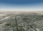
Doha is the capital city of the state of Qatar. Located on the coast of the Persian Gulf, it had a population of 998,651 and is also one of the municipalities of Qatar. The scenery covers the whole city of Doha and the surroundings, with the new airport under construction and "The Pearl", an artificial island built in the bay of Doha which is involved in a huge residential development. The autogen, with buildings, skyscrapers and vegetation, is included in the scenery.
| Filename: | Doha_Qatar___Photoreal_and_Autogen.zip |
| License: | Freeware |
| Added: | 4th June 2013, 21:49:11 |
| Downloads: | 4,169 |
| Author: | Luca Esposito, Fabio Ferrari |
| Size: | 76.26 MB |
| Category: Flight Simulator 2004 - Scenery | |
| Brevoort CWOB and BAF-3 radar plus Cartwright LAB-6 radar Canada |
|
Images related to this file:
File Description:
Brevoort airstrip and the BAF-3 radar it serves is on Brevoort Island, off one of the southeastern tips of Baffin Island and 140 miles east of Iqaluit. This scenery includes the BAF-3 buildings on the hilltop and those on the airstrip below, plus the roads connecting them and down to the beach landing area on the rocky coast. This scenery is made for the FSGenesis 76m terrain mesh for northern Canada, and there will be a repost of all my northern Canada airfields to suit this; I cannot think now why I never installed this mesh before. The AI reflects the use of civil airlines for resupply and transportation of personnel. Given the terrain the wind should be from the north so that ai lands using the 02 runway. Landing from the north will involve a terrain clash while take off towards the north will not as the climb out clears the hilltop. The video shows the 600 foot cliff at the runway threshold and an Air Tindi plane on the apron. Cartwright CYCA is on the Labrador coast and has been posted by Flight Ontario as part of their Goose Bay and Labrador Regional Airports sceneries. The nearby LAB-6 radar site is included here, connected to CYCA by an extended road. The site uses the same buildings as Brevoort and Saglek (posted recently) and although I have included them here as separate sceneries the contents can be placed in the same folders as Saglek with a saving in duplicated textures. The textures here are more accurate than Saglek so say yes to over-write; a downloader with personal experience of Brevoort noted that in reality they are lighter.
| Filename: | Brevoort_CWOB_and_BAF3_radar_plus_Cartwright_LAB6_.zip |
| License: | Freeware, limited distribution |
| Added: | 20th August 2017, 15:46:36 |
| Downloads: | 177 |
| Author: | Roger Wensley |
| Size: | 4.37 MB |


© 2001-2026 AVSIM Online
All Rights Reserved
Privacy Policy |