
Where Flight Simulation Enthusiasts Gather from Around the World!
AVSIM Library - Search Results

| Category: Flight Simulator 2004 - Scenery | |
| CYVP - Kuujjuaq - Quebec, Canada |

|
Images related to this file:
File Description:
Kuujjuaq is in northern Quebec at the southern end of Ungava Bay, and 30 miles up the Koksoak River. Kuujjuaq has a population of around 2,400; it was previously called Fort Chimo and in 1830 there was a Hudson Bay trading post established close by, but on the other bank of the river. A nursing station and a school were established in 1948 and the Hudson Bay post moved across the river to the current location. The airport is to the south of the town and, unusally for northern airfields, has two runways. The asphalt runway is 6,000 feet long and aligned 07/25, and the gravel runway is 5,000 feet long and aligned 13/31; 07 has ILS. There is fuel available, both 100LL and JetA, but the 100LL will be in drums and you are required to have your own pump. There are numerous flights that stop at Kuujjuaq; the AI included here has Air Creebec, First Air, Wasaya Airways, and Air Inuit (Kuujjuaq is a maintenance centre for Air Inuit) plus private flights by various aircraft. There is also a flight by my poor representation of a Helicopter Transport Services chopper. There is a float base on the nearby Stewart Lake during the summer months. The base is within the Kuujjuaq control zone, and normally you would talk to the tower and inform them of your intentions, but in FS9 this cannot be replicated.
| Filename: | CYVP__Kuujjuaq__Quebec_Canada.zip |
| License: | Freeware, limited distribution |
| Added: | 11th February 2013, 06:22:50 |
| Downloads: | 815 |
| Author: | Roger Wensley |
| Size: | 5.92 MB |
| Category: Flight Simulator 2004 - Scenery | |
| CYYQ - Churchill Port & York Factory - Northern Manitoba, Canada |
|
Images related to this file:
File Description:
The main part of this scenery installs the Port of Churchill and the grain silos. Churchill CYYQ has been made by Sidney Schwartz, and this also adds AI and slightly modifies his parking to make a space big enough for Buffalo's C46. Churchill is in northern Manitoba, on the Churchill River where it empties into Hudson Bay. The town is accesible by air, by boat (once the winter ice melts) and most importantly by rail from the south. Grain from the Canadian prairies is hauled north and stored in Churchill for export to Europe by a sea route that is significantly shorter than any other, and there is a grain carrier included in the AI. Today there are perhaps 810 people living in Churchill, a slowly declining number. There are also a number of impressive polar bears. There was another port south of Churchill, but it was never completed, never connected to a railroad track, and never used. It was called Port Nelson, and was at the mouth of the Nelson River. Nearby, on the Hayes River, there is an old trading post called York Factory, built in 1684 and preserved as part of the living history of the north of Canada. The second scenery is for this, and for the nearby tourist camp called Silver Goose Lodge, which as the name suggests is for hunters. The large grassy area alongside the fort was for the trappers to camp on when they all arrived in early summer to trade the furs for goods.
| Filename: | CYYQ__Churchill_Port__York_Factory__Northern_Manit.zip |
| License: | Freeware, limited distribution |
| Added: | 23rd July 2014, 02:26:04 |
| Downloads: | 546 |
| Author: | Roger Wensley |
| Size: | 3.69 MB |
| Category: Flight Simulator 2004 - Scenery | |
| CYZS - Coral Harbour - Nunavut, Canada Modified V1 |
|
Images related to this file:
File Description:
This modified version of Coral Harbour corrects the PAPI postion on the runway, installs new taxiway lights and windsocks, and modifies the AI. This is a complete version and does not require you to have installed the original. Coral Harbour is on Southampton Island, which partly blocks the northern end of Hudson Bay and is around the size of Switzerland. The village has a population of just under 800 people and is some 200 miles from Cape Dorset, Ivujivik, and Repulse Bay, and 230 miles from Chesterfield Inlet to the southwest. The airfield is inland from the village and the 5,000 feet of gravel runway is aligned 155T/335T where T stands for "true" as opposed to magnetic in the Northern Domestic Airspace. JETA-1 fuel is officially available, and in practice so is 100LL, though the latter will be in drums. The visiting AI airlines are First Air and Calm Air, and there is a GA plane too that is stock FS9.
| Filename: | CYZS__Coral_Harbour__Nunavut_Canada_Modified_V1.zip |
| License: | Freeware, limited distribution |
| Added: | 23rd August 2014, 11:25:23 |
| Downloads: | 224 |
| Author: | Roger Wensley |
| Size: | 12.92 MB |
| Category: Flight Simulator 2004 - Scenery | |
| Frozen rivers and lakes for winter ski operations along the Canada/USA border and Alaska |
|
Images related to this file:
File Description:
This "freezes" lakes and rivers in a wide strip along both sides of the Canadian and US border and part of Alaska (and is reversible with a tick in the FS9 library) and can be landed on with skis or wheels for winter operations. The area covered is from east of Quebec City to west of Calgary and Edmonton, with an extension north to cover Hudson Bay, so from from 70 west to 100 west and 40 north to 56 north (65 north in the Hudson Bay area). This includes large parts of Quebec, Ontario, Manitoba, Saskatchewan, Alberta, Michigan, Wisconsin, and Minnesota, and most of North Dakota and Montana, and the Alaska north shore and around Anchorage.
This is really for use with Ultimate Terrain, though it will work without it. But as UT is what gets all the lakes and rivers there and in the right place it would be a shame not to be using UT.
| Filename: | Frozen_rivers_and_lakes_for__winter_ski_operations.zip |
| License: | Freeware, limited distribution |
| Added: | 18th February 2010, 14:33:41 |
| Downloads: | 629 |
| Author: | Roger Wensley |
| Size: | 424.36 KB |
| Category: Flight Simulator 2004 - Scenery | |
| Inukjuak CYPH - Northern Quebec, Canada |
|
Images related to this file:
File Description:
Inukjuak is a fairly large village on the east coast of Hudson Bay, in Quebec, around 115 miles south of Puvirnituq. The usual Hudson Bay Company post was established there in 1920, and with the opening of a school in 1951 the population grew as the nomadic way of life faded away; the population is now around 1350. Some of the population was forcibly relocated to Resolute and Grise Fiord in 1953 as "human flagpoles", a shameful act by the Canadian government that is hard to believe could ever happen. The airfield is a mile inland from the village and the 3,520 feet of gravel runway is aligned 07/25, and these are magnetic bearings as Inukjuak is not in the Northern Domestic Airspace zone. Both JETA-1 and 100LL fuel is available, though there may be only a limited quantity of 100LL, and probably in drums. The visiting AI airline is Air Inuit.
| Filename: | Inukjuak_CYPH__Northern_Quebec_Canada.zip |
| License: | Freeware, limited distribution |
| Added: | 12th December 2011, 14:44:32 |
| Downloads: | 540 |
| Author: | Roger Wensley |
| Size: | 1.81 MB |
| Category: Flight Simulator 2004 - Scenery | |
| Waskaganish CYKQ in northern Quebec, Canada - revised |
|
Images related to this file:
File Description:
Waskaganish is at the southern end of James Bay, in Quebec, and this is a revised version. It deletes a hold short that should not have been showing on the gravel, and adds in signage, runway lights, taxiway lights, terminal night textures, and revised AI. I have no idea why I didn't include the night textures before. It presumes you have already installed my October 2010 Waskaganish.
| Filename: | Waskaganish_CYKQ_in_northern_Quebec_Canada__revise.zip |
| License: | Freeware, limited distribution |
| Added: | 6th January 2013, 00:08:58 |
| Downloads: | 222 |
| Author: | Roger Wensley |
| Size: | 1.49 MB |
| Category: Flight Simulator 2004 - Scenery | |
| PAFE - Kake - Southern Alaska, USA |
|
Images related to this file:
File Description:
This is the terminal for Kake PAFE in southern Alaska. Try not to laugh; Kake is a small town and a bus shelter works very well when there might be just one or two passengers for the only flight of the day. This presumes you have installed Tongass Fjords, one of the three by Holger Sandmann and his team, the other two being Misty Fjords and Glacier Bay.
| Filename: | PAFE__Kake__Southern_Alaska_USA.zip |
| License: | Freeware, limited distribution |
| Added: | 7th July 2013, 16:13:55 |
| Downloads: | 300 |
| Author: | Roger Wensley |
| Size: | 1.43 MB |
| Category: Flight Simulator 2004 - Scenery | |
| Loney's Alaska Vol 2 |
|
File Description:
FS2004 Scenery-Loney's Alaska vol2. This download comprises of 6 more Alaskan airports enhanced using Rwy12 and EZ Scenery. The airports include Johnstone Point (2AK5), Boswell Bay (AK97), Cordova Muni (CKU), Thompson Pass (K55), Sheep Mountain (PASP) and Skelton (PAZK). There are some challenging approaches once again. Includes AI traffic through Traffic Tools with modified AFCAD files and dynamic scenery with Lago's FSE. Rwy12 and EZ Scenery libraries required.
| Filename: | Loneys_Alaska_Vol_2.zip |
| License: | Freeware |
| Added: | 1st April 2006, 22:47:31 |
| Downloads: | 1,826 |
| Author: | John B. Loney, Jr. |
| Size: | 1.12 MB |
| Category: Flight Simulator 2004 - Scenery | |
| Spokane River Area for Ultimate Terrain |
|
File Description:
Spokane River Area for Ultimate Terrain - scenery & effects
for the Spokane River area from Cougar Bay in Couer d'Alene, ID to Long Lake, WA.
Includes most major bridges (road & rail), 5 dams & power houses, river scenery and effects.
All scenery is placed to correspond with Google Earth and Ultimate Terrain.
Designed in GMAX for use with Ultimate Terrain USA and 38m mesh.
DXT1 textures. For Flight Simulator 2004 (FS9) ONLY.
| Filename: | Spokane_River_Area_for_Ultimate_Terrain.zip |
| License: | Freeware |
| Added: | 29th September 2005, 01:18:16 |
| Downloads: | 1,264 |
| Author: | Lou Frost |
| Size: | 1.99 MB |
| Category: Flight Simulator 2004 - Scenery | |
| Kara sea polar stations and seaports |
|
Images related to this file:
File Description:
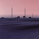
MSFS 2004 scenery: Kara sea polar stations and seaports (as it appears before 1940).
This scenery represents most important polar stations, seaports and objects on the Kara sea coasts. For object locations see Map_E.jpg.
NOTE: Installation of the sceneries Tiksi-1935.zip (Tiksi bay), gusmp_ships.zip (ships opn the Nothern Seaway) and soviet_polar_stations_1932.zip (Soviet Arctic Stations) is strongly recommended.
Freeware (c) 2013 Alexander Belov
| Filename: | Kara_sea_polar_stations_and_seaports.zip |
| License: | Freeware, limited distribution |
| Added: | 24th June 2013, 18:11:55 |
| Downloads: | 183 |
| Author: | Alexander Belov |
| Size: | 32.64 MB |


© 2001-2026 AVSIM Online
All Rights Reserved
Privacy Policy |