
Where Flight Simulation Enthusiasts Gather from Around the World!
AVSIM Library - Search Results

| Category: Flight Simulator 2004 - Scenery | |
| Hauraki Gulf v5 |

|
File Description:
This replaces all my previous Pakatoa Island and Hauraki Gulf sceneries.You must have Christian Stock's NZ mesh in the form of "Mountains of New Zealand" and topo in the form of "Lakes and Rivers of New Zealand". Includes all previous scenery candy. New in this version: MOTUTAPU ISLAND: Home Bay Wharf; WW2 Observation Hut, Billy Goat Point; Motutapu Outdoor Education Camp Trust, Administration Bay.
| Filename: | hauraki_gulf_vs5.zip |
| License: | Freeware |
| Added: | 13th November 2008, 02:24:13 |
| Downloads: | 503 |
| Author: | Godfrey Tier |
| Size: | 6.43 MB |
| Category: Flight Simulator 2004 - Scenery | |
| Loney's Alaska Vol 1 |
|
File Description:
FS2004 Scenery-Loney's Alaska vol1. This download comprises of 6 Alaskan airports enhanced using Rwy12 and EZ Scenery. The airports include English Bay (KEB), Port Graham (PGM), Seldovia (PASO), Oyster Cove (2AK4), Kasitsna (5Z7) and Jakolof Bay (4Z9). There are some challenging approaches. Includes AI traffic through Traffic Tools with modified AFCAD files. Rwy12 and EZ Scenery libraries required. By John B. Loney, Jr.
| Filename: | Loneys_Alaska_Vol_1.zip |
| License: | Freeware |
| Added: | 19th February 2006, 23:59:57 |
| Downloads: | 1,692 |
| Author: | John B. Loney, Jr. |
| Size: | 772.85 KB |
| Category: Flight Simulator 2004 - Scenery | |
| NZKY Kowhai Aerodrome |
|
Images related to this file:
File Description:
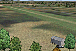
Small airstrip near Tikokino, Central Hawke's Bay. Approx. 20nm south-west of Hastings,(NZHS), New Zealand. Fertilizer bin available. Grazing sheep may be encountered.
| Filename: | kowhai_nzky.zip |
| License: | Freeware |
| Added: | 28th November 2010, 19:47:12 |
| Downloads: | 275 |
| Author: | Godfrey Tier |
| Size: | 929 KB |
| Category: Flight Simulator 2004 - Scenery | |
| Ría de Vigo (Bay of Vigo) |
|
File Description:
Comprehensive revision of the area surroinding the Bay of Vigo, near the Vigo Airport (LEVX, aprox. at 42º18'N 8º38'W), in Galicia, Spain, including a more accurate coastline, from the Ría de Aldán until Toralla Island, plus the San Simon Island and other minor islands, detailed piers in Vigo and Cangas, several beaches, and a lot of 3D VFR references (more than 180 macros added), such as buildings (the City Hall, the Hospital Xeral, the Balaídos Stadium, the Castro stronghold...), working lighthouses, several monuments and statues, some main streets redrawn, a new version of my Rande Bridge, now with collision detection and landable surface, and a handfull of eye-candies I can't even remember! -
Completa revisión da costa da Ría de Vigo, dende a Ría de Aldán ata pasada a Illa de Toralla, incluíndo, por suposto, á Illa de San Simón e outros pequenos illotes, praias (Samil, Nerga...), os peiraos de Cangas e de Vigo, dende o Areal ata Bouzas, unha morea de novas referencias visuais (máis de 180 macros), con edificios (o Concello, o Hospital Xeral, o estadio de Balaídos, o castelo do Castro, o lazareto de San Simón...), faros (nas Cíes e na costa...), algún que outro monumento, unha revisión do trazado dalgunhas das vías principais, unha nova versión da miña Ponte de Rande, con detección de colisións e superficie "aterrable", e moitas cousas máis que xa nin eu mesmo lembro. -
Completa revisión de la costa de la Ría de Vigo (Galicia, España, aprox. en 42º18'N 8º38'O), desde la Ría de Aldán hasta pasada la Isla de Toralla, incluyendo la Isla de San Simón y otros pequeños islotes, playas (Samil, Nerga...), los muelles de Cangas y de Vigo, desde el Areal hasta Bouzas, un montón de nuevas referencias visuales (más de 180 macros), con edificios (el Ayuntamiento, el Hospital Xeral, el estadio de Balaídos, el castillo del Castro, el lazareto de San Simón...), faros (en las Cíes y en la costa...), algún que otro monumento, una revisión del trazado de algunas de las vías principales, una nueva versión de mi Puente de Rande, con detección de colisiones y superficie "aterrizable", y muchas cosas más de las que ni yo mismo me acuerdo.
| Filename: | riavigo.zip |
| License: | Freeware |
| Added: | 16th May 2004, 23:48:38 |
| Downloads: | 4,467 |
| Author: | Rubén Castiñeiras |
| Size: | 367 KB |
| Category: Flight Simulator 2004 - Scenery | |
| Fitch Bay Airfield, Québec Short Hops |
|
File Description:
Fitch Bay is situated on Lake Memphrémagog. This large lake stretches from the City of Magog in Québec to Newport Vermont. It is well known for its ski resorts and great vacation areas. Sounds are included for those who have the Lago program.
| Filename: | qsh9_24.zip |
| License: | Freeware |
| Added: | 15th March 2004, 06:15:06 |
| Downloads: | 2,221 |
| Author: | Leon Louis |
| Size: | 5.38 MB |
| Category: Flight Simulator 2004 - Scenery | |
| Walvis Bay International Airport, Namibia (FYWB) |
|
Images related to this file:
File Description:
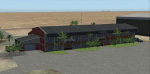
A custom Gmax made Walvis Bay International Airport (FYWB) in Namibia. This representation still has the old terminal building before it was rebuilt into the current structure. The scenery consist of custom made models with photorealistic textures and a photoreal ground that blends nicely with the dessert surroundings. This scenery was around 90% completed when I stopped to wait for the new terminal to be finished, but I have since lost all my source files and as such I am releasing this as is (with the old terminal still in use). The scenery only covers the airport and so the Rooikop Army Base is not included.
| Filename: | buscen05.zip |
| License: | Freeware, limited distribution |
| Added: | 9th March 2021, 05:29:38 |
| Downloads: | 205 |
| Author: | Kobus van Wyk |
| Size: | 4.71 MB |
| Category: Flight Simulator 2004 - Scenery | |
| Shepherd Bay CWSB in Nunavut, Canada |
|
Images related to this file:
File Description:
This was a DEW line Auxiliary Station on the western shore of the lower reaches of the Boothia Peninsula, 50 miles south of Taloyoak and 60 miles east of Gjoa Haven. The station was closed in 1989 but is almost intact except for a diesel tank or two. There are also other buildings nearby, and others on the beach landing area. A NWS automated station was opened in the same year as the Dew station was closed. The runway is also still there and is around 4,500 feet of gravel 100' wide, aligned 027T/207T. There are no lights, signage, or windsock, but the usual large hangar which was built at all Auxiliary Stations still survives. This is one of the more interesting DEW line stations to visit and walk around.
| Filename: | shepherd_bay.zip |
| License: | Freeware, limited distribution |
| Added: | 22nd November 2012, 16:28:45 |
| Downloads: | 216 |
| Author: | Roger Wensley |
| Size: | 2.06 MB |
| Category: Flight Simulator 2004 - Scenery | |
| Repulse Bay CYUT in Nunavut Canada |
|
Images related to this file:
File Description:
This is a scenery that I started in 2013, temporarily abandoned when I found there was a fault in the coastline that reduced it all to straight lines, and then totally forgot about. Until now, when I discovered that while I had made the Repulse Bay terminal building I had mysteriously not made the scenery. Investigation revealed the reason why and here it is with a coastline that has been repaired to the extent that the fault allowed. Repulse Bay has a population of around 1,100 and since 2015 has been officially named Naujaat, the traditional Inuit name. It is located exactly on the arctic circle on the northern extension of the western side of Hudson Bay, in a large bay off the northern tip of Southampton Island. Coral Harbour is on the far side of the island, 180 miles to the south. The airfield is alongside the town and the coast, with the runway 3,400 feet of gravel with PAPI at both ends, aligned 161T-341T with "T" standing for true as opposed to the unreliable magnetic bearing this far north. The regular scheduled flights are by Air Baffin (an Air Nunavut subsiduary), connecting to Iqaluit some 550 miles to the east. The helicopters are there in the summer with their own fuel in drums around their own parking apron. They land directly on the apron, which cannot be replicated in AI, so they are present only as parked choppers and not flying ones.
| Filename: | repulse_bay.zip |
| License: | Freeware, limited distribution |
| Added: | 6th September 2018, 00:34:38 |
| Downloads: | 172 |
| Author: | Roger Wensley |
| Size: | 8.16 MB |
| Category: Flight Simulator 2004 - Scenery | |
| Hartley Bay replacement landclass - BC Canada |
|
Images related to this file:
File Description:
This is a replacement landclass bgl for the Hartley Bay float base area, which was posted as part of BC Canada West Coast Fields and Floats in July 2008, and downloaded by over a thousand people since then. Which means that for over 6 years hundreds of people knew that the object textures for Hartley Bay were not showing up, but did not tell me. Find where you installed the original download, find the folder with the same name as in this new download, and replace the existing with the new. All object textures will now show, and so will the landclass.
| Filename: | hartley_bay_v2.zip |
| License: | Freeware, limited distribution |
| Added: | 17th November 2014, 22:42:50 |
| Downloads: | 142 |
| Author: | Roger Wensley |
| Size: | 146 KB |
| Category: Flight Simulator 2004 - Scenery | |
| MKJS Montego Bay Jamaica 1955-1947 |
|
File Description:
Scenery for Montego Bay Jamaica as it was in the mid 1950s. The terminal was then on the north side of the runway but at the same time a new terminal area was under construction on the south side. With custom built scenery objects based on contemporary photographs. A companion scenery to the recently released dowbload on Kingston Jamaica.
| Filename: | mkjs_montego_bay_1955-57.zip |
| License: | Freeware |
| Added: | 10th December 2023, 22:57:47 |
| Downloads: | 57 |
| Author: | Ken Lawson |
| Size: | 10.63 MB |
© 2001-2025 AVSIM Online
All Rights Reserved