
Where Flight Simulation Enthusiasts Gather from Around the World!
AVSIM Library - Search Results

| Category: Flight Simulator 2004 - Scenery | |
| FYWB Walvis Bay, Namibia for FS9 |

|
File Description:
Based on googleEarth. Ez-scenery and rwy12 objects included.
Compatible with Holger Sandmann's Namibia LOD9 Terrain mesh (namibia_ne.zip, namibia_nw.zip, namibia_se.zip, namibia_sw.zip, namibia_cp.zip) as well as his namibia_scenery_updates.zip, all found at avsim.com.
| Filename: | fywb.zip |
| License: | Freeware |
| Added: | 18th November 2008, 21:25:49 |
| Downloads: | 1,443 |
| Author: | Detlev J. Rohmer |
| Size: | 4.01 MB |
| Category: Flight Simulator 2004 - Scenery | |
| Tiksi bay, Russia (as it appears before 1940). |
|
Images related to this file:
File Description:
MSFS2004 scenery: Tiksi bay (as it appears before 1940) - settlement in Bulunsky Ulus of the Sakha Republic, Russia - situated on the Arctic Ocean coast. Freeware (c) 2009 Alexander Belov.
This scenery represents the Tiksi bay in the late of 1930-th years. It includes Tiksi airstrip and seaplane mooring positions, Tiksi polar station and Muostakh Island polar staton. Also Tiksi seaport, Tiksi and Sogo villages are presented.
| Filename: | tiksi_1935.zip |
| License: | Freeware, limited distribution |
| Added: | 31st May 2010, 12:57:13 |
| Downloads: | 186 |
| Author: | Alexander Belov |
| Size: | 3.12 MB |
| Category: Flight Simulator 2004 - Scenery | |
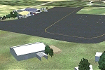
| Echo Bay CAA7 in British Columbia, Canada |
|
Images related to this file:
File Description:
This is the fifth in a series of new and renovated float bases in BC. Echo Bay is a floating marina on the northwest coast of Gilford Island, just 6 miles northwest of Health Bay (the previous post in this series). It is run by a beard called Pierre and his wife, and the food seems to attract crowds. Watch the video, and others about the marina; some of the more interesting buildings are replicated here, others are representative. There is no fuel or oil available but you can post a letter as there is a post office in the store that sells food etc to boaters. The AI is a further adaptation of the CF36 AI and involves a Baxter Beaver flying from Port Hardy on a round trip in the area through Port McNeill, Health Bay, Echo Bay, and Sullivan Bay, plus Harbour Air from Vancouver, and small GA. At Echo Bay the AI appears to work for both landing and takeoff for the Beaver and sometimes for the Otter, depending on wind direction. All of these float bases can be installed together in the same folders, with a saving in duplicate textures. So a series called BC Floats (or whatever you want to call it) or individually installed float bases; your choice. The next in the series will be Sullivan Bay, another floating marina. I have used what was a RWY12 boat here, but my RWY12 no longer includes the "Port and Sea" part that included this and other boats. Somewhere I must still have the textures as they are showing up as required, but I cannot find them to include them here. Hopefully your installation will find them on your hard drive and use them. If not, complain to me and I will attempt to demonstrate diligence.
| Filename: | Echo_Bay_CAA7_in_British_Columbia_Canada.zip |
| License: | Freeware, limited distribution |
| Added: | 18th January 2017, 17:09:19 |
| Downloads: | 200 |
| Author: | Roger Wensley |
| Size: | 6.92 MB |
| Category: Flight Simulator 2004 - Scenery | |
| Saldanha Steel, South Africa |
|
File Description:
Saldanha Steel Plant and Harbour in Saldanha Bay, Western Cape, South Africa. Developed on Aeroworx South Africa Scenery for FS2004, but could also work on default scenery.
| Filename: | saldanha.zip |
| License: | Freeware, limited distribution |
| Added: | 1st January 2009, 19:06:16 |
| Downloads: | 1,329 |
| Author: | Jacques van Zyl |
| Size: | 741 KB |
| Category: Flight Simulator 2004 - Scenery | |
| Wairoa Airport - NZWO |
|
Images related to this file:
File Description:
Northern Hawkes' Bay. Made for Christian Stock's NZ mesh in the form of "Mountains of New Zealand" and topo in the form of "Lakes and Rivers of New Zealand".
| Filename: | wairoa_nzwo.zip |
| License: | Freeware |
| Added: | 18th January 2011, 05:57:56 |
| Downloads: | 297 |
| Author: | Godfrey Tier |
| Size: | 1.75 MB |
| Category: Flight Simulator 2004 - Scenery | |
| California Central Coast Scenery Revision 1 |
|
File Description:
California Central Coast Scenery for FS2004, Revision 1 to CCCOAST4.ZIP released 12/27/03. This revision replaces several textures with DXT1 formatted textures, adds some wave spray effects at Morro Bay and Santa Barbara and removes the lighthouses at San Simeon and San Luis Obispo Bay to make room for Larry Silsbee's California lighthouses.
Scenery files for all 8 airports were also revised to eliminate loss of autogen under
certain conditions.
CCCOAST4.ZIP is required. 1/15/04
| Filename: | ccc4rev1.zip |
| License: | Freeware |
| Added: | 15th January 2004, 23:37:12 |
| Downloads: | 5,236 |
| Author: | Al Wheeler |
| Size: | 2.7 MB |
| Category: Flight Simulator 2004 - Scenery | |
| Boundary Bay CZBB in British Columbia, Canada |
|
Images related to this file:
File Description:
Boundary Bay is south of Vancouver in British Columbia, close to the US/Canada border. It is the 5th busiest airfield in Canada measured in terms of take offs and landings as there are several training companies based there. The airfield was purchased by Alpha Aviation in 2009 and and modernised for the 2010 Winter Olympics, the main addition being a new terminal. This is an ex-military training base which was built in 1941, and one of the original hangars still survives. The two runways in use now (07/25 5,600' and 12/30 2,750', both of them 100' wide) are reduced asphalted areas of the original runways; the third runway is now an apron for GA parking and has had hangars built along it. There is JetA and 100LL available. The large building at the east end of the north apron is a HQ and maintenance facility for a helicopter company, Heli-one. All of the north apron buildings on the field have been modelled specifically for this scenery, plus the nearby huge greenhouse farm structures which are visible from further away than the airfield is. AI for Boundary Bay will be posted later this week.
| Filename: | boundary_bay.zip |
| License: | Freeware, limited distribution |
| Added: | 12th May 2011, 13:30:18 |
| Downloads: | 847 |
| Author: | Roger Wensley |
| Size: | 4.55 MB |
| Category: Flight Simulator 2004 - Scenery | |
| Sanikiluaq CYSK in Hudson Bay, Nunavut, Canada |
|
Images related to this file:
File Description:
Sanikiluaq is a village 740 or so inhabitants at N56 30, W79, which means in the southern part of Hudson Bay, close to James Bay. The village is at the north end of Flaherty Island, which is the largest of the Belcher Islands. You might fly there from La Grande Riviere in Quebec (200 miles SSE) or maybe from Moosonee in Ontario at the bottom of James Bay (350 miles SSW). Sanikiluaq village does not feature in FS9, so the first thing to do was to add it; it is the right shape and with around the right number of houses on the right streets but as I wasn't going to model 100+ individual houses just think of it as a hand-made auto-generated village. I also had to move the airfield over beside the river, so there is a DELETE file and a GRASS file and a ROADS file, as well as an AFCAD for AI and a scenery file. And AI for a visiting Air Inuit plane.
| Filename: | sanikiluaq.zip |
| License: | Freeware, limited distribution |
| Added: | 11th October 2010, 23:15:41 |
| Downloads: | 509 |
| Author: | Roger Wensley |
| Size: | 2.27 MB |
| Category: Flight Simulator 2004 - Scenery | |
| Waskaganish CYKQ in James Bay, Quebec, Canada |
|
Images related to this file:
File Description:
Waskagansh is a village with 2,500 or so inhabitants at N51 28 W78 45 on the southeast shore of James Bay. It was founded in 1668 as Fort Charles (later it became Fort Rupert) and was the first Hudson's Bay Company trading post in the James Bay area. The village's current name means Little House in the Cree language. The village does not feature in FS9 but is included in this scenery with approximately the right shape; just think of it as a hand-made auto-generated village.
I also had to add the roads (the file called "waskROADS"), delete the stock airfield background ("WaskDELETE"), and add a new background ("WaskGRASS") plus of course there is the usual scenery file and the AFCAD and AI. There is also a note in here on what to do about a possible texture problem for the village that I have discussed with two downloaders and solved. I hope.
| Filename: | waskaganish.zip |
| License: | Freeware, limited distribution |
| Added: | 21st October 2010, 23:32:16 |
| Downloads: | 537 |
| Author: | Roger Wensley |
| Size: | 1.43 MB |
| Category: Flight Simulator 2004 - Scenery | |
| Puvirnituq CYPX in Hudson Bay, Quebec, Canada |
|
Images related to this file:
File Description:
Puvirnituq is a village of 1,300 or so inhabitants at N60 W77 on the east shore of Hudson Bay. It's name means "Putrid" in Inuit, and there are two different stories about how it got the name. The village does not feature in FS9, but is included in this scenery with approximately the right shape (the coast, even with UT, is not exactly right) so just think of it as a hand-made auto-generated village which gives the airfield a reason for being there. The runway is a very generous 6,300 feet of gravel 148 feet wide, which should be enough for almost anything. I also had to add the roads, delete the stock airfield background and add a new background, plus of course there is the scenery file and the AFCAD and AI.
| Filename: | puvirnituq.zip |
| License: | Freeware, limited distribution |
| Added: | 30th October 2010, 13:34:30 |
| Downloads: | 372 |
| Author: | Roger Wensley |
| Size: | 1.78 MB |
© 2001-2025 AVSIM Online
All Rights Reserved