
Where Flight Simulation Enthusiasts Gather from Around the World!
AVSIM Library - Search Results

| Category: Flight Simulator 2004 - Scenery | |
| Hana Heli-Obstacle Course v3.0 |

|
File Description:
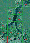
Hana Airport is a regional airport of the State of Hawaii on the east shore of the island of Maui, 3 NM northwest of the unincorporated town of Hana. The airport covers 119 acres and has one runway. It is primarily a commuter facility used by unscheduled air taxis and general aviation. This scenery is intended as a single/multiplayer helicopter obstacle course where heli pilots can meet to compete, show off, and share their helo skills. Since birdseye (Timm Turner) already did a neat scenery called Hana_Scenery_PHHN (search for "hana" in the HoverControl Downloads), we decided to convert PHHN to a full helicopter training area. Makes a great place for helo pilots to gather to practice and perfect their skills, and challenge other pilots! And keep an eye-out for that Hot Air Balloon, cruising around an altitude of 3000 feet (don't forget to wave at them!).
Another unique thing about this scenery is the neighboring islands (Honolulu Intl/Hickam AFB, Bellows AFB, Lanai City, Kahului, Molokai, etc). If you get frustrated during your heli obstacle course training, just take a heading of 275 degrees, and relax at one of the neighboring islands. We also added an Easter Egg - If you set your FS calendar to July 21st, you'll see a large ridge fire up in the hills. Load Jordan Moore's Erickson S64E (http://www.hovercontrol.com/) & try your skills at water bombing!
| Filename: | Hana_HeliObstacle_Course_v30.zip |
| License: | Freeware |
| Added: | 28th August 2011, 17:53:18 |
| Downloads: | 467 |
| Author: | Greg Spellmen, Bob Ferguson |
| Size: | 95.52 MB |
| Category: Flight Simulator 2004 - Scenery | |
| Hana Heli-Obstacle Course v2.0 |
|
Images related to this file:
File Description:
Hana Airport is a regional airport of the State of Hawaii on the east shore of the island of Maui, 3 NM northwest of the unincorporated town of Hana. The airport covers 119 acres and has one runway. It is primarily a commuter facility used by unscheduled air taxis and general aviation. This scenery is intended as a single/multiplayer helicopter obstacle course where heli pilots can meet to compete, show off, and share their helo skills. Since birdseye (Timm Turner) already did a neat scenery called Hana_Scenery_PHHN (search for "hana" in the HoverControl Downloads), we decided to convert PHHN to a full helicopter training area. Makes a great place for helo pilots to gather to practice and perfect their skills, and challenge other pilots! And keep an eye-out for that Hot Air Balloon, cruising around an altitude of 3000 feet (don't forget to wave at them!). Another unique thing about this scenery is the neighboring islands (Honolulu Intl/Hickam AFB, Bellows AFB, Lanai City, Kahului, Molokai, etc). If you get frustrated during your heli obstacle course training, just take a heading of 275 degrees, and relax at one of the neighboring islands. We also added an Easter Egg - If you set your FS calendar to July 21st, you'll see a large ridge fire up in the hills. Load Jordan Moore's Erickson S64E (http://www.hovercontrol.com/) & try your skills at water bombing!
| Filename: | Hana_HeliObstacle_Course_v20.zip |
| License: | Freeware |
| Added: | 7th December 2010, 03:28:47 |
| Downloads: | 475 |
| Author: | Greg Spellmen & Bob Ferguson |
| Size: | 58.56 MB |
| Category: Flight Simulator 2004 - Scenery | |
| VFR of Lario - Como lake, Italy |
|
Images related to this file:
File Description:
This is the first of the expected seventeen sceneries in the "VFR of Lario" project, that will include the full view of the Como Lake, made with photorealistic terrain (multiseason & night) and with 3D GMax realistic objects, including some motions. Further the Como seaplane airport, the project will include some other virtual ones, and all the piers of NLC (Navigation Lake Como). The project will be completed with a related AI seaplane traffic.
The "VFR of Lario" project REQUEST the installation of the scenery "Itcoast2.zip" & the related "ITAC2_P1.zip", both available for free download from different libraries.
Information: Como is the main and beautifull city on the namesake lake (called Lario), placed in the north of Italy, closed to the Helvetic border. It includes the AeroClub Como seaplanes international airport, with his own flight school. Como has the headseat of NLC, the fleet management for connection of forty Lario's piers. This first scenery covers approximately an area of 7.5x6 kmt.
Contents: airport water track with hangar and static seaplanes; breackwater and stadium lake front, war memorial monument, Volta's temple and lighthouse, main Cathedral, Social theater, city old towers and wall, villa Olmo, square Cavour's buildings, NLC main pier and some minor others, Como-Brunate's funicolar connection (animated), lake fountain, Tavernola shipyard, Baradello's castle, Valduce hospital; motor ships (animated), steamer, hydrofoils and other minor boats; several other buildings (GenericBuilding system), trees and lights widespread all over the scenery.
| Filename: | VFR_of_Lario__Como_lake_Italy.zip |
| License: | Freeware |
| Added: | 22nd December 2011, 23:30:47 |
| Downloads: | 3,549 |
| Author: | Aldo Della Vedova, Daniele Lanfranchi, Diego Caligiuri |
| Size: | 25.33 MB |
| Category: Flight Simulator 2004 - Scenery | |
| Maurice Bishop TGPY on Grenada in the Caribbean |
|
Images related to this file:
File Description:
Grenada island is 17 miles south of the southernmost island of the Grenadines, Carriacou; there are some smaller islands between the two. Grenada is 18 miles long and around 8 miles wide, has an estimated population of 110,000, and produces a very large part of the world's annual nutmeg harvest. The capital, St Georges, is by far the largest town and is at the southern end of the island, with the airport close by.
The airport is now called Maurice Bishop, but for some years was called Point Salines. The runway is just over 9,000 feet long and oriented 10/28. Point Salines replaced Pearl Airport, which is on the east coast 12 miles northeast of St Georges and was difficult to expand as the runway had mountains at one end and the sea at the other. Pearl is now closed; it is included here but only as a visual landmark with "closed" markings. There are regular international flights from North America and Europe, some of which are seasonal only (Air Canada for instance) and local connecting flights by LIAT and SVG. I retained the default control tower as it is some distance away. In real life it is also some distance away and on a hill northwest of the terminal. Which is why I did not take photos from which I would have made the real one. The hill does not feature in FS9.
| Filename: | Maurice_Bishop_TGPY_on_Grenada_in_the_Caribbean.zip |
| License: | Freeware, limited distribution |
| Added: | 11th June 2013, 23:28:17 |
| Downloads: | 825 |
| Author: | Roger Wensley |
| Size: | 7.38 MB |
| Category: Flight Simulator 2004 - Scenery | |
| Durango-La Plata County (KDRO) |
|
File Description:
FS2004 Scenery-Durango-La Plata County Airport (KDRO)serves Durango and La Plata County in Colorado and is owned by Durango City/La Plata County. The paved runway extends for 9201 feet. The facility is at an elevation of 6685 feet at a distance of about 10 miles from Durango. Created with EZ Scenery and Lago FSE. EZ Scenery libraries required. Lago optional. By John B. Loney, Jr.
| Filename: | DurangoLa_Plata_County_KDRO.zip |
| License: | Freeware |
| Added: | 18th December 2006, 03:45:44 |
| Downloads: | 1,622 |
| Author: | John B. Loney, Jr. |
| Size: | 590.29 KB |
| Category: Flight Simulator 2004 - Scenery | |
| Morrisville-Stowe State, Vermont (KMVL) |
|
File Description:
FS204 Scenery-Morrisville-Stowe State Airport, Vt. (KMVL) serves Morrisville and Lamoille County and is owned by the State Of Vermont. The paved runway extends 3,701 feet. The facility is at an elevation of 732 feet and is about two miles from Morrisville. Scenery requires EZ Scenery and Rwy12 libraries,(Please read the readme file) AFCAD2, Traffic Tools and Nova texture sets. Lago's FSE is optional. By John B. Loney, Jr.
| Filename: | MorrisvilleStowe_State_Vermont_KMVL.zip |
| License: | Freeware |
| Added: | 21st May 2006, 18:51:01 |
| Downloads: | 717 |
| Author: | John B. Loney, Jr. |
| Size: | 938.42 KB |
| Category: Flight Simulator 2004 - Scenery | |
| Murfreesboro Municipal - KMBT |
|
Images related to this file:
File Description:
FS2004 Scenery-Murfreesboro Municipal Airport (KMBT) serves Murfreesboro and Rutherford County and is owned by the City Of Murfreesboro. The paved runway extends for 3898 feet. The facility is at an elevation of 615 feet at a distance of about 2 miles from Murfreesboro. Created entirely with EZ Scenery. EZ Scenery library objects required. New AFCAD file and AI traffic from Traffic Tools included. By John B. Loney, Jr.
| Filename: | Murfreesboro_Municipal__KMBT.zip |
| License: | Freeware, limited distribution |
| Added: | 3rd June 2010, 00:43:34 |
| Downloads: | 817 |
| Author: | John B. Loney, Jr. |
| Size: | 1.09 MB |
| Category: Flight Simulator 2004 - Scenery | |
| Cape May-Lewes Ferry |
|
File Description:
FS2004 Scenery - Cape May-Lewes Ferry. This scenery consists of the ferry terminal at Cape May, New Jersey and the ferry terminal at Lewes, Delaware. The AI ferry, M.V. Cape May sails from The Cape May Ferry Terminal, just south of the Cape May County Airport(KWWD), to the Lewes Ferry Terminal in Lewes Delaware. AI ferryboat included. Compatible with default FS9 and Ultimate Terrain. By John B. Loney, Jr.
| Filename: | Cape_MayLewes_Ferry.zip |
| License: | Freeware, limited distribution |
| Added: | 30th January 2008, 03:12:46 |
| Downloads: | 876 |
| Author: | John B. Loney, Jr. |
| Size: | 648.42 KB |
| Category: Flight Simulator 2004 - Scenery | |
| Optional 32-bit textures for my Harare and Victoria Falls sceneries. |
|
File Description:
This archive contains only the 32-bit format replacement textures for use with my sceneries for Harare and Victoria Falls that are also hosted on Avsim. This archive has been made separate because people using dial-up access shouldn't be forced to upload gargantuan texture files simply to enjoy a new airport or two. Note that the textures were worked on as 24-bit images and saved as 32-bit.
| Filename: | Optional_32bit_textures_for_my_Harare_and_Victoria.zip |
| License: | Freeware, limited distribution |
| Added: | 28th November 2005, 13:51:54 |
| Downloads: | 1,950 |
| Author: | Matthew Ministry |
| Size: | 8.95 MB |
| Category: Flight Simulator 2004 - Scenery | |
| Landing Areas for Western Australia V1 |
|
File Description:
A collection of 35 dirt station strips (ranch strips)and country airstrips for Western Australia made from a blend of AFCAD, Airport, Runway 12, E.O.D. and Google Earth and using my country api's. Some textures are mine and the rest are an accumulation of 6 years FS. An addition to the many other fine contributions for WA. Simply unzip in addon scenery and register the folder in your FS.
| Filename: | Landing_Areas_for_Western_Australia_V1.zip |
| License: | Freeware |
| Added: | 13th August 2006, 20:39:56 |
| Downloads: | 1,162 |
| Author: | Alan Blencowe |
| Size: | 5.03 MB |
© 2001-2026 AVSIM Online
All Rights Reserved
Privacy Policy |