
Where Flight Simulation Enthusiasts Gather from Around the World!
AVSIM Library - Search Results

| Category: Flight Simulator 2004 - Scenery | |
| Campbell River CAE3 in BC Canada, textures and revised AI with Beaver aircraft |

|
Images related to this file:
File Description:
Campbell River CAE3 float base is in the middle of the eastern shore of Vancouver Island, six miles from the airport of the same name and where the channel between island and coast narrows down. Coril Air and Vancouver Island Air are both based there, but any number of other company planes can be seen on a daily basis, for instance Harbour Air which runs a regular service from Vancouver. This post provides all the textures required for the original post (some were missing, as I was told recently after some years had passed) plus a revised traffic file for Campbell River which has Beaver float planes flying between Campbell River and Vancouver Harbour. The Beaver planes are included, with permission, from the payware Alaska scenery by FSAddon. The layout of the dock moorings has been revised and the AFCAD included here replaces the one previously provided. The date of the scenery is around 2010, before a lot of the holiday trailers had been removed.
| Filename: | Campbell_River_CAE3_in_BC_Canada_textures_and_revi.zip |
| License: | Freeware, limited distribution |
| Added: | 19th November 2018, 18:06:42 |
| Downloads: | 248 |
| Author: | Roger Wensley |
| Size: | 7.68 MB |
| Category: Flight Simulator 2004 - Scenery | |
| Beaver Creek CYXQ 1.1 |
|
Images related to this file:
File Description:
Version 1.1 adds the missing door on the ground side of the terminal building. It is complete and does not require that you already have the previous version.
Beaver Creek CYXQ is a small airport in the northern Canada Yukon Territory, near the Alaskan border. There is a customs facility located on the Alaska Highway adjacent to the airport. There is an NDB located on the field, but no published instrument approaches. The single gravel runway is 3740'long.
This scenery was completely redone and features a custom photoreal terminal and custom runway/taxiway lights. The adjacent customs facility is included but is not based on the real one as I had no photos to work from. The custom runway lights are always on, even during the day...sorry, this is an FS9 limitation.
This scenery was designed for use with Ultimate Terrain and was not tested in the default scenery. It may or may not work in FSX.
| Filename: | Beaver_Creek_CYXQ_11.zip |
| License: | Freeware |
| Added: | 6th November 2010, 22:31:24 |
| Downloads: | 913 |
| Author: | Sidney Schwartz & Peter Ham |
| Size: | 447.05 KB |
| Category: Flight Simulator 2004 - Scenery | |
| Pete & Sid's Viva Scenery Volume 4 |
|
File Description:
This is a collection of scenery enhancements for 81 airports, mostly smaller ones, located primarily in the Pacific Northwest, Alaska and Western Canada. (Yes, there's one in New Zealand.) It was not our intention to do anything fancy or particularly accurate, but simply to make the default scenery less boring and more fun. General aviation AI traffic (using default FS9 aircraft) is also included for some of these airports. The scenery for any individual airport may be removed without affecting the other airports. Some the airports we've done may also be included in Glacier Bay and other scenery add-ons; you'll need to remove one or the other to resolve any conflicts. This scenery was designed to work with Flight1's Ultimate Terrain and has not been tested with the default FS9 scenery. Most of the airports will probably work fine with the default scenery; those airports near water features (lakes, rivers, coastlines) are the ones most likely to have problems.
| Filename: | Pete__Sids_Viva_Scenery_Volume_4.zip |
| License: | Freeware |
| Added: | 12th July 2008, 13:22:06 |
| Downloads: | 2,255 |
| Author: | Sidney Schwartz & Peter Ham |
| Size: | 1.03 MB |
| Category: Flight Simulator 2004 - Scenery | |
| Airstrips of Eastern France |
|
Images related to this file:
File Description:
Next in my ongoing "Airstrips of Western Europe" project for FS2004, herewith about 100 sceneries of small, mostly default airfields in the eastern section of France, each enhanced with taxiways, parking spaces and aprons as appropriate, to further facilitate the generation of lightweight AI traffic in the area without overloading the more major airfields. When combined with the French airstrips from my previous uploads, the majority of the default small French airstrips in FS2004 will be able to generate AI traffic, should you so wish, as well as putting a little basic detail into the countryside.
Again, there's no photo-realism here, just a selection of basic 'generic' buildings, more or less accurately sized and placed to reflect the airfield layout as seen on on-line satellite imagery and aerial photography. These buildings have minimal effect on frame-rates, so are ideal for this kind of job. The airfields are aligned as well as possible with the roads etc. in UT Europe and the Genesis Europe mesh, but should mostly be fine in a default installation or other configuration.
| Filename: | Airstrips_of_Eastern_France.zip |
| License: | Freeware |
| Added: | 25th September 2024, 13:37:50 |
| Downloads: | 148 |
| Author: | Chris Eve |
| Size: | 2.83 MB |
| Category: Flight Simulator 2004 - Scenery | |
| Little Port Walter for Holger Sandmann's Tongass Fjords scenery |
|
Images related to this file:
File Description:
This is a second fish farm at the southern end of Baranof Island and Chatham Strait in southern Alaska. Big Port Walter is named on the chart of the area, and there is a section of the chart included here. Little Port Walter is a much smaller offshoot bay, sheltered from the weather and ideal for a fish farm. This scenery is designed specifically for use in the Tongass Fjord scenery. I may have incorrectly identified Tongass Fjords as being required for Hawk Logging when Glacier Bay is needed. Ah well, it is one or the other of them. The fish farm (or hatchery, the description varies) has an identifying code so it will show up on a gps as PWL. There is no interaction with atc as there are no designated water runways, so PWL on the gps just acts as a waypoint. There will be further posts for use with Tongass Fjords, Misty Fjords, and Glacier Bay, and I still find these scenery areas by Holger and his crew the most satisfying in FS9.
| Filename: | Little_Port_Walter_for_Holger_Sandmanns_Tongass_Fj.zip |
| License: | Freeware, limited distribution |
| Added: | 23rd November 2014, 01:33:12 |
| Downloads: | 233 |
| Author: | Roger Wensley |
| Size: | 3.38 MB |
| Category: Flight Simulator 2004 - Scenery | |
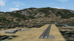
| CYYD - Smithers Regional Airport - Smithers, British Columbia, Canada |
|
Images related to this file:
File Description:
Smithers is in northwest BC, 60 miles east and a bit north of Terrace (my previous post) and directly east of the southern border of Alaska, 430 miles north of Vancouver on the Yellowhead highway. The town has a population of 5,500 and is set in a north-south valley between mountains, the most impressive of which is Hudson Bay Mountain to the west. The airport is to the north of the town and has a single runway of 7,544 feet, aligned 33-15. The main user is Central Mountain Air, who are headquartered in Smithers and have a large maintenance hangar there next to the terminal building. The airport has scheduled flights by Central Mountain Air, Jazz, and Hawk Air, which are in the AI along with a Lockheed Electra of Conair (who are the largest operator of fire fighting planes in BC and have re-fill tanks in Smithers) and also a HS 748 of Air North, which is actually for an upcoming post of Old Crow CYOC.
| Filename: | CYYD__Smithers_Regional_Airport__Smithers_British_.zip |
| License: | Freeware, limited distribution |
| Added: | 30th November 2014, 13:53:46 |
| Downloads: | 713 |
| Author: | Roger Wensley |
| Size: | 8.06 MB |
| Category: Flight Simulator 2004 - Scenery | |
| Minstrel Island CAX7 float base in British Columbia, Canada |
|
Images related to this file:
File Description:
This is the third in a series of new and renovated float bases in BC. Minstrel Island is on the south side of Knight Inlet and 25 miles west of Knight Inlet Lodge (the previous post in this series). There is a resort on the island, though it is hidden from the air by the trees. Fuel and oil are both available at the dock, and there is a 17 feet tidal range, which would be interesting of it could be replicated in FS. The AI is an adaptation of that for CF36 and involves a GA Cessna, and a Seair Beaver flying from Campbell River to Knight Inlet Lodge via Minstrel Island. Again, because of large hills the landing of the AI may or may not take place, depending on wind direction and whether or not they fly into solid rock before landing. Take off and departure will take place. Ultimate Terrain Alaska/Canada would be a definite plus to get the water in the right shape and place. This scenery will not work without it.
| Filename: | Minstrel_Island_CAX7_float_base_in_British_Columbi.zip |
| License: | Freeware, limited distribution |
| Added: | 3rd January 2017, 15:38:57 |
| Downloads: | 224 |
| Author: | Roger Wensley |
| Size: | 3.54 MB |
| Category: Flight Simulator 2004 - Scenery | |
| Airstrips of South-West France |
|
File Description:
Part two of my "Airstrips of Western Europe" project, these 90+ sceneries are mostly default basic airstrips from FS2004, enhanced with taxiways, parking spaces and aprons as appropriate, to facilitate the activation of lightweight GA AI traffic, primarily over the south-west of France. Hopefully these will allow a degree of continuity between my previous upload (Airstrips of North-West Europe) and the existing freeware releases for Spain and Portugal.
Again, there's no photo-realism here, just a selection of basic 'generic' buildings, more or less accurately sized and placed to reflect the airfield layout as seen on on-line satellite imagery and aerial photography. These buildings have minimal effect on frame-rates, so are ideal for this kind of job. The airfields are aligned as well as possible with the roads etc. in UT Europe and the Genesis Europe mesh, but should mostly be fine in a default installation or other configuration.
A good number of airfields in this area have been neatly implemented in the "Occitania_VFR" package, so I've not duplicated their work.
Also included are some "bonus" sceneries from further north that weren't included in my previous upload. Just copy them over as appropriate if required.
| Filename: | Airstrips_of_SouthWest_France.zip |
| License: | Freeware |
| Added: | 16th July 2024, 18:20:44 |
| Downloads: | 111 |
| Author: | Chris Eve |
| Size: | 274.73 KB |
| Category: Flight Simulator 2004 - Scenery | |
| Airstrips of Switzerland |
|
Images related to this file:
File Description:

Just a small collection of of ai-enabled airfields, that don't appear to have been implemented by other authors, to further expand my Airstrips of Europe project.
Again, there's no photo-realism here, just a selection of basic 'generic' buildings, more or less accurately sized and placed to reflect the airfield layout as seen on on-line satellite imagery and aerial photography. These buildings have minimal effect on frame-rates, so are ideal for this kind of job. The airfields are aligned as well as possible with the roads etc. in UT Europe and the Genesis Europe mesh, but should mostly be fine in a default installation or other configuration. As before, the files for each airfield can be easily identified by the ICAO code, even if the airfield names vary slightly, so you can pick and choose and mix and match to suit any sceneries you already have, should you so wish. There is no requirement for any other download. Each airfield will exist as a stand-alone entity should you only want a few of them. Please read the rest of this "blurb" in the included text file. There may be some details of note or interest.
| Filename: | Airstrips_of_Switzerland.zip |
| License: | Freeware |
| Added: | 6th March 2025, 21:00:04 |
| Downloads: | 113 |
| Author: | Chris Eve |
| Size: | 437.07 KB |
| Category: Flight Simulator 2004 - Scenery | |
| Hewanorra TLPL on Saint Lucia in the eastern Caribbean |
|
Images related to this file:
File Description:
St Lucia island is to the north of the Grenadines, between Martinique and Saint Vincent. St Lucia is nearly 30 miles long and has a population of 175,000, with two airports. Hewanorra International is at the southern end of the island, the end furthest from the capital, Castries. The reason for this is that at the southern end it was possible to build a runway almost 9,000 feet long, while the airport in the north (Vigie) could not be extended further to accomodate the largest jets. The airport was originally a USAAF base, converted to commercial use.
All buildings are made with photographic textures and include the new terminal and a new control tower. The apron has been extended so that 747's etc can be accommodated, and there are regular international flights by Virgin, BA, Air Canada, Air France, etc and local connecting flights by LIAT; the AI includes both major international airlines and LIAT. The towns around the airport (Vieux Fort etc) are included here: the scenery is based on the "Lesser Antilles Mesh" which is required and can be downloaded for free.
| Filename: | Hewanorra_TLPL_on_Saint_Lucia_in_the_eastern_Carib.zip |
| License: | Freeware, limited distribution |
| Added: | 11th June 2013, 16:23:49 |
| Downloads: | 831 |
| Author: | Roger Wensley |
| Size: | 4.25 MB |
© 2001-2026 AVSIM Online
All Rights Reserved
Privacy Policy |