
Where Flight Simulation Enthusiasts Gather from Around the World!
AVSIM Library - Search Results

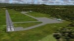
| Category: Flight Simulator 2004 - Scenery | |
| Green Lake CBG2 in British Columbia Canada |

|
Images related to this file:
File Description:
Green Lake is on the eastern side of the Coast Mountains of British Columbia, around 40 miles north of Cache Creek and 15 miles south of 100 Miles House (a previous posting). The airfield is beside the lake shore and serves the Flying U holiday ranch with a grass runway 2,575 feet long and aligned 18-36. There is no lighting. There is also mooring on the lake for boats and float planes. I have posted it as Green Lake CBG2, but I suggest that you just add it to your previously created "BC airfields", if you followed my previous suggestion. You then avoid the inevitable doubling up of common textures etc. Plus that way you will have just one FS9 library post to do and new airfields will not need yet another posting. Up to you. It just occurred to me that probably only a few of you have a copy of the Nav Canada Airfields handbook, so won't know the airfield altitudes, which is useful to have amid mountains. So, Pemberton is 670 feet Above Sea Level, Cache Creek 2,034 feet ASL, and Green Lake 3,550 feet ASL. The others to follow as posted. If you find a defect, email me.
| Filename: | Green_Lake_CBG2_in_British_Columbia_Canada.zip |
| License: | Freeware, limited distribution |
| Added: | 18th November 2020, 19:44:00 |
| Downloads: | 85 |
| Author: | Roger Wensley |
| Size: | 10.05 MB |
| Category: Flight Simulator 2004 - Scenery | |
| Bethel: Yukon Area |
|
Images related to this file:
File Description:
This presumes you have already installed Bethel PABE, Bethel Local Airfields, and Bethel St Mary's. In the Yukon River area of Alaska to the north of Bethel and to the south around the equally wide (but shorter) Kuskowim River there are small villages, served by flights from both Bethel PABE and St Mary's PASM. These villages are dependent upon fishing for survival, and in this flat and very wet terrain are equally dependent upon the gravel runways that link them to the outside world. There are no surfaced roads, and the rivers and their tributaries wind into the distance and are impractical delivery routes except from nearby places. In an area 300 miles by 200 miles most places cannot be described as "nearby". This post is of the small villages, including those previously posted; I had missed on picking up some terrain conflicts between nighttime grass and town textures. They are corrected here and included along with new airfields. Bethel and St Mary's are also reposted to include the further enlargement of parking for the increased number of small AI aircraft. These smaller airfields vary in quality; some have runway signage but most do not, and while some have two or even three hangars/garages/terminal buildings on the apron there are others who have none at all. The 39 small airfields included here are as listed:
Akiak AKI, Akiakchak Z13, Alakanuk AUK, Anvik PANV, Atmautluak 4A2, Cape Romanzof PACZ, Chefornak PACK, Chevak VAK, Eek EEK, Emmonak PAEM, Goodnews GNU, Grayling KGX, Holy Cross HCA, Hooper Bay PAHP, Kako 9AK2, Kalskag KLG, Kasigluk Z09, Kipnuk PAKI, Kongiganak PADY, Kotlik KOT, Kwethluk KWT, Kwigillingok A85, Marshall MLL, Mountain Village MOU, Napakiak WNA, Napaskiak PKA, Newtok PAEW, Nightmute IGT, Nunapichuk 16A, Pilot Station 0AK, Quinhagak PAQH, Russian Mission RSH, Scammon Bay SCM, Shageluk SHX, Sheldon Point SXP, Toksook Bay OOK, Tuluksak TLT, Tuntutuliak A61, Tununak 4KA.
I am currently going through the airfields again to check if further modifications are required, and I am also adding a few new ones. As I am going to be updating my computer I am posting now, complete or not, and I will post an update later of further additions.
| Filename: | Bethel_Yukon_Area.zip |
| License: | Freeware, limited distribution |
| Added: | 3rd May 2019, 17:20:53 |
| Downloads: | 169 |
| Author: | Roger Wensley |
| Size: | 6.3 MB |
| Category: Flight Simulator 2004 - Scenery | |
| Airstrips East of the Adriatic |
|
Images related to this file:
File Description:
A collection of about 60 small airfields in Albania, Bosnia & Herzegovina, Kosovo, North Macedonia and Serbia & Montenegro, many of which aren't featured in FS2004, each enhanced with taxiways, parking spaces, buildings etc. and aprons as appropriate, to fill in a few gaps to the east of Italy. Most of these airfields are relatively "rural", often little more than a shed and a grass runway in a field, but they allow the generation of lightweight GA AI traffic in this area and into the adjacent countries.Again, there's no photo-realism here, just a selection of basic 'generic' buildings, more or less accurately sized and placed to reflect the airfield layout as seen on on-line satellite imagery and aerial photography. These buildings have minimal effect on frame-rates, so are ideal for this kind of job. The airfields are aligned as well as possible with the default roads etc. and the Genesis Europe mesh, but should mostly be fine in a default installation or other configuration.As before, the files for each airfield can be easily identified by the ICAO code, even if the airfield names vary slightly, so you can pick and choose and mix and match to suit any sceneries you already have, should you so wish. There is no requirement for any other download. Each airfield will exist as a stand-alone entity should you only want a few of them. A few default airfields have had new ICAO codes allocated, in these instances I've provided files to remove the default scenery from the landscape, though the original airfield will still appear on the maps and menu.
| Filename: | Airstrips_East_of_the_Adriatic.zip |
| License: | Freeware |
| Added: | 20th October 2025, 11:48:25 |
| Downloads: | 53 |
| Author: | Chris Eve |
| Size: | 525.71 KB |
| Category: Flight Simulator 2004 - Scenery | |
| Airstrips of Austria |
|
Images related to this file:
File Description:

Probably the last of my Airstrips of Western Europe project, herewith 30+ sceneries for smaller airfields in Austria, a particularly scenic area of Europe, many of which are not included in FS2004, each enhanced with taxiways, parking spaces, buildings etc. and aprons as appropriate, to further facilitate the generation of lightweight AI traffic in the area, without overloading the more major airfields.
Again, there's no photo-realism here, just a selection of basic 'generic' buildings, more or less accurately sized and placed to reflect the airfield layout as seen on on-line satellite imagery and aerial photography. These buildings have minimal effect on frame-rates, so are ideal for this kind of job. The airfields are aligned as well as possible with the roads etc. in UT Europe and the Genesis Europe mesh, but should mostly be fine in a default installation or other configuration.
As before, the files for each airfield can be easily identified by the ICAO code, even if the airfield names vary slightly, so you can pick and choose and mix and match to suit any sceneries you already have, should you so wish. There is no requirement for any other download. Each airfield will exist as a stand-alone entity should you only want a few of them.
Very few basic library objects are used ... you can add "eye-candy" to suit your own taste should you wish, or just leave them as vague shapes in the scenery that can put a few more small aircraft into the air. As with other airfields in this series, now these are "ai-activated" you might expect to see the occasional little aircraft turn up at some of them if you've got any third-party traffic installed.
| Filename: | Airstrips_of_Austria.zip |
| License: | Freeware |
| Added: | 26th April 2025, 13:59:32 |
| Downloads: | 82 |
| Author: | Chris Eve |
| Size: | 1.04 MB |
| Category: Flight Simulator 2004 - Scenery | |
| Bethel area airfields in southwest Alaska close to the Yukon River |
|
Images related to this file:
File Description:
This presumes you have already installed my post of Bethel PABE. In the Yukon River area of Alaska there are a lot of small villages close together, which is unusual for Alaska. Almost all of them are on the coast or a river bank, and the local economies depend on fishing. Some are larger than others and have a fish processing plant, such as in Emmonak. This is the largest such plant and it exports prepared fish by cargo planes which fly in on a daily basis, using an extended runway. This post includes airfields to the south and west of PABE, 17 of them; some of them already included and now modified. There will be more airfields to the north and northwest of Bethel in a future post. There are revisions to Bethel to include parking spaces for Yute Air (newly included here) and extra spaces for Ryan Air. Both of these flew Cessna 205 planes into the smaller village strips from Bethel (past tense as Yute Air recently went bankrupt). The northwest area is served both from Bethel and also from St Mary's PASM, which is in the northwest and at a more economical range to the local airfields (100 miles closer than Bethel). These smaller airfields have few airfield buildings or any other creature comforts; featuring heavily are a new standard blue garage building (sometimes not yet installed) and a small and old terminal shed (that has sometimes collapsed and been removed). Go to "http://vfrmap.com/" for free vfr maps of the area, There is a pic of the local chart area included here. The screenshots are a random sample. Kipnuk PAKI is the one that appears to have a second and long grass runway; what it actually has is the ground prepared for a new and long gravel runway but which hasn't been started yet as it has taken 10 years just to prepare the ground. I have no idea why.
| Filename: | Bethel_area_airfields_in_southwest_Alaska_close_to.zip |
| License: | Freeware, limited distribution |
| Added: | 16th April 2019, 22:47:47 |
| Downloads: | 154 |
| Author: | Roger Wensley |
| Size: | 5.93 MB |
| Category: Flight Simulator 2004 - Scenery | |
| Backcountry airfields for 19m terrain mesh in Idaho USA series 2 |
|
Images related to this file:
File Description:
These backcountry fields are for use with the FSGenesis 19m mesh of Idaho; they almost certainly do not work without it. The six airfields are a follow-on series to the previous four, ranging from Stanley that has a village and airfield buildings of one sort or another and even a length of asphalt runway, to Bruce Meadows that has two bathrooms. The full list from northwest to southeast is Bruce Meadows U63, Garden Valley U88, Warm Springs Creek 0U1, Stanley 2U7, Graham U45, and Smiley Creek U87. These airfields compensate for the loss of airfield flattens after the removal of AF917150 and AF917160, but there remain some now-unflattened airfields I have not included here, whether for reason of the impossibility of realistically creating it (as in the case of Flying B) or just a total lack of anything interesting about it. There may be some more follow-on fields that are new, to the north of the original four; these six are all to the south. The landclass files either change forested areas, as in Bruce Meadows, or add a village, as in Stanley. Although these are stand-alone, the presumption is that you have already installed the original four for use with the FS Genesis 19m terrain mesh, and there is a correction for Big Creek where I missed spotting a lack of flatten in one area.
| Filename: | Backcountry_airfields_for_19m_terrain_mesh_in_Idah.zip |
| License: | Freeware, limited distribution |
| Added: | 29th May 2017, 04:20:10 |
| Downloads: | 111 |
| Author: | Roger Wensley |
| Size: | 9.09 MB |
| Category: Flight Simulator 2004 - Scenery | |
| Kamouraska Airfield --- Québec Short Hops |
|
File Description:
Kamouraska is a beautiful region situated, a bit downstream from my Rivière Ouelle scenery. It is a basic field but with all the services. The night lighting for the runway features my old vintage style kerosene torch balls. The dirt/grass strip field is fictitious and so is my rendition of the village. Included is the afcad file by Tom Constantine and very soon, Tom will add traffic between all my QSH sceneries. Thanks to Tom for bringing those scenes to life.
| Filename: | Kamouraska_Airfield__Qubec_Short_Hops.zip |
| License: | Freeware |
| Added: | 7th December 2003, 04:13:37 |
| Downloads: | 2,402 |
| Author: | Léon Louis |
| Size: | 5.45 MB |
| Category: Flight Simulator 2004 - Scenery | |
| Chiang Mai Thailand (VTCC) |
|
File Description:
This is scenery for Chiang Mai, Thailand. It also creates scenery for two smaller airfields nearby (Lanna and Lamphun). This is a complete rebuild of the default airport, and inlcudes all gates, the cargo area, and the Air Force base. The scenery is fully compatible with my mesh scenery that I had created for Thailand. An AFCAD2 file, and landclass is included.
| Filename: | Chiang_Mai_Thailand_VTCC.zip |
| License: | Freeware, limited distribution |
| Added: | 18th January 2004, 19:49:31 |
| Downloads: | 7,086 |
| Author: | Martin Strong |
| Size: | 6.67 MB |
| Category: Flight Simulator 2004 - Scenery | |
| Meschede-Schueren Airfield |
|
File Description:
Scenery of german general aviation and glider airfield Meschede-Schueren (EDKM).
Meschede is one of the oldest glider airfields in Germany. In 1933 an airshow
was the begining of flying in Schueren. Today only the old building of the pilot´s school can be seen. Schueren is located near the lake Hennesee in west Germany.
The scenery has night effects and winter textures.
| Filename: | MeschedeSchueren_Airfield.zip |
| License: | Freeware, limited distribution |
| Added: | 27th October 2003, 00:07:51 |
| Downloads: | 2,169 |
| Author: | Thomas Gierse |
| Size: | 4.41 MB |
| Category: Flight Simulator 2004 - Scenery | |
| EGMD - Lydd Airport - Lydd, England ** UPDATED VERSION ** |
|
File Description:
Lydd Airport (IATA: LYX, ICAO: EGMD) is located 1.2 NM (2.2 km; 1.4 mi) northeast of the town of Lydd and 12 NM (22 km; 14 mi) south of Ashford in the District of Shepway within Kent, England. It is also known as London Ashford Airport, which officially only refers to its operator.
| Filename: | EGMD__Lydd_Airport__Lydd_England___UPDATED_VERSION.zip |
| License: | Freeware |
| Added: | 16th December 2014, 17:38:41 |
| Downloads: | 462 |
| Author: | Billy Guo |
| Size: | 397.57 KB |
© 2001-2026 AVSIM Online
All Rights Reserved
Privacy Policy |