
Where Flight Simulation Enthusiasts Gather from Around the World!
AVSIM Library - Search Results

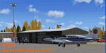
| Category: Flight Simulator 2004 - Scenery | |
| Chicoutimi / St-Honore CYRC in Quebec Canada |

|
Images related to this file:
File Description:
This is the third of five sceneries around Lac Saint-Jean in Quebec, Canada. Saint-Honore is a village on a crossroads 32 miles east of the lake, and the airport, called Chicoutimi in the Nav Canada Flight Supplement, is a mile or so east of the village. It is of the familiar triangular military design with three runways 12-30, 06-24, and 18-36. Of these, the longest is 12-30 at over 6,000 feet and has approach lighting and glide slope indicators. Of the other two 06-24 is now closed, but this scenery is based on the 2010 situation with all three open. There are two apron areas, one just to the south of 12-30 and a second to the northwest of 06-24 and served by a separate taxiway. The largest operator is a training establishment based on the northern apron and with a sizeable fleet of Beechcraft trainers (Skipper) that does not exist as an FS9 plane, so these are represented by a similar stand-in substitute. There is also a helicopter emergency evacuation operation to the east of the large control tower, and other hangars. The south apron has two main companies, Max Aviation and Exact Air, both of which run local regular scheduled flights in the area (though both appear to have now subcontracted these out to other companies) and also engage in training and charter flights. There is also a parachute training company. The ai includes flights by the companies on the field and also GA. The list of AI planes is explained in the AI folder, with details of downloads etc. The fleet of training aircraft is one of the planes in the revised (by Nick Tselepides) Piper Aircraft, designed for AI Traffic by Andras Neumann with a Paintkit by Charles Dayhuff adapted by Graham Eccleston, and Paints by Graham Eccleston, Andras Neuman and Frank Cooper along with the trainer repaint by Nick Tselepides. The Max and Exact aircraft textures are approximations by me; apologies. The use of the runways also as taxiways complicates the AI on runway 12-30 as directed by ATC. The AI will always leave 12-30 by the earliest exit, which means that the fleet of trainers will exit to the southern apron but will then taxi back onto the runway to reach taxiway A or runway 36 (according to wind direction) to proceed to the northern apron. In real life they land long and then taxi straight to the end of the runway to reach taxiway A or runway 36 without using the south apron at all. There is no way to correct this so just be ready to go around.
| Filename: | Chicoutimi__StHonore_CYRC_in_Quebec_Canada.zip |
| License: | Freeware, limited distribution |
| Added: | 12th November 2017, 17:35:21 |
| Downloads: | 342 |
| Author: | Roger Wensley |
| Size: | 29.03 MB |
| Category: Flight Simulator 2004 - Scenery | |
| Dolbeau - St. Félicien Airport, Québec Bush Scenery |
|
File Description:
This scenery can be used with or without the freeware 'Golden Wings' enhancement from Bill Lyons. It will work perfectly in regular FS2004 and should also work in FS2002. Please read the easy installation options. It features animated Northen Lights and lots of candies.
| Filename: | Dolbeau__St_Flicien_Airport__Qubec_Bush_Scenery.zip |
| License: | Freeware |
| Added: | 3rd December 2005, 09:56:58 |
| Downloads: | 1,821 |
| Author: | Leon Louis |
| Size: | 3.6 MB |
| Category: Flight Simulator 2004 - Scenery | |
| Havre St-Pierre, Quebec (CYGV) Airport, V1.0 |
|
Images related to this file:
File Description:
This scenery is a rendition of Havre-St-Pierre (CYGV) airport using GMAX for FS2004.
Information available in the latest official aeronautical publications and
pictures were used as guide in order to reproduce buildings
and other custom 3D objects as accurately as possible.
| Filename: | Havre_StPierre_Quebec_CYGV_Airport_V10.zip |
| License: | Freeware, limited distribution |
| Added: | 31st October 2009, 10:16:47 |
| Downloads: | 852 |
| Author: | Pierre Gallant |
| Size: | 1.17 MB |
| Category: Flight Simulator 2004 - Scenery | |
| EGDG - RAF St. Mawgan - Newquay, Cornwall - UK |
|
Images related to this file:
File Description:

Representative scenery of RAF. St. Mawgan in Cornwall. Opened as a civilian airfield in 1933, it was requistioned by the Royal Air Force in 1939. After use as a satellite field, it was taken over by Coastal Command in 1951 and since has been connected with that particular role, having Shackelton, Canberra, Wessex and Nimrod all flying from there at one point or another. The airfield is now home to the RAF SERE training unit. The bulk of the airfield was handed over to civilian use in 2008. This scenery has been made using various scenery libraries, mainly from MAIW. Full listing in the docs.
| Filename: | EGDG__RAF_St_Mawgan__Newquay_Cornwall__UK.zip |
| License: | Freeware, limited distribution |
| Added: | 5th October 2014, 11:17:11 |
| Downloads: | 1,659 |
| Author: | Brian Clarke, Daryl Payne, Stewart Pearson |
| Size: | 675.59 KB |
| Category: Flight Simulator 2004 - Scenery | |
| City of St. Petersburg, Florida Version 5. |
|
File Description:
Here is it, the fifth version of my St Pete scenery.
This new version includes: Roads, lakes, landclass modifications, new buildings and i excluded allmost all default buildings. So what are you waiting for, download it, test it and enjoy ;)
| Filename: | City_of_St_Petersburg_Florida_Version_5.zip |
| License: | Freeware |
| Added: | 8th May 2004, 18:12:58 |
| Downloads: | 4,638 |
| Author: | Toni Hiltunen |
| Size: | 2.98 MB |
| Category: Flight Simulator 2004 - Scenery | |
| Dolbeau-St-Felicien CYDO in Quebec Canada |
|
Images related to this file:
File Description:
This is the fourth of five sceneries around Lac Saint-Jean in Quebec, Canada. Saint-Felicien is a village on a small river at the western end of Lac Saint-Jean, and the airfield is just under 10 miles to the northeast. At the same distance further to the northeast of the airfield and on a slightly larger river is the village called Dolbeau. The village of Sainte-Methode is closer than either of the other villages but presumably lacked influence. The airfield effectively has one runway aligned 11-29 and just under 5,000 feet long, with approach lights on 11. There is, or was, a second runway aligned north-south but this has badly deteriorated without maintenance and has loose stones that threaten propellor damage. The taxiway that runs east-west is in a similar condition and all planes operate as if there is no taxiway. There is a clubhouse and a maintenance facility along with a line of old hangars that remain in full use, plus planes parked in the open. The landclass has been modified along with the grassed area of the airfield, and in the AI (included with the post of CYRC) there are scheduled flights by Max Aviation, and GA flights etc. It is a really typical airfield in northern(ish) rural Canada with a lot more activity than one might expect.
| Filename: | DolbeauStFelicien_CYDO_in_Quebec_Canada.zip |
| License: | Freeware, limited distribution |
| Added: | 19th November 2017, 15:52:32 |
| Downloads: | 166 |
| Author: | Roger Wensley |
| Size: | 4.17 MB |
| Category: Flight Simulator 2004 - Scenery | |
| Minneapolis St. Paul MSP / KMSP, Version 5.0 |
|
Images related to this file:
File Description:

Thank you for downloading this scenery. This is a major rebuild of Minneapolis/St Paul International airport. All default elements of the main terminal and cargo ramps have been replaced. The Humphrey terminal as well as runway 17/35 have been added. The included AFCAD will activate rwy 17/35 during normal runway 12's/30's ops. When conditions call for rwy 4/22, traffic will really stack up. Also included are 2 bgl files which add the ILS for rwy 35 and changes some of the ground texture and elevation around the airport. All gates are laid out per the MSP website and sat photos.
Version 5 has an all new AFCAD file by AFX with all taxiway signs in place, and all taxiways correctly named. Also parking has been updated to compensate for the Delta/Northwest merger. There are several modifications to the cargo ramps and maintainance areas as well.
| Filename: | Minneapolis_St_Paul_MSP__KMSP_Version_50.zip |
| License: | Freeware |
| Added: | 20th May 2010, 08:56:00 |
| Downloads: | 15,183 |
| Author: | William Morgan, FRFSTUDIO.NET |
| Size: | 14.57 MB |
| Category: Flight Simulator 2004 - Scenery | |
| Scenery Ultimate Terrain Updates 1 |
|
File Description:
Re-upload. These are Ultimate Terrain scenery fixes for six airports in the Pete & Sid's Scenery collection. These are all airports that had problems with misplaced lakes or rivers: Bettles, Ft. Yukon, Northway, Galena-Pitka, Kotzebue-Wien Memorial, St. Mary's.
| Filename: | Scenery_Ultimate_Terrain_Updates_1.zip |
| License: | Freeware |
| Added: | 21st June 2010, 11:10:16 |
| Downloads: | 856 |
| Author: | Sidney Schwartz |
| Size: | 849.04 KB |
| Category: Flight Simulator 2004 - Scenery | |
| Bethel: St Mary's area airfields in southwest Alaska close to the Yukon River |
|
Images related to this file:
File Description:
This presumes you have already installed Bethel PABE and Bethel Local Airfields. In the Yukon River area of Alaska to the north of Bethel there are small villages, served by flights from both Bethel and the nearer St Mary's PASM. St Mary's has a gravel runway like the other villages, but has a larger population and airport services including maintenance and fuel. This, plus the saving of an average one hundred miles of flying by a Cessna 205 when compared with flights from Bethel, means it acts as a distribution centre fed from Bethel by larger aircraft. Go to "http://vfrmap.com/" for free vfr maps of the area (see the attached). The ten village airfields included here are all to the north and west of St Mary's: Hooper Bay PAHP, Chevak VAK, Cape Romanzof PACZ (closed air force field servicing a radar station), Scammon Bay SCM, Sheldon Point SXP, Alakanuk AUK, Emmonak PAEM, Kotlik 2A9, Mountain Village MOU, and of course St Mary's PASM itself. With these airfields not everything is as it appears to be. For instance, Hooper Bay is not a new and modernised airfield, despite the asphalt runway and apron; the current version has dispensed with the aging asphalt and gone back to gravel. I have tended to go for the 2005 or so versions, which sometimes means a small runway amid or close to the housing; Kotlik was an early renewal for reasons of safety as much as anything else and has had (since 2003?) a new and longer runway located outside of the town. The second batch of airfields will be to the east of St Mary's.
| Filename: | Bethel_St_Marys_area_airfields_in_southwest_Alaska.zip |
| License: | Freeware, limited distribution |
| Added: | 29th April 2019, 17:07:24 |
| Downloads: | 224 |
| Author: | Roger Wensley |
| Size: | 11.53 MB |
| Category: Flight Simulator 2004 - Scenery | |
| Bastia Poretta (LFKB) Corsica France |
|
File Description:
GMAX scenery. Located north of the island of Corsica. One of the two major airports. Very accurate scenery with custom buildings, St Exupery aero-club, canadair hangars and lots of custom vehicles. A lighter version is included for those who don't have a fast computer.
| Filename: | Bastia_Poretta_LFKB_Corsica__France.zip |
| License: | Freeware, limited distribution |
| Added: | 29th February 2004, 23:48:09 |
| Downloads: | 21,557 |
| Author: | Christian Santoni |
| Size: | 2.28 MB |
© 2001-2026 AVSIM Online
All Rights Reserved
Privacy Policy |