
Where Flight Simulation Enthusiasts Gather from Around the World!
AVSIM Library - Search Results

| Category: Flight Simulator 2004 - Scenery | |
| Ogdensburg International KOGS New York state close to the St. Lawrence River |

|
File Description:
Ogdensburg is called "International" but there is in fact very little activity, in spite of Big Sky Airways now operating flights between Ogdensburg and Boston. The airfield and the town of the same name are close to the St. Lawrence and the border with Ontario in Canada, and would be very convenient for a cross border hop except for the stepped up security that now applies to cross-border flights. So it is now even emptier than before, in spite of the excellent condition of the 5,200' runway.
| Filename: | Ogdensburg_International__KOGS_New_York_state_clos.zip |
| License: | Freeware |
| Added: | 2nd August 2007, 03:16:36 |
| Downloads: | 843 |
| Author: | Roger Wensley and Jim Turner |
| Size: | 1.13 MB |
| Category: Flight Simulator 2004 - Scenery | |
| CYDF Deer Lake Regional Airport for Newfoundland & Labrador FS9 |
|
Images related to this file:
File Description:
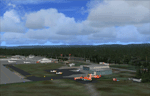
This scenery is a very accurate freeware version of Deer Lake Regional airport and sorounding area, on the west coast of the island of Newfoundland.
Designed to suit a variaty of computers, there is a setup for everyone.
There is something here for Heli, Bush, Low and slow right up to the IFR hight in the sky fliers.
Two solid years went into this scenery to try to capture as much detail as possible.
I really hope you enjoy it as much as Flight Ontario enjoyed working on it.
| Filename: | CYDF_Deer_Lake_Regional_Airport_for_Newfoundland__.zip |
| License: | Freeware |
| Added: | 2nd May 2010, 02:07:39 |
| Downloads: | 1,935 |
| Author: | Al Sibley Flight Ontario |
| Size: | 89.8 MB |
| Category: Flight Simulator 2004 - Scenery | |
| Resized Environment Map Texture |
|
File Description:
Replacement "Environment Map" texture (Envmap.bmp) for FS2004.
Envmap.bmp controls the reflection effect in "metallic" textures.
Texture was edited to remove the "spinning" effect, now the reflection is static.
With static reflection it is now "OK" to repaint interior textures (chrome, leather, plastic, glass etc.)
to make them more reflective, as the dizzying "spinning" effect is removed.
Texture was also repainted to make horizon reflection at more accurate height,
and its sky reflection in more vibrant color.
Now the metallic textures have blueish tint.
Texture was also resized from 256X256 to 128X128.
Smaller texture sizes improve framerate (FPS).
TEXTURE ONLY.
| Filename: | Resized_Environment_Map_Texture.zip |
| License: | Freeware |
| Added: | 9th March 2004, 06:24:46 |
| Downloads: | 10,999 |
| Author: | Bart Dylkiewicz |
| Size: | 298.97 KB |
| Category: Flight Simulator 2004 - Scenery | |
| Camarillo, CA - (KCMA) - Update |
|
File Description:
Camarillo, CA Airport (KCMA) - UPDATE. This update adds AI Ultra-lite aircraft to the beautifully detailed airport by John B. Loney Jr. The excellent Sky Seeker Ultra-lite (included in this package) by Fern Marques has been repainted by John Burford in 5 colorful textures and is used with permission from the author. Use the Zip-Dive option to see more screenshots. A proper installation of KCMA is required (kcma_v1.zip.zip - available here). This update package also includes two minor visual corrections to the Camarillo airport property. Please unzip to a temporary folder and follow the easy installation instructions. Project compiled for your flying enjoyment by David "Opa" Marshall.
| Filename: | Camarillo_CA__KCMA__Update.zip |
| License: | Freeware |
| Added: | 29th May 2007, 14:46:15 |
| Downloads: | 1,295 |
| Author: | David "Opa" Marshall and John B. Loney Jr. |
| Size: | 3.35 MB |
| Category: Flight Simulator 2004 - Scenery | |
| Weaver MT54 Montana USA |
|
Images related to this file:
File Description:
I made this because I downloaded and tried the Glacier Park scenery by Blue Sky Scenery and then discovered that the airfield runways are not always correctly positioned or aligned. So I moved the Weaver runway over and added a couple of buildings. That's it, almost the same as I did for Whitefish. If I find some more airfields in this area with similar problems then I'll do more of the same. Weaver is a private field 4 miles south of Glacier Park International at 2,929 feet ASL and around 45 miles south of the Canadian border. There are no large towns close by; the nearest would be Missoula, which is some 90 miles further south.
| Filename: | Weaver_MT54__Montana_USA.zip |
| License: | Freeware, limited distribution |
| Added: | 26th May 2010, 03:18:46 |
| Downloads: | 203 |
| Author: | Roger Wensley |
| Size: | 14.23 MB |
| Category: Flight Simulator 2004 - Scenery | |
| Dillingham Airfield, HI |
|
File Description:
FS2004 Scenery-Dillingham Airfield, Oahu, HI (PHDH) is a general aviation joint-use facility on the north shore of Oahu near the community of Waialua. The airfield has one 5,000' by 75' runway, a State-operated UNICOM (air traffic advisory) facility, several hangars, and a tie down area for recreation aircraft, but no other facilities. Air traffic is limited to daytime operations by small single-engine and light twin-engine aircraft, sailplanes, ultra-lights aircraft, and helicopters. Traditionally, the airfield has been used mainly for recreation, such as glider soaring, hang-gliding, parachuting, and sky jumping. A taxiway extension will be built in 2005. Created with EZ Scenery. PLEASE READ THE README FILE!
| Filename: | Dillingham_Airfield_HI.zip |
| License: | Freeware, limited distribution |
| Added: | 29th May 2007, 04:02:32 |
| Downloads: | 2,022 |
| Author: | John B. Loney, Jr. |
| Size: | 802.31 KB |
| Category: Flight Simulator 2004 - Scenery | |
| Gjoa Haven CYHK, on King William Island, Nunavut, Canada, |
|
Images related to this file:
File Description:
Gjoa Haven is a village of 1,200 or so inhabitants at N 68 38 W 95 51 on the southeast corner of King William Island, around 155 miles north of the Arctic Circle. It's Inuit name is Uqsuqtuuq; the Gjoa Haven name was given by the Norwegian explorer Roald Amundsen when he spent two years there from 1903 to 1905 during his exploration of the northwest passage from east to west. His boat was called Gjoa and the cove was named Gjoa Harbour, in Norwegian. The village has been added in this scenery with approximately the right shape; though the coastline with Ultimate Terrain does have the small cove that serves as a harbor the coast shape is wrong. The airfield runway is 4,400 feet of gravel 100 feet wide at 154 feet above sea level. There is no LL100 available, only JetA1, delivered once a year by ship along with all the other requirements of the town. There is also a nearby CAM-B remotely operated defence radar station with its three protective domes. The old terminal building is still there, albeit repainted and spruced up, along with the far larger and newer one alongside it.
One of the screen shots shows Gjoa Haven as it appears for at least 8 months of the year, with snow on the ground and sea ice all around. If you want the ice then download my recent post of All Canada frozen lakes, rivers, and the northern seas, reversible with an untick in the FS scenery library.
| Filename: | Gjoa_Haven_CYHK_on_King_William_Island_Nunavut_Can.zip |
| License: | Freeware, limited distribution |
| Added: | 19th February 2011, 15:42:51 |
| Downloads: | 550 |
| Author: | Roger Wensley |
| Size: | 2.68 MB |
| Category: Flight Simulator 2004 - Scenery | |
| Naknek (5NK) and Naknek South (WSN) - Alaska, USA |
|
Images related to this file:
File Description:
Naknek and Naknek South are two towns close to the mouth of the Naknek River and on opposite banks. King Salmon is approximately 15 miles to the east. The canneries on both banks of the river are the reason for the existence of both towns and airfields, with fishing for salmon being the primary industry of the area. This takes place from the beach by individuals, by small boats in the river and the immediate sea area, and offshore by larger craft. There is a picture of one boat unloading in Naknek which will be known to anyone who has watched the most famous television fishing programme of all, Deadliest Catch. Cornelia Marie is better known for the crab fishing based in Dutch Harbor, but this area too is just as productive though without the drama. Naknek 5NK has two gravel runways and a float runway in the adjoining lake; all three are just under 2,000 feet long. Naknek South WSN has two gravel runways, 12-30 being 3,300 feet long and 04-22 2,260 feet. As the road connecting to King Salmon is on the north bank it is probable that more seasonal workers are brought into the southern canneries by air, hence the longer runway (and with PAPI on 12). Grant Aviation run scheduled flights into both and there are numerous seasonal charter flights. The AI is a further modification of that posted with King Salmon PAKN and includes these flights, and presumes that you have already downloaded PAKN.
| Filename: | Naknek_5NK_and_Naknek_South_WSN__Alaska_USA.zip |
| License: | Freeware, limited distribution |
| Added: | 29th April 2015, 20:44:31 |
| Downloads: | 214 |
| Author: | Roger Wensley |
| Size: | 6.09 MB |
| Category: Flight Simulator 2004 - Scenery | |
| Dhulia Airport, India |
|
Images related to this file:
File Description:
its always interesting and enjoyable to taxi an aircraft thru tight areas,and especially when a taxiway is
surrounded by trees like Eucalyptus,capable of attaining a height that can range anywhere between 6fts to 300fts! after a short evening
flight from Mumbai you've just landed at small airport at Dhulia(India) and vacated the runway, AND you've just spotted a
hanger, good! that's were you want to be, but hey! it's already occupied. now what?.Well..good news! there is another hanger,
but were? can't even see were taxiway is leading to because of dense trees. Can you find the Hanger? surely you don't
want to leave your cessna under open sky for whole night long or do you?
| Filename: | Dhulia_Airport_India.zip |
| License: | Freeware, limited distribution |
| Added: | 10th May 2011, 03:56:06 |
| Downloads: | 526 |
| Author: | Ashish Singh |
| Size: | 17.93 MB |
| Category: Flight Simulator 2004 - Scenery | |
| Havana 1962 Scenery |
|
File Description:
This scenery includes Havana as it was in 1962 (a mysterious city of much fascination for me) including El Morro Fortress on its rocky outcropping at the entrance to Havana harbor, the largest such fortress in the Caribbean, and its adjacent lighthouse. In downtown Havana you will see the capital building and several old cathedrals. Near the Malicon sea walk by the beach, you will find 3 famous hotels and former casinos, the Flamingo, the Riviera, and the Havana Hilton. The Havana Hilton opened just days before Castro seized power and nationalized it. When he first came to power he occupied the top floor for some time. Havana Airport opened originally as Rancho Los Boyeos Airport, located just southwest from the city in the village of the same name, which was then mostly farms, small ranches, and tiny communities. The original terminal was a very pretty Spanish colonial building, which the dictator Fulgencio Batista had remodeled in a 1950's cubist-tudor style. It was at the time of this remodeling (1957) that the airport's name was changed to Jose Marti International Airport, named after the famous Cuban revolutionary and poet of the 19th century. Jose Marti Airport was in the 1950s and 1960s the primary port of entry airport for Cuba. Up until the January 1st 1959 revolution many US airlines served Havana, but due to mounting tensions, the crisis of the Bay of Pigs attack, and later on the October 1962 missile crisis, traffic and tourism was ended as the US led blockade of Cuba took hold. By the time of this scenery, April 1962, the once former bustling Jose Marti airport had become quite sedate.
| Filename: | Havana_1962_Scenery.zip |
| License: | Freeware, limited distribution |
| Added: | 4th March 2010, 23:36:41 |
| Downloads: | 3,864 |
| Author: | Mike Stevens and Tom Gibson |
| Size: | 9.72 MB |
© 2001-2026 AVSIM Online
All Rights Reserved
Privacy Policy |