
Where Flight Simulation Enthusiasts Gather from Around the World!
AVSIM Library - Search Results

| Category: Flight Simulator 2004 - Scenery | |
| Colorado Lakes Project II |

|
File Description:
This project features the Blue Mesa Reservoir and the Black Canyon of the Gunnison and adds over 300 highly detailed lakes to the central portion of western Colorado. Three reservoirs, named for corresponding dams on the Gunnison River, form the heart of Curecanti National Recreation Area. Panoramic mesas, fjord-like reservoirs, and deep, steep and narrow canyons abound. Blue Mesa Reservoir is Colorado's largest body of water, and is the largest Kokanee Salmon fishery in the United States. Morrow Point Reservoir is the beginning of the Black Canyon of the Gunnison and below it is Crystal Reservoir.
These lakes are specifically designed to show off their photo realistic detail when used in combination with "FSGenesis-The Rockies 38.2m Terrain Mesh-Colorado" available as "fsg_dem38m_usrk_co.zip" at avsim.com, or comparable mesh. The free FSGenesis US National Landclass Project Beta 6 also adds beautifully to the landscape. These lakes work equally as well with the default mesh.
All lake information was projected from satellite imagery and compiled with a beta version of Jim Keir's "Slartibartfast" utility. Much thanks to Holger Sandmann and Jim Keir for their help and advice on interpreting the satellite data properly.
| Filename: | Colorado_Lakes_Project_II.zip |
| License: | Freeware |
| Added: | 1st June 2004, 02:34:42 |
| Downloads: | 6,055 |
| Author: | Carlyle Sharpe |
| Size: | 332.25 KB |
| Category: Flight Simulator 2004 - Scenery | |
| Tongass Remote Airfield (RATR) - for "Tongass Fjords" (FS9) |
|
Images related to this file:
File Description:
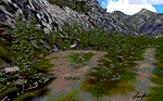
"Tongass Remote Airfield" (RATR) Alaskan scenery (Fictitious)
Tongass Remote Airfield is for Flight Simulator 2004 and for the "Tongass Fjords" (FS9) addon by Holger Sandmann & Bill Womack . You must have "Tongass Fjords" (FS9) for this to work.
Field history and description:
In the early days this area was well known to prospectors and hunters. A small mine was established and later abandoned. Around the late 40���¢��������s a crew was contracted to clear a small landing area to gain easier access for hunters and campers. Due to the extreme remoteness of this area that clearing took several years. The last phase was the approach, clearing by hand a descending glide slope through just the tops of the tall trees. There is now just enough room for a very experienced pilot to get in and out of this field. The airfield is 26 miles north of Petersburg Alaska (PAPG). This is a tricky narrow approach with a left hand dogleg and then an immediate right hand dogleg turn just before the final approach. Not much time to set up your approach, also, it's a very short runway. For experienced pilots only, and make sure that your life insurance is up to date. See enclosed Maps and info. Good luck.
| Filename: | Tongass_Remote_Airfield_RATR__for_Tongass_Fjords_F.zip |
| License: | Freeware, limited distribution |
| Added: | 11th February 2010, 00:49:22 |
| Downloads: | 625 |
| Author: | Jay Langham |
| Size: | 3.51 MB |
| Category: Flight Simulator 2004 - Scenery | |
| Tongass Remote Airfield v2 - for Tongass Fjords |
|
Images related to this file:
File Description:
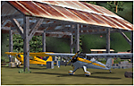
Tongass Remote Airfield v2 - for Tongass Fjords (FS9)
"Tongass Remote Airfield" v2 (RATR) Alaskan bush flying scenery (Fictitious).
This airstrip is for Flight Simulator 2004 and for the "Tongass Fjords" (FS9) addon by Holger Sandmann & Bill Womack; you must have "Tongass Fjords" (FS9) for this to work. Version 2 is a detailed, stand alone, remake of the first version, see PDF file.
Field history and description:
In the early days this area was well known to prospectors and hunters. A small mine was established and later abandoned. Around the late 40s a crew was contracted to clear a small landing area to gain easier access for hunters and campers. Due to the extreme remoteness of this area that clearing took several years. The last phase was the approach, clearing by hand a descending glide slope through just the tops of the tall trees. There is now just enough room for a very experienced pilot to get in and out of this field. The airfield is 26 miles north of Petersburg Alaska (PAPG). This is a tricky narrow approach with a left hand dogleg and then an immediate right hand dogleg turn just before the final approach. Not much time to set up your approach; also, it's a very short runway. For experienced pilots only, and make sure that your life insurance is up to date. Good luck.
| Filename: | Tongass_Remote_Airfield_v2__for_Tongass_Fjords.zip |
| License: | Freeware, limited distribution |
| Added: | 22nd March 2010, 13:16:16 |
| Downloads: | 627 |
| Author: | Jay Langham |
| Size: | 6.18 MB |
| Category: Flight Simulator 2004 - Scenery | |
| Glacier Bay - Alaska/Canada, Version 2, Part 1 of 2 |
|
Images related to this file:
File Description:
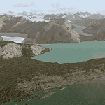
Glacier Bay v2 is a complete replacement of the default FS2004 landscape and scenery of more than 90,000 square kilometers (36,000 sq miles) of Southeast Alaska and adjacent areas of Yukon and British Columbia. File 1 of 2 (also requires glbayv2b.zip)
Landscape enhancements include high-resolution terrain mesh, detailed shorelines, rivers, lakes, and glaciers, and accurate land cover data with custom seasonal ground textures. Inland water bodies can be made to "freeze over" via an on/off switch. Other landmarks include the settlements of Juneau, Haines, Skagway, Yakutat, Atlin, and Carcross as well as road and railroad networks, cabins, lodges, and lighthouses. We modeled or enhanced 16 main airfields (plus one fictitious airstrip), 20 unlisted airstrips, 16 seaplane bases, and seven heliports. We've also included AI ship traffic in various locations as well as optional flightplans for GA and floatplane AI traffic.
Glacier Bay v2 is fully compatible with other third-party add-ons, including terrain mesh (FSGlobal, FS Genesis, etc.), ground textures (Ground Environment, BEV, FScene, etc.), and landscape enhancements (Ultimate Terrain Canada/Alaska, Misty Fjords, Tongass Fjords, Freight Dogs). A configurator panel (requires .Net Framework!) allows users to set compatibility options and to choose levels of scenery detail. We provide an autoinstaller and detailed documentation with a sectional map of the coverage area and a list of weblinks to real-world information.
For feedback and questions, please visit the Glacier Bay v2 support forum at http://forums.fsaddon.eu/viewforum.php?f=10. This project is a collaboration of nine FS developers from Germany, Austria, USA, and Canada, logging more than 1000 hours of work over the past 14 months. We acknowledge the kind support of FSAddon.com. However, this project is independent of any commercial company or product. Enjoy!
| Filename: | Glacier_Bay__AlaskaCanada_Version_2_Part_1_of_2.zip |
| License: | Freeware, limited distribution |
| Added: | 28th May 2010, 19:34:54 |
| Downloads: | 41,284 |
| Author: | Holger Sandmann, Rainer Duda, Michael Eder, Scot Fraser, Manfred Herz, Jay Langham, Jon Patch, Larry Silsbee, and Jim Vile |
| Size: | 56.46 MB |
| Category: Flight Simulator 2004 - Scenery | |
| Glacier Bay - Alaska/Canada, Version 2, Part 2 of 2 |
|
Images related to this file:
File Description:

Glacier Bay v2 is a complete replacement of the default FS2004 landscape and scenery of more than 90,000 square kilometers (36,000 sq miles) of Southeast Alaska and adjacent areas of Yukon and British Columbia. File 2 of 2 (also requires glbayv2a.zip)
Landscape enhancements include high-resolution terrain mesh, detailed shorelines, rivers, lakes, and glaciers, and accurate land cover data with custom seasonal ground textures. Inland water bodies can be made to "freeze over" via an on/off switch. Other landmarks include the settlements of Juneau, Haines, Skagway, Yakutat, Atlin, and Carcross as well as road and railroad networks, cabins, lodges, and lighthouses. We modeled or enhanced 16 main airfields (plus one fictitious airstrip), 20 unlisted airstrips, 16 seaplane bases, and seven heliports. We've also included AI ship traffic in various locations as well as optional flightplans for GA and floatplane AI traffic.
Glacier Bay v2 is fully compatible with other third-party add-ons, including terrain mesh (FSGlobal, FS Genesis, etc.), ground textures (Ground Environment, BEV, FScene, etc.), and landscape enhancements (Ultimate Terrain Canada/Alaska, Misty Fjords, Tongass Fjords, Freight Dogs). A configurator panel (requires .Net Framework!) allows users to set compatibility options and to choose levels of scenery detail. We provide an autoinstaller and detailed documentation with a sectional map of the coverage area and a list of weblinks to real-world information.
For feedback and questions, please visit the Glacier Bay v2 support forum at http://forums.fsaddon.eu/viewforum.php?f=10. This project is a collaboration of nine FS developers from Germany, Austria, USA, and Canada, logging more than 1000 hours of work over the past 14 months. We acknowledge the kind support of FSAddon.com. However, this project is independent of any commercial company or product. Enjoy!
| Filename: | Glacier_Bay__AlaskaCanada_Version_2_Part_2_of_2.zip |
| License: | Freeware, limited distribution |
| Added: | 28th May 2010, 19:36:31 |
| Downloads: | 40,558 |
| Author: | Holger Sandmann, Rainer Duda, Michael Eder, Scot Fraser, Manfred Herz, Jay Langham, Jon Patch, Larry Silsbee, and Jim Vile |
| Size: | 85.99 MB |


© 2001-2026 AVSIM Online
All Rights Reserved
Privacy Policy |