
Where Flight Simulation Enthusiasts Gather from Around the World!
AVSIM Library - Search Results

| Category: Flight Simulator 2004 - Scenery | |
| Alps LOD10 Topo Mesh - Switzerland and France |

|
Images related to this file:
File Description:
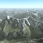
Yet another terrain mesh package of the European Alps? Well, this one is different in that it is NOT primarily based on the Shuttle Radar (SRTM) data with their incomplete coverage of prominent peaks and ridges. Instead, most of the source data for this project were developed over many months by Jonathan de Ferranti using detailed topographic maps. While Jonathan's work is unrelated to flight simulation he kindly gave me permission to compile his data for use in FS. The result is a wonderful improvement in detail and accuracy over any existing SRTM- or DTED-based mesh file, freeware or commercial (a link to an extensive set of screenshot comparisons is included in the read-me file).
I've compiled the source data at LOD10 (38-m) grid resolution because the coverage area is smaller than most existing mesh files. Thus, anyone can use these files without having to first uninstall their current mesh set. Also included are LOD9 and LO8 buffer mesh files. Note: if you own Switzerland Professional with its high-resolution terrain mesh then you don't need this package, at least not the Switzerland files!
| Filename: | Alps_LOD10_Topo_Mesh__Switzerland_and_France.zip |
| License: | Freeware, limited distribution |
| Added: | 30th May 2010, 09:51:03 |
| Downloads: | 59,003 |
| Author: | Holger Sandmann, Jonathan de Ferranti |
| Size: | 50.03 MB |
| Category: Flight Simulator 2004 - Scenery | |
| Victoria, Canada area scenery |
|
File Description:
This is a complete upgrade of vicenh05, Victoria, Canada area scenery for FS9. New in this version: automated installer and configurator from Ken Peters; several detailed models including the Empress Hotel, the Legislature, the Regent Hotel and the Johnson St. Bridge; greatly enhanced Inner Harbour; many generic buildings representing buildings throughout the area; 7 new small airfields with sloping runways; seven new floatplane bases (owners of Vancouver+ get extensive floatplane traffic in local liveries); 7 new heliports (Vancouver+ users get additional heli AI traffic) and a myriad of minor fixes and improvements. Included from previous versions are revised shorelines, landclass and 19m mesh and buffer meshes for South-Eastern Vancouver Island; boat docks with static boats, seaplane docks and terminal buildings for Harbour Air, Kenmore Air and West Coast Air; piers, buildings, breakwater and other components of the Ogden Point Terminal; dock, service building and pilot boats of the Pacific Pilotage Authority; Odgen Point Cafe and Dive Shop; marine navigational lights for Victoria Harbour and area, including Esquimalt harbour and Oak Bay; antennae location corrections for the area; AFCADs included: Land based (CML2), Floatplane (CAB3, CAP5, CAP8, CAV8, CAW7, CAX6, CMAP, CYWH), Heli (CAL7, CBF5, CBF7, CBK8, CBW7, CBW9, CBZ7, CMBH); AI craft models and repaints (Cruise ships are repaints of Asuka model by Mitsuya Hamaguchi: MS Amsterdam of the Holland America Line travelling from Victoria to Vancouver, MS Summit of the Celebrity Cruise Line travelling from Seattle to Victoria); S-61 Sea-King helicopter in Helijet colours; Pacific Pilot custom vessel working from the Pilot dock; 22, 30 and 40 foot vessels plying the harbour and nearby Straight of Juan de Fuca. Effects included for lights, water, smoke effects. Many flights are offered, including two flights for owners of the Aerosoft Beaver (not required). Ultimate Terrain compatible (not required). Users of Misty Fjords will also get additional cruise ship traffic: the Island Princess and the Volendam alternating with the Amsterdam and Summit. Fully compatible with Don Grovestine's excellent CYYJ 2007. Replaces viflat.zip, ve4_tr1.zip, vicenh02.zip, vicenh03.zip, vicenh04.zip and vicenh05.zip. Detailed documentation included. By Jon Patch and Holger Sandmann.
| Filename: | Victoria_Canada_area_scenery.zip |
| License: | Check within download |
| Added: | 29th January 2010, 21:22:09 |
| Downloads: | 5,318 |
| Author: | Jon Patch and Holger Sandmann |
| Size: | 24.28 MB |
| Category: Flight Simulator 2004 - Scenery | |
| Alps LOD10 Topo Mesh - Austria and Italy |
|
Images related to this file:
File Description:
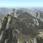
Yet another terrain mesh package of the European Alps? Well, this one is different in that it is NOT primarily based on the Shuttle Radar (SRTM) data with their incomplete coverage of prominent peaks and ridges. Instead, most of the source data for this project were developed over many months by Jonathan de Ferranti using detailed topographic maps. While Jonathan's work is unrelated to flight simulation he kindly gave me permission to compile his data for use in FS. The result is a wonderful improvement in detail and accuracy over any existing SRTM- or DTED-based mesh file, freeware or commercial (a link to an extensive set of screenshot comparisons is included in the read-me file).
I've compiled the source data at LOD10 (38-m) grid resolution because the coverage area is smaller than most existing mesh files. Thus, anyone can use these files without having to first uninstall their current mesh set. Also included are LOD9 and LO8 buffer mesh files. Note: if you own Austria Professional 2004 with its 1:50,000 scale terrain mesh then you don't need this package!
| Filename: | Alps_LOD10_Topo_Mesh__Austria_and_Italy.zip |
| License: | Freeware, limited distribution |
| Added: | 30th May 2010, 09:46:58 |
| Downloads: | 62,961 |
| Author: | Holger Sandmann, Jonathan de Ferranti |
| Size: | 73.32 MB |
| Category: Flight Simulator 2004 - Scenery | |
| Hong Kong Kai Tak 1963 |
|
File Description:
This is Kai Tak airport as it was in 1963. Kowloon Bay has yet to be filled in, and the runway is only 8405 ft long. Includes mesh files by Holger Sandmann and charts of the era scanned by Chic Eather. Navaids backdated to the early 60's, except the IGS for runway 13 is included although not actually installed until 1974. Curving approach lights will help you find the runway. Chek Lap Kok airport has been removed. The IGS and other approaches created by Jim Vile. The AI aircraft will follow the curved approach to runway 13 in good weather or bad. Please note that Jim Vile has produced a modern version of this airport (kaitak98.zip).
| Filename: | Hong_Kong_Kai_Tak_1963.zip |
| License: | Freeware, limited distribution |
| Added: | 27th April 2006, 02:02:13 |
| Downloads: | 15,225 |
| Author: | Tom Gibson and Jim Vile |
| Size: | 5.74 MB |
| Category: Flight Simulator 2004 - Scenery | |
| "Himalayan Peaks" LOD10 Mesh, Volume 3 - Namcha Barwa |
|
File Description:
Highly detailed terrain mesh of the Namcha Barwa area, N29°-31° E94°-96°. The files in this package are based on Shuttle Radar (SRTM) Version 2 data but with many of the void areas, especially the most significant sections, filled with elevation data generated from topographic maps by Jonathan de Ferranti. While Jonathan's work is unrelated to flight simulation he kindly gave me permission to compile his data for use in FS. The result is a wonderful improvement in detail and accuracy over any existing mesh file, freeware or commercial, based on SRTM or DTED data alone. Due to the large area of the Himalayas I've compiled the source data as two separate series: the "Himalayan Peaks" series covers prominent mountains and ranges in higher detail and locally overrides any existing LOD9 terrain mesh. In addition, a LOD9 "base mesh" series covering the entire Himalayas will be available for those who do not yet have an add-on terrain mesh of these beautiful mountains.
| Filename: | Himalayan_Peaks_LOD10_Mesh_Volume_3__Namcha_Barwa.zip |
| License: | Freeware, limited distribution |
| Added: | 18th February 2006, 23:15:17 |
| Downloads: | 12,188 |
| Author: | Holger Sandmann and Jonathan de Ferranti |
| Size: | 15.09 MB |
| Category: Flight Simulator 2004 - Scenery | |
| "Himalayan Peaks" LOD10 Mesh, Volume 5 - Garhwal |
|
File Description:
Highly detailed terrain mesh of the Garhwal area, N30°-32° E78°-81°. The files in this package are based on Shuttle Radar (SRTM) Version 2 data but with many of the void areas, especially the most significant sections, filled with elevation data generated from topographic maps by Jonathan de Ferranti. While Jonathan's work is unrelated to flight simulation he kindly gave me permission to compile his data for use in FS. The result is a wonderful improvement in detail and accuracy over any existing mesh file, freeware or commercial, based on SRTM or DTED data alone. Due to the large area of the Himalayas I've compiled the source data as two separate series: the "Himalayan Peaks" series covers prominent mountains and ranges in higher detail and locally overrides any existing LOD9 terrain mesh. In addition, a LOD9 "base mesh" series covering the entire Himalayas will be available for those who do not yet have an add-on terrain mesh of these beautiful mountains.
| Filename: | Himalayan_Peaks_LOD10_Mesh_Volume_5__Garhwal.zip |
| License: | Freeware, limited distribution |
| Added: | 18th February 2006, 23:16:47 |
| Downloads: | 10,134 |
| Author: | Holger Sandmann and Jonathan de Ferranti |
| Size: | 27.72 MB |
| Category: Flight Simulator 2004 - Scenery | |
| Himalayan Peaks LOD10 Mesh, Volume 1 - Mt. Everest and Kula Kangri |
|
File Description:
Highly detailed terrain mesh of the Mt. Everest and Kula Kangri areas, N26°-29° E85°-92°. The files in this package are based on Shuttle Radar (SRTM) Version 2 data but with many of the void areas, especially the most significant sections, filled with elevation data generated from topographic maps by Jonathan de Ferranti. While Jonathan's work is unrelated to flight simulation he kindly gave me permission to compile his data for use in FS. The result is a wonderful improvement in detail and accuracy over any existing mesh file, freeware or commercial, based on SRTM or DTED data alone. Due to the large area of the Himalayas I've compiled the source data as two separate series: the "Himalayan Peaks" series covers prominent mountains and ranges in higher detail and locally overrides any existing LOD9 terrain mesh. In addition, a LOD9 "base mesh" series covering the entire Himalayas will be available for those who do not yet have an add-on terrain mesh of these beautiful mountains.
| Filename: | Himalayan_Peaks_LOD10_Mesh_Volume_1__Mt_Everest_an.zip |
| License: | Freeware, limited distribution |
| Added: | 9th February 2006, 22:13:00 |
| Downloads: | 37,047 |
| Author: | Holger Sandmann and Jonathan de Ferranti |
| Size: | 52.01 MB |
| Category: Flight Simulator 2004 - Scenery | |
| The Victoria Falls of the Zambezi River, Zambia/Zimbabwe |
|
File Description:
One of the main landmarks of Africa, the spectacular Victoria Falls of the Zambezi River are missing in out-of-the-box FS. With a local SRTM LOD9 mesh as a base (included) and the help of satellite imagery, maps, Ground2K4, and GMax, we did our best to model a realistic representation of the falls, the river, and the gorge, complete with custom waterfall and spray effects. The portion of the Zambezi covered in this project extends from E25 to E26.5 (more than 100km), with the falls at its center. Also included is a replacement landclass file for an area of about 20km on either side of the Zambezi River and an optional AI boat (by Lynn and Bill Lyons) cruising on the Zambezi above the falls. Tested with FS2004 only but most scenery enhancements (not the AI boat) should work just as well in FS2002.
| Filename: | The_Victoria_Falls_of_the_Zambezi_River_ZambiaZimb.zip |
| License: | Freeware, limited distribution |
| Added: | 8th May 2004, 02:45:30 |
| Downloads: | 19,146 |
| Author: | Holger Sandmann and Johan van Wyk, Aeroworx |
| Size: | 3.5 MB |
| Category: Flight Simulator 2004 - Scenery | |
| Vancouver Island and Inner Passage float bases in BC, Canada |
|
File Description:
This is a series of float bases to the east of the northern part of Vancouver Island. They are all zipped together because: first, they are all in the same geographical area and if you like one you may like them all; second it means I only write one set of notes; and third I only upload once. I was looking to fill in the gap between what Holger Sandmann and his cohorts have done with Alaska, and Vancouver and Vancouver Island to the south, and there are these 16 float bases in a stretch of 180 miles between the northern part of Vancouver Island and the mainland coast. And if you leave out the relatively isolated Rivers Inlet to the north then they are all within a 140 mile stretch. Some are on the east coast of Vancouver Island, but most are on islands between the mainland and the island.
| Filename: | Vancouver_Island_and_Inner_Passage_float_bases_in_.zip |
| License: | Freeware |
| Added: | 3rd August 2008, 06:03:09 |
| Downloads: | 1,875 |
| Author: | Roger Wensley & Jim Turner |
| Size: | 6.85 MB |
| Category: Flight Simulator 2004 - Scenery | |
| CYCQ - Chetwynd - British Columbia, Canada |
|
Images related to this file:
File Description:
The town of Chetwynd (population around 2,600) is on the east side of the Rocky Mountains, the first town to be encountered when descending from the Rockies on highway 97. Previously known as Little Prairie, the town name was changed in 1962. The main occupations of the town are linked to forestry, fossil fuels, and transportation; there are railway lines north to Fort St John, east to Dawson Creek, and south to Prince George. The airport is on the southern side of the town, with one runway aligned 05-23, asphalted in 1975 and just under 4,500 feet long. There are no scheduled services, although a new terminal building was constructed in 2008, and the helicopter operations by at least two companies (oil and gas and medical evacuation flights) are the primary operations from the field. These are included in the AI, incorporating helicopter modifications made by Holger Sandmann so that they function properly as AI at an airfield. As an aside, landing like a plane and using the runway and taxiways is in fact exactly what a helicopter does at a normal airfield in real life; everyone does the same thing so that guessing is unneccesary.
| Filename: | CYCQ__Chetwynd__British_Columbia_Canada.zip |
| License: | Freeware, limited distribution |
| Added: | 28th March 2016, 21:36:33 |
| Downloads: | 300 |
| Author: | Roger Wensley |
| Size: | 18.84 MB |


© 2001-2026 AVSIM Online
All Rights Reserved
Privacy Policy |