
Where Flight Simulation Enthusiasts Gather from Around the World!
AVSIM Library - Search Results

| Category: Flight Simulator 2004 - Scenery | |
| Montana Unleashed! - Part Two |

|
File Description:
Montana Unleashed! Part Two is a continuation of the original Montana Unleashed! scenery which was released just over a year ago. The original scenery package currently has over 3,500 downloads on AVSIM alone and I'm hoping you all will enjoy this new collection as much as the first set. Part Two adds 14 more Montana airports bringing the combined total of the two packages to 28 highly detailed airports. Please do a Zip Dive for an in depth look at the included airports in picture form. Also in the Read Me file is a link to Joe Degregorio's FlightLevel390 website where you can download all the necessary Object Libraries (192MB). Thanks Joe! Included airports are 3U7, 1S3, 4U6, S64, M75, KHWQ, KRPX, KJDN, KMLS, KOLF, KGDV, KPWD, KSDY, and KBHK as well as the Wind Generator Farm in the St, Jude Pass. This scenery runs pretty well on older PC's and smooth as silk on newer PC's! Happy flying to all!! (Designed for FS9)
| Filename: | Montana_Unleashed__Part_Two.zip |
| License: | Freeware, limited distribution |
| Added: | 25th April 2008, 08:13:55 |
| Downloads: | 3,265 |
| Author: | Lauren Robison with Sidney Schwartz |
| Size: | 2.78 MB |
| Category: Flight Simulator 2004 - Scenery | |
| Scotports Volume 1 |
|
Images related to this file:
File Description:
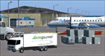
It is well noted that Scottish Airports are very neglected by scenery developers in FS9, mainly the smaller Airports. Therefore I decided to do a little something about it! - Using the wonderful Airport Design Editor (ADE), I have constructed these sceneries from scratch, after deleting all of the disappointing default buildings and objects. The airports included are 99% realistic regarding runways, aprons and taxiways and general airport layout, however there may be a one or two minor discrepancies due to FS limitations. I have also added fictional ILS to runways which don't have ILS in the real world. All scenery objects and textures are by Sidney Schwartz (especially for ADE), of whom, without his long hours of work, none of this would have been possible. Airports in this package are: Campbeltown (EGEC), Eday (EGED), Kirkwall (EGPA), Sumburgh (EGPB), Wick (EGPC), Inverness v2 (EGPE), Islay (EGPI), and Dundee (EGPN). All these airports are served by Loganair.
| Filename: | Scotports_Volume_1.zip |
| License: | Freeware |
| Added: | 3rd November 2011, 19:35:10 |
| Downloads: | 4,356 |
| Author: | Chris Horsfield |
| Size: | 70.7 MB |
| Category: Flight Simulator 2004 - Scenery | |
| HKMO - Moi Intl. Airport - Mombasa, Kenya |
|
Images related to this file:
File Description:

This FS2004 project reproduce the african "Mombasa Moi International Airport" (IATA: MBO, ICAO: HKMO) located on the coast of Kenya. If you are a tourist long-haul pilot, an air-safari bush pilot or a night-freight pilot this airport is a "must have" ! In the scenery you'll find all buildings (airport and close surroundings buildings with full night lighting), hundred of custom made detailed objects, static and animated vehicles, animated scenery parts and a photoreal airport background. Each scenery part and object (frame-rate friendly thanks to the low poly design) has photoreal textures and everything is placed in the right position (which has been seen on summer 2015 at the real airport). English extended handbook is included. Watch the screenshot and the demo video on the Albysim youtube channel and enjoy all scenery features (in this free/demo edition some features are limited).
This is the free/demo version of the complete package, for more details please refer to the manual.
| Filename: | HKMO__Moi_Intl_Airport__Mombasa_Kenya.zip |
| License: | Check within download |
| Added: | 21st November 2015, 20:19:24 |
| Downloads: | 3,089 |
| Author: | Albysim Scenery Design (Alberto Di Bolzano) |
| Size: | 32.39 MB |
| Category: Flight Simulator 2004 - Scenery | |
| Exploring Our World - Part 1. Canaima Park - Canaima Airport (SCVN) - Angel Falls, Venezuela |
|
Images related to this file:
File Description:

Exploring Our World - Part 1. Canaima Park - Canaima Airport (SCVN) - Angel Falls, Venezuela. Visit the worlds highest waterfall (16 times higher than Niagara) - one of the Natural Wonders of the World!
This new package features David Maldonado's excellent Mesh of Canaima Park in Venezuela and a very special "animated" depiction of Angel Falls by Ron Jeffers. The Canaima Airport has been enhanced using EZ Scenery libraries. There is also an optional Lago sound file created by Lou Frost. A brief history of Angel Falls along with a suggested tour of the area is included. You will also find a flight plan for use with the FSNavigator program. This is the first of a projected series exploring lesser known parts of our FS world. Please unzip (using folders option) to a temporary folder and follow the instructions very carefully.
This project was compiled for your flying enjoyment by David "Opa" Marshall.
| Filename: | Exploring_Our_World__Part_1_Canaima_Park__Canaima_.zip |
| License: | Freeware |
| Added: | 31st October 2009, 10:36:18 |
| Downloads: | 3,259 |
| Author: | David "Opa" Marshall |
| Size: | 3.22 MB |
| Category: Flight Simulator 2004 - Scenery | |
| Milan Malpensa Airport (LIMC - MXP) |
|
Images related to this file:
File Description:
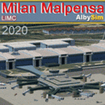
This FS2004 scenery reproduce the second-busiest italian airport "Milan Malpensa" (Iata: MXP, Icao: LIMC) located in the northwest area of Italy. The airport is used by over 100 airlines (passenger and cargo) that fly to Milan from all over the world, so this scenery is a “must have†for every simmer!
In the scenery you'll find almost all airport buldings exsisting at the real airport, hundred of custom made detailed objects, static and animated vehicles and a photoreal airport background with night lighting and hard winter textures. Each scenery part and object (frame-rate friendly thanks to the hi-performance design) has day and night photoreal textures and everything is placed in the right position which has been seen on autumn 2020 at the real airport.English extendet handbook is included and AES support is working too. Watch the screenshot inside this zip package or on the Albysim Website and enjoy all scenery features (in this free/demo edition some features are limited).
| Filename: | Milan_Malpensa_Airport_LIMC__MXP.zip |
| License: | Shareware, limited functionality |
| Added: | 15th January 2021, 20:25:12 |
| Downloads: | 2,037 |
| Author: | Alberto Di Bolzano (Albysim Scenery Design) |
| Size: | 48.72 MB |
| Category: Flight Simulator 2004 - Scenery | |
| AI Tall Ships sailing on Long Island Sound |
|
Images related to this file:
File Description:
AI Tall Ships sailing on Long Island Sound - A gathering of ten vintage AI Sailing Ships near Fisher's Island, New York. This scenery features incredibly detailed AI Sailing Ships modeled by Ron Jeffers, Pierre de Rotalier and Mike Hill. The project includes a replica of the Pequod - Captain Ahab's whaling ship in the epic novel "Moby Dick". Eight of the ten ships make twice daily trips around Fisher's Island. There is also an animated naval rowboat which makes short demonstration runs daily. With one exception, all required files are included. This scenery has been tested with Ultimate Terrain and the FS2004 default environment. Please unzip to a temporary folder and follow the simple, illustrated instructions. Then sit back, watch the seas come to life and relive a little history. This package works very well with John B.Loney's Elizabeth Airport - 0b8_v1.zip - available here. Compiled for your flying (and sailing) enjoyment by David "Opa" Marshall.
| Filename: | AI_Tall_Ships_sailing_on_Long_Island_Sound.zip |
| License: | Freeware |
| Added: | 10th December 2009, 12:42:56 |
| Downloads: | 2,385 |
| Author: | David "Opa" Marshall |
| Size: | 21.05 MB |
| Category: Flight Simulator 2004 - Scenery | |
| "Himalayan Peaks" LOD10 Mesh, Volume 4 - Annapurna |
|
Images related to this file:
File Description:

Highly detailed terrain mesh of the Annapurna area, N28-30 E83-85. The files in this package are based on Shuttle Radar (SRTM) Version 2 data but with many of the void areas, especially the most significant sections, filled with elevation data generated from topographic maps by Jonathan de Ferranti. While Jonathan's work is unrelated to flight simulation he kindly gave me permission to compile his data for use in FS. The result is a wonderful improvement in detail and accuracy over any existing mesh file, freeware or commercial, based on SRTM or DTED data alone.
Due to the large area of the Himalayas I've compiled the source data as two separate series: the "Himalayan Peaks" series covers prominent mountains and ranges in higher detail and locally overrides any existing LOD9 terrain mesh. In addition, a LOD9 "base mesh" series covering the entire Himalayas will be available for those who do not yet have an add-on terrain mesh of these beautiful mountains.
| Filename: | Himalayan_Peaks_LOD10_Mesh_Volume_4__Annapurna.zip |
| License: | Freeware, limited distribution |
| Added: | 29th May 2010, 08:59:29 |
| Downloads: | 10,463 |
| Author: | Holger Sandmann, Jonathan de Ferranti |
| Size: | 15.07 MB |
| Category: Flight Simulator 2004 - Scenery | |
| Himalayan Peaks LOD10 Mesh, Volume 1 - Mt. Everest and Kula Kangri |
|
File Description:
Highly detailed terrain mesh of the Mt. Everest and Kula Kangri areas, N26°-29° E85°-92°. The files in this package are based on Shuttle Radar (SRTM) Version 2 data but with many of the void areas, especially the most significant sections, filled with elevation data generated from topographic maps by Jonathan de Ferranti. While Jonathan's work is unrelated to flight simulation he kindly gave me permission to compile his data for use in FS. The result is a wonderful improvement in detail and accuracy over any existing mesh file, freeware or commercial, based on SRTM or DTED data alone. Due to the large area of the Himalayas I've compiled the source data as two separate series: the "Himalayan Peaks" series covers prominent mountains and ranges in higher detail and locally overrides any existing LOD9 terrain mesh. In addition, a LOD9 "base mesh" series covering the entire Himalayas will be available for those who do not yet have an add-on terrain mesh of these beautiful mountains.
| Filename: | Himalayan_Peaks_LOD10_Mesh_Volume_1__Mt_Everest_an.zip |
| License: | Freeware, limited distribution |
| Added: | 9th February 2006, 22:13:00 |
| Downloads: | 37,049 |
| Author: | Holger Sandmann and Jonathan de Ferranti |
| Size: | 52.01 MB |
| Category: Flight Simulator 2004 - Scenery | |
| "Himalayan Peaks" LOD10 Mesh, Volume 6 - Jammu and Kashmir |
|
Images related to this file:
File Description:
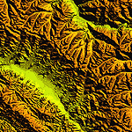
Highly detailed terrain mesh of the Jammu and Kashmir areas, N31-36 E76-78. The files in this package are based on Shuttle Radar (SRTM) Version 2 data but with many of the void areas, especially the most significant sections, filled with elevation data generated from topographic maps by Jonathan de Ferranti. While Jonathan's work is unrelated to flight simulation he kindly gave me permission to compile his data for use in FS. The result is a wonderful improvement in detail and accuracy over any existing mesh file, freeware or commercial, based on SRTM or DTED data alone.
Due to the large area of the Himalayas I've compiled the source data as two separate series: the "Himalayan Peaks" series covers prominent mountains and ranges in higher detail and locally overrides any existing LOD9 terrain mesh. In addition, a LOD9 "base mesh" series covering the entire Himalayas will be available for those who do not yet have an add-on terrain mesh of these beautiful mountains.
| Filename: | Himalayan_Peaks_LOD10_Mesh_Volume_6__Jammu_and_Kas.zip |
| License: | Freeware, limited distribution |
| Added: | 29th May 2010, 08:55:43 |
| Downloads: | 9,667 |
| Author: | Holger Sandmann, Jonathan de Ferranti |
| Size: | 52.19 MB |
| Category: Flight Simulator 2004 - Scenery | |
| "Himalayan Peaks" LOD10 Mesh, Volume 7 - K2 and Karakoram |
|
Images related to this file:
File Description:

Highly detailed terrain mesh of the Karakoram area, N35-37 E73-77. The files in this package are based on Shuttle Radar (SRTM) Version 2 data but with many of the void areas, especially the most significant sections, filled with elevation data generated from topographic maps by Jonathan de Ferranti. While Jonathan's work is unrelated to flight simulation he kindly gave me permission to compile his data for use in FS. The result is a wonderful improvement in detail and accuracy over any existing mesh file, freeware or commercial, based on SRTM or DTED data alone.
Due to the large area of the Himalayas I've compiled the source data as two separate series: the "Himalayan Peaks" series covers prominent mountains and ranges in higher detail and locally overrides any existing LOD9 terrain mesh. In addition, a LOD9 "base mesh" series covering the entire Himalayas will be available for those who do not yet have an add-on terrain mesh of these beautiful mountains.
| Filename: | Himalayan_Peaks_LOD10_Mesh_Volume_7__K2_and_Karako.zip |
| License: | Freeware, limited distribution |
| Added: | 30th May 2010, 09:56:27 |
| Downloads: | 9,481 |
| Author: | Holger Sandmann, Jonathan de Ferranti |
| Size: | 38.58 MB |


© 2001-2026 AVSIM Online
All Rights Reserved
Privacy Policy |