
Where Flight Simulation Enthusiasts Gather from Around the World!
AVSIM Library - Search Results

| Category: Flight Simulator 2004 - Scenery | |
| Canyonlands National Park, The Maze-North, Utah, Photo-Scenery (FSX too) |

|
Images related to this file:
File Description:
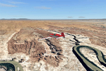
This is a re-upload of a package that was corrupted during the crash of the AVSIM library. The Maze is the wildest and least accessible district of Canyonlands National Park. It is a perplexing jumble of canyons that has been described as a '30 sq miles puzzle in sandstone'. The Maze covers the area west of the Green River and north of the Colorado River. Getting to most locations requires multiple hours of 4WD road driving. Hiking trails usually require multi day backpack trips.
Too strenous? Let's go flying! Checking out the area from an eagles perspective is certainly a stunning experience. The colors are awesome and the landforms are of breathtaking beauty. The scenery extends my Arches National Park scenery to the west and brings you another 3.500 sq km in 4.7m/pix quality. YourDonation@Work: Dedicated to Frans, Francois and James. Thanks!
| Filename: | Canyonlands_National_Park_The_MazeNorth_Utah_Photo.zip |
| License: | Freeware, limited distribution |
| Added: | 31st December 2009, 11:01:39 |
| Downloads: | 2,373 |
| Author: | Gottfried Razek - blueskyscenery.com |
| Size: | 92.88 MB |
| Category: Flight Simulator 2004 - Scenery | |
| Geneer AKR Stations A thru G v3.0 |
|
Images related to this file:
File Description:

Version 3.0! Seven fictional seaplane bases with helicopter support (three new from v2.0) located south of Juneau, Alaska. Scenery completely redesigned in Gmax for compatible use with Glacier Bay v2, Tongas Fjords, and Misty Fjords by Holger Sandman. All but one spot included one or more helipads, and are intended for cargo distribution and supplies, these seven AKR Stations were also intended to serve as tourism spots for hunting, fishing, skiing, camping, etc. Just fun little spots to hop in a floatplane. No AI traffic in this version, however afcads do accommodate for ai traffic.
All Objects fully designed and completely redone using higher resolution 32bit textures. Optional DXT textures included. Also includes new AFCAD files, animated hangar doors. No AI traffic tracks included with this release, but AFCAD designed to support AI. This v3.0 package is a Full Install (w/ effect file).
| Filename: | Geneer_AKR_Stations_A_thru_G_v30.zip |
| License: | Freeware, limited distribution |
| Added: | 15th June 2010, 22:28:01 |
| Downloads: | 818 |
| Author: | EdGeneer Cox |
| Size: | 45.66 MB |
| Category: Flight Simulator 2004 - Scenery | |
| Mehrabad Ver 1.0 (Tehran-Iran) |
|
Images related to this file:
File Description:

.::PERSIAN-SIM::. This package contains a simple scenery of Mehrabad Intl Airport OIII (Tehran-IRAN) and its buildings, aprons and hangars. The aprons contain all civil ,military and others. The AFCAD file of the airport is designed and updated exactly using the latest changes of Mehrabad which includes the following changes: 1.The complete change of Taxiway names and Taxiway signs; 2.Additional west parking space with 10 parking positions (APRON 4); 3.TWY 13 has been eliminated; 4.Apron names have been changed; 5.The position of Fire Fighting Station is changed (a new station is built); 6.All Parking positions are changed in names and headings. This version of Mehrabad is fully freeware and is available only from PERSIAN-SIM and AVSIM Library. The PROFESSIONAL version of Mehrabad (Payware), including the realistic scenery, buildings, static aircrafts, and realistic dynamic scenery, will be available soon on www.PERSIAN-SIM.com.
| Filename: | Mehrabad_Ver_10_TehranIran.zip |
| License: | Freeware, limited distribution |
| Added: | 3rd November 2010, 23:26:41 |
| Downloads: | 1,647 |
| Author: | PERSIAN-SIM ::: Behnam Zamani |
| Size: | 5.12 MB |
| Category: Flight Simulator 2004 - Scenery | |
| Loring Air Force Base - Maine, USA |
|
Images related to this file:
File Description:

This expansive airfield was built to serve as a home to over 100 of the Air Force's then-new B-36 Peacemaker. It's strategic location made it a natural location for a SAC (Strategic Air Command)base and so it has served for over 40 years. However the B-36 itself was destined to be short-lived in Air Force service and Loring replaced its B-36s with new jet B-52 bombers in 1956. This scenery attempts to capture the base during it's cold-war years of the 1970's. Scenery contains all-new custom objects for Loring Air Force Base as well as utilizing some common objects from the standard scenery libraries used by MAIW. Although there are no aircraft included with this package, the separate instruction sheet will guide users in easily obtaining quality AI aircraft that are appropriate to the period.
| Filename: | Loring_Air_Force_Base__Maine_USA.zip |
| License: | Freeware, limited distribution |
| Added: | 28th January 2014, 13:59:45 |
| Downloads: | 1,402 |
| Author: | John Stinstrom |
| Size: | 4.91 MB |
| Category: Flight Simulator 2004 - Scenery | |
| Kasba Lake CJL8 Northwest Territories Canada |
|
Images related to this file:
File Description:
This is a sixth airfield with links to Lake Athabasca, which is in Alberta and Saskatchewan. Kasba Lake is some 135 miles northeast of Stony Rapids and is in the Northwest Territories. The airfield is owned and run by and for Kasba Lake Lodge and it is one of several fishing vacation spots that are serviced by flights from Stony Rapids. It is these flights to the north that explain the number of regular scheduled flights into Stony Rapids from the south. The Kasba Lake Lodge has docks for boats and also for clients that want to arrive in their own floatplanes. The ai is for both Kasba Lake and Obre Lake and replaces the porpoising plane that I had used for Obre Lake. Norilor flies the weekend package-deal-long-distance delivery flights for Kasba Lake direct from Winnipeg, and now also for Obre Lake.
| Filename: | Kasba_Lake_CJL8_Northwest_Territories_Canada.zip |
| License: | Freeware, limited distribution |
| Added: | 9th August 2018, 14:21:17 |
| Downloads: | 152 |
| Author: | Roger Wensley |
| Size: | 2.48 MB |
| Category: Flight Simulator 2004 - Scenery | |
| BFU Brooks |
|
File Description:
With BFU Brooks, BFU enters the faraway bush country of northern Alaska. Located at Coldfoot in the southern foothills of the Brooks mountains, this base will cater to the needs of visitors to the area, and of sportsmen who indulge in hunting and fishing. This scenery package consists of three sceneries: our new northern base BFU Brooks, Moose Camp and Moose Lodge. The camp sits in the mountains on a small lake, whereas the lodge is situated on the shore of a large lake. Visitors are flown into Coldfoot from Fairbanks, then on to the camp or lodge as desired. Moose Camp and Moose Lodge will not show on the GPS, and of course do not have an NDB or similar to guide you. You'd better start in the camp/lodge, and fly toward Coldfoot to get to know the area. The sceneries have only been tested with the default mesh.
| Filename: | BFU_Brooks.zip |
| License: | Freeware |
| Added: | 30th September 2003, 15:17:31 |
| Downloads: | 5,317 |
| Author: | Naji Chehabeddine |
| Size: | 2.96 MB |
| Category: Flight Simulator 2004 - Scenery | |
| Torrejon Air Force Base (LETO), 1957-62 |
|
File Description:
Torrejón Air Base was originally the home of the Spanish National Institute of Aeronautics, but as a result of an agreement between Franco and the Unites States in 1953 an air base was created there with a large military apron and a runway 13,400 feet long - the longest in Europe for some decades. Officially opened in June 1957, both US bombers and fighters were based there, most significantly the B-47 Stratojet, which had too short a range to be operated only from the U.S. In July of 1958 the 497th Fighter Interceptor Squadron became the first permanently stationed Air Defence Group operating F-86L Sabres and from April 1960 the F-102 Delta Dagger. Over the years many different units and therefore many different aircraft types did TDY (Temporary Duty Assignments - usually 30-90 days) at Torrejon. Units of the Spanish Air Force were also present and are represented in this scenery package.
| Filename: | Torrejon_Air_Force_Base_LETO_195762.zip |
| License: | Freeware |
| Added: | 15th August 2021, 16:11:23 |
| Downloads: | 222 |
| Author: | Al Von Pingel and Ken Lawson |
| Size: | 44.81 MB |
| Category: Flight Simulator 2004 - Scenery | |
| Buffalo Narrows CYVT in Saskatchewan, Canada |
|
Images related to this file:
File Description:
Buffalo Narrows is a small town (around 1,400 folks) 130 miles west and a bit north of La Ronge in Saskatchewan, and I discovered that the Buffalo Narrows airfield, wrongly positioned in FS9, had been flooded out by Ultimate Terrain's lake; this is the rescue package. Actually that would be several lakes as the place is surrounded by water including Churchill Lake, Little Peter Pond Lake, and of course Big Peter Pond Lake.
There are two runways, the longest being 5,006' of 100' wide asphalt aligned 11/29, and the other 2,297 and 75' wide, also asphalt. Both runways are lit, and there is JetA and 100LL fuel available. I have placed taxiway lights, but I haven't made proper signage or placed runway lights, or a ton of other things, but it is now landable and with the buildings and fire chemical retarder tanks etc, and there is AI that includes a CL-415. The roads have also been modified to fit.
| Filename: | Buffalo_Narrows_CYVT_in_Saskatchewan_Canada.zip |
| License: | Freeware, limited distribution |
| Added: | 15th July 2012, 19:31:20 |
| Downloads: | 499 |
| Author: | Roger Wensley |
| Size: | 1.8 MB |
| Category: Flight Simulator 2004 - Scenery | |
| Quebec sceneries Enhancements |
|
File Description:
The files in this package contain enhanced sceneries of the province of Quebec, Canada (for FS2004 only). It's update for some islands of St.Lawrence river with much more new enhanced sceneries (see file list in Files_List.txt). Must be used with new terrain mesh for parts of the province of Quebec : QC09_2k4a.zip to QC09_2k4d.zip in AVSIM library.
Les fichiers contenus dans cette archive sont une mise � jour des sc�¨nes des �®les du fleuve Saint-Laurent avec un ajout important de nouvelles sc�¨nes. Vous en trouverez la liste compl�¨te dans le fichier �«Liste_fichiers.txt�». Pour ces sc�¨nes, l'utilisation du nouveau mesh du Qu�©bec pour FS2004 est indispensable. Vous les trouverez dans la biblioth�¨que d'AVSIM. Ils sont archiv�©s en quatre (4) parties : QC09_2k4a.zip � QC09_2k4d.zip.
| Filename: | Quebec_sceneries_Enhancements.zip |
| License: | Freeware, limited distribution |
| Added: | 1st November 2009, 06:48:12 |
| Downloads: | 4,960 |
| Author: | Gilles Gauthier |
| Size: | 4.15 MB |
| Category: Flight Simulator 2004 - Scenery | |
| Dallas, Texas - Helijet Shuttle Service - Scenery plus an AI Helicopter |
|
File Description:
Dallas, Texas - Helijet Shuttle service. This scenery adds the fictitious Helijet Shuttle service which
shuttles passengers from smaller local airports to Dallas-Ft. Worth International (KDFW) and back again.
The fine Sikorsky S-76C AI Helicopter by Chris 'Elvis' Jones (not included) will be seen departing and
arriving at Addison (KADS), Redbird (KRDB), Love (KDAL) and KDFW. At each location there is a small service area created with the EZ Scenery Object Placer program. All necessary files - other than the AI
Helicopter - are included. This scenery is presented not only as an interesting addition to the Dallas
area airports, but also as a “case study” to help you add the same type of service in other suitable
locations. By studying the Afcads I have created, you will quickly see how it is possible to include AI Helicopters in your sceneries using the "invisible” airport technique. Please unzip this package (using folders option) to a temporary folder and carefully follow the simple installation instructions.
| Filename: | Dallas_Texas__Helijet_Shuttle_Service__Scenery_plu.zip |
| License: | Freeware |
| Added: | 19th July 2006, 00:27:17 |
| Downloads: | 2,087 |
| Author: | David "Opa" Marshall |
| Size: | 1.72 MB |


© 2001-2026 AVSIM Online
All Rights Reserved
Privacy Policy |