
Where Flight Simulation Enthusiasts Gather from Around the World!
AVSIM Library - Search Results

| Category: Flight Simulator 2004 - Scenery | |
| Chelsea Dams on the Gatineau River |

|
Images related to this file:
File Description:
The Chelsea Dams are on the Gatineau River, just north of Rockcliffe airfield. I have used the plural as while there is only one dam as such, there is a second generating station just south of the dam; so "it" is more generally called "the Chelsea Dams". The dams mark the point where, if you are flying south down the Gatineau River towards Rockcliffe, you should be either below 1,500 feet or talking to the Ottawa control tower. While not a reporting point as noted in the supplement notes about flying vfr in the Ottawa area the dams are still the natural reporting point when approaching Rockcliffe and announcing landing intentions. Plus they are a visible landmark from way off, so here they are.
| Filename: | Chelsea_Dams_on_the_Gatineau_River.zip |
| License: | Freeware, limited distribution |
| Added: | 14th February 2010, 23:11:15 |
| Downloads: | 255 |
| Author: | Roger Wensley |
| Size: | 879.08 KB |
| Category: Flight Simulator 2004 - Scenery | |
| Port of Spain waterfront in Trinidad |
|
File Description:
Port of Spain is the capital of Trinidad and Tobago and happens to be where I am right now. As the flying down here is completely different to Canada (the only direction to go is north up the chain of islands, unless you want to be a suspected drug smuggler) and there aren't a whole bunch of airfields to model I turned my attention to the waterfront as a place where a floatplane would tie up. The result is here, and makes the harbour and some of the city more realistic. I had to use Lago for some of the buildings in the city itself but if you've never been to Trinidad then it won't make any diference to you if they're missing.
| Filename: | Port_of_Spain_waterfront_in_Trinidad.zip |
| License: | Freeware |
| Added: | 20th October 2007, 17:05:30 |
| Downloads: | 2,196 |
| Author: | Roger Wensley and Jim Turner |
| Size: | 1.29 MB |
| Category: Flight Simulator 2004 - Scenery | |
| Asia Pacific 1962 Scenery |
|
Images related to this file:
File Description:

This scenery package contains the major airports for the Pacific Islands, China, and the Asian portion of the Pacific Rim as they were circa 1962, based upon material and photographs Mike has gathered. Major airports have been detailed with custom GMAX objects, and many other smaller airports/strips have been backdated by providing parking spots, correcting runway lengths, and removing the irritating strobes, taxi lines, and other features that did not normally exist during the 1950s and early 1960s. Cities/countries/islands covered include Fiji, Polynesia, Guam, Midway, Taipei, Korea, Philippines, New Guinea, China, and North Korea, among many others. Much of the rest of Asia has been already been covered by the Indochina 1962 scenery package, and is required for this package as well.
| Filename: | Asia_Pacific_1962_Scenery.zip |
| License: | Freeware, limited distribution |
| Added: | 23rd January 2012, 20:15:44 |
| Downloads: | 4,853 |
| Author: | Mike Stevens, Wolfgang Gersch, Tom Gibson |
| Size: | 12.24 MB |
| Category: Flight Simulator 2004 - Scenery | |
| CNU8 - Toronto - Markham Airport (2008), Ontario, Canada |
|
Images related to this file:
File Description:
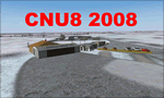
CNU8 - Toronto - Markham Airport (2008) - Markham v1. The airport is owned and operated by Markham Airport Inc., and is not part of the Greater Toronto Airport Authority.
The airport consists of a single 2,000 foot runway for small and private aircraft only (with night flying capabilities). The Royal Canadian Air Cadets Gliding Program uses the north side or the runway 09/27 for glider operations in the spring and fall months, and use a northern traffic pattern. This airport may disappear with the establishment of a planned Pickering Airport or re-location of Toronto/Buttonville Municipal Airport.
(This is a re-upload of the scenery to replace the original that was lost in the AVSIM hack. No changes have been made)
| Filename: | CNU8__Toronto__Markham_Airport_2008_Ontario_Canada.zip |
| License: | Freeware, limited distribution |
| Added: | 16th May 2010, 10:06:40 |
| Downloads: | 1,588 |
| Author: | Keith Murphy |
| Size: | 5.24 MB |
| Category: Flight Simulator 2004 - Scenery | |
| Denver (KDEN), Colorado, Photo-Scenery |
|
Images related to this file:
File Description:

Denver (KDEN), Colorado, Photo-Scenery for FS9 & FSX.
This package covers Denver, the capital of Colorado which is also nicknamed Mile-High City because its elevation is one mile (5.280 ft). The sixth RW (16R/34L) of Denver Int'l. Airport (KDEN) is the longest commercial RW in the US with a length of 16.000ft. This allows fully loaded B747's to take off in Denvers mile-high altitude during hot summer days, when density altitudes can approach 9.000(!) ft.
KDEN is a major hub for United Airlines and the headquarters for Frontier Airlines. The airports distinctive white tent-like fabric roof is designed to be reminiscent of the snow-covered peaks of the Rocky Mountains which you can see on approach or departure.
Other important airports covered by this region are Centennial Airport (KAPA), Buckley AFB (KBKF) and Rocky Mountain Metropolitan Airport (KBJC). Extends my Mt.Evans/Georgetown package to the east and provides another 3.500 sq km in 4.7m/pix quality.
High resolution versions for FS9 and FSX (much sharper, but larger and multiple downloads) are available at www.blueskyscenery.com/GNB_SouthEast.html
. The screenies are taken from the high-res versions, so expect this version to be slightly more blurry. YourDonation@Work: Dedicated to Mark and Charles. Thanks!
| Filename: | Denver_KDEN_Colorado_PhotoScenery.zip |
| License: | Freeware, limited distribution |
| Added: | 31st October 2009, 11:24:39 |
| Downloads: | 7,274 |
| Author: | Gottfried Razek, blueskyscenery.com |
| Size: | 95.21 MB |
| Category: Flight Simulator 2004 - Scenery | |
| Sulphur Creek Ranch ID74 private airfield in Idaho USA |
|
Images related to this file:
File Description:
This airfield is in the mountains of Idaho, around 30 miles south of Johnson Creek 3U2 which was the third in the series to be posted. Sulphur Creek Ranch is a privately owned airfield, serving the "Ranch", which translates into "restaurant-bar-lodge-and-holiday-cabins". The field is at 5,744 feet ASL, and the runway is 2,920 feet long and aligned 10-28. It is a single-ended runway, with 28 used for landing and 10 for take offs; this is down to a large chunk of mountain occupying the sky at the western end of the runway. The AI planes comply with this single runway concept and the only snag is that you cannot announce a landing as there is no runway offered for you to select for landing in the AI procedure. When taking off runway 10 is offered and you can announce take off. The land used by the ranch is mostly flat, and with a slant approach on finals and a late turn it is fairly straightforward. The largest landark is the man-made lake. Morgan Ranch 02ID is nearby and the grass area has been modified down in size as per reality. The buildings have been omitted as they are not adjacent to the runway and not visible, and I have no information on them.
| Filename: | Sulphur_Creek_Ranch_ID74_private_airfield_in_Idaho.zip |
| License: | Freeware, limited distribution |
| Added: | 25th May 2017, 17:54:33 |
| Downloads: | 164 |
| Author: | Roger Wensley |
| Size: | 6.21 MB |
| Category: Flight Simulator 2004 - Scenery | |
| Bethel: St Mary's area airfields in southwest Alaska close to the Yukon River |
|
Images related to this file:
File Description:
This presumes you have already installed Bethel PABE and Bethel Local Airfields. In the Yukon River area of Alaska to the north of Bethel there are small villages, served by flights from both Bethel and the nearer St Mary's PASM. St Mary's has a gravel runway like the other villages, but has a larger population and airport services including maintenance and fuel. This, plus the saving of an average one hundred miles of flying by a Cessna 205 when compared with flights from Bethel, means it acts as a distribution centre fed from Bethel by larger aircraft. Go to "http://vfrmap.com/" for free vfr maps of the area (see the attached). The ten village airfields included here are all to the north and west of St Mary's: Hooper Bay PAHP, Chevak VAK, Cape Romanzof PACZ (closed air force field servicing a radar station), Scammon Bay SCM, Sheldon Point SXP, Alakanuk AUK, Emmonak PAEM, Kotlik 2A9, Mountain Village MOU, and of course St Mary's PASM itself. With these airfields not everything is as it appears to be. For instance, Hooper Bay is not a new and modernised airfield, despite the asphalt runway and apron; the current version has dispensed with the aging asphalt and gone back to gravel. I have tended to go for the 2005 or so versions, which sometimes means a small runway amid or close to the housing; Kotlik was an early renewal for reasons of safety as much as anything else and has had (since 2003?) a new and longer runway located outside of the town. The second batch of airfields will be to the east of St Mary's.
| Filename: | Bethel_St_Marys_area_airfields_in_southwest_Alaska.zip |
| License: | Freeware, limited distribution |
| Added: | 29th April 2019, 17:07:24 |
| Downloads: | 225 |
| Author: | Roger Wensley |
| Size: | 11.53 MB |
| Category: Flight Simulator 2004 - Scenery | |
| PAWS - Wasilla - Anchorage, Alaska - USA |
|
Images related to this file:
File Description:
Wasilla PAWS is in Alaska, some 27 miles northeast of Anchorage and 11 miles due north of Birchwood, on the northern side of the Knik Arm. It is, like Birchwood, a small version of Merrill Field for mostly GA aircraft and private hangars, with some maintenance shops. The town of Wasilla is shown in FS9 and is quite large. There are a bunch of private airfields within a ten mile radius and some of these will be posted in this series, as will some other larger airfields. The main runway is around 3,700 feet long, aligned 03-21 and asphalted and lit, as are the taxiways. Again, like Birchwood, there is also a shorter and parallel runway that is grass and which receives no winter maintenance, for winter use by planes that are on skis.
| Filename: | PAWS__Wasilla__Anchorage_Alaska__USA.zip |
| License: | Freeware, limited distribution |
| Added: | 13th October 2014, 15:04:08 |
| Downloads: | 318 |
| Author: | Roger Wensley |
| Size: | 18.73 MB |
| Category: Flight Simulator 2004 - Scenery | |
| Whitefish 58S in Montana US |
|
Images related to this file:
File Description:
I have made this because I downloaded and tried the Glacier Park scenery by Blue Sky Scenery and then discovered that the runway for Whitefish was wrongly aligned and headed off across the adjacent railroad tracks. This would be inconvenient if you had to wait for a train to pass before landing so I fixed that and added a couple of buildings. That's it, nothing more complicated than that. If I find some more airfields in this area with similar problems then I'll do more of the same. Whitefish is 3 or so miles north of Glacier Park International at 3,066 feet ASL and around 35 miles south of the Canadian border. There are no large towns close by; the nearest would be Missoula, which is 90 miles further south.
| Filename: | Whitefish_58S_in_Montana_US.zip |
| License: | Freeware, limited distribution |
| Added: | 23rd May 2010, 02:05:52 |
| Downloads: | 194 |
| Author: | Roger Wensley |
| Size: | 826.52 KB |
| Category: Flight Simulator 2004 - Scenery | |
| SeaTac Mall Visual Landmark Object for Seattle-Tacoma INTL. KSEA |
|
File Description:
Sea-Tac Mall has been the center of the community in Federal Way WA for over 25 years and for just as long has been a landmark for thousands of flights that use KSEA yearly. The phrase...........Alaska 69 is with you at 7.5 DME for the MALL VISUAL 34L or Right is heard on many a sunny days on those with airband scanners. My motivation for creating this scenery is not only because I live within walking distants but that Microsoft did not include the landmark for it in FS9COF however they did not forget about the HUSKY Visual that starts at UofWASH Husky stadium to the north. Im certian that if you have arrived from the south you have seen Sea-Tac Mall out your window seat.
| Filename: | SeaTac_Mall_Visual_Landmark_Object_for_SeattleTaco.zip |
| License: | Freeware |
| Added: | 11th August 2003, 01:41:16 |
| Downloads: | 3,217 |
| Author: | Randall Smith |
| Size: | 320.63 KB |
© 2001-2026 AVSIM Online
All Rights Reserved
Privacy Policy |