
Where Flight Simulation Enthusiasts Gather from Around the World!
AVSIM Library - Search Results

| Category: Flight Simulator 2004 - Scenery | |
| Trapani "Birgi" airport ( LICT - TPS ) |

|
Images related to this file:
File Description:

This FS2004 project reproduce the south-italian "Trapani Birgi Airport" (Iata: TPS, Icao: LICT) located on the east coast of Sicily. If you are a Ryanair, charter flights or military pilot, this scenery is a “must have†! In the scenery you'll find almost all airport buldings (civilian and military), hundred of custom made detailed objects, static and animated vehicles and a photoreal airport background. Each scenery part and object (frame-rate friendly thanks to the hi-performance design) has day and night photoreal textures and everything is placed in the right position (which has been seen on summer 2018 at the real airport).English extendet handbook is included. Watch the screenshots inside the package or on the Albysim website (in this free/demo edition some features are limited).
| Filename: | Trapani_Birgi_airport__LICT__TPS_.zip |
| License: | Check within download |
| Added: | 9th May 2019, 16:28:44 |
| Downloads: | 841 |
| Author: | Albysim Scenery Design / Alberto Di Bolzano |
| Size: | 27.16 MB |
| Category: Flight Simulator 2004 - Scenery | |
| Sao Luis (Brazil) - Photoreal |
|
Images related to this file:
File Description:
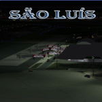
Sao Luis is a Brazilian city, capital of Maranhao state, founded on September 8, 1612. It is located on the island Upaon-Acu (the name was given by the Indians tupinambas meaning "Big Island"), South Atlantic, between the bays of San Marcos and San Jose. It is one of three Brazilian state capitals located on islands (the others are Florianopolis and Vitoria). The scenery contains:
Photoreal of Sao Luis island with hand placed autogen; Marechal Cunha Machado Intl. Airport photoreal in HD; real lighting effect; grass textures; AZL with detailed buildings and hangars; ground support vehicles; detailed terminal with fingers; ships on the coast; Itaqui harbor.
# Courtesy of Marco Santiago (Addons): Bridges Pres. Sarney, Bandeira Tribuzi and the Estreito dos Mosquitos; Terminal de Integracao BR; Alexandre Raposo aerodrome; CAVU aerodrome (Ultralight).
| Filename: | Sao_Luis_Brazil__Photoreal.zip |
| License: | Freeware, limited distribution |
| Added: | 4th December 2010, 03:58:01 |
| Downloads: | 2,727 |
| Author: | Jorge Amengol |
| Size: | 60.29 MB |
| Category: Flight Simulator 2004 - Scenery | |
| Marsa Alam Int. Airport (Iata: RMF, Icao: HEMA) |
|
Images related to this file:
File Description:
This FS2004 project reproduce the egyptian "Marsa Alam International Airport" (Iata: RMF, Icao: HEMA) located on the Red Sea coast. If you are a holiday-flights pilot, this airport is a “must have†!
In the scenery you'll find all buildings (airport, close surroundings and Port Ghalib resorts), hundred of custom made detailed objects, static and animated vehicles and a photoreal airport background. Each scenery part and object (frame-rate friendly thanks to the low poly design) has photoreal textures and everything is placed in the right position (which has been seen on summer 2016 at the real airport).English extended handbook is included. Watch the screenshot and the demo video on the Albysim youtube channel and enjoy all scenery features (in this free/demo edition some features are limited).
| Filename: | Marsa_Alam_Int_Airport_Iata_RMF_Icao_HEMA.zip |
| License: | Check within download |
| Added: | 29th October 2016, 21:26:52 |
| Downloads: | 1,010 |
| Author: | Albysim Scenery Design / Alberto Di Bolzano |
| Size: | 33.46 MB |
| Category: Flight Simulator 2004 - Scenery | |
| Columbia-Willamette Rivers Fix |
|
File Description:
These flattening files lower the elevated water on the Columbia and Willamette rivers in and around Portland, Oregon. On the Columbia River they start east of Astoria, OR (KAST) and proceed east and south through Portland, OR (KPDX) then east to Cascade Locks, OR (KXZK). On the Willamette River they proceed from Portland south to just north of Aurora, OR (KUAO) ending at the collapsed bridge. Several bodies of water next to the Columbia and Willamette rivers have also been flattened. These files work well with FS default scenery and FS Genesis 38m mesh scenery.
| Filename: | ColumbiaWillamette_Rivers_Fix.zip |
| License: | Freeware |
| Added: | 19th April 2004, 22:19:32 |
| Downloads: | 3,062 |
| Author: | Dan Reynolds |
| Size: | 10.4 KB |
| Category: Flight Simulator 2004 - Scenery | |
| Yorkshire Gliding Club EG96 in Yorkshire, England |
|
Images related to this file:
File Description:
These are the buildings, gliders, tow tug, trailers etc on the airfield of the Yorkshire Gliding Club in Yorkshire England. This is on the top of an escarpment just north of the White Horse; take a look at the screenshot and you will see what this refers to. This is made to fit in with the VFR Photographic Scenery made from an aerial survey of England and Wales in the year 2000. This will be known to those who have it, and probably never been heard of by those who don't.
| Filename: | Yorkshire_Gliding_Club_EG96_in_Yorkshire_England.zip |
| License: | Freeware, limited distribution |
| Added: | 12th July 2013, 17:26:17 |
| Downloads: | 265 |
| Author: | Roger Wensley |
| Size: | 2.81 MB |
| Category: Flight Simulator 2004 - Scenery | |
| Vidsel (ESPE) |
|
File Description:
This scenery makes the Vidsel base (ESPE) functional in FS2004 and FSX by adding taxiways, taxiway signs, aprons, parking stands, buildings and navaids.
The Vidsel base, or RFN (Missile Test Site North) as it is officially called, was inaugurated in 1958, and the first mission was to test missiles for the Draken fighter aircraft. The base remained secret until the mid 1960s, and today it is still used by the Swedish Armed Forces as well as foreign air forces to test missiles in the largest test range in Europe.
| Filename: | Vidsel_ESPE.zip |
| License: | Freeware |
| Added: | 10th January 2010, 05:20:16 |
| Downloads: | 293 |
| Author: | Martin Loxbo |
| Size: | 15.33 KB |
| Category: Flight Simulator 2004 - Scenery | |
| Alexandria CNS4 field near Ottawa, Ontario, Canada |
|
Images related to this file:
File Description:
This was the thirteenth of a projected 16 airfields in the Ottawa area originally posted in 2006; this version has specifically modeled buildings. Alexandria is just a mile east of the town of the same name, 50 miles east of Ottawa International and 16 miles north of Cornwall. It has one grass runway which is 2,020' long and 100' wide and which parallels the road. There are two hangers and a two storey clubhouse, and fuel. And in the summer look out for the gliders doing right hand circuits and the parachutists on vertical finals.
| Filename: | Alexandria_CNS4_field_near_Ottawa_Ontario_Canada.zip |
| License: | Freeware, limited distribution |
| Added: | 16th February 2010, 01:41:39 |
| Downloads: | 440 |
| Author: | Roger Wensley |
| Size: | 1.33 MB |
| Category: Flight Simulator 2004 - Scenery | |
| Stade-Agathenburg (EDHS) |
|
File Description:
Scenery Add-on of Stade-Agathenburg/North Germany/Lower Saxony. This Scenery is not really new; it is originally for fs2000. Ascension Day 2001 when there was a meeting of several aeroclubs and there was much traffic though I know there is not normally so many airplanes on normal days. A crowded airport looks much better. If you have a former version you only need to exchange the scenery folder and intall the af2.bgl. Some flusi-friends told me about mesh problems so I decided to make the ground new with the freeware Afcad.
| Filename: | StadeAgathenburg_EDHS.zip |
| License: | Freeware |
| Added: | 28th February 2006, 01:02:11 |
| Downloads: | 1,568 |
| Author: | Uwe Schweitzer |
| Size: | 1.63 MB |
| Category: Flight Simulator 2004 - Scenery | |
| Telluride Regional Airport v3 ( KTEX ) |
|
File Description:
FS2004 Scenery - Telluride Regional Airport (IATA: TEX, ICAO: KTEX) is a public airport located 5 miles (8 km) west of Telluride, in San Miguel County, Colorado, USA. It is the highest commercial airport in North America, at an elevation of 9,078 feet (2767 m) above sea level. Located on a plateau, the airport's single runway literally dips slightly in the centre. This is version 3. Unlike versions 1 and 2, this scenery had the advantage of Google Earth's satellite image. Created using Instant Scenery by John B. Loney, Jr.
| Filename: | Telluride_Regional_Airport_v3__KTEX_.zip |
| License: | Freeware, limited distribution |
| Added: | 25th March 2008, 15:55:10 |
| Downloads: | 2,795 |
| Author: | John B. Loney, Jr. |
| Size: | 17.23 MB |
| Category: Flight Simulator 2004 - Scenery | |
| Hay River - Merlyn Carter Airport NT |
|
Images related to this file:
File Description:
This scenery is the Hay River (CYHY)NT, Canada Airport located on the Southern side of Great Slave Lake. This small busy airport is an important part of the moving of freight and passengers to the North. During the spring and fall when the ice roads are not passable and the waterways cannot be used these Northern airports are vital to get the essential into Northern communities. Buffalo Airways is a great user of this airport for moving freight and passengers as well as operating a fleet of fire fighting tankers.
| Filename: | Hay_River__Merlyn_Carter_Airport_NT.zip |
| License: | Freeware, limited distribution |
| Added: | 28th April 2012, 03:32:22 |
| Downloads: | 1,083 |
| Author: | Flight Ontario - Al Gay |
| Size: | 26.09 MB |
© 2001-2026 AVSIM Online
All Rights Reserved
Privacy Policy |