
Where Flight Simulation Enthusiasts Gather from Around the World!
AVSIM Library - Search Results

| Category: Flight Simulator 2004 - Scenery | |
| Northern Venezuela SRTM Mesh part 2 |

|
File Description:
This terrain mesh scenery covers north of Venezuela (southern boundary is 8°48'N) and Dutch caribeans: Aruba, Curacao & Bonaire islands.
Based on SRTM Data (3 arcsec, 90m), generated with Matthew Styles's program "SRTM To BGL v1.04", sampled to LOD9 resolution (76m) with 5 interpolation passes.
This part contains Venezuela-NW.bgl. See venezuela_n_mesh_pt2-1.jpg for the .BGL files coverage.
| Filename: | Northern_Venezuela_SRTM_Mesh_part_2.zip |
| License: | Freeware |
| Added: | 7th October 2003, 18:19:24 |
| Downloads: | 8,628 |
| Author: | Yohann Baptiste |
| Size: | 14.31 MB |
| Category: Flight Simulator 2004 - Scenery | |
| CYSV Canada, New Foundland, Saglek |
|
Images related to this file:
File Description:
This scenery for FS-2004 as much as possible represents Saglek (CYSV), located at the north of New Foundland, Canada according to photographs found on the Web. This scenery is compatible with Mesh de M.Gilles Gauthier. Several originators took part in the design of this scenery: Regis Dassylva, Gerald Allaire, Gilles Gauthier and Jean-Pierre Fillion, all members of Concepteurs Virtual du Quebec.
| Filename: | CYSV_Canada_New_Foundland_Saglek.zip |
| License: | Freeware |
| Added: | 31st December 2009, 04:53:29 |
| Downloads: | 656 |
| Author: | Regis Dassylva |
| Size: | 2.33 MB |
| Category: Flight Simulator 2004 - Scenery | |
| SACO - Ingeniero Aeronáutico Ambrosio L.V. Taravella Intl. - Cordoba, Argentina |
|
Images related to this file:
File Description:
Ingeniero Aeronautico Ambrosio L.V. Taravella International Airport (Spanish: Aeropuerto Internacional de Cordoba "Ingeniero Aeronautico Ambrosio L.V. Taravella") (IATA: COR, ICAO: SACO), more commonly known as Pajas Blancas, is located 9 km (5.6 mi) north-northwest away from the center of Cordoba, the capital city of the Cordoba Province in Argentina. The airport covers an area of 1,020 ha (2,520 acres). Photorealistic ground.
| Filename: | SACO__Ingeniero_Aeronutico_Ambrosio_LV_Taravella_I.zip |
| License: | Freeware |
| Added: | 10th February 2014, 22:46:58 |
| Downloads: | 2,798 |
| Author: | Ignacio Campos |
| Size: | 53.17 MB |
| Category: Flight Simulator 2004 - Scenery | |
| Fort Good Hope CZGH - Northwest Territories, Canada |
|
Images related to this file:
File Description:
This is the second in a series of airfields that follow that early access route to the Canadian northern shore, the Mackenzie River. At the far northern end of the river there are Tuktoyaktuk, Inuvik, and Fort McPherson, all posted. Fort Good Hope is at 268 feet ASL and on the east bank of the Mackenzie, 180 miles southeast of Fort McPherson and 100 miles west of Great Bear Lake. The town has a population of around 560, and the main sources of income are from the traditional trapping and hunting. The airport is a mile south of the town, and has almost 4,000 feet of gravel runway. There are scheduled flights to the town by North Wright; I also have two AI GA flights and a Buffalo Airways delivery trip that hops north and south from field to field.
| Filename: | Fort_Good_Hope_CZGH__Northwest_Territories_Canada.zip |
| License: | Freeware, limited distribution |
| Added: | 4th July 2014, 21:03:03 |
| Downloads: | 276 |
| Author: | Roger Wensley |
| Size: | 3.08 MB |
| Category: Flight Simulator 2004 - Scenery | |
| Whenuapai Air Force Base , New Zealand. NZWP. |
|
File Description:
Welcome to Whenuapai Air Force Base. The base is situated north west of Auckland City, in Waitakari District, in the North Island of New Zealand. Whenuapai is home to several different R.N.Z.A.F. squadrons, with varying aircraft and helicopter types, including the Lockheed P3 Orion, Lockheed C130 Hercules, Iroquois and Seasprite helicopters. This scenery is designed and built to fit the "RealNZ Auckland City" photoreal scenery (payware) by Robin Corn. It will however, work fine in default FS9. The scenery contains some custom items, and also custom ground textures for all 4 seasons to replace the original RealNZ ground textures. The scenery was also designed to work with the newly updated RNZAF AI package, filename rnzafa11.zip, by Charl Du Toit. The AI package is freely available here on Avsim. Scenery also requires some EZ Scenery Object Sets (see INSTALL instructions for detsils).
| Filename: | Whenuapai_Air_Force_Base__New_Zealand__NZWP.zip |
| License: | Freeware, limited distribution |
| Added: | 26th February 2009, 11:32:03 |
| Downloads: | 1,586 |
| Author: | Lawrie Roache |
| Size: | 4.7 MB |
| Category: Flight Simulator 2004 - Scenery | |
| Burgas LBBG v1.01 |
|
File Description:
Burgas (Bourgas) International Airport (IATA: BOJ, ICAO: LBBG) is the airport of the city of Burgas, Bulgaria. It is one of the biggest international Bulgarian airports. It's location is on the coast of the Black Sea and is a popular tourist destination during the summer months, when it is subject to heavy traffic.
The airport has one long runway - concrete; direction 04/22; it is 3200m (10,500ft) in length and is capable of accepting the biggest airplanes in the world.
What's new?
- AFCAD with 4 new gates, reworked all other stands, apron lights and removed trees.
| Filename: | Burgas_LBBG_v101.zip |
| License: | Freeware |
| Added: | 31st August 2011, 22:15:10 |
| Downloads: | 3,275 |
| Author: | Vasil Madjarov |
| Size: | 9.07 MB |
| Category: Flight Simulator 2004 - Scenery | |
| 14S, Westport WA - FSE |
|
File Description:
Here you'll find a fictional representation of 14S, a small airport on Washingtons coast as well as three water areas for you to enjoy your favorite amphibian or seaplane with. This area is just loaded with ear and eye candy and includes many tracks of dynamic scenery so that you will feel like youre immeresed in your own little world. For the ultimate adventure, switch to the foggy day weather theme. Its beautiful! Lago's FSE for FS2004 required to view the scenery and FSGenesis's US Landclass required to correctly place the towns position (freeware or payware version will do fine)
| Filename: | 14S_Westport_WA__FSE.zip |
| License: | Check within download |
| Added: | 14th January 2004, 17:22:11 |
| Downloads: | 5,077 |
| Author: | Lauren Robison |
| Size: | 342.32 KB |
| Category: Flight Simulator 2004 - Scenery | |
| Hartley Bay replacement landclass - BC Canada |
|
Images related to this file:
File Description:
This is a replacement landclass bgl for the Hartley Bay float base area, which was posted as part of BC Canada West Coast Fields and Floats in July 2008, and downloaded by over a thousand people since then. Which means that for over 6 years hundreds of people knew that the object textures for Hartley Bay were not showing up, but did not tell me. Find where you installed the original download, find the folder with the same name as in this new download, and replace the existing with the new. All object textures will now show, and so will the landclass.
| Filename: | Hartley_Bay_replacement_landclass__BC_Canada.zip |
| License: | Freeware, limited distribution |
| Added: | 17th November 2014, 22:42:50 |
| Downloads: | 147 |
| Author: | Roger Wensley |
| Size: | 146.47 KB |
| Category: Flight Simulator 2004 - Scenery | |
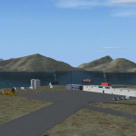
| CWCY - Cape Young - Nunavut, Canada |
|
Images related to this file:
File Description:
Cape Young was a DEW line station on the nothern mainland coast 50 miles northwest of Kugluktuk, and 50 miles west of Lady Franklin Point. It closed in August 1993. Most of the buildings are still there, in various shades of decay. The runway is also still there and close to 5,000 feet of gravel in length, aligned and signed 110T/290T, though on the atc it will be called 07/25 as FS9 knows nothing about the Canadian Northern Domestic Airspace. There is no runway lighting, and don't be surprised if there are bushes growing amid the gravel.
| Filename: | CWCY__Cape_Young__Nunavut_Canada.zip |
| License: | Freeware, limited distribution |
| Added: | 11th November 2012, 01:23:51 |
| Downloads: | 223 |
| Author: | Roger Wensley |
| Size: | 1.53 MB |
| Category: Flight Simulator 2004 - Scenery | |
| Fernando de Noronha Photoreal |
|
Images related to this file:
File Description:

Fernando de Noronha is an archipelago of 21 islands and islets in the Atlantic Ocean, around 354 km (220 miles) offshore from the Brazilian coast. The main island has an area of 18.4 square kilometres (7.1 sq mi) and had a population of 3,108 in the year 2009.[3] The area is a special municipality (distrito estadual) of the Brazilian state of Pernambuco[4] (despite being closer to the state of Rio Grande do Norte)[5] and is also a UNESCO World Heritage Site. Its timezone is UTC-2h. Flight this great scenery today with photoreal environment and realistic terminal buildings.
| Filename: | Fernando_de_Noronha_Photoreal.zip |
| License: | Freeware, limited distribution |
| Added: | 17th November 2010, 15:32:36 |
| Downloads: | 2,740 |
| Author: | Jorge Amengol & Gustavo Luna |
| Size: | 2.61 MB |
© 2001-2026 AVSIM Online
All Rights Reserved
Privacy Policy |