
Where Flight Simulation Enthusiasts Gather from Around the World!
AVSIM Library - Search Results

| Category: Flight Simulator 2004 - Scenery | |
| Central Europe 1961 |

|
Images related to this file:
File Description:
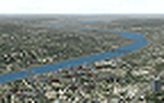
This scenery package contains twelve airports in Germany, nine in the Netherlands, one in Luxembourg, three in Switzerland , and three in Austria - providing taxiways and details as they were at the beginning of the 1960's.
We also created the harbors of Rotterdam, Hamburg and Den Helder, all the lighthouses along the Dutch coast and some along the German coast, and created the island of Helgoland from scratch. Although most of the airports of the package are for civil use, we also produced some Dutch military bases with AI and static aircraft. At many of the airports you will find moving crash tenders and at Amsterdam moving airport buses. Although we did not always have enough photos and information we tried to come as close as possible. Our goal was to reflect something of the atmosphere and feel of that period, prior to the all-jet era of today.
| Filename: | Central_Europe_1961.zip |
| License: | Freeware, limited distribution |
| Added: | 17th May 2013, 20:07:54 |
| Downloads: | 6,638 |
| Author: | Wolfgang Gersch, Harry Biard, Michael Schneider,Jaap de Baare, Nikko Yaginuma, Tom Gibson, Bernard Leuenberger and Mike Stevens |
| Size: | 55.23 MB |
| Category: Flight Simulator 2004 - Scenery | |
| Alaska North Slope 4: Lonely Air Force Station (AK71) |
|
Images related to this file:
File Description:
The town of Barrow is in the far north of Alaska, and these are coastal villages or radar installations to the west, south, and now east of Barrow. There will be further additions. Lonely Air Force Station AK71 is 80 miles east of Barrow and on the coast. It was, and at first sight appears still to be, a DEW station until you are close enough to see that the gravel apron is deteriorating. There is a gravel runway around 5,000 feet long, a large hangar, the DEW buildings, radar under the domes, the remains of huge line-of-sight communications reflectors, and oil tanks. Some DEW sites are not worth a visit; others are surprisingly intact and this is one of those. The AI takes place three days a week and is a C130, in which case the DEW site is still functioning or under mothball maintenance, a chartered Reeve Aleutian in which case the site is closed and they are documenting wildlife, and a Cessna with a group of the curious.
| Filename: | Alaska_North_Slope_4_Lonely_Air_Force_Station_AK71.zip |
| License: | Freeware, limited distribution |
| Added: | 20th June 2016, 08:02:18 |
| Downloads: | 306 |
| Author: | Roger Wensley |
| Size: | 2.32 MB |
| Category: Flight Simulator 2004 - Scenery | |
| CYYH - Taloyoak - Nunavut, Canada |
|
Images related to this file:
File Description:
Taloyoak is on the coast of northern mainland Canada, on the west of the Boothia Peninsula, where it is at it's narrowest. Gjoa Haven is 80 miles southwest, and Hall Beach is 300 miles to the east. Taloyoak was established around a Hudson Bay trading post that was relocated from Fort Ross in 1948 because of poor ice conditions. There is now a clinic, school, church, recreation centre, two markets, two small hotels, and housing for the population of around 900. The airfield is to the west of the village on higher ground at 92 feet asl, and the 4,020 feet of 100 feet wide gravel runway is aligned 151T/331T where T stands for "true" as opposed to magnetic in the Northern Domestic Airspace. Only JETA-1 is available, unless there is some 100LL in drums. There are flights by First Air and Canadian North and the AI includes a daily flight of each, plus an afternoon cargo visit by a Buffalo C46; the closest large city is Yellowknife, 750 miles southwest.
| Filename: | CYYH__Taloyoak__Nunavut_Canada.zip |
| License: | Freeware, limited distribution |
| Added: | 18th November 2012, 09:23:20 |
| Downloads: | 374 |
| Author: | Roger Wensley |
| Size: | 3 MB |
| Category: Flight Simulator 2004 - Scenery | |
| Clinton Point CWCP, Horton River CWHR & Keats Point CWKP; DEW sites in Northwest Territories, Canada |
|
Images related to this file:
File Description:
These are three DEW line sites in northern mainland Canada, to the east of Tuktoyaktuk.
Clinton Point is almost 300 miles east of Tuktoyaktuk and on the Northwest Territories and Nunavut border. It is the site of a closed DEW station (closed in 1993) and all the buildings have been removed, unlike many other sites where buildings are still almost complete. The roads and the gravel runway down by the beach are still there.
Horton River is 150 miles east of Tuktoyaktuk, up on higher land above the cliffs at around 500 feet ASL. The NWS (North Warning System) replaced the I site which was there previously and which ceased operations in 1963. The NWS is serviced by helicopter from a barge 400 yards away on the beach.
Keats Point is 270 miles east of Tuktoyaktuk, 7 miles from the coast but significantly close to a lake, which was probably used for float plane delivery in the summer (or ski plane delivery in the winter) of NWS station elements during construction.
| Filename: | Clinton_Point_CWCP_Horton_River_CWHR__Keats_Point_.zip |
| License: | Freeware, limited distribution |
| Added: | 17th July 2012, 18:57:08 |
| Downloads: | 279 |
| Author: | Roger Wensley |
| Size: | 2.07 MB |
| Category: Flight Simulator 2004 - Scenery | |
| Whole Alabama,USA, Soaring |
|
File Description:
FS2002/2004 Whole Alabama,USA, Soaring Scenery
This file adds thermals lifts to flights over whole Alabama Sytate Region ,USA,North America.
Good Flights and better Landings
Volta Redonda,Brazil,04/21/2006
E-mail:[email protected]
| Filename: | Whole_AlabamaUSA_Soaring.zip |
| License: | Freeware |
| Added: | 27th April 2006, 02:11:08 |
| Downloads: | 279 |
| Author: | Francisco Augusto Vargas Carneiro |
| Size: | 431.53 KB |
| Category: Flight Simulator 2004 - Scenery | |
| Whole Long Island, USA, Soaring Scenery |
|
File Description:
FS2004 Whole Long Island, USA, Soaring Scenery. This file adds thermals lifts to flights over Long Island and completes thermals to New York State Region, USA,North America. It is freeware. Good Flights and better Landings
| Filename: | Whole_Long_Island_USA_Soaring_Scenery.zip |
| License: | Freeware |
| Added: | 8th May 2006, 00:44:34 |
| Downloads: | 352 |
| Author: | Francisco Augusto Vargas Carneiro |
| Size: | 68.23 KB |
| Category: Flight Simulator 2004 - Scenery | |
| KCRW - Kanawha River Valley - West Virginia, USA |
|
Images related to this file:
File Description:
This scenery is made to blend with autogen scenery and the defaults of FS9. Transits crossing the southern Allegheny Mountains will follow this valley seeing some of the landmark bridges and dams of the central WV area. The New river bridge scenery is not included in this package because (not only my own version which works default mesh), but another fellow has made one. It also fits with this package and looks real good. This package blends well with default or compliments my Land Class Central Appalachia package.
| Filename: | KCRW__Kanawha_River_Valley__West_Virginia_USA.zip |
| License: | Freeware |
| Added: | 9th July 2015, 17:26:13 |
| Downloads: | 228 |
| Author: | Rick Connolly |
| Size: | 2.33 MB |
| Category: Flight Simulator 2004 - Scenery | |
| LISA - Samolaco Airfield - Valchiavenna, Italy |
|
Images related to this file:
File Description:
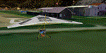
Scenery realized on the real coordinates and including several buildings to real image. Requires the use of the libraries dva51 and the system of vegetations TreePlanter. This scenery represents the airfield for ultralight of Samolaco, home of the flying school A.V.L.U. for trikes, three aces, flights over the mountains, and helicopter. Located at the beginning of Chiavenna valley, municipality of Samolaco (N46 14.10 E09 25.52) has a grass runway of 400 meters; Code: LISA. Enjoy.
Video available here: http://youtu.be/anPrFoIEqOE
| Filename: | LISA__Samolaco_Airfield__Valchiavenna_Italy.zip |
| License: | Freeware |
| Added: | 4th November 2014, 19:35:28 |
| Downloads: | 317 |
| Author: | Aldo Della Vedova |
| Size: | 3.15 MB |
| Category: Flight Simulator 2004 - Scenery | |
| Hauraki Gulf |
|
File Description:
This replaces all my previous Pakatoa Island and Hauraki Gulf sceneries.
An ongoing project - maybe more to come.
You must have Christian Stock's NZ mesh in the form of "Mountains of New Zealand" and topo in the form of "Lakes and Rivers of New Zealand".
Pakatoa Island: A few houses plus a jetty with parking for float planes.
Waiheke Island: Floatplane parking and a ferry terminal at Matiatia Beach. Jetty at Orapiu.
Kawau Island: Jetty at Mansion House Bay..including the Mansion House.
Auckland: Ferry Terminal.
Also included...Afcads for Floatplane and ferry boat parking.
| Filename: | Hauraki_Gulf.zip |
| License: | Freeware |
| Added: | 21st October 2008, 08:47:41 |
| Downloads: | 390 |
| Author: | Godfrey Tier |
| Size: | 4.81 MB |
| Category: Flight Simulator 2004 - Scenery | |
| Innsbruck-LOWI, version 2 |
|
File Description:
Here is my second version of Innsbruck-lowi, the airport of Innsbruck located in Austria, in the middle of the alps. The scenery is made including the active approach system of Jim Vile, with his permission. I modified his afcad file, that is part of this system, a bit to better fit with my scenery. The result of this system is a better AI traffic behavior when flying in or departing from Innsbruck. (No more flying into the mountains). For user aircraft there is a more correct ATC vectoring when using an IFR flightplan.
| Filename: | InnsbruckLOWI_version_2.zip |
| License: | Freeware |
| Added: | 12th January 2010, 19:28:45 |
| Downloads: | 32,793 |
| Author: | Johan Thiers |
| Size: | 1.16 MB |
© 2001-2026 AVSIM Online
All Rights Reserved
Privacy Policy |