
Where Flight Simulation Enthusiasts Gather from Around the World!
AVSIM Library - Search Results

| Category: Flight Simulator 2004 - Scenery | |
| VFR of Lario, Area D2 - Como lake, Italy |

|
Images related to this file:
File Description:
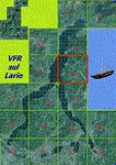
This is the seventh scenery of the "VFR of Lario" project, made with photorealistic terrain and some 3D GMax realistic objects. This scenery covers approximately an area of 7.5x6 kmt, from
north of Bellano (NW) to Casargo (NE), and from Fiumelatte (SW) to Cortenova (SE) and includes the NLC piers of Varenna and Bellano; it includes several dedicated buildings as Vezio castle (Perledo), villa Monastero, S.Giorgio church, marina, piers, hotel Olivedo, and some villas (Varenna), Tommaso Grossi square with pier and light fountain, S.Nazaro-Celso and S.Rocco-Sebastiano churches, Cantoni old cotton mill, group of houses by the lake (Bellano). There are also included four viaducts between the tunnels of the freeway 36, with moted traffic. Hydrofoil G. Marconi at Bellano pier together with other minor boats and docks alongside the lake coast; a moted traffic of motorboats is placed between Varenna's piers.
| Filename: | VFR_of_Lario_Area_D2__Como_lake_Italy.zip |
| License: | Freeware |
| Added: | 23rd July 2012, 15:45:14 |
| Downloads: | 1,259 |
| Author: | Aldo Della Vedova, Daniele Lanfranchi, Gian Mario Verga |
| Size: | 17.95 MB |
| Category: Flight Simulator 2004 - Scenery | |
| FoxPine AirPark, New Zealand. NZFP. |
|
File Description:
Welcome to FoxPine Airpark ,NZFP.
FoxPine AirPark is situated by the small provincial town of Foxton on the South West coast of New Zealand’s North Island.
This Private Airfield set in park-like grounds is sited on a broad coastal plain of mixed farming and forestry bounded by sweeping beaches,
a meandering river, and off to the East, rugged bush-clad ranges, all great places to fly.
FoxPine is also where the "Jabiru" light aircraft is assembled, sold and serviced.
This scenery contains a bonus custom AI package, comprising of seven Jabiru-2's, a Cessna 172, and a Maule M6, and a traffic file for the aircraft. (AI Aircraft are complete with all files).
The AI aircraft, and the traffic file are fully compatible with GNZLAP traffic. Scenery requires some EZ Scenery Object Sets (see INSTALL instructions for details).
| Filename: | FoxPine_AirPark_New_Zealand__NZFP.zip |
| License: | Freeware, limited distribution |
| Added: | 14th August 2008, 21:27:16 |
| Downloads: | 927 |
| Author: | Lawrie Roache |
| Size: | 5.98 MB |
| Category: Flight Simulator 2004 - Scenery | |
| Matheson Point CWMP in Nunavut, Canada |
|
Images related to this file:
File Description:
This was a DEW line I Station on the southeast shore of King William Island; the island is around 70 miles square and Gjoa Haven is also on the southeast corner, 20 miles to the south. The station was closed in 1963 and has now been totally dismantled and removed except for a fallen 300 feet communications tower. The runway is still there (mostly) and is around 3,360 feet of gravel 120' wide, aligned 146T/326T. There are no lights, signage, or windsock, or any building remaining. All of these DEW line stations are not particularly impressive or even interesting. However, you can bet that any pilot flying regularly in the north along the coast knows where all these runways are, in case one of them suddenly becomes his favourite in the whole world just after the sudden silence.
| Filename: | Matheson_Point_CWMP_in_Nunavut_Canada.zip |
| License: | Freeware, limited distribution |
| Added: | 22nd November 2012, 16:28:19 |
| Downloads: | 178 |
| Author: | Roger Wensley |
| Size: | 785.57 KB |
| Category: Flight Simulator 2004 - Scenery | |
| HEPS - Port Said Airport - Port Said, Egypt |
|
File Description:
Port Said Airport (IATA: PSD, ICAO: HEPS) serves the city of Port Said, Egypt, at the north end of the Suez Canal.
| Filename: | HEPS__Port_Said_Airport___Port_Said_Egypt.zip |
| License: | Freeware |
| Added: | 22nd November 2014, 16:09:42 |
| Downloads: | 492 |
| Author: | Billy Guo |
| Size: | 190.12 KB |
| Category: Flight Simulator 2004 - Scenery | |
| Denver of the East 4NC9 |
|
File Description:
Lake Norman is in close proximity to the big city activities of Charlotte, North Carolina and 15 minutes north by car. The dam has dynamic spray effects and adjoining industry. This project lends itself to Runway12 and Lago additions. A map of the state camp ground is included for your adding to this. Scene is based on the terra server.
| Filename: | Denver_of_the_East_4NC9.zip |
| License: | Freeware |
| Added: | 27th August 2005, 23:18:58 |
| Downloads: | 1,007 |
| Author: | Rick Connolly |
| Size: | 3.02 MB |
| Category: Flight Simulator 2004 - Scenery | |
| Grand Forks International Airport |
|
File Description:
Grand Forks International Airport (KGFK) serves northeastern North Dakota and northwestern Minnesota and sees plenty of air traffic, thanks to the University of North Dakota's flight school. Scenery includes airline terminal, jetways, FBOs, and hangars from scenery library objects. See readme for required object library files. No custom models were created for this scenery. Not tested with FSX or FS2002.
| Filename: | Grand_Forks_International_Airport.zip |
| License: | Freeware, limited distribution |
| Added: | 30th June 2008, 08:47:53 |
| Downloads: | 1,500 |
| Author: | Eric O'Link |
| Size: | 257.36 KB |
| Category: Flight Simulator 2004 - Scenery | |
| Masterton, New Zealand |
|
File Description:
NZMS - Hood Aerodrome - Masterton - New Zealand.
For FS2004.
Made to fit Christian Stock's NZ 20-mesh and Topo;
aka. "Mountains of New Zealand" and "Roads and Rivers of New Zealand".Don't know what it would be like with the 75-mesh - probably hopeless with default scenery.
This is not meant to be accurate, but is a fairly true representation.
It's meant to give you the "feel" of being there.
| Filename: | Masterton_New_Zealand.zip |
| License: | Freeware |
| Added: | 4th July 2008, 23:35:17 |
| Downloads: | 502 |
| Author: | Godfrey Tier |
| Size: | 2.49 MB |
| Category: Flight Simulator 2004 - Scenery | |
| Hastings, New Zealand |
|
File Description:
NZHS - Hastings Aerodrome - Bridge Pa - Hastings - New Zealand. Made to fit Christian Stock's NZ 20-mesh and Topo;
aka. "Mountains of New Zealand" and "Roads and Rivers of New Zealand".Don't know what it would be like with the 75-mesh - probably hopeless with default scenery.
This is not meant to be accurate, but is a fairly true representation. It's meant to give you the "feel" of being there.
| Filename: | Hastings_New_Zealand.zip |
| License: | Freeware |
| Added: | 9th July 2008, 01:35:12 |
| Downloads: | 573 |
| Author: | Godfrey Tier |
| Size: | 3.97 MB |
| Category: Flight Simulator 2004 - Scenery | |
| Helmericks 22AK on the North Slope, Alaska |
|
Images related to this file:
File Description:
Helmericks is on the northern coast of Alaska, 150 miles east of Barrow and 50 miles west of Prudhoe Bay. It is on the shore of Colville Island in the delta of the Colville River, and hasn't changed much from when Harmon Helmericks set up house there in the late 1950's. He lived there with his wife and two sons guiding hunting trips and running a fishing operation, and then in 1966 he was involved in the first north slope exploratory oil well drilling operation by Sinclair Oil, which was to lead to the opening up of the north slope in the 1970's. Read "The last of the Bush Pilots" if you want to know more about it. The dirt runway is around 2,400 feet long (long enough for the Wien DC3 to get in with supplies) and the house is still there along with storage sheds. To the southwest are the other houses (three of them) which make up the rest of Colville Village. If you want to have the frozen lakes and river and sea then look for my recent post which will freeze them until you get bored and want to put your floats back on.
| Filename: | Helmericks_22AK_on_the_North_Slope_Alaska.zip |
| License: | Freeware, limited distribution |
| Added: | 17th April 2010, 16:21:03 |
| Downloads: | 392 |
| Author: | Roger Wensley |
| Size: | 1.22 MB |
| Category: Flight Simulator 2004 - Scenery | |
| Clyde River CYCY & Cape Christian in Nunavut Canada |
|
Images related to this file:
File Description:
Clyde River is a village on the northeast coast of Baffin Island, 250 miles above the Arctic Circle and around 150 miles north of Cape Hooper. It is on the shore of Patricia Bay at the entrance to Cylde Inlet, a fjord which stretches over 60 miles inland. The population is around 880 folks, and it was named by the explorer John Ross in 1818. The airfield is just east of the village and the lighted runway is 3,501' of 100' wide gravel at 87' ASL, aligned 018 True 198 True; "True" as opposed to magnetic in the Northern Domestic Airspace. There are two aprons, one with the new terminal building and one with the old terminal and the garage. Five miles northeast of Clyde River is Cape Christian, where there is a gravel runway around 3,000' long and adjacent to the beach, built to serve what was started as a weather station and later became a LORAN navigation system station. The station is still there, though it was closed some time ago and is now the subject of decontamination work. The runway is usable, though only for light planes as it is a bit rough. First Air and Canadian North are the AI planes visting Clyde River.
| Filename: | Clyde_River_CYCY__Cape_Christian_in_Nunavut_Canada.zip |
| License: | Freeware |
| Added: | 14th July 2011, 20:26:14 |
| Downloads: | 454 |
| Author: | Roger Wensley |
| Size: | 3.33 MB |
© 2001-2026 AVSIM Online
All Rights Reserved
Privacy Policy |