
Where Flight Simulation Enthusiasts Gather from Around the World!
AVSIM Library - Search Results

| Category: Flight Simulator 2004 - Scenery | |
| California Central Coast Scenery Version X Fix |

|
File Description:
This fix applies only to CCCOASTX.ZIP and its revision CCCXREV1.ZIP. Included are fixes for the 9 BGL's that create taxiway/runway signs and the BGL that places buildings at UCSB adjacent to the SBA airport.
| Filename: | California_Central_Coast_Scenery_Version_X_Fix.zip |
| License: | Freeware |
| Added: | 8th August 2006, 05:25:29 |
| Downloads: | 2,384 |
| Author: | Al Wheeler |
| Size: | 25.43 KB |
| Category: Flight Simulator 2004 - Scenery | |
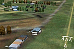
| CWBH - Bernard Harbour - Nunavut, Canada |
|
Images related to this file:
File Description:
Bernard Harbour was a DEW line "iStation" (a small station with a staff of 5 or 7 people) on the nothern mainland coast 75 miles north of Kugluktuk, and 45 miles west of Lady Franklin Point. It closed in 1963. The slowly deteriorating buildings are still there, along with a fallen radio communications mast. The runway is also still there and has 3,040 feet of gravel, aligned 122T/302T. There is now no runway lighting, no signage, no windsock, and the bushes growing amid the gravel are winning, though slowly. In 1991 a North Warning System (NWS) automated station was established 3 miles to the southwest and there is a second smaller runway there (1,450 feet) along with a helicopter pad. A road joins the two sites for when diesel resupply is undertaken from a ship in the summer, and the zigzag route is (in reality) dictated by the numerous ponds that are too small to be picked up by Ultimate Terrain.
| Filename: | CWBH__Bernard_Harbour__Nunavut_Canada.zip |
| License: | Freeware, limited distribution |
| Added: | 11th November 2012, 01:24:20 |
| Downloads: | 256 |
| Author: | Roger Wensley |
| Size: | 1.49 MB |
| Category: Flight Simulator 2004 - Scenery | |
| Detailed Road Infrastructure, South Africa |
|
File Description:
A detailed road infrastructure for South Africa. This is Part 1 of 2 parts and the area covered is from 28 deg South right up to the southern coast.
| Filename: | Detailed_Road_Infrastructure_South_Africa.zip |
| License: | Freeware, limited distribution |
| Added: | 1st July 2010, 02:49:55 |
| Downloads: | 1,996 |
| Author: | Aeroworx |
| Size: | 1.75 MB |
| Category: Flight Simulator 2004 - Scenery | |
| Pudding Hill - NZPH |
|
Images related to this file:
File Description:
44nm east from Christchurch, New Zealand. 22nm from Ashburton.
Pudding Hill Lodge and Holiday Park. Skydiving area. Choice of 2 runways. Made for Christian Stock's NZ mesh in the form of "Mountains of New Zealand" and topo in the form of "Lakes and Rivers of New Zealand".
| Filename: | Pudding_Hill__NZPH.zip |
| License: | Freeware |
| Added: | 2nd January 2011, 21:56:28 |
| Downloads: | 285 |
| Author: | Godfrey Tier |
| Size: | 1.15 MB |
| Category: Flight Simulator 2004 - Scenery | |
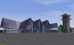
| Tui Brewery |
|
Images related to this file:
File Description:

Tui Brewery, Mangatainoka, New Zealand. This replaces my previous Tui Brewery scenery. Made to fit Christian Stock's NZ mesh in the form of "Mountains of New Zealand" and topo in the form of "Lakes and Rivers of New Zealand". Most buildings are custom-made for this project.
| Filename: | Tui_Brewery.zip |
| License: | Freeware |
| Added: | 31st January 2012, 09:33:40 |
| Downloads: | 271 |
| Author: | Godfrey Tier |
| Size: | 2.36 MB |
| Category: Flight Simulator 2004 - Scenery | |
| FYAR Arandis, Namibia |
|
File Description:
Based on googleEarth and fotos. Ez-scenery and rwy12 objects included. Includes the airport, as well as landclass for the town of Arandis and a textured area to represent the uranium mine east-south-east of the airport. Roads in the vicinity have been added and adjusted. Compatible with Holger Sandmann's Namibia LOD9 Terrain mesh (namibia_ne.zip, namibia_nw.zip, namibia_se.zip, namibia_sw.zip, namibia_cp.zip) as well as his namibia_scenery_updates.zip, all found at avsim.com.
| Filename: | FYAR_Arandis_Namibia.zip |
| License: | Freeware |
| Added: | 4th January 2009, 12:17:39 |
| Downloads: | 876 |
| Author: | Detlev J. Rohmer |
| Size: | 7.41 MB |
| Category: Flight Simulator 2004 - Scenery | |
| Brevoort CWOB and BAF-3 radar plus Cartwright LAB-6 radar Canada |
|
Images related to this file:
File Description:
Brevoort airstrip and the BAF-3 radar it serves is on Brevoort Island, off one of the southeastern tips of Baffin Island and 140 miles east of Iqaluit. This scenery includes the BAF-3 buildings on the hilltop and those on the airstrip below, plus the roads connecting them and down to the beach landing area on the rocky coast. This scenery is made for the FSGenesis 76m terrain mesh for northern Canada, and there will be a repost of all my northern Canada airfields to suit this; I cannot think now why I never installed this mesh before. The AI reflects the use of civil airlines for resupply and transportation of personnel. Given the terrain the wind should be from the north so that ai lands using the 02 runway. Landing from the north will involve a terrain clash while take off towards the north will not as the climb out clears the hilltop. The video shows the 600 foot cliff at the runway threshold and an Air Tindi plane on the apron. Cartwright CYCA is on the Labrador coast and has been posted by Flight Ontario as part of their Goose Bay and Labrador Regional Airports sceneries. The nearby LAB-6 radar site is included here, connected to CYCA by an extended road. The site uses the same buildings as Brevoort and Saglek (posted recently) and although I have included them here as separate sceneries the contents can be placed in the same folders as Saglek with a saving in duplicated textures. The textures here are more accurate than Saglek so say yes to over-write; a downloader with personal experience of Brevoort noted that in reality they are lighter.
| Filename: | Brevoort_CWOB_and_BAF3_radar_plus_Cartwright_LAB6_.zip |
| License: | Freeware, limited distribution |
| Added: | 20th August 2017, 15:46:36 |
| Downloads: | 175 |
| Author: | Roger Wensley |
| Size: | 4.37 MB |
| Category: Flight Simulator 2004 - Scenery | |
| Alaska South Slope 1: Noatak PAWN in AK, US |
|
Images related to this file:
File Description:
The town of Kotzebue is in the far northwest of Alaska, and these are villages to the north and then the east of Kotzebue on the South Slope of the Brooks Range of mountains. There will be further additions. Noatak is a small village (population now around 520 and rising) on the west bank of the Noatak River, around 50 miles north of Kotzebue. It is on the edge of the Noatak National Preserve and as the only village on the river is the centre for fishing, rafting, canoe, and other types of outdoor expeditions. The airfield has almost 5,000 feet of lit gravel just south of the town, aligned 18-36. There are scheduled flights by Era (now renamed Ravn) and by Bering Air, both of them originating in Kotzebue and routing north to Noatak, Kivalina, Point Hope, and then back again. The AI includes these flights plus a daily Everts Air cargo flight and GA. There are new bgl's for Kotzebue; the development of the northern and eastern AI meant that more dedicated parking spaces were needed at Kotzebue. The two new Bering Air planes are as listed in the AI folder, and there is also a new Era Cessna 208 to be installed. The next South Slope scenery will be Noorvik ORV, to the east of Kotzebue.
| Filename: | Alaska_South_Slope_1_Noatak_PAWN_in_AK_US.zip |
| License: | Freeware, limited distribution |
| Added: | 2nd September 2016, 20:54:32 |
| Downloads: | 250 |
| Author: | Roger Wensley |
| Size: | 4.22 MB |
| Category: Flight Simulator 2004 - Scenery | |
| Landclass Scenery |
|
File Description:
FS2004 Land Class scenery that covers the area between San Luis Obispo to Oxnard California. All towns in this area and that extend east of the coast are also included.
| Filename: | Landclass_Scenery.zip |
| License: | Freeware |
| Added: | 11th October 2008, 02:12:15 |
| Downloads: | 1,694 |
| Author: | Charles Reid |
| Size: | 3.52 MB |
| Category: Flight Simulator 2004 - Scenery | |
| Dominican Republic |
|
Images related to this file:
File Description:
Fully detailed scenery VFR. It contains 13 airports, 102 cities and little cities located in the perimeter of the coast. Many hotels and holiday centers, Punta Cana, Playa Bavaro, Puerto Plata
| Filename: | Dominican_Republic.zip |
| License: | Freeware |
| Added: | 11th March 2010, 19:57:24 |
| Downloads: | 8,183 |
| Author: | Toni Agramont |
| Size: | 13.33 MB |
© 2001-2026 AVSIM Online
All Rights Reserved
Privacy Policy |