
Where Flight Simulation Enthusiasts Gather from Around the World!
AVSIM Library - Search Results

| Category: Flight Simulator 2004 - Scenery | |
| VFR of Lario - Como lake, Italy |

|
Images related to this file:
File Description:
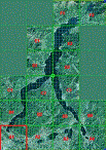
This is the first of the expected seventeen sceneries in the "VFR of Lario" project, that will include the full view of the Como Lake, made with photorealistic terrain (multiseason & night) and with 3D GMax realistic objects, including some motions. Further the Como seaplane airport, the project will include some other virtual ones, and all the piers of NLC (Navigation Lake Como). The project will be completed with a related AI seaplane traffic.
The "VFR of Lario" project REQUEST the installation of the scenery "Itcoast2.zip" & the related "ITAC2_P1.zip", both available for free download from different libraries.
Information: Como is the main and beautifull city on the namesake lake (called Lario), placed in the north of Italy, closed to the Helvetic border. It includes the AeroClub Como seaplanes international airport, with his own flight school. Como has the headseat of NLC, the fleet management for connection of forty Lario's piers. This first scenery covers approximately an area of 7.5x6 kmt.
Contents: airport water track with hangar and static seaplanes; breackwater and stadium lake front, war memorial monument, Volta's temple and lighthouse, main Cathedral, Social theater, city old towers and wall, villa Olmo, square Cavour's buildings, NLC main pier and some minor others, Como-Brunate's funicolar connection (animated), lake fountain, Tavernola shipyard, Baradello's castle, Valduce hospital; motor ships (animated), steamer, hydrofoils and other minor boats; several other buildings (GenericBuilding system), trees and lights widespread all over the scenery.
| Filename: | VFR_of_Lario__Como_lake_Italy.zip |
| License: | Freeware |
| Added: | 22nd December 2011, 23:30:47 |
| Downloads: | 3,549 |
| Author: | Aldo Della Vedova, Daniele Lanfranchi, Diego Caligiuri |
| Size: | 25.33 MB |
| Category: Flight Simulator 2004 - Scenery | |
| Chisasibi CSU2 in northern Quebec, Canada |
|
Images related to this file:
File Description:
Chisasibi is in northern Quebec on the east shore of James Bay, 60 miles from the corner of James Bay and Hudson Bay. Originally called Fort George and founded at the mouth of La Grande Riviere around the Hudson Bay trading post that was established in 1803, the town had to move 5 miles upstream in 1981 when the Quebec hydro project increased the flow rate of the river. The name was changed to Chisasibi at the time of the move (Chisasibi = Great River in Cree) and the population (750 as early as 1940) has now grown to around 2,000. There is a paved road east to Radisson that connects to the north-south James Bay road, which was built at the time of the hydro project work. The original Fort George airport runway is still visible but not usable, just south of the original town site. Chisasibi airport is to the west of the new town, and the gravel runway is 3,792 feet long and aligned 14/32, which is approximately parallel to the river. There is officially no fuel available, but there is JetA on site for Air Creebec in a tank protected by used fuel drums (filled with sand?). The terminal and the garage building are both relatively new; the terminal dates from 2002 and has unusual touches. There are two AI flights by Air Creebec each day plus other private planes.
| Filename: | Chisasibi_CSU2_in_northern_Quebec_Canada.zip |
| License: | Freeware, limited distribution |
| Added: | 27th February 2013, 21:24:47 |
| Downloads: | 287 |
| Author: | Roger Wensley |
| Size: | 2.79 MB |
| Category: Flight Simulator 2004 - Scenery | |
| CYKF – Kitchener / Waterloo, Ontario, Canada Version 3.0 |
|
File Description: I have now overhauled the CYKF Airport and made it the lively place it is today. I used the Canada Flight Supplement and my real life knowledge of the airport as this is where I do my flight training.
After seeing the traffic in my Southwestern Ontario addon, CYKF 2.1 looked a little bare in comparison, so added more parking and traffic. There are now 35 parking spots and 2 gates. All parking spots and gates have been assigned codes, which like the airline codes for the larger airports will tell the GA aircraft where to park. I organized the different aprons into parking areas. The Waterloo Wellington flight centre is referred to as “North” parking. There are 3 other parking areas as well as the gates. Traffic includes weekly scheduled aircraft that will fly up to the cottage or down south on the weekend etc.
• 35 parking spots, 2 gates
• Extended runway 25/07 and added the new taxiway and renamed the others
• Changed the landclass for the runway 25/07 extension
• Updated the airport in AFCAD for AI to use the runway 25/07 extension
• Added 22 AI flightplans to the 3 already there. AI will model real life training and commercial operations of the airport
• AI use proper Canadian registration codes
• Tested the files to make sure it operates correctly including AI
| Filename: | CYKF__Kitchener__Waterloo_Ontario_Canada_Version_3.zip |
| License: | Freeware, limited distribution |
| Added: | 14th November 2003, 19:39:31 |
| Downloads: | 2,749 |
| Author: | David Voogd |
| Size: | 1.06 MB |
| Category: Flight Simulator 2004 - Scenery | |
| FS2004 Scenery--Goose Bay Canadian Forces Base and US Air Base. Goose Bay Canadian Forces Base and US Air Base (CYYR), Newfoundland and Labrador, Canada, 1955-62. |
|
File Description:
Goose Bay Canadian Forces Base and US Air Base (CYYR), Newfoundland and Labrador, Canada, 1955-62. Originally built to facilitate the transport of US aircraft to Europe during the Second World War, during the Cold War Goose Bay was a base of major importance. Like nearby Gander it was a vital refuelling point for transatlantic crossings, but also along with the recently released Ernest Harmon Air Base (CYJT) an important part of the defences against the threat of Soviet bombers carrying muclear weapons attacking the USA via the North Pole. F-89 Scorpions and then F-102 Delta Daggers were based there, and this download includes F-89s especially made for this scenery by David Wooster. Flight plans are provided for 1955, 1957, 1959 and 1962, doing much to recreate this significant Cold War base as it really was; many of the aircraft which passed through Goose at that time are provided for.
This file is an update to the scenery issued in October 2021, made necessary by the discovery of new information as a result of further historical research. There have also been changes to the ADE and traffic files intended to improve the performance of both, and to the navaids too. Instructions are included for those installing from scratch and those updating our previous version, and there have been improvements to the clarity of the instructions for the downloading and installation of the ai aircraft.
There will be no further updates.
| Filename: | FS2004_SceneryGoose_Bay_Canadian_Forces_Base_and_U.zip |
| License: | Freeware |
| Added: | 25th December 2021, 19:00:49 |
| Downloads: | 282 |
| Author: | Al Von Pingel, Dan French, Bill Douglas, Ken Lawson |
| Size: | 50.25 MB |
| Category: Flight Simulator 2004 - Scenery | |
| Naknek (5NK) and Naknek South (WSN) - Alaska, USA |
|
Images related to this file:
File Description:
Naknek and Naknek South are two towns close to the mouth of the Naknek River and on opposite banks. King Salmon is approximately 15 miles to the east. The canneries on both banks of the river are the reason for the existence of both towns and airfields, with fishing for salmon being the primary industry of the area. This takes place from the beach by individuals, by small boats in the river and the immediate sea area, and offshore by larger craft. There is a picture of one boat unloading in Naknek which will be known to anyone who has watched the most famous television fishing programme of all, Deadliest Catch. Cornelia Marie is better known for the crab fishing based in Dutch Harbor, but this area too is just as productive though without the drama. Naknek 5NK has two gravel runways and a float runway in the adjoining lake; all three are just under 2,000 feet long. Naknek South WSN has two gravel runways, 12-30 being 3,300 feet long and 04-22 2,260 feet. As the road connecting to King Salmon is on the north bank it is probable that more seasonal workers are brought into the southern canneries by air, hence the longer runway (and with PAPI on 12). Grant Aviation run scheduled flights into both and there are numerous seasonal charter flights. The AI is a further modification of that posted with King Salmon PAKN and includes these flights, and presumes that you have already downloaded PAKN.
| Filename: | Naknek_5NK_and_Naknek_South_WSN__Alaska_USA.zip |
| License: | Freeware, limited distribution |
| Added: | 29th April 2015, 20:44:31 |
| Downloads: | 214 |
| Author: | Roger Wensley |
| Size: | 6.09 MB |
| Category: Flight Simulator 2004 - Scenery | |
| Amundsen-Scott Station |
|
File Description:
The Amundsen-Scott South Pole Station is the American scientific research station on the high plateau of Antarctica. This station is located at the southernmost place on the Earth, the Geographic South Pole, at an elevation of 2,835 meters (9301 feet) above sea level.
Since the Amundsen-Scott Station is located at the South Pole, it is at the only place on the land surface of the Earth where the sun is continuously up for six months and then continuously down for six months. (The only other such place is at the North Pole, on the sea ice in the middle of the Arctic Ocean.) Thus, during each year, this station experiences one extremely long "day" and one extremely long "night". During the six-month "day", the angle of elevation of the Sun above the horizon varies continuously. The sun rises on the September equinox, reaches its maximum angle above the horizon on the summer solstice in the Southern Hemisphere, around 20 December, and sets onthe March equinox.
During the six-month "night", it gets extremely cold at the South Pole, with air temperatures sometimes dropping below -73 C (-100 F). This is also the time of the year when blizzards, sometimes with gale-force winds, strike the Amundsen-Scott Station. The continuous period of darkness and dry atmosphere make the station an excellent place from which to make astronomical observations.
This file has the apron and characteristics of the airport the coordenates are placed as far south FS allow it.
| Filename: | AmundsenScott_Station.zip |
| License: | Freeware |
| Added: | 17th October 2011, 22:02:39 |
| Downloads: | 668 |
| Author: | Anwar Gonzalez |
| Size: | 5.92 KB |
| Category: Flight Simulator 2004 - Scenery | |
| CYQS - St Thomas - Ontario, Canada *V1* |
|
Images related to this file:
File Description:
St Thomas is a town in Ontario around 12 miles south of London and less than 10 miles from the north shore of Lake Erie, with a population of just under 40,000. The airport (actually more of an airfield, as there are no scheduled flights) has three runways typical of an ex-military field, with one remaining hangar from RCAF flight training times in the 1940's, and the east-west runway now extended to just over 5,000 feet. The main presence at CYQS is a company in the crop seeding and spraying business over a wide area of Ontario; as a result there are several AT-802 planes based there which are included here as AI planes and also as parked scenery objects. To the west of the original apron area there are added taxiways to cater for a herd of new individual hangars wearing orange and white uniforms. There is fuel, runway lighting on 09-27, taxiway lights, visitor parking on the edge of the apron, and maintenance companies in the large hangars, plus a flight training group. A small terminal building sits quietly between hangars, waiting. Ditches along the road and around much of the airfield provide separation, which is why the fences are not continuous. I presume that the warning balls on the electricity cables were found to be necessary to persuade pilots not to land there; probably ski planes in winter, they tend to land anywhere so long as it has snow on it. This V1 version includes previous updates.
| Filename: | CYQS__St_Thomas__Ontario_Canada_V1.zip |
| License: | Freeware, limited distribution |
| Added: | 30th August 2015, 02:35:28 |
| Downloads: | 265 |
| Author: | Roger Wensley |
| Size: | 11.13 MB |
| Category: Flight Simulator 2004 - Scenery | |
| KLBB - Lubbock Preston Smith Intl - Texas V3.0.1 |
|
Images related to this file:
File Description:

Lubbock is another one of those little known, neglected airports that populate the
FS world. Avery simple airport, LBB somewhat feels like a little DFW. There is a very DFW-ish main terminal with fewer than
10 gates and plenty of space to grow. The only mainline service is courtesy Southwest, but several RJ's freqent Lubbock
several times per day along with the big freighters. This airport was built from the ground up with excellent detail,
and because of the sparse traffic, frame rates are excellent as well.
V2.0 Update:
Recently, Lubbock has moved their east-west runway 8/26 roughly 1000 feet to the East so as to eliminate runway incursions
by separation from the north-south runway 17R-35L. Version 2.0 reflects this modificaton. Several taxiways have been removed
or modified, and airport fencing has been altered to reflect the change.
V3.0 Update:
This update fixes some major errors mainly on the West side of the airport. The cargo ramp and some of the GA parking had been
found to be located in the wrong positions. They have been relocated and rebuilt to match GoogleEarth images. Also, the afcad
has been updated to line up with these changes along with airline parking updates at the main terminal. All the jetways have
been replaced with more accurate representations, and they have also been adjusted to match their current real world positioning.
v3.0.1 update:
There was a missing scenery library that has been added to the download, so now the jetways will appear if they had not before.
| Filename: | KLBB__Lubbock_Preston_Smith_Intl__Texas__V301.zip |
| License: | Freeware |
| Added: | 18th May 2013, 07:39:35 |
| Downloads: | 1,550 |
| Author: | FRFStudio.net / William Morgan |
| Size: | 8.17 MB |
| Category: Flight Simulator 2004 - Scenery | |
| Stephenville CYJT in Newfoundland Canada |
|
Images related to this file:
File Description:
Stephenville is on the east coast of Canada, and the airport was an American base from 1941, when it was built, until 1966. It was named the "Ernest Harmon Airforce Base" and I will leave that for you to research if you wish to know more. Operating in my version (around 2010?) as a civilian airport, it's main features are a long 10,000 feet 09-27 runway (with ILS on 27) and acres of empty space. The runway was one of those designated as an emergency space shuttle landing runway if required. There is a shorter 20-02 runway (3,000 feet) that is not maintained during the winter (and which would be closed in 2018). The revised perimeter fence of the airport now encloses less than half of the original area, with the northern parts replanned as an industrial park. The attached screenshot from Google Earth shows this, and also that the main operating part of the airport is at the western end of the main runway, with only one hangar connecting to the runway from the eastern end. Like Gander, the airport is still shrinking, with taxiways and aprons not maintained (particularly in the winter) or even formally closed, and flight numbers falling. Until the early 1990's Stephenville was serving most of western Newfoundland and Air Canada, for instance, was one of the airlines that flew there. Deer Lake took over this task for western Newfoundland when the Provincial Government so decided. Stephenville remains as a port of entry, and planes with a total of 30 or less passengers can still be serviced there. My version is a mixture that cannot be precisely dated. For instance, I know there was a large hangar there until 2013 but as I do not have any photos to make it I have shown only the concrete square where it formerly stood. So 2008 or 2013, or somewhere in between? I have the airport being served by Provincial Airlines and also by Porter, though in fact Porter only flew there during the Summer months; I say "flew" as right now all flights are of course almost totally non-existent. As with Gander, I have made it clear which of the taxiways and aprons are still in regular use by showing them as asphalt, while those in the process of decaying disuse or removal are in the darker gravel or tarmac textures; this is somewhat realistic as when asphalt aprons are "ploughed" for removal the darker underside becomes visible. I have also shown the areas that now form part of the Industrial Park as cement, as this better matches the Ultimate Terrain road texture. It may seem odd that the new Canadian Coastguard hangar is not properly served by an asphalt taxiway instead of sitting on an apron that is not cleared in the winter, but it caters (mainly?) for helicopters. The original coastguard hangar is the large and decrepit one in the northeastern corner of the airport. Almost all of the buildings within the original perimeter of the airport are fairly accurately replicated here, whether still in use (Road Maintenance Department, Garbage Disposal, Armour Trucking Company, etc) or vacant (including the very strange atom-bomb-proof buried shelter) or still part of the airport (the east side of the main apron with Shell to the north, then the terminal, the Marine Institute, etc). The AI included here (a revised Gander AI) is for daily flights by Provincial Airlines, Porter, and some charter planes and GA. You will see, once the scenery is installed, that like Gander there two scenery folders called "Scenery summer" and "Scenery winter". Obviously in August you will want the summer scenery and you get this by editing the folder name down from "scenery summer" to just "scenery" and FS9 loads the summer ground textures. If FS9 decides that there is snow on the ground then you need the winter textures which do not show the aprons or taxiways that do not receive winter maintenance. One thing you must NOT DO is to edit both folders down at the same time.
| Filename: | Stephenville_CYJT_in_Newfoundland_Canada.zip |
| License: | Freeware, limited distribution |
| Added: | 24th June 2020, 18:01:58 |
| Downloads: | 233 |
| Author: | Roger Wensley |
| Size: | 43.78 MB |
| Category: Flight Simulator 2004 - Scenery | |
| Nulato NUL in Alaska |
|
Images related to this file:
File Description:
Nulato is a small village on the west bank of the Yukon River, around 8 miles south of where the river turns from north-south to east-west, east being upstream towards the distant Fairbanks. The population is just under 300 and living from fishing and the land. During the late 1800's the village lived by the spin off from gold mining, such as supplying cut wood as fuel for the boats plying the Yukon River. In 1900 a measles epidemic cut the population down by a third, and in the early 1900's the gold mining moved to Nome and Fairbanks, with obvious results for local prosperity. The airfield is close by and has a gravel runway aligned 2-20 and just under 4,500 feet long. Apart from the airfield itself, and it's buildings, this scenery modifies the local land class, adds village buildings while reducing the village size to reality, and creates a new airfield background. Don't ask me about the odd arrangement of the airfield buildings, I have no idea why they are like that. Nulato is served by Wright Air from Fairbanks in the east and this is included in the AI. A note here about my scenery making. This is post number 508 and there will not be many more to follow this as I am almost at the end of the photos I either took or found for scenery purposes. There is a limit to what can be located online and I have already been making use of the little there is; eg Unalakleet. So, if you are near an airport (preferably Canadian or Alaskan) and have a camera..... Let me know.
| Filename: | Nulato_NUL_in_Alaska.zip |
| License: | Freeware, limited distribution |
| Added: | 25th August 2019, 17:34:25 |
| Downloads: | 103 |
| Author: | Roger Wensley |
| Size: | 3.05 MB |
© 2001-2026 AVSIM Online
All Rights Reserved
Privacy Policy |