
Where Flight Simulation Enthusiasts Gather from Around the World!
AVSIM Library - Search Results

| Category: Flight Simulator 2004 - Scenery | |
| Schwenz Vintage 1938 Air-strip |

|
File Description:
1938 is a scenery built in the high mountainous terrain of Alaska. It was built for my friend Scott Schwenz and as a dedication to his fathers Alaskan dream. This scenery features mostly a vintage appeal with sounds custom sounds and custom vintage texture ideas. Also included is an FX pack that will enable blowing snow during the Fall and Winter seasons as well as blowing dust at the start of Spring. Pick a flight and have fun...stop in fuel up and grab a bite to eat at Marnie's Cafe'
Complete with AI and Lago Flight Simulator Scenery Enhancer Sounds & Images
Airport Code: 1938
| Filename: | Schwenz_Vintage_1938_Airstrip.zip |
| License: | Freeware |
| Added: | 18th November 2005, 14:28:52 |
| Downloads: | 1,534 |
| Author: | Michael Woolsey |
| Size: | 15.65 MB |
| Category: Flight Simulator 2004 - Scenery | |
| Hellas Scenery Project (HSP) - All in One scenery package 1 of 2 |
|
Images related to this file:
File Description:
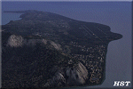
First of the two files needed. The package includes all freeware scenery created by the HSP team for Greece in FS9 up to June 2009. The package bundles all HSP released scenery in one pack which was necessary following the loss of several files after avsim's file library crash.
By using this scenery you do not need to download anything else from HSP. Included are detailed airport sceneries of LGAL Alexandroupolis, LGAV Athens Venizelos, LGIR Iraklion, LGKO Kos, LGMK Mikonos, LGSA Chania, LGSO Syros, LGSR Santorini as well as HSP base scenery with essential improvements to other airports and finally the detailed mesh terrain for all Hellenic territory.
| Filename: | Hellas_Scenery_Project_HSP__All_in_One_scenery_pac.zip |
| License: | Freeware, limited distribution |
| Added: | 20th May 2010, 13:12:04 |
| Downloads: | 165,069 |
| Author: | Hellas Scenery Team (HST) |
| Size: | 59.32 MB |
| Category: Flight Simulator 2004 - Scenery | |
| PAHT - Amchitka - Aleutians, Alaska - USA |
|
Images related to this file:
File Description:
Amchitka is near the western end of the Aleutian chain of islands in Alaska, around 180 miles west of Adak, and was not included in FS9. There is no small town on Amchitka Island, which is why it was used for atom bomb testing after being closed down as an Air Force base. There are three runways from the 1940's, the largest of which is aligned 07-25 and just over 10,000 feet of overgrown asphalt 300 feet wide. The second runway is aligned 15-33 and 6,000 feet (also 300 feet wide) and the third is 05-23 and 5,000 feet. The whole eastern end of the island is crowded with old munitions storage areas and other military paraphernalia, including old quonset huts; some of those are included here. There are also some old buildings still standing but on their way to becoming piles of old wood or rust, and some of these are included. There is almost no visual information available about Amchitka; even Google Earth has snow obscuring what buildings still exist and where they are, so much of this is at best only approximate apart from the two large hangars. There are no markings, lights, signage, or a control tower.
| Filename: | PAHT__Amchitka__Aleutians_Alaska__USA.zip |
| License: | Freeware, limited distribution |
| Added: | 6th February 2015, 00:06:26 |
| Downloads: | 269 |
| Author: | Roger Wensley |
| Size: | 2.6 MB |
| Category: Flight Simulator 2004 - Scenery | |
| Port McNeill CAT5 in British Columbia, Canada |
|
Images related to this file:
File Description:
Port McNeill is at the northern end of Vancouver Island, on the coast and around 20 miles east of Port Hardy. The town population is just over 2,000 and the main industry is logging, followed by sand and gravel quarrying and exporting for the construction industry. Tourism rates third.
The airport, a mile or so east of the town, provides a swift connection for nearby islands and the surrounding area to the rest of the west coast, and serves as the HQ main base for West Coast Helicopters. Their newly built large hangar and office accommodation is next to their older hangar to one side of the central public parking area, opposite the club house cum terminal and hangars. There are two runways: 06-24 which is asphalt, 2,400 feet long, and lit; and 11-29 of gravel, 3,650 feet long and also lit. There is some taxiway lighting, but not, for instance, for the connection between runways, which is in real life a ramp up to the gravel runway which is 15 feet higher. There are no regularly scheduled flights and traffic consists mainly of the West Coast helicopters, plus GA and irregular charters, the latter being mostly from Port Hardy.
| Filename: | Port_McNeill_CAT5_in_British_Columbia_Canada.zip |
| License: | Freeware, limited distribution |
| Added: | 18th November 2018, 05:49:13 |
| Downloads: | 138 |
| Author: | Roger Wensley |
| Size: | 13.29 MB |
| Category: Flight Simulator 2004 - Scenery | |
| PAAT (ATU) - Attu - Alaska, USA |
|
Images related to this file:
File Description:
Attu is AT the western end of the Aleutian chain of islands in Alaska, around 40 miles west of Shemya. There was small village on Attu before the Japanese invasion in mid 1942, but the island is now uninhabited. The Coast Guard Loran navigation station remains in place, though it is no longer in operation and visitors to the island are now either tourists or wildlife experts conducting surveys of numbers of nesting birds, etc. The runway still usable is aligned 02-20 and 5,800 feet long; right hand circuits on 02 to stay away from rising ground to the west. The "terminal" building has lost its sign regarding the Horny Bird, removed in 2010 by one of the last of the station operators, but the building is still there, as are some sheds and shacks that lately were used for the uncomfortable accommodation of bird counters. FS9 has used an incorrect icao identification for Attu but correcting it now would make life complicated so ATU it is and shall remain. I have removed the default FS9 roads that came complete with streetlights and telephone poles and replaced and amended the layout with gravel roads to better resemble real life, though the island shape is at best approximate, as is usual in FS9.
| Filename: | PAAT_ATU__Attu__Alaska_USA.zip |
| License: | Freeware, limited distribution |
| Added: | 2nd March 2015, 20:58:09 |
| Downloads: | 281 |
| Author: | Roger Wensley |
| Size: | 3.27 MB |
| Category: Flight Simulator 2004 - Scenery | |
| PASN St Paul Island in Alaska |
|
Images related to this file:
File Description:
This is St Paul Island airport, plus the town and the harbour which has featured alongside Dutch Harbor in the tv series Deadliest Catch.
St Paul is in the Pribilof group of five islands around 250 miles north of Dutch Harbour. The town has a population of less than 600, so a lot smaller than Dutch Harbour and with only one processing plant, Trident.
The Ai includes a PenAir flight, a Coast Guard C-130, and Coast Guard helicopters; sea AI includes a fishing boat and a Coast Guard cutter. The Coast Guard C-130 and helicopter flights are to Dutch Harbor, so both sceneries are required to make it work as it should. The airport has 6,500 feet of 150 feet wide asphalt with 1,000 feet of over-run at each end, aligned 36/18, lit, and with two aprons at the southern end. There is no hangerage except for Coast Guard helicopters. Runway 36 has at its northern end a hill.
In real life the runway slopes up to the north by over 60 feet, but in FS9 it doesn't; hence the change in airport elevation to 80 feet ASL to get the northern end at least partly out of a box canyon. There is fuel available and it is dispensed from a truck, there are no pumps.
| Filename: | PASN_St_Paul_Island_in_Alaska.zip |
| License: | Freeware, limited distribution |
| Added: | 12th August 2012, 17:39:02 |
| Downloads: | 1,100 |
| Author: | Roger Wensley, Sidney Schwartz |
| Size: | 4.06 MB |
| Category: Flight Simulator 2004 - Scenery | |
| Norfolk Trees pt2 |
|
File Description:
This pack will place trees into the scenery for Norfolk UK for FS9. It is designed to be compliant with VFR Photographic Scenery, VFR Terrain part 1 and the UK2000 scenery. The scenery has been created using GianP's agen_x trees and Tree Planter by George Davison.
Part Two covers the area in an arc approximately 10 miles to the west and south of Norwich and is contiguous with part one.
If you have parts one and two installed you will now have tree cover for over 240 square miles of Norfolk comprising of more than 250,000 trees, the large majority of which have been �¢����hand planted�¢����
| Filename: | Norfolk_Trees_pt2.zip |
| License: | Freeware |
| Added: | 5th May 2010, 22:09:32 |
| Downloads: | 351 |
| Author: | Norman Dean |
| Size: | 1.15 MB |
| Category: Flight Simulator 2004 - Scenery | |
| Guam 2004 |
|
File Description:
DBWsim’s fourth scenery for Flightsim2004 covers the Marianas island of Guam in its entirety, following up our previous FS2004 sceneries for Tinian, Saipan and Rota. This scenery pack includes fully updated and improved scenery of the remnants of historical WWII airbases on the island, as well as a significantly enhanced full island landclass. There are 2 abandoned fields on the island, featuring flattened strips that can be used for landing. This is the final in our Marianas Island scenery series.
This scenery is designed to work optimally with Bill Melichar’s 'Guam International' scenery for FS2002 (Guam.zip) and Kenneth Barrett’s 'New Coastline for Guam, USA' scenery for FS2004 (apparently another Guam.zip). Our screenshots of our scenery are taken with both these scenery packs activated. The scenery does work without these other packs.
| Filename: | Guam_2004.zip |
| License: | Freeware |
| Added: | 29th February 2004, 17:29:15 |
| Downloads: | 6,049 |
| Author: | Derek and Brendan Webb |
| Size: | 1.29 MB |
| Category: Flight Simulator 2004 - Scenery | |
| Maurice Bishop TGPY on Grenada in the Caribbean |
|
Images related to this file:
File Description:
Grenada island is 17 miles south of the southernmost island of the Grenadines, Carriacou; there are some smaller islands between the two. Grenada is 18 miles long and around 8 miles wide, has an estimated population of 110,000, and produces a very large part of the world's annual nutmeg harvest. The capital, St Georges, is by far the largest town and is at the southern end of the island, with the airport close by.
The airport is now called Maurice Bishop, but for some years was called Point Salines. The runway is just over 9,000 feet long and oriented 10/28. Point Salines replaced Pearl Airport, which is on the east coast 12 miles northeast of St Georges and was difficult to expand as the runway had mountains at one end and the sea at the other. Pearl is now closed; it is included here but only as a visual landmark with "closed" markings. There are regular international flights from North America and Europe, some of which are seasonal only (Air Canada for instance) and local connecting flights by LIAT and SVG. I retained the default control tower as it is some distance away. In real life it is also some distance away and on a hill northwest of the terminal. Which is why I did not take photos from which I would have made the real one. The hill does not feature in FS9.
| Filename: | Maurice_Bishop_TGPY_on_Grenada_in_the_Caribbean.zip |
| License: | Freeware, limited distribution |
| Added: | 11th June 2013, 23:28:17 |
| Downloads: | 825 |
| Author: | Roger Wensley |
| Size: | 7.38 MB |
| Category: Flight Simulator 2004 - Scenery | |
| Campbell River floats CAE3 in BC Canada |
|
Images related to this file:
File Description:
Campbell River is a medium sized town on Vancouver Island, some 50 miles north of Vancouver. The base is just north and west of the town on Spit Road. And Ultimate Terrain is required for the cost to be in the right place. The docks are on the south side of the spit, on the (relatively) sheltered river side, though take offs and landings are requested to take place outside the harbour if conditions permit. The base is noted as used and run by Corilair, though in fact there is also another company based there, Vancouver Island Air, who like Coril Air also have two docks, one for boarding passengers and one for maintenance and refuelling tie-ups. At the river mouth there is a small marina, run by the same folks who run the trailer park, and next to that a dock for visiting float planes. There is a seventh dock at the end furthest from the river mouth; I don't know what that is used for but it is next to Vancouver Island Air and might be theirs. At low tide there are numerous sandbanks (and more permanent islands with bushes and trees) in the mouth of the Campbell River and I decided to ignore installing these with all the problems they would cause me. The main buildings and most of the others are modeled specifically for this scenery; minor items like parked cars are RWY12.
| Filename: | Campbell_River_floats_CAE3_in_BC_Canada.zip |
| License: | Freeware, limited distribution |
| Added: | 12th February 2010, 18:45:00 |
| Downloads: | 881 |
| Author: | Roger Wensley |
| Size: | 5.3 MB |


© 2001-2026 AVSIM Online
All Rights Reserved
Privacy Policy |