
Where Flight Simulation Enthusiasts Gather from Around the World!
AVSIM Library - Search Results

| Category: Flight Simulator 2004 - Scenery | |
| Queensland Airports - Maroochydore, Hamilton Island & Rockhampton |

|
File Description:
From the designers of VOZ comes 3 of Queensland Airports.
YBMC - is the gateway to holiday destinations such as Noosa, Maroochydore, Mooloolaba and Caloundra. There are direct daily flights to Sydney and Melbourne, with frequent connecting
flights to both domestic and international ports.
YBHM - Great Barrier Reef Airport is the primary airport of the Whitsunday Islands Group, and airport of Hamilton Island. The airport is settled on mostly reclaimed land and due the
island's tourism status, is occupied mostly and favoured by Australia's leading low-cost airlines, Jetstar Airways and Virgin Blue.
YBRK - is a major Australian regional airport that services the city of Rockhampton, with flights to the cites of Brisbane, Sydney, Gladstone, Cairns, Townsville, Mackay and Melbourne.
***For VOZ 1.8 users this file contains updates for the following 3 fields***
| Filename: | Queensland_Airports__Maroochydore_Hamilton_Island_.zip |
| License: | Freeware, limited distribution |
| Added: | 25th January 2011, 11:34:27 |
| Downloads: | 2,040 |
| Author: | Robert Fluke, Anthony Lynch, Tony Arnold, Rob Nieuwenhoven & the former VOZ Development Team |
| Size: | 10.5 MB |
| Category: Flight Simulator 2004 - Scenery | |
| Sao Luis (Brazil) - Photoreal |
|
Images related to this file:
File Description:
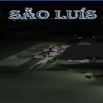
Sao Luis is a Brazilian city, capital of Maranhao state, founded on September 8, 1612. It is located on the island Upaon-Acu (the name was given by the Indians tupinambas meaning "Big Island"), South Atlantic, between the bays of San Marcos and San Jose. It is one of three Brazilian state capitals located on islands (the others are Florianopolis and Vitoria). The scenery contains:
Photoreal of Sao Luis island with hand placed autogen; Marechal Cunha Machado Intl. Airport photoreal in HD; real lighting effect; grass textures; AZL with detailed buildings and hangars; ground support vehicles; detailed terminal with fingers; ships on the coast; Itaqui harbor.
# Courtesy of Marco Santiago (Addons): Bridges Pres. Sarney, Bandeira Tribuzi and the Estreito dos Mosquitos; Terminal de Integracao BR; Alexandre Raposo aerodrome; CAVU aerodrome (Ultralight).
| Filename: | Sao_Luis_Brazil__Photoreal.zip |
| License: | Freeware, limited distribution |
| Added: | 4th December 2010, 03:58:01 |
| Downloads: | 2,731 |
| Author: | Jorge Amengol |
| Size: | 60.29 MB |
| Category: Flight Simulator 2004 - Scenery | |
| Western Australia - South West Landclass |
|
File Description:
Western Australia - South West Landclass version 1.1. Detailed and accurate landclass from Geraldton down to Albany and east to E120 deg. longitude. All towns as shown on the Albany and Perth WAC charts are represented. Perth metro area included with many visual landmarks. This landclass is designed to work with all other Westsim work - namely Jandakot Airport, Murrayfield aerodrome and the Perth Metro pack v1.0. http://www.westsim.com.au/
| Filename: | Western_Australia__South_West_Landclass.zip |
| License: | Freeware, limited distribution |
| Added: | 15th December 2003, 16:19:23 |
| Downloads: | 2,747 |
| Author: | Westsim Design Grouo - Derek Kippo |
| Size: | 65.33 KB |
| Category: Flight Simulator 2004 - Scenery | |
| Hauraki Gulf v4 |
|
File Description:
This replaces all my previous Pakatoa Island and Hauraki Gulf sceneries.You must have Christian Stock's NZ mesh in the form of "Mountains of New Zealand" and topo in the form of "Lakes and Rivers of New Zealand". Includes all previous scenery candy. New in this pack...RANGITOTO ISLAND: Rangitoto Lighthouse; Rangitoto Wharf, public conveniences and baches; Islington Bay Wharf with toilets, telephone and information stand.
| Filename: | Hauraki_Gulf_v4.zip |
| License: | Freeware |
| Added: | 9th November 2008, 08:12:31 |
| Downloads: | 299 |
| Author: | Godfrey Tier |
| Size: | 6 MB |
| Category: Flight Simulator 2004 - Scenery | |
| Ford-Timor (Jump Ramp Heaven) |
|
Images related to this file:
File Description:
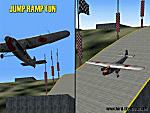
6 different layers in one pack. This scenery pack is a fun experiment in Jump Ramp development - to get aircraft to launch into the air.
Many different angles and many different challenges for your fun flying pleasure.
Contains lots of small and large Jump Ramps, a couple of Ski Ramps and a Grass up/down Hill Runway.
Also contains an Aircraft Carrier with two jump ramps and an Airship with a runway and jump ramp on top.
All set up on 6 different height levels - absolute fun flying and some great challenges for takeoff and landings.
BONUS AIRFIELDS
For those that already have Ford-Blackhawk, Ford-Brazil and Ford-Switzerland installed - a collection of files are included in the Ford-Timor project that will add ramps and jumps to these packages.
Slideshow to show you what is included:
http://www.ford-tri-motor.net/Slideshows/JUMP_RAMP_HEAVEN.html
| Filename: | FordTimor_Jump_Ramp_Heaven.zip |
| License: | Freeware, limited distribution |
| Added: | 16th July 2016, 14:34:48 |
| Downloads: | 80 |
| Author: | Garry J. Smith - Ford Project Team |
| Size: | 3.91 MB |
| Category: Flight Simulator 2004 - Scenery | |
| DBWsim: Saipan 2004 |
|
File Description:
DBWsim’s second scenery for Flightsim2004 covers the Northern Marianas island of Saipan in its entirety, following up our First FS2004 scenery for Tinian. This scenery pack includes fully updated and improved scenery of the remnants of historical WWII airbases on the island, as well as a significantly enhanced full island landclass. There are four abandoned fields on the island, featuring flattened strips that can be used for landing.
| Filename: | DBWsim_Saipan_2004.zip |
| License: | Freeware |
| Added: | 9th January 2004, 15:11:01 |
| Downloads: | 5,363 |
| Author: | Derek Webb, Brendan Webb |
| Size: | 1.87 MB |
| Category: Flight Simulator 2004 - Scenery | |
| Nyíregyháza Airport |
|
File Description:
Nyíegyháza Airport LHNY,Hungary. Continuing the Hungarian aiports series, I will upload about 3 or 4 more aiports(Taszár, Debrecen, Szebtkirályszabadja,and maybe Kecskemét) before releasing within a few months the whole Hungary airport scenery pack. AFCAD file included, so You can make AI traffic for this airport as well. I hope the AFCAD is OK snd the aircrafts won't taxi next to the taxiway.
Have a good flight pilots!
| Filename: | Nyregyhza_Airport.zip |
| License: | Check within download |
| Added: | 20th May 2004, 04:02:03 |
| Downloads: | 2,284 |
| Author: | Kornél Várhelyi |
| Size: | 3.24 MB |
| Category: Flight Simulator 2004 - Scenery | |
| Alps LOD10 Topo Mesh - Switzerland and France |
|
Images related to this file:
File Description:
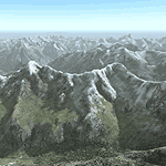
Yet another terrain mesh package of the European Alps? Well, this one is different in that it is NOT primarily based on the Shuttle Radar (SRTM) data with their incomplete coverage of prominent peaks and ridges. Instead, most of the source data for this project were developed over many months by Jonathan de Ferranti using detailed topographic maps. While Jonathan's work is unrelated to flight simulation he kindly gave me permission to compile his data for use in FS. The result is a wonderful improvement in detail and accuracy over any existing SRTM- or DTED-based mesh file, freeware or commercial (a link to an extensive set of screenshot comparisons is included in the read-me file).
I've compiled the source data at LOD10 (38-m) grid resolution because the coverage area is smaller than most existing mesh files. Thus, anyone can use these files without having to first uninstall their current mesh set. Also included are LOD9 and LO8 buffer mesh files. Note: if you own Switzerland Professional with its high-resolution terrain mesh then you don't need this package, at least not the Switzerland files!
| Filename: | Alps_LOD10_Topo_Mesh__Switzerland_and_France.zip |
| License: | Freeware, limited distribution |
| Added: | 30th May 2010, 09:51:03 |
| Downloads: | 59,003 |
| Author: | Holger Sandmann, Jonathan de Ferranti |
| Size: | 50.03 MB |
| Category: Flight Simulator 2004 - Scenery | |
| Alps LOD10 Topo Mesh - Austria and Italy |
|
Images related to this file:
File Description:
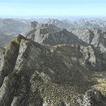
Yet another terrain mesh package of the European Alps? Well, this one is different in that it is NOT primarily based on the Shuttle Radar (SRTM) data with their incomplete coverage of prominent peaks and ridges. Instead, most of the source data for this project were developed over many months by Jonathan de Ferranti using detailed topographic maps. While Jonathan's work is unrelated to flight simulation he kindly gave me permission to compile his data for use in FS. The result is a wonderful improvement in detail and accuracy over any existing SRTM- or DTED-based mesh file, freeware or commercial (a link to an extensive set of screenshot comparisons is included in the read-me file).
I've compiled the source data at LOD10 (38-m) grid resolution because the coverage area is smaller than most existing mesh files. Thus, anyone can use these files without having to first uninstall their current mesh set. Also included are LOD9 and LO8 buffer mesh files. Note: if you own Austria Professional 2004 with its 1:50,000 scale terrain mesh then you don't need this package!
| Filename: | Alps_LOD10_Topo_Mesh__Austria_and_Italy.zip |
| License: | Freeware, limited distribution |
| Added: | 30th May 2010, 09:46:58 |
| Downloads: | 62,960 |
| Author: | Holger Sandmann, Jonathan de Ferranti |
| Size: | 73.32 MB |
| Category: Flight Simulator 2004 - Scenery | |
| Whaletown CAW9 in British Columbia, Canada |
|
Images related to this file:
File Description:
Whaletown is a float base serving a village on Cortes Island, another one of the many islands squeezed between Vancouver Island and the mainland at this northern end. At this island passengers are delivered by amphibious Grumman Goose from Port Hardy, the main airport of the northern half of Vancouver Island with daily scheduled flights onward to and from Vancouver International. The AI was included with the post of Port Hardy. Regretably, the amphibious Goose behaves as if it is on land and moves on the water with it's wheels extended; there is no way around this. This scenery is a modification of a post made some years ago that did not support AI. In my FS9, close to Whaletown, there was an FS9 or Ultimate Terrain fault consisting of a long straight beach sticking out into the sea for a few thousand feet. This scenery now deletes that.
| Filename: | Whaletown_CAW9_in_British_Columbia_Canada.zip |
| License: | Freeware, limited distribution |
| Added: | 28th November 2018, 22:43:21 |
| Downloads: | 106 |
| Author: | Roger Wensley |
| Size: | 1.67 MB |


© 2001-2026 AVSIM Online
All Rights Reserved
Privacy Policy |