
Where Flight Simulation Enthusiasts Gather from Around the World!
AVSIM Library - Search Results

| Category: Flight Simulator 2004 - Scenery | |
| Chisasibi CSU2 in northern Quebec, Canada |

|
Images related to this file:
File Description:
Chisasibi is in northern Quebec on the east shore of James Bay, 60 miles from the corner of James Bay and Hudson Bay. Originally called Fort George and founded at the mouth of La Grande Riviere around the Hudson Bay trading post that was established in 1803, the town had to move 5 miles upstream in 1981 when the Quebec hydro project increased the flow rate of the river. The name was changed to Chisasibi at the time of the move (Chisasibi = Great River in Cree) and the population (750 as early as 1940) has now grown to around 2,000. There is a paved road east to Radisson that connects to the north-south James Bay road, which was built at the time of the hydro project work. The original Fort George airport runway is still visible but not usable, just south of the original town site. Chisasibi airport is to the west of the new town, and the gravel runway is 3,792 feet long and aligned 14/32, which is approximately parallel to the river. There is officially no fuel available, but there is JetA on site for Air Creebec in a tank protected by used fuel drums (filled with sand?). The terminal and the garage building are both relatively new; the terminal dates from 2002 and has unusual touches. There are two AI flights by Air Creebec each day plus other private planes.
| Filename: | Chisasibi_CSU2_in_northern_Quebec_Canada.zip |
| License: | Freeware, limited distribution |
| Added: | 27th February 2013, 21:24:47 |
| Downloads: | 287 |
| Author: | Roger Wensley |
| Size: | 2.79 MB |
| Category: Flight Simulator 2004 - Scenery | |
| Homer PaHO in Alaska US |
|
Images related to this file:
File Description:
Homer is a mainly GA airfield with rows of open air parking, but it also has scheduled flights, a terminal building, a long (for GA) runway of just under 6,700 feet that is 150 feet wide and aligned 03-21 with VASI on both ends and ILS on 03. So I think we can refer to it as an airport. Plus, at the time of this scenery (around 2010) there were three newly completed hangars on the north apron that I was told were for three companies, Bald Mountain Air service, Maritime Helicopters, and Pathfinder Aviation. I do not know which was for whom, but all three companies are in the helicopter and/or plane charter business. The south apron has a number of hangars and other buildings along it's length, starting at the western end with Smokey Bay Air that has an old control tower on the roof, then the Fire Station, and then Homer Air. I am not aware of who owns what after those first three, except that at the far eastern end there are several garages etc for the airport maintenance equipment. Next to the airport at that end there are a number of boat maintenance companies with boats pulled out of the water; this could not be well replicated due to the airport elevation above the sea level and a misplaced road. The nearby Beluga Lake 5BL float base is also included here, with some AI. The lake height above sea level has been adjusted to cope with too many cliffs intruding into the water; this is an annoying FS9 habit. The Homer scenery is as close to the actual airport as I could make it, while coping with inaccurate coast lines and roads, and grassed areas that could not all be modified for reasons that I will not bore you with. The Spit is a major scenery feature next to the airport, and I have added to this to provide some boats, docks, and nearby buildings etc. Small planes use the adjacent gravel taxi path instead of the runway when back-tracking to take off on runway 21. They only go as far as the path takes them and then u-turn onto the runway and take off. By the way, this airport's AI will function at its best if the prevailing wind makes 03 the runway in use. And I will eventually stop writing 03 and just call it 3, as the US, alone in the world, does not put a zero in front of 01, 02, 03, 04 etc. Just one other thing to note is that all access to the runway is from taxiways A and B; there was (in 2010) no access to the extreme western end of the runway as the taxiway there is marked as out of service pending a needed resurfacing.
If you find an error email me please, and note that my email address has been changed to rogwens at Gmail dot com.
| Filename: | Homer_PaHO_in_Alaska_US.zip |
| License: | Freeware, limited distribution |
| Added: | 28th July 2021, 03:31:04 |
| Downloads: | 125 |
| Author: | Roger Wensley |
| Size: | 11.86 MB |
| Category: Flight Simulator 2004 - Scenery | |
| Prudhoe Bay area on Alaska North Slope US |
|
Images related to this file:
File Description:
The Prudhoe Bay area of the Alaska north slope is dominated by all the equipment and machinery that is necessary for the extraction of oil and its transfer by the pipeline that reaches south to Valdez. Prudhoe Bay airport is now closed, and its replacement just to the south is Deadhorse PASC, with numerous storage, maintenance, and accomodation areas immediately to the north of the apron, and others adjacent to the road between the two. The runway is just under 6,500 feet with approach lights at both ends and ILS on 04 (true heading of 75 degrees). This scenery reflects the overall situation in 2011 and oil production facilities and buildings are included here. The airport buildings and those close to the airport are replicas of the real life buildings; while as distance increases the accuracy fades somewhat there are everywhere replica trucks and cross country vehicles that are true to life. Deadhorse handles around 7,000 passengers per month as staff are rotated in and out on Alaska Air and ERA flights and by oil company private flights. There are also freight flights to complement the trucking effort up the Dalton Highway. The Alaska Airlines terminal building and ERA (the red buildings nearby) are at one end of the apron, while at the other end is a very large and new green terminal, storage, hangar building built by the airport authority. All of the airport components, runways, taxiways, and aprons, are built up on a gravel base to raise them above the surrounding terrain that floods with melting snow, freezes, or dries out, according to the seasons. There are other new airstrips included here that serve the oil industry. Around 33 miles to the east is Badami PABP airport servicing a subsiduary oil producing area, with 5,000 feet of gravel runway. Some 28 miles to the west of Deadhorse is Ugnu-Kuparuk UBW with just over 6,000 feet of gravel (gravel in 2011, it is now asphalted) servicing oil production by Conoco Phillips, which uses 737's to fly staff in and out. A further 32 miles west is Alpine AK15 with 5,400 feet of gravel and also served by the Conoco Phillips 737's. To the south of Alpine and connected by road is the village of Nuiqsut. To the north of Alpine and reachable only by air in the delta of the Sagavanirktok River is CD-3, an oil collection and pump station area with another gravel runway of 3,000 feet. Other airstrips that were prviously posted are now updated, Nuiqsut and Oliktok. I experimented, but decided against trying to reproduce the several hundred miles of pipelines. The are new AI aircraft, and there are notes regarding downloading. There is a new "cement" texture (not its name, but used as that by SBuilder) for the built up gravel bases. It is slightly darker than the original but not so much that any previous use will be spoilt. You may wish to download my "Alaska Frozen Rivers and Lakes" which freezes lakes and the northern sea and makes them landable on wheels.
| Filename: | Prudhoe_Bay_area_on_Alaska_North_Slope_US.zip |
| License: | Freeware, limited distribution |
| Added: | 19th December 2017, 00:38:06 |
| Downloads: | 583 |
| Author: | Roger Wensley |
| Size: | 28.54 MB |
| Category: Flight Simulator 2004 - Scenery | |
| TimeZone 2.2/3.0 Update 5 |
|
File Description:
1. Europe reworked so that all of Finland is in the correct TZ. Lithuania now observes DST.
2. All previous updates are included here.
Installation:
Replace the BGLs with that from the appropriate archive, FS8 for FS8 and before, and FS9 for FS9. IMPORTANT: Delete eur200.bgl if it exists since fs8eur2.bgl and fs9eur2.bgl replaces it.
| Filename: | TimeZone_2230_Update_5.zip |
| License: | Freeware, limited distribution |
| Added: | 14th January 2005, 17:14:53 |
| Downloads: | 3,462 |
| Author: | Dennis Thompson |
| Size: | 4.95 KB |
| Category: Flight Simulator 2004 - Scenery | |
| Utsunomiya Air Field (RJTU) |
|
Images related to this file:
File Description:
This scenery brings to life Utsunomiya Airfield (RJTU) in Japan. Utsunomiya is home to aviation units of the Japanese Ground Self Defense Force and performs overhauls on several aircraft types for the Japanese Air Self Defense Force. See the readme file for commonly available scenery libraries needed to bring this scenery to life and JGSDF and JASDF AI available.
| Filename: | Utsunomiya_Air_Field_RJTU.zip |
| License: | Freeware |
| Added: | 11th October 2015, 12:29:57 |
| Downloads: | 594 |
| Author: | Brent Newman |
| Size: | 11.89 KB |
| Category: Flight Simulator 2004 - Scenery | |
| KPVG - Hampton Roads Executive Airport - Virginia, USA **Update** |
|
Images related to this file:
File Description:
FS2004 Scenery - This is an update for my FS9 version of Hampton Roads Executive Airport scenery, KPVG. (hampton-roads_kpvg_fs9_2014.zip) In September 2014, Hampton Roads unveiled their new runway 10/28 replacing the old 10/28. The new runway is 5350 ft. in length and 100 ft. wide. For your Flight Sim flying pleasure by John B. Loney, Jr.
| Filename: | KPVG__Hampton_Roads_Executive_Airport__Virginia_US.zip |
| License: | Freeware, limited distribution |
| Added: | 30th December 2014, 01:22:56 |
| Downloads: | 284 |
| Author: | John B. Loney, Jr. |
| Size: | 412.19 KB |
| Category: Flight Simulator 2004 - Scenery | |
| DBWsim San Rafael 2005 |
|
File Description:
DBWsim proudly reopens Hamilton AFB in the northern San Francisco Bay Area. Included as well is scenery for the small local airfield of San Rafael. Both airports have been comprehensively redeveloped and the scenery features an improved local landclass.
VERSION 1.1
Major Content inclusion error fixed, the primary scenery for Hamilton AFB is now included in the pack.
| Filename: | DBWsim_San_Rafael_2005.zip |
| License: | Freeware |
| Added: | 28th September 2005, 13:02:06 |
| Downloads: | 3,166 |
| Author: | Derek and Brendan Webb |
| Size: | 1.59 MB |
| Category: Flight Simulator 2004 - Scenery | |
| RAF Cranwell 2007 |
|
File Description:
This is a new full Scenery based on my original Cranwell Part 1. It has many additions and has been renamed RAF Cranwell 2007. The Scenery is aligned with the UK VFR Photoscenery. See PDF at end of Installation for info on extra files need. This version is for FS2004 only it has not been tested in FSX.
| Filename: | RAF_Cranwell_2007.zip |
| License: | Freeware, limited distribution |
| Added: | 14th March 2007, 17:29:23 |
| Downloads: | 2,938 |
| Author: | Keith Steadman |
| Size: | 11.99 MB |
| Category: Flight Simulator 2004 - Scenery | |
| Balear Islands |
|
Images related to this file:
File Description:
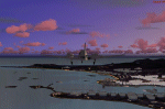
This is had been the first scenery design that I had made for Fs2004 before the appearance in the markets the new Fs2004 and for my own pleasure and residents in the islands. I wanted to represent it as accurately as possible with 100% of detail.
230 towns are represented and 7 old monumets and 4 aiports
| Filename: | Balear_Islands.zip |
| License: | Freeware |
| Added: | 18th March 2010, 16:58:20 |
| Downloads: | 8,814 |
| Author: | Toni Agramont |
| Size: | 18.4 MB |
| Category: Flight Simulator 2004 - Scenery | |
| Naples Capodichino LIRN 2006 v1.4 |
|
Images related to this file:
File Description:
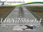
This file contains the Napoli Capodichino LIRN 2006 v1.4 airport for FS2004. The scenery was created by Gianni Mantellini (Napulevola.it vice-CEO) using GMax, photorealistic/hand-made texture and full custom programming techniques. Very frame-rate friendly. For any kind of support please write a mail to [email protected] or post a question on forum.napulevola.it. Powered by www.napulevola.it. Enjoy!
| Filename: | Naples_Capodichino_LIRN_2006_v14.zip |
| License: | Freeware |
| Added: | 9th December 2011, 14:18:49 |
| Downloads: | 4,472 |
| Author: | Gianni Mantellini - Napulevola |
| Size: | 8.71 MB |
© 2001-2026 AVSIM Online
All Rights Reserved
Privacy Policy |