
Where Flight Simulation Enthusiasts Gather from Around the World!
AVSIM Library - Search Results

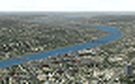
| Category: Flight Simulator 2004 - Scenery | |
| Peawanuck CYPO / Winisk CYWN - Northern Ontario, Canada |

|
Images related to this file:
File Description:
Peawanuck is on the bank of the Winisk River, 23 miles upstream from where the river empties into the Hudson Bay just west of James Bay. It has a population of around 240, and was established in 1986 when the original settlement (Winisk) at the mouth of the river was destroyed by a flood. The airport is on a bluff in a corner of the river at 171 feet ASL, with a gravel runway just over 3,500 feet long and aligned 11-29. There is only basic runway lighting, with no ILS, VASI, or PAPI; there is also no apron lighting, or fuel. Service is provided by Air Creebec with connector flights to Moosonee and Timmins, and on to Montreal. A search of their timetable did not provide any information regarding timings but I made the AI flight from Timmins a daily one; it is probably only once or twice a week. There is also a daily private Cessna from Moosonee. Winisk, at the mouth of the river, has another gravel runway which is over 6,000 feet long. There is also a large hangar and to the north the remaining buildings and fuel tanks etc of a Radar Control site which was closed in 1965 after only 7 years of use.
| Filename: | Peawanuck_CYPO__Winisk_CYWN__Northern_Ontario_Cana.zip |
| License: | Freeware, limited distribution |
| Added: | 29th December 2012, 09:14:03 |
| Downloads: | 280 |
| Author: | Roger Wensley |
| Size: | 2.61 MB |
| Category: Flight Simulator 2004 - Scenery | |
| KCRW - Kanawha River Valley - West Virginia, USA |
|
Images related to this file:
File Description:
This scenery is made to blend with autogen scenery and the defaults of FS9. Transits crossing the southern Allegheny Mountains will follow this valley seeing some of the landmark bridges and dams of the central WV area. The New river bridge scenery is not included in this package because (not only my own version which works default mesh), but another fellow has made one. It also fits with this package and looks real good. This package blends well with default or compliments my Land Class Central Appalachia package.
| Filename: | KCRW__Kanawha_River_Valley__West_Virginia_USA.zip |
| License: | Freeware |
| Added: | 9th July 2015, 17:26:13 |
| Downloads: | 228 |
| Author: | Rick Connolly |
| Size: | 2.33 MB |
| Category: Flight Simulator 2004 - Scenery | |
| Some Islands of St.Lawrence river, Quebec, Canada |
|
File Description:
The files in this package contain some islands of St.Lawrence river and other sceneries of province of Quebec, Canada. For FS2004 only. To use with terrain mesh for parts of this province after some corrections : qclod09a.zip to qclod09e.zip (5 files).
Les fichiers contenus dans cette archive corrigent la representation qui est faite dans FS2004 de quelques iles du fleuve Saint-Laurent. D'autres scenes sont egalement jointes. L'utilisation du mesh du Quebec est recommandée : 5 fichiers - qclod09a.zip a qclod09e.zip
| Filename: | Some_Islands_of_StLawrence_river_Quebec_Canada.zip |
| License: | Freeware, limited distribution |
| Added: | 20th April 2004, 16:55:41 |
| Downloads: | 4,860 |
| Author: | Gilles Gauthier |
| Size: | 1.82 MB |
| Category: Flight Simulator 2004 - Scenery | |
| Campbell River floats CAE3 in BC Canada |
|
Images related to this file:
File Description:
Campbell River is a medium sized town on Vancouver Island, some 50 miles north of Vancouver. The base is just north and west of the town on Spit Road. And Ultimate Terrain is required for the cost to be in the right place. The docks are on the south side of the spit, on the (relatively) sheltered river side, though take offs and landings are requested to take place outside the harbour if conditions permit. The base is noted as used and run by Corilair, though in fact there is also another company based there, Vancouver Island Air, who like Coril Air also have two docks, one for boarding passengers and one for maintenance and refuelling tie-ups. At the river mouth there is a small marina, run by the same folks who run the trailer park, and next to that a dock for visiting float planes. There is a seventh dock at the end furthest from the river mouth; I don't know what that is used for but it is next to Vancouver Island Air and might be theirs. At low tide there are numerous sandbanks (and more permanent islands with bushes and trees) in the mouth of the Campbell River and I decided to ignore installing these with all the problems they would cause me. The main buildings and most of the others are modeled specifically for this scenery; minor items like parked cars are RWY12.
| Filename: | Campbell_River_floats_CAE3_in_BC_Canada.zip |
| License: | Freeware, limited distribution |
| Added: | 12th February 2010, 18:45:00 |
| Downloads: | 880 |
| Author: | Roger Wensley |
| Size: | 5.3 MB |
| Category: Flight Simulator 2004 - Scenery | |
| Eastmain River CZEM in northern Quebec, Canada |
|
Images related to this file:
File Description:
Eastmain River is on the south bank of the river of the same name, close to the eastern shore of James Bay at it's southern end. Moosonee is around 110 miles to the southwest, and Waskaganish (my post October 2010) just 50 miles to the south. The town has a population of around 770 who are mostly Cree speakers. The airport is just to the south of the town with a gravel runway just over 3,500 feet long and aligned 02/20; there is no PAPI and there is no fuel available, unless there is some in drums. There are flights by Air Creebec and Wasaya; their textures are available for download on Flightsim and the planes are as listed in the AI folder. The AI bgl is for both CYAT and CZEM; don't think I have included the wrong one.
| Filename: | Eastmain_River_CZEM_in_northern_Quebec_Canada.zip |
| License: | Freeware, limited distribution |
| Added: | 10th January 2013, 22:00:34 |
| Downloads: | 252 |
| Author: | Roger Wensley |
| Size: | 2.14 MB |
| Category: Flight Simulator 2004 - Scenery | |
| Québec Short Hops 2 -- Montnagny and Île-aux-Grues |
|
File Description:
Montmagny and Île-aux-Grues are situated downstream from Québec City. Montmagny is on the South shore while Île-aux-Grues is in the St.Lawrence river 5nm offshore. From there you can link to my other Québec Short Hops sceneries by following the lighthouses or 'drifting' down the River. These sceneries are ideal for the VFR pilot and very nice to fly at dawn or dusk. There are activities off the Montmagny airfield.
| Filename: | Qubec_Short_Hops_2____Montnagny_and_leauxGrues.zip |
| License: | Freeware |
| Added: | 5th November 2003, 23:07:11 |
| Downloads: | 2,543 |
| Author: | Léon Louis |
| Size: | 6.42 MB |
| Category: Flight Simulator 2004 - Scenery | |
| FS 2004 Blexen Scenery |
|
File Description:
The airfield Blexen is situated on the west bank of the river Weser, opposite to Bremerhaven on the east bank. This is a preliminary outcome of my work on Bremerhaven.
| Filename: | FS_2004_Blexen_Scenery.zip |
| License: | Freeware |
| Added: | 7th August 2005, 23:49:58 |
| Downloads: | 1,523 |
| Author: | Frank Lücke |
| Size: | 3.99 MB |
| Category: Flight Simulator 2004 - Scenery | |
| FSFlightline FSE Vol. 2 - Apex Aipark (WA05) & Olympic Airfield (WA45) |
|
File Description:
The second installment of my series of Washington State airports sceneries for use with Lago's FS Enhancer. This volume features Apex Airpark in Silverdale, WA and Olympic Airfield in Discovery Bay, WA. Both are fictional representations and feature static and dynamic scenery including moving cars, highway traffic, ambient sounds, and dynamic wildlife. Fly over the Hood Canal and look for the subs leaving Subase Bangor. Includes custom AFCADs for both airfields. Requires Lago's FS Enhancer to function.
| Filename: | FSFlightline_FSE_Vol_2___Apex_Aipark_WA05__Olympic.zip |
| License: | Freeware |
| Added: | 7th February 2004, 22:16:40 |
| Downloads: | 1,063 |
| Author: | Jeff Shields |
| Size: | 482.04 KB |
| Category: Flight Simulator 2004 - Scenery | |
| St.Siméon Airfield, Québec Short Hops |
|
File Description:
Saint-Siméon, part of Québec Short Hops sits on the banks of the St. Lawrence River, downstream from Québec City. The village is situated directly across the St.Lawrence River from Rivière-du-Loup. It has the docking facilities for the ferry that goes to Rivière-du-Loup. To help navigation, I have added a beam on top of the ferry dock. My rendition of the village is fictitious. The grass strip is on top of the cliff.
| Filename: | StSimon_Airfield_Qubec_Short_Hops.zip |
| License: | Freeware |
| Added: | 10th June 2004, 14:10:46 |
| Downloads: | 1,429 |
| Author: | Leon Louis |
| Size: | 4.1 MB |
| Category: Flight Simulator 2004 - Scenery | |
| OACC - Chakhcharan Airport - Chakhcharan, Afghanistan |
|
File Description:
Chakhcharan Airport (OACC/CCN), Afghanistan. It is an airport serving the city of Chaghcharan in Ghor Province, Afghanistan.It is located north East of the Hari River, one mile east/northeast of Chaghcharan
| Filename: | OACC__Chakhcharan_Airport__Chakhcharan_Afghanistan.zip |
| License: | Freeware |
| Added: | 24th April 2013, 22:47:16 |
| Downloads: | 470 |
| Author: | Billy Guo |
| Size: | 61.37 KB |
© 2001-2026 AVSIM Online
All Rights Reserved
Privacy Policy |