
Where Flight Simulation Enthusiasts Gather from Around the World!
AVSIM Library - Search Results

| Category: Flight Simulator 2004 - Scenery | |
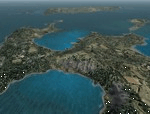
| Erding Air Base, Germany |

|
Images related to this file:
File Description:

FS2004 scenery for Erding Air Base, Southern Germany. Erding was turned over to Allied control after the second world war and served for many years as home to first the U.S. 440th Fighter-Interceptor Squadron, and then the 52nd Tactical Fighter Group. When the 52nd withdrew in 1971 the base served as a rotation point for various NATO units finally becoming a repair and upgrade center for the then-new Typoon Eurofighter. Serving Southern Germany for over 50 years, the base now faces an uncertain future due to plans for a high-speed rail connection through the property. Scenery includes custom 3-D objects as well as seasonal photo-groundcover.
| Filename: | Erding_Air_Base_Germany.zip |
| License: | Freeware, limited distribution |
| Added: | 29th March 2013, 06:37:40 |
| Downloads: | 1,893 |
| Author: | John Stinstrom |
| Size: | 8.27 MB |
| Category: Flight Simulator 2004 - Scenery | |
| WION Ranai, Indonesia |
|
File Description:
Googly scenery for Ranai, a domestic airport located on Natuna Besar,
the main island of the 272 islands comprising the Natuna archipeligo in
Indonesia. The airport is served by daily flights of Riau Airlines using
Fokker 50 turboprop aircraft.
Flight Simulator 2004 has only provided a runway at this airport and this scenery
seeks to redress the situation so that you and your "AI" traffic can use the
airport.
The scenery does not purport to be ultra-accurate. Based on high quality
satellite imagery from Google Earth, the layout is proportionally correct but the
added airport features, such as buildings, are built from default Microsoft objects
and add-on libraries so will not look exactly like the real thing.
You are not obliged to download and install any additional scenery libraries,
but to enjoy this scenery in its entirety, you may wish to. It will work fine,
with or without.
| Filename: | WION_Ranai_Indonesia.zip |
| License: | Freeware |
| Added: | 11th October 2008, 13:12:55 |
| Downloads: | 1,242 |
| Author: | John Hinson |
| Size: | 60.07 KB |
| Category: Flight Simulator 2004 - Scenery | |
| HSMK Rumbek, Sudan |
|
File Description:
Googly scenery for HSMK Rumbek, a small airport serving the city of the same
name, capital of the Buhayrat (or Lakes) state in southern Sudan. The airport
is served daily by Beech 1900 aircraft operating for Delta Connection, a
Kenyan airline.
Flight Simulator 2004 has completely omitted this airport and this scenery
seeks to redress the situation so that you and your "AI" traffic can use the
airport.
The scenery does not purport to be ultra-accurate. Based on high quality
satellite imagery from Google Earth, the layout is proportionally correct but the
added airport features, such as buildings, are built from default Microsoft objects
and add-on libraries so will not look exactly like the real thing.
You are not obliged to download and install any additional scenery libraries,
but to enjoy this scenery in its entirety, you may wish to. It will work fine,
with or without.
| Filename: | HSMK_Rumbek_Sudan.zip |
| License: | Freeware |
| Added: | 19th April 2008, 20:33:09 |
| Downloads: | 754 |
| Author: | John Hinson |
| Size: | 78 KB |
| Category: Flight Simulator 2004 - Scenery | |
| UPDATE - Islip Long Island MacArthur Airport (KISP) Main Terminal |
|
File Description:
Flight Simulator 2004 Main terminal scenery for Islip Long Island MacArthur Airport (KISP). I have tried to as accurately recreate the main terminal at KISP according to my personal experience working there for a number of years, and from images I was able to find on the web. This is just a starting point, and anyone who wants to take my GMAX source to the next level PLEASE DO SO! I am not an expert in GMAX, and I believe it would be great to add animation to the gates for realism. Please also check out my AFCAD file that accurately represents the current and historical gate assignments as well. This update corrects some of the jetway positions to better fit with the new AFCAD for KISP. It makes the ramp better able to handle the traffic with the Ultimate Traffic add-on for FS2004. The AFCAD filename is 'AF2_KISP2.zip'.
| Filename: | UPDATE__Islip_Long_Island_MacArthur_Airport_KISP_M.zip |
| License: | Freeware, limited distribution |
| Added: | 23rd November 2003, 23:18:17 |
| Downloads: | 2,299 |
| Author: | Phil Perlman |
| Size: | 417.3 KB |
| Category: Flight Simulator 2004 - Scenery | |
| South West Islands, Japan and Taiwan Ver.3.0 |
|
Images related to this file:
File Description:
FS2004 Scenery SWIJT2004 Ver 3.0 (South West Islands, Japan and Taiwan)
These files improve specific scenerys (South West Islands of Japan and Taiwan, Asia) of FS2004. Included islands: Ohsumi Islands, Tokara Islands, Amami Islands, Okinawa lands, Kerama-Kume Islands, Miyako Islands, Yaeyama Islands and Taiwan Island.
In this scenery design, the coastline was reproduced as exactly as possible, following the specification of FS2004. Moreover, 90m mesh geographical data is reproduced by
using SRTM 3arc/sec. Correction of missing holes is perfect.
==NOTAM== I exhibited "SWIJ2k4.zip" on August 26, 2004.
However, it became clear that some of files of "SWIJ2k4" are infringing on the opyright of Microsoft. Then, I stopped public presentation of "SWIJ2k4". I apologize for having
made you trouble to those who already downloaded "SWIJ2k4.zip". New "SWIJT2k4.zip" is vast scenery which covered South West Islands, Japan and Taiwan Island. Please install new "SWIJT2k4".
By Kazuo Kawamura
| Filename: | South_West_Islands_Japan_and_Taiwan_Ver30.zip |
| License: | Freeware, limited distribution |
| Added: | 4th December 2011, 00:05:05 |
| Downloads: | 7,739 |
| Author: | Kazuo Kawamura |
| Size: | 20.5 MB |
| Category: Flight Simulator 2004 - Scenery | |
| OP0C Bandari, Pakistan |
|
File Description:
Googly scenery for Bandari, a minor airport in Palistan served once weekly by
Metroliner turboprops of Royal Airlines. The airport has neither ICAO not IATA
status, but Microsoft have given it an unofficial ICAO code of OP0C.
Flight Simulator 2004 has only provided a runway at this airport and this scenery
seeks to redress the situation so that you and your "AI" traffic can use the
airport.
The scenery does not purport to be ultra-accurate. Based on high quality
satellite imagery from Google Earth, the layout is proportionally correct but the
added airport features, such as buildings, are built from default Microsoft objects
and add-on libraries so will not look exactly like the real thing.
You are not obliged to download and install any additional scenery libraries,
but to enjoy this scenery in its entirety, you may wish to. It will work fine,
with or without.
| Filename: | OP0C_Bandari_Pakistan.zip |
| License: | Freeware |
| Added: | 20th April 2008, 17:04:59 |
| Downloads: | 556 |
| Author: | John Hinson |
| Size: | 74.99 KB |
| Category: Flight Simulator 2004 - Scenery | |
| Siofok Kiliti-Sagvar (LHSK) 2.0 |
|
File Description:
Freeware Scenery of Siófok Kiliti-Ságvár airport. This airport is used for general aviation, at Lake Balaton, has grass runway. Only for Flight simulator 2004. Changes and addons for version 2.0: Correct AFCAD from map, correct city placement, with VTP2 polygons. Roads, railways, Rivers, bridges and coastline position is now correct. Added Docks, detailed landclass with VTP2 polygons. Every centimeter of the detailed area now fits the sattelite photo. This scenery itself has a large addition to the default LHSK, which only has a runway. This addon has a correct afcad with taxiways and apron. Also added the ILS and PAPI for runway 33. This scenery was made for an aerobatic event on the IVAO network, so an aerobatic box is also added above Lake Balaton. You can remove this box at anytime via the instructions. Hope you enjoy this scenery and will have fun with it.
| Filename: | Siofok_KilitiSagvar_LHSK_20.zip |
| License: | Freeware, limited distribution |
| Added: | 11th March 2006, 16:45:04 |
| Downloads: | 1,530 |
| Author: | David Zoltan |
| Size: | 571.88 KB |
| Category: Flight Simulator 2004 - Scenery | |
| Kangiqsujuaq CYKF in northern Quebec, Canada |
|
Images related to this file:
File Description:
Kangiqsujuaq is on the north coast of Quebec, 85 miles west of Quaqtaq and 125 miles east of Salluit, while across the Hudson Strait and 100 miles away on Baffin Island is Kimmirut. The town grew around two trading posts, the first opened by Revillon Freres in 1910, and the second by the Hudson Bay Company in 1914. A school was opened in 1960, and a clinic in 1961. The town was known as Wakeham Bay until 1961, and now has a population of around 700. The airport is to the south of the town and up on the hill at 511 feet ASL (this has been remeasured since 2004 and is now known to be 501). The gravel runway is just over 3,500 feet long and aligned 15/33; there is no PAPI, but there is fuel available, both 100LL and JetA. There are flights by Air Inuit.
| Filename: | Kangiqsujuaq_CYKF_in_northern_Quebec_Canada.zip |
| License: | Freeware, limited distribution |
| Added: | 27th January 2013, 00:55:00 |
| Downloads: | 231 |
| Author: | Roger Wensley |
| Size: | 2.31 MB |
| Category: Flight Simulator 2004 - Scenery | |
| OIBJ Jam/Tohid, Iran |
|
File Description:
Googly scenery for OIBJ Jam/Tohid - a small Iranian domestic airport for which
nothing more than a runway is provided in Flight Simulator 2004. These scenery
files add taxiways, aprons, buildings and other airport features so that you
and your "AI" traffic can land, taxi, park and take off in a realistic manner.
The airport is served about twice per week by Fokker jets of Iran Air.
The scenery does not purport to be ultra-accurate. Based on high-detail satellite
imagery from Google Earth, the layout is proportionally correct but the added
airport features, such as buildings, are built from default Microsoft objects
and add-on libraries so will not look like the real thing.
You are not obliged to download and install any additional scenery libraries,
but to enjoy this scenery in its entirety, you may wish to. It will work fine,
with or without.
| Filename: | OIBJ_JamTohid_Iran.zip |
| License: | Freeware |
| Added: | 8th July 2007, 21:19:39 |
| Downloads: | 1,020 |
| Author: | John Hinson |
| Size: | 80.11 KB |
| Category: Flight Simulator 2004 - Scenery | |
| RAF Upper Heyford EGUA 1955-1962 |
|
File Description:
EGUA RAF Upper Heyford 1955-1962
The airfield was originally built in 1918 by the Royal Air Force on land owned by New College Oxford, closed briefly after the end of the First World War and then re-opened in the 1920s. During the Second World War it was used by units of RAF Bomber Command but these were training rather than operational forces, even if aircraft of the 16th OTU (Operational Training Unit) may sometimes have taken part in bombing operations against the Third Reich. New runways were laid in 1942. During the Cold War Upper Heyford was chosen as one of the airfields used to operate bomber aircraft belonging to the US Strategic Air Command, and in 1950 the main runway was extended while new hardstandings were constructed for the bombers concerned. However, units were not stationed there permanently, but did Temporary Duty Assignments from their bases in the US. They included the 93rd Bomb Wing, 97th Air Refueling Squadron, 509th Air Refueling Squadron, 301st Bomb Wing, 8th Air Sea Rescue Squadron, 2nd Bomb Wing, 5th Bomb Wing Detachment, and the 22nd Bomb Wing. Aircraft included the B-50 Superfortress, (briefly) the B-36 Peacemaker, the B-47 and from 1960 the B-52. There were further significant developments after 1962 which fall outside the remit of this scenery, Upper Heyford being finally returned to the British Ministry of Defence in 1994 after the end of the Cold War.
| Filename: | RAF_Upper_Heyford_EGUA_19551962.zip |
| License: | Freeware |
| Added: | 7th October 2022, 03:40:20 |
| Downloads: | 152 |
| Author: | Al Von Pingel, Ken Lawson |
| Size: | 42.75 MB |
© 2001-2026 AVSIM Online
All Rights Reserved
Privacy Policy |