
Where Flight Simulation Enthusiasts Gather from Around the World!
AVSIM Library - Search Results

| Category: Flight Simulator 2004 - Scenery | |
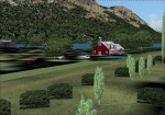
| Reservoirs and Lakes of Lesotho and Western Natal, South Africa |

|
File Description:
Replacement files for water bodies of eastern South Africa, in and near the Drakensberg Range (S28.1-29.5 E28.3-30.0). Natural and man-made lakes are now in their accurate position and elevation. Includes the Katse Dam reservoir in Lesotho as well as about 100 smaller lakes in Lesotho and western Natal not present in the FS default scenery. Based on a watermask derived from Landsat 7 ETM+ satellite data and compiled with a beta version of Jim Keir's "Slartibartfast" utility. Meant to be used with the Aeroworx SRTM LOD9 South Africa mesh.
| Filename: | Reservoirs_and_Lakes_of_Lesotho_and_Western_Natal_.zip |
| License: | Freeware, limited distribution |
| Added: | 8th May 2004, 02:43:38 |
| Downloads: | 6,202 |
| Author: | Holger Sandmann, Aeroworx |
| Size: | 464.27 KB |
| Category: Flight Simulator 2004 - Scenery | |
| Landscape Enhancements for Ultimate Terrain Canada/Alaska |
|
File Description:
This is a re-issue of my previously published landscape enhancement packages for parts of Southeast Alaska, British Columbia, Alberta, and Washington State. These files have been edited and adjusted to be fully compatible with FlightOne's "Ultimate Terrain: Canada/Alaska" product. Also, I have adjusted some of Ultimate Terrain's lake and river elevations to better fit new third-party add-on mesh files, such as the "Cordillera" mesh by FS Genesis and my freeware mesh files made for the individual coverage areas. Please note: A registered copy of "Ultimate Terrain: Canada/Alaska is required!!!
| Filename: | Landscape_Enhancements_for_Ultimate_Terrain_Canada.zip |
| License: | Freeware, limited distribution |
| Added: | 8th June 2005, 03:47:26 |
| Downloads: | 7,332 |
| Author: | Holger Sandmann |
| Size: | 3.44 MB |
| Category: Flight Simulator 2004 - Scenery | |
| Alps LOD10 Topo Mesh - Update 1 |
|
File Description:
Patch files to remove tall spike in terrain near Salzburg at N47 44´ E13 00´ and to add the missing/distorted peaks of La Grande Moucherolle at N45 00´ E5 34´ and Mont Aiguille at N44 50' E5 33'.
Requires the full version of our Alps LOD10 mesh files, alpse_fe.zip and alpsw_fe.zip. Source data by Jonathan de Ferranti, compiled for FS by Holger Sandmann. Fully compatible with FS2002. A big thank-you to those who reported the "Salzbug" and the missing peaks in the French Alps.
| Filename: | Alps_LOD10_Topo_Mesh__Update_1.zip |
| License: | Freeware, limited distribution |
| Added: | 9th February 2006, 15:02:59 |
| Downloads: | 32,355 |
| Author: | Holger Sandmann, Jonathan de Ferranti |
| Size: | 2.57 MB |
| Category: Flight Simulator 2004 - Scenery | |
| Louisville KSDF--UPS Ramp |
|
File Description:
This is a complete re-do for the UPS cargo area at Louisville-Standiford Int'l. The default FS version of UPS's main hub was way off. The scenery was built with Rwy12 and EZ-Scenery. The AFCAD was based on the Patrick Finch version of the airport which is available at AVSIM.net. I reccommend that if you don't have his scenery, that you download and install it as well. It will revamp the passenger side of the airport and complement the cargo side to make a complete package.
| Filename: | Louisville_KSDFUPS_Ramp.zip |
| License: | Freeware |
| Added: | 26th January 2006, 05:05:16 |
| Downloads: | 4,371 |
| Author: | William Morgan/FRF Studio |
| Size: | 1.14 MB |
| Category: Flight Simulator 2004 - Scenery | |
| FPST - Sao Tome International Airport Scenery Fix |
|
File Description:
Some users encountered the elevation issue at Runway 29 and to the southwestern part (Hotel Praia Bay) of my prior released 'FPST - Sao Tome International Airport' scenery, especially those who are using the scenery with the default mesh or freeware meshes; also users with FS Global Mesh 2008 encountered it.
The content in this fix covers two alternatives; one softens heavily the issue but with a loss of mentionable details, the other is a compromise with a less softening of the issue but with a minor loss of details.
| Filename: | FPST__Sao_Tome_International_Airport_Scenery_Fix.zip |
| License: | Freeware |
| Added: | 22nd November 2024, 15:14:30 |
| Downloads: | 73 |
| Author: | Taner Akol |
| Size: | 612.42 KB |
| Category: Flight Simulator 2004 - Scenery | |
| ORNI - Najaf International Airport V1.0 |
|
Images related to this file:
File Description:
This package is designed to create a basic scenery of Najaf (Al-Najaf) airport (ORNI) to fill the gap which has been a problem for the simmers (especially Iranian pilots and simmers) who want to simulate their regular flights to Najaf. ALI (Al-Najaf International) airport was founded after the Microsoft Flight Simulator published. Then it does not exist in default FS and there was no add-on for that yet. This pack will solve the problem both for who wants to fly to by himself and for AI traffic.
| Filename: | ORNI__Najaf_International_Airport_V10.zip |
| License: | Freeware, limited distribution |
| Added: | 16th June 2014, 06:30:36 |
| Downloads: | 729 |
| Author: | Behnam Zamani / PERSIAN-SIM |
| Size: | 1.55 MB |
| Category: Flight Simulator 2004 - Scenery | |
| Niederstetten-Army Update |
|
File Description:
UPDATE UPDATE UPDATE UPDATE UPDATE UPDATE UPDATE UPDATE UPDATE UPDATE UPDATE
FS2002/FS2004 Scenery - Niederstetten Army Ver2.5
Niederstetten-Army (ETHN) are one of the oldest military Heliport at south of Germany. From here there are starting a lot of AMF-Flight´s around the NATO Country´s. At the last years, they are fling to Norway (Bardufoss-AAB), Turky, (Erzerum),....). The last fife year´s the Airport have mad a good job and now from here are starting any civil Airplan´s e.g. WÜRTH, EBM,... to Traffel around the world. At the weekend´s there are start´s smal Probs to find new airprt in Europe.
| Filename: | NiederstettenArmy_Update.zip |
| License: | Freeware |
| Added: | 3rd December 2003, 00:32:08 |
| Downloads: | 3,550 |
| Author: | Edgar Stahl |
| Size: | 4.34 MB |
| Category: Flight Simulator 2004 - Scenery | |
| World's Highest Airfield @ 16600 feet - Daulat Beg Oldie |
|
File Description:
Located at an altitude of 16600 feet in North Eastern Ladakh near the strategic Karakoram Pass, DBO is an important Indian Army post which links with the ancient Silk Route to China. The Indian army maintains a helipad and an airstrip here, which is highest in the world. It is just 8 km south the Chinese border and 9 km northwest of the Aksai Chin & line of actual control between China and India. The scenery is truly fictional as no information is available on internet regarding the orientation of airstrip. Works best with Himalayan Peaks LOD10 Mesh, Volume 6 - Jammu and Kashmir avaiable at avsim: (fs_him_06.zip)
| Filename: | Worlds_Highest_Airfield__16600_feet__Daulat_Beg_Ol.zip |
| License: | Freeware |
| Added: | 26th June 2008, 10:57:26 |
| Downloads: | 964 |
| Author: | Deepak Blassi |
| Size: | 1.3 MB |
| Category: Flight Simulator 2004 - Scenery | |
| 1961 Berlin Tegel Airport |
|
File Description:
I've produced this scenery to provide taxiways, buildings and details as they were around 1961 for Berlin - Tegel airport. I've added many new GMAX buildings, with many other details included. After World War 2, Tegel lay in the French sector of Berlin. After the Berlin airlift, the airport was used mainly by the French military. Air France moved all of its operations out of Berlin - Templehof at the end of 1959 and began operations at Berlin - Tegel on 2 January, 1960, with a Lockheed Super G Constellation as the first incoming flight. This scenery has been updated from the original version with more details and an improved AFCAD file.
| Filename: | 1961_Berlin_Tegel_Airport.zip |
| License: | Freeware, limited distribution |
| Added: | 25th October 2008, 02:29:50 |
| Downloads: | 4,861 |
| Author: | Mike Stevens |
| Size: | 16.5 MB |
| Category: Flight Simulator 2004 - Scenery | |
| Argentina, Cholila Lodge V 1.0 |
|
Images related to this file:
File Description:
Lake Cholila in Patagonia is one of the few last "great outdoors" left in this world, a paradise for mountain bikers, fishermen, hikers and hunters... the only drawback is that it is difficult to get there, there are some gravel roads but that is something for those really wanting adventure . Taking that into consideration the operators of the lodge on lake Cholila have created a grass airstrip making the access very easy...for those who don't mind flying in small planes.
The idea for this scenery, as well as all data and picture collection to make it, was from Federico Malfu Sanchez
| Filename: | Argentina_Cholila_Lodge_V_10.zip |
| License: | Freeware |
| Added: | 25th May 2010, 19:01:31 |
| Downloads: | 418 |
| Author: | Alf B. Meier |
| Size: | 5.95 MB |
© 2001-2026 AVSIM Online
All Rights Reserved
Privacy Policy |