
Where Flight Simulation Enthusiasts Gather from Around the World!
AVSIM Library - Search Results

| Category: Flight Simulator 2004 - Scenery | |
| CLUBE CEU - Flight Sports Club - SIAN (Aeródromo Armando Nogueira) |

|
Images related to this file:
File Description:
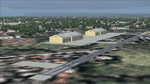
I bring you a scenery made by me with the help of AFCAD and ADE165, of the new CLUBE CEU airfield at its new address near Santa Cruz, Rio de Janeiro.
This scenery is quite simple and this airfield is also used by the CEU Squadron, an aerial demonstration group formed by civilian pilots and former officers of the Brazilian Air Force (FAB). The squadron conducts aerobatic training flights and performances at events throughout Brazil, using primarily sports aircraft.
In addition to serving as a meeting point and hangars for private pilots, the site houses civil aviation schools (such as Sky Training) focused on training civil pilots (Private, Commercial, Instructor and CPA/Ultraleve). The club annually promotes integrated flyovers and sporting events such as FlyCEU.
| Filename: | CLUBE_CEU__Flight_Sports_Club__SIAN_Aerdromo_Arman.zip |
| License: | Freeware |
| Added: | 30th October 2026, 01:29:17 |
| Downloads: | 16 |
| Author: | CLAUDIO LUIZ |
| Size: | 5.37 MB |
| Category: Flight Simulator 2004 - Scenery | |
| Lake Hood LHD and Z41 in Anchorage Alaska UPDATED |
|
Images related to this file:
File Description:
This is an updated version that is complete in itself and which greatly upgrades Lake Hood Airstrip Z41 and also makes minor modifications to LHD. Lake Hood is right next door and to the north of Ted Stevens Anchorage International Airport, and there is a second airfield on the north side of the lake called Lake Hood Airstrip. The airstrip is coded Z41, the International is PANC, and Lake Hood itself is LHD. You will need Ultimate Terrain Alaska Canada for this to work, and you should also download and install Anchorage International (verson 4?) by William Morgan of FRFStudio. LHD/Z41 includes a fair proportion of the 780 float planes that are based there and which make Lake Hood the largest and busiest float plane base in the world, averaging 190 flights per day during the year and a lot more than that per day during the summer months. There is fuel at two places on the lake, and a lot of maintenance help available. The documentation showing the VFR routes to Lake Hood is also included in the Lake Hood VFR procedures folder, and basically, if you listen to the ATC chatter, planes either route via the Ball Park or the Gravel Pit, which gets abbreviated to something like "You want the park or the gravel?" which wouldn't mean a whole lot to an unrehearsed stranger. Unfortunately FS doesn't reach that level of sophistication, but you can still take the right route. There is a google marked map showing the locations of the checkpoints.
| Filename: | Lake_Hood_LHD_and_Z41_in_Anchorage_Alaska_UPDATED.zip |
| License: | Freeware, limited distribution |
| Added: | 18th July 2010, 08:16:48 |
| Downloads: | 984 |
| Author: | Roger Wensley |
| Size: | 9.25 MB |
| Category: Flight Simulator 2004 - Scenery | |
| Frozen & Landable Lakes & Rivers for All Canada Winter Ski Operations |
|
Images related to this file:
File Description:
This "freezes" ALL Canadian lakes and rivers for winter flying and means they can be landed on with skis or wheels. This edition covers all of Canada plus parts of the USA along the border, including Michigan, Wisconsin, Minnesota, North Dakota, and Montana. It is reversible with an "untick" in the FS scenery library. I have spent some time making sure that the sea and the inlets along the coast do not get frozen too, and also some of the lakes that are close to the coast and rarely get cold enough to freeze over. Along the north shore I went for the peak of the winter with sea ice all the way to the permanent polar cap; this is not totally realistic as there is usually a partially open lead along the coast, but this would be difficult to replicate convincingly. This is really for use with Ultimate Terrain, though it will work without it. The pics show Rockcliffe in the winter with the frozen Ottawa River for real and in FS for comparison; without UT the river would not be in the right place.
| Filename: | Frozen__Landable_Lakes__Rivers_for_All_Canada_Wint.zip |
| License: | Freeware, limited distribution |
| Added: | 15th November 2010, 01:01:36 |
| Downloads: | 603 |
| Author: | Roger Wensley |
| Size: | 871.82 KB |
| Category: Flight Simulator 2004 - Scenery | |
| Pocono Mountains Municipal Airport |
|
Images related to this file:
File Description:
FS2004 Scenery - Pocono Mountains Municipal Airport (KMPO) serves Mount Pocono and Monroe County, PA and is owned by Pocono Mtns Muni Arpt Auth. The airport has more than one runway. The longest is a paved runway extending 5001 feet. The facility is at an elevation of 1916 feet at a distance of about 2 miles from Mount Pocono. Includes the runway 13/31 which was extended to 5,001 ft x 75 ft. Tested in Ultimate Terrain and Default FS. By John B. Loney, Jr.
| Filename: | Pocono_Mountains_Municipal_Airport.zip |
| License: | Freeware, limited distribution |
| Added: | 22nd February 2011, 23:02:23 |
| Downloads: | 389 |
| Author: | John B. Loney, Jr. |
| Size: | 813.69 KB |
| Category: Flight Simulator 2004 - Scenery | |
| Scottsdale Airport KSDL |
|
File Description:
FS2004 Scenery-Scottsdale Airport (KSDL) is a general aviation reliever facility with no commuter or airline service, and is home to many corporate aircraft in the valley. Located 7 miles north of Scottsdale's downtown area, and in close proximity to a wide range of world class resorts, hotels, restaurants, and golf courses. Scottsdale Airport serves Scottsdale and Maricopa County and is owned by the City Of Scottsdale. The paved runway extends for 8251 feet. The facility is at an elevation of 1508 feet. Scenery created with FSDS2, Rwy12 and Lago's FSE. Requires AFCAD2 and Traffic Tools. Textures included.
| Filename: | Scottsdale_Airport_KSDL.zip |
| License: | Freeware |
| Added: | 7th October 2005, 23:24:07 |
| Downloads: | 1,609 |
| Author: | John B. Loney, Jr. |
| Size: | 2.56 MB |
| Category: Flight Simulator 2004 - Scenery | |
| The Water Tower at Dover Heights, Sydney |
|
File Description:
The skyline of Dover Heights, on the high ridge south of South Head, is dominated by a distinctive water tower, a feature of the landscape for decades.
I thought it time that the thing was featured in Flight Sim, so here it is.
Although the real-world terrain is not accurately represented, at least the tower is in roughly the right location.
The tower is just one of the default FSim items, so no third-party material is needed.
It's not exactly the same as the real-life item but at least it is a tower and will be visible......at last!
| Filename: | The_Water_Tower_at_Dover_Heights_Sydney.zip |
| License: | Freeware |
| Added: | 22nd February 2006, 02:10:54 |
| Downloads: | 530 |
| Author: | Bruce Kennewell |
| Size: | 290.26 KB |
| Category: Flight Simulator 2004 - Scenery | |
| Arnold Ranch (8Q9) Fresno, California. Scenery |
|
File Description:
This is a scenery upgrade for Arnold Ranch (8Q9) (37CN Real World code) Fresno, California. Number ten in the series. As the strip has just a small concrete pad and a hanger at one end, there is not much in the way of scenery. The default landclass is all to pot and has most of the area as some kind of scrubland instead of the agricutural land google shows it to be. A small town to the west is misplaced, plus some workings to the south. This update addresses the landclass faults to some extent as well as the airstrip.
| Filename: | Arnold_Ranch_8Q9_Fresno_California_Scenery.zip |
| License: | Freeware |
| Added: | 4th April 2006, 22:35:20 |
| Downloads: | 796 |
| Author: | Kim Gowney |
| Size: | 348.99 KB |
| Category: Flight Simulator 2004 - Scenery | |
| California Central Coast Revision #3 |
|
Images related to this file:
File Description:
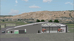
This is revision #3 to CCCOASTX.ZIP for FS2004 uploaded and dated 4/18/06 and only applies
to that version of my California Central Coast Scenery. Rev 3 includes several SBP modifications to reflect current and pending real world construction projects. Also revised "T" hangars at several airports, added distance signs on IFR runways at SBP, SMX, SBA and some minor PRB building graphics revisions. CCCOASTX.ZIP, CCCXREV1.ZIP, CCCXREV2.ZIP and CCCXFIX.ZIP required. Al Wheeler 11/3/06.
Note: This is a re-upload to replace the original ZIP that was corrupted by the Avsim hack.
| Filename: | California_Central_Coast_Revision_3.zip |
| License: | Freeware |
| Added: | 31st May 2010, 14:46:17 |
| Downloads: | 1,989 |
| Author: | Al Wheeler |
| Size: | 1.44 MB |
| Category: Flight Simulator 2004 - Scenery | |
| Fernando de Noronha Photoreal |
|
Images related to this file:
File Description:

Fernando de Noronha is an archipelago of 21 islands and islets in the Atlantic Ocean, around 354 km (220 miles) offshore from the Brazilian coast. The main island has an area of 18.4 square kilometres (7.1 sq mi) and had a population of 3,108 in the year 2009.[3] The area is a special municipality (distrito estadual) of the Brazilian state of Pernambuco[4] (despite being closer to the state of Rio Grande do Norte)[5] and is also a UNESCO World Heritage Site. Its timezone is UTC-2h. Flight this great scenery today with photoreal environment and realistic terminal buildings.
| Filename: | Fernando_de_Noronha_Photoreal.zip |
| License: | Freeware, limited distribution |
| Added: | 17th November 2010, 15:32:36 |
| Downloads: | 2,747 |
| Author: | Jorge Amengol & Gustavo Luna |
| Size: | 2.61 MB |
| Category: Flight Simulator 2004 - Scenery | |
| Neubibergv1_fs2004 |
|
Images related to this file:
File Description:
This airfield located in the southwest of Munich has been closed down in the early
seventeenth. After World War II the airfield was operated by the US Air Force until
it was handed over to the German Air Force in 1957. The German Air Force stationed
"Transport Wing 61" there flying the French Noratlas (Nord N2501) until an aircraft
model change took place (Transall C-160) which was then the main reason for moving
to Landsberg (ETSA). In memory of spending some nice years in Neubiberg as a Radio
Operator and Navigator I decided to reanimate this airfield.
| Filename: | Neubibergv1_fs2004.zip |
| License: | Freeware |
| Added: | 11th April 2011, 06:32:52 |
| Downloads: | 461 |
| Author: | Klaus Jone |
| Size: | 155.51 KB |


© 2001-2026 AVSIM Online
All Rights Reserved
Privacy Policy |