
Where Flight Simulation Enthusiasts Gather from Around the World!
AVSIM Library - Search Results

| Category: Flight Simulator 2004 - Scenery | |
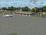
| RAF Wethersfield |

|
Images related to this file:
File Description:

Used by USAAF Bostons and RAF Stirlings during World War Two, Wethersfield became home to the 20th FBW in 1952, flying the F-84, and then the F-100, up until 1970. It was used for operational exercises by CONUS-based Air National Guard units up until 1993, by which time the base was handed back to the MoD. The runways and maintenance buildings are still useable. Thanks to Tony Dalton for the use of his radio masts. Made with ADE9X. Needs additional scenery libraries, listed in the readme.
| Filename: | RAF_Wethersfield.zip |
| License: | Freeware, limited distribution |
| Added: | 22nd July 2013, 23:47:23 |
| Downloads: | 641 |
| Author: | Brian Clarke |
| Size: | 3.58 MB |
| Category: Flight Simulator 2004 - Scenery | |
| Sabie Airfield - Sabie, South Africa |
|
Images related to this file:
File Description:
A Gmax representation of Sabie Airfield, Sabie, Mpumalanga, South Africa with photoreal textures. There is also a new Landclass file included to add the town of Sabie to your flightsim world. Sabie airfield is a small airfield with a grass runway measuring just over 700m. The airfield is situated on top of a hill with a sloping runway (Rwy 10/28). This package will add the sloping runway to the best of my abilities considering the serious limitation in FS9 with regards to runways on un-even surfaces.
| Filename: | Sabie_Airfield__Sabie_South_Africa.zip |
| License: | Freeware, limited distribution |
| Added: | 28th June 2014, 05:28:19 |
| Downloads: | 391 |
| Author: | Kobus van Wyk / Aeroworx |
| Size: | 2.71 MB |
| Category: Flight Simulator 2004 - Scenery | |
| Dhulia Airport, India |
|
Images related to this file:
File Description:
its always interesting and enjoyable to taxi an aircraft thru tight areas,and especially when a taxiway is
surrounded by trees like Eucalyptus,capable of attaining a height that can range anywhere between 6fts to 300fts! after a short evening
flight from Mumbai you've just landed at small airport at Dhulia(India) and vacated the runway, AND you've just spotted a
hanger, good! that's were you want to be, but hey! it's already occupied. now what?.Well..good news! there is another hanger,
but were? can't even see were taxiway is leading to because of dense trees. Can you find the Hanger? surely you don't
want to leave your cessna under open sky for whole night long or do you?
| Filename: | Dhulia_Airport_India.zip |
| License: | Freeware, limited distribution |
| Added: | 10th May 2011, 03:56:06 |
| Downloads: | 526 |
| Author: | Ashish Singh |
| Size: | 17.93 MB |
| Category: Flight Simulator 2004 - Scenery | |
| Québec Short Hops - Île-aux-Coudres |
|
File Description:
Ile-aux_Coudres is a lovely island situated in the St.Lawrence River some 40nm downstream from Québec City. It has lots of candies and reproduction of historical buildings and landmarks. I think it has an exclusive first in FS, the runway is lit with kerosene pots for night flying as it was years ago. With these sceneries, ideal for the VFR pilot. you will be able to hop form one field to the other following the lighthouses' beacons and other aids.
| Filename: | Qubec_Short_Hops___leauxCoudres.zip |
| License: | Freeware |
| Added: | 5th November 2003, 20:03:41 |
| Downloads: | 2,290 |
| Author: | Léon Louis |
| Size: | 5.33 MB |
| Category: Flight Simulator 2004 - Scenery | |
| JRM Bahamas EZ Scenery #1 Highly detailed |
|
File Description:
FS9 Scenery - JRM Bahamas EZ Scenery #1 JRM_Bhm1.zip
This scenery utilizes FS Global Terrain Mesh and
all objects are available by download linked inside. Payware expected detail in which you can even motorcar on sightseeing trips
stopping and watching all the eye candy. Covers Eleutheria &
Cat Islands plus ship and boat traffic in open waters.
Watch for campers. Packed with hidden detail even for the smaller islands. FS9 & FS10
only. My best yet and more to come!
jimmy R martin
[email protected]
| Filename: | JRM_Bahamas_EZ_Scenery_1__Highly_detailed.zip |
| License: | Freeware |
| Added: | 21st March 2006, 01:39:30 |
| Downloads: | 3,245 |
| Author: | jimmy R martin |
| Size: | 1.15 MB |
| Category: Flight Simulator 2004 - Scenery | |
| Faroe Islands Mesh and Scenery v2 |
|
File Description:
Version 2 of our mesh scenery based on the free data made available by Jonathan de Ferranti on his site www.viewfinderpanoramas.org/dem3.html. The mesh is now compiled from new 1 arcsecond data to LOD 10 and several terrain features have been added as have many ports, towns and helipads (AFCAD-files included). The beautiful Faroese landscape with fjords and valleys looking dull in the FS default, is displayed in all its splendour. Please study the Read Me for correct installation.
| Filename: | Faroe_Islands_Mesh_and_Scenery_v2.zip |
| License: | Freeware |
| Added: | 21st May 2006, 19:32:40 |
| Downloads: | 2,460 |
| Author: | Ryan Andersen and Peter H. Poulsen |
| Size: | 1.57 MB |
| Category: Flight Simulator 2004 - Scenery | |
| Maroc_sc_Supplement |
|
File Description:
These files are for anyone who has installed Toni Agramont's scenery files for Morocco (maroc_sc.zip - available from a number of FS sites on-line: a web search will easily locate them) and wants to remove the static aircraft from the airport sceneries. A large number of these planes are unpainted, so appear as white 'ghosts', and also can end up being superimposed upon dynamic FS9/Ultimate Traffic etc. AI traffic at a number of locations. A few other small alterations ...
| Filename: | Maroc_sc_Supplement.zip |
| License: | Freeware |
| Added: | 6th November 2009, 08:36:21 |
| Downloads: | 6,393 |
| Author: | Martin Stebbing |
| Size: | 963.19 KB |
| Category: Flight Simulator 2004 - Scenery | |
| DGSI Kumasi, Ghana |
|
Images related to this file:
File Description:
Googly scenery for Kumasi - a small domestic airport in Ghana for which no facilities
are provided in Flight Simulator 2004. These scenery files add taxiways, aprons,
buildings and other airport features, so that you and your "AI" traffic can land,
taxi, park and take off in a realistic manner.
The airport serves the city of Kumasi (capital of the Ashanti region) and sees
regular flights using turboprop airliners operated by Accra based operators
Antrak Air and Citylink.
The scenery does not purport to be ultra-accurate. Based on high-detail satellite
imagery from Google Earth, the layout is proportionally correct but the added
airport features, such as buildings, are built from default Microsoft objects
and add-on libraries so will not look like the real thing.
[File re-uploaded at request of AVSIM]
| Filename: | DGSI_Kumasi_Ghana.zip |
| License: | Freeware |
| Added: | 23rd May 2010, 01:25:23 |
| Downloads: | 1,419 |
| Author: | John Hinson |
| Size: | 80.3 KB |
| Category: Flight Simulator 2004 - Scenery | |
| Chile Pack1 Soaring Scenery |
|
File Description:
FS2002/2004 Chile Pack1 Soaring Scenery
This file add some thermals to default Microsoft scenery for Chile Region:
1.Santiago de Chile City - Lo Castillo Airp.(ICAO-SCLC);
2.Valparaiso City - Quintero Airp.(ICAO-SCER);
3.Arica City - Chacalluta Airp.(ACAO-SCAR);
4.Iquique City - Diego Aracena Airp.(ICAO-SCDA);
5.Antofagasta City - La Chimba Airp.(ICAO-SCMB);
6.Copiapo City - Chamonate Airp.(ICAO-SCHA);
7.Las Tacas City near Coquimbo/La Serena Cities- Las Tacas Airp.(ICAO-SCQT);
8.Linares City near Talca - Linares Airp.(ICAO-SCLN);
9.Concepcion City - Carriel Sur Airp.(ICAO-SCIE);
10.Osorno City - Pampa Alegre Airp.(ICAO-SCOS);
11.Puerto Montt City - El Mirador Airp.(ICAO-SCPV);
12.Moquegua City - Moquegua Airp(ICAO-SPEQ).
It is freeware.
Good Flights and better landings
By Francisco Vargas.
E-mail:[email protected]
| Filename: | Chile_Pack1_Soaring_Scenery.zip |
| License: | Freeware |
| Added: | 11th November 2005, 06:27:57 |
| Downloads: | 1,261 |
| Author: | Francisco Augusto Vargas Carneiro |
| Size: | 268.08 KB |
| Category: Flight Simulator 2004 - Scenery | |
| Whitefish 58S in Montana US |
|
Images related to this file:
File Description:
I have made this because I downloaded and tried the Glacier Park scenery by Blue Sky Scenery and then discovered that the runway for Whitefish was wrongly aligned and headed off across the adjacent railroad tracks. This would be inconvenient if you had to wait for a train to pass before landing so I fixed that and added a couple of buildings. That's it, nothing more complicated than that. If I find some more airfields in this area with similar problems then I'll do more of the same. Whitefish is 3 or so miles north of Glacier Park International at 3,066 feet ASL and around 35 miles south of the Canadian border. There are no large towns close by; the nearest would be Missoula, which is 90 miles further south.
| Filename: | Whitefish_58S_in_Montana_US.zip |
| License: | Freeware, limited distribution |
| Added: | 23rd May 2010, 02:05:52 |
| Downloads: | 194 |
| Author: | Roger Wensley |
| Size: | 826.52 KB |
© 2001-2026 AVSIM Online
All Rights Reserved
Privacy Policy |