
Where Flight Simulation Enthusiasts Gather from Around the World!
AVSIM Library - Search Results

| Category: Flight Simulator 2004 - Scenery | |
| Old Rhinebeck Aerodrome |

|
File Description:
Old Rhinebeck, the living museum of antique aviation, located at NY94 in Rhinebeck NY. Included are all the buildings and hangars at the field. Photoreal ground textures for the Rock City area surrounding ORA. All lakes streams, and rivers were hand edited for accuracy. Hand placed autogen and trees to match the ground textures. Special effects that make crowds of people appear during show times, and a few easter eggs as well. Mesh compliled from clean 1 arc sec SRTM data. Afcad is AI ready for your flightplans. All Gmax 3d models, and optimized textures for smooth performance.
happy flyin.
| Filename: | Old_Rhinebeck_Aerodrome.zip |
| License: | Freeware, limited distribution |
| Added: | 4th December 2005, 03:32:41 |
| Downloads: | 4,624 |
| Author: | Joe Binka |
| Size: | 38.57 MB |
| Category: Flight Simulator 2004 - Scenery | |
| Inchon Intl Airport (RKSI) 'The Winged City' v1.0 |
|
File Description:
FS2002/2004 Inchon Intl Airport scenery "the Winged City" v1.0 is the most realistic freeware scenery of Inchon Intl Airport (RKSI) in Korea. RKSI is the largest airport in Korea and ranked sixth airport in handling cargo(2002). Also it is the first airport in Asia to earn the rating of the ILS CAT III-b operation.(Sep, 03) In my scenery there are... * Two runways (15R/33L, 15L, 33R) and VOR, ILS * Passenger Terminal and Cargo and Maintenance ramp, Taxiway * Control tower and 44 gates with boarding bridge * Shoreline of Yeongjong Island, Yongyu Island and around Islands and SRTM 3 arc-sec mesh scenery data around the airport.
| Filename: | Inchon_Intl_Airport_RKSI_The_Winged_City_v10.zip |
| License: | Freeware |
| Added: | 22nd February 2004, 21:31:29 |
| Downloads: | 91,355 |
| Author: | Yunjin Lee |
| Size: | 14.73 MB |
| Category: Flight Simulator 2004 - Scenery | |
| Freeflow Bahamas |
|
File Description:
FREEflow Bahamas is a FREE scenery addon for Microsoft Flight Simulator: ACOF which will transform the Bahamas.
Features include:
* Land class scenery which accurately reflects vegetation and population of the Bahamas.
* Water class scenery which properly reflects vibrant tropical reefs of the Bahamas.
* Completely new ocean coasts, bays, and ponds accurately placed using SRTM v2 Water body data.
* Many new airports and custom AFCADs.
* Accurately placed, custom GMax models for many landmarks in the Bahamas.
* All major roads, highways and bridges.
* A configuration utility to tailor this scenery to your system and personal preferences.
Please visit http://www.fs-freeflow.com for more information and expansions to this scenery.
| Filename: | Freeflow_Bahamas.zip |
| License: | Freeware, limited distribution |
| Added: | 8th December 2006, 05:01:23 |
| Downloads: | 5,332 |
| Author: | Scott Gridley, Bob Brown, Joe Watson, Harry Gordon, Jim Campisi, Toni Hiltunen |
| Size: | 12.9 MB |
| Category: Flight Simulator 2004 - Scenery | |
| South West Islands, Japan and Taiwan Ver.3.0 |
|
Images related to this file:
File Description:
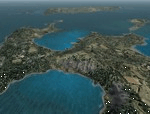
FS2004 Scenery SWIJT2004 Ver 3.0 (South West Islands, Japan and Taiwan)
These files improve specific scenerys (South West Islands of Japan and Taiwan, Asia) of FS2004. Included islands: Ohsumi Islands, Tokara Islands, Amami Islands, Okinawa lands, Kerama-Kume Islands, Miyako Islands, Yaeyama Islands and Taiwan Island.
In this scenery design, the coastline was reproduced as exactly as possible, following the specification of FS2004. Moreover, 90m mesh geographical data is reproduced by
using SRTM 3arc/sec. Correction of missing holes is perfect.
==NOTAM== I exhibited "SWIJ2k4.zip" on August 26, 2004.
However, it became clear that some of files of "SWIJ2k4" are infringing on the opyright of Microsoft. Then, I stopped public presentation of "SWIJ2k4". I apologize for having
made you trouble to those who already downloaded "SWIJ2k4.zip". New "SWIJT2k4.zip" is vast scenery which covered South West Islands, Japan and Taiwan Island. Please install new "SWIJT2k4".
By Kazuo Kawamura
| Filename: | South_West_Islands_Japan_and_Taiwan_Ver30.zip |
| License: | Freeware, limited distribution |
| Added: | 4th December 2011, 00:05:05 |
| Downloads: | 7,752 |
| Author: | Kazuo Kawamura |
| Size: | 20.5 MB |
| Category: Flight Simulator 2004 - Scenery | |
| Tokyo Bay 2005 |
|
Images related to this file:
File Description:
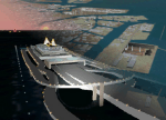
FS2004 Scenery Tokyo Bay Scenery 2005 Ver. 5.0
This add-on scenery improves specific scenerys (Tokyo Bay, Japan) of FS2004.
There are a lot of reclaimed land in Tokyo Bay.
They form an artificial peculiar coastline. This scenery reproduces these coastlines precisely.
And, this scenery reproduces the Keihin industrial area and the Keiyo industrial area in Tokyo Bay located west and east. In this scenery design, the coastline was reproduced as exactly as possible, following the specification of FS2004.
Moreover, 90m mesh geographical data is reproduced by using SRTM 3arc/sec.
The range of detailed coastline and 90m digital elevation data is as follows:
** [detailed coastline] N33:45 E138:45 to N36:55 E141:05 (included Izu Islands)
** [90m digital elevation data] N33:00 E138:00 to N37:00 E141:00 --
The Tokyo Wan AquaLine is arranged in the exact location. By Kazuo Kawamura
| Filename: | Tokyo_Bay_2005.zip |
| License: | Freeware, limited distribution |
| Added: | 3rd December 2011, 23:51:31 |
| Downloads: | 11,801 |
| Author: | Kazuo Kawamura |
| Size: | 9.74 MB |
| Category: Flight Simulator 2004 - Scenery | |
| The Victoria Falls of the Zambezi River, Zambia/Zimbabwe |
|
File Description:
One of the main landmarks of Africa, the spectacular Victoria Falls of the Zambezi River are missing in out-of-the-box FS. With a local SRTM LOD9 mesh as a base (included) and the help of satellite imagery, maps, Ground2K4, and GMax, we did our best to model a realistic representation of the falls, the river, and the gorge, complete with custom waterfall and spray effects. The portion of the Zambezi covered in this project extends from E25 to E26.5 (more than 100km), with the falls at its center. Also included is a replacement landclass file for an area of about 20km on either side of the Zambezi River and an optional AI boat (by Lynn and Bill Lyons) cruising on the Zambezi above the falls. Tested with FS2004 only but most scenery enhancements (not the AI boat) should work just as well in FS2002.
| Filename: | The_Victoria_Falls_of_the_Zambezi_River_ZambiaZimb.zip |
| License: | Freeware, limited distribution |
| Added: | 8th May 2004, 02:45:30 |
| Downloads: | 19,151 |
| Author: | Holger Sandmann and Johan van Wyk, Aeroworx |
| Size: | 3.5 MB |
| Category: Flight Simulator 2004 - Scenery | |
| High-resolution 76-m (LOD9) Terrain Mesh and Scenery Enhancements for the Southern Canadian Rockies |
|
File Description:
Not simply an add-on mesh, these files include many scenery enhancements for the southern Rockies of British Columbia and Alberta. Coverage extends from Cranbrook to Calgary, and Hinton to Edmonton (N48.9-53.4 W112.3-116.3). The mesh source data are 3-arcsec (~90-m) Shuttle Radar (SRTM) files, compiled at LOD9 (76-m) resolution. All lake elevations (!) have been adjusted to eliminate the problems with the default lake data and to better fit the new terrain mesh. In addition, the Transcanada Highway/Icefields Parkway corridor in Banff National Park, from Canmore to the Hwy 11 junction, has been completely re-made, with dozens of alpine lakes (including Lake Louise, Moraine Lake, and Lake O'Hara), accurate transportation network, and landclass/waterclass updates based on satellite imagery. Due to significant changes in FS2004 to vector layering and autogen features, the special scenery enhancements cannot be used with FS2002. However, terrain mesh, lake corrections and landclass replacements will work well in FS2002.
| Filename: | Highresolution_76m_LOD9_Terrain_Mesh_and_Scenery_E.zip |
| License: | Freeware, limited distribution |
| Added: | 29th October 2003, 03:01:22 |
| Downloads: | 15,468 |
| Author: | Holger Sandmann |
| Size: | 21.81 MB |
| Category: Flight Simulator 2004 - Scenery | |
| Fascene Airport - Nosy Be Island, Madagascar |
|
Images related to this file:
File Description:

In Italy the poltical situation is very caotic! what is better of an exotic place for a time of relax? :-) With this scenery, I wanted to recreate as much as possible the area of the airport "Fascene" located in Nosy Be Island in Madagascar. To do it, i used the srtm mesh Madagsacar by Mr Jean laurent gabriel that you will find already in the scenery. If you have already installed these meshes need to remove them. The scenery, faithfully recreates the terminal, and therefore there is a generic airport using the Bgl Mr. Visan. for the rest, using the real video and real photo, I tried to recreate the atmosphere of the island, which is certainly very exciting to work with a landing jetliner. If so you're tired of the usual ILS landing in mega hub of Europe, a nice Visual land in Nosy Be, is for you!
Best regards from Italy by Fabio "Fafo Air" Ferrari
| Filename: | Fascene_Airport__Nosy_Be_Island_Madagascar.zip |
| License: | Freeware |
| Added: | 26th February 2013, 06:49:34 |
| Downloads: | 1,643 |
| Author: | Fabio Ferrari |
| Size: | 40.42 MB |
| Category: Flight Simulator 2004 - Scenery | |
| RAF Woodvale, EGOW |
|
File Description:
Back in January 2001 Danny Rowland of the AI Scenery Club released a freeware scenery of RAF Woodvale for use in FS2000. The files included in this zip will enable users to install this fine piece of scenery within FS2004 with all facilties working for AI traffic to inhabit RAF Woodvale.
This zip includes; AF2 file for Woodvale, fully tested flightplans, amended FS2004 default bgl file to prevent AI Traffic floating above ground level, especially for for users of Eddie Denney's freeware UK SRTM Mesh Scenery, I have not tested the scenery with the FS2004 default terrain mesh which I don't use.
Also included are screenshots of RAF UAS Bulldog aircraft "thrashing" the circuit at Woodvale, and full instructions of how to set this up for yourself, with locations of freeware aircraft and zip file names for you to download to achieve this.
Thanks once more to Danny Rowland for his Woodvale scenery, which incidentally does not show it's age when used in FS2004.
| Filename: | RAF_Woodvale_EGOW.zip |
| License: | Freeware, limited distribution |
| Added: | 11th March 2004, 20:45:52 |
| Downloads: | 1,426 |
| Author: | Bill Hughes |
| Size: | 202.42 KB |
| Category: Flight Simulator 2004 - Scenery | |
| LFRD2004 Dinard/St-Malo VFR Scenery |
|
Images related to this file:
File Description:
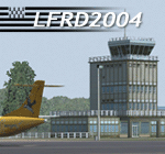
LFRD is a regional airport in Brittany, France. This scenery was created entirely with GMax and the latest Microsoft compilers. Everything was made to ensure maximum framerate while giving maximum visual impact, even on humbler machines. This scenery will run just as fast as the default one (which is very bare) with your current settings, even though there are literally thousands of houses, buildings, trees and a detailed airport.
This is a complete package:
-SRTM local mesh with custom coast trimming
-Custom phototexture (200sq km), with seamless blending into FS9 standard landclass
-Full autogen with custom local texture
-Custom landclass and waterclass
-AFCAD2 file with parking codes
-Custom Hi-res photographic textures at airport.
-Gmax buildings and xml librairy objects.
It was made by a real life pilot and is totally aimed at recreating the feeling of being there, not so much on the ground (after all, this is a FLIGHT simulator), but at circuit altitudes. This is not about recreating an airport in all its glorious details at the cost of framerate, but instead an exercise in balancing visual cues and details as viewed from up there to make it 'as real as it gets' within the limits of FS9. Scenery made by Vauchez (http://mapage.noos.fr/euro_vauchez/)
| Filename: | LFRD2004_DinardStMalo_VFR_Scenery.zip |
| License: | Freeware, limited distribution |
| Added: | 28th April 2010, 18:06:05 |
| Downloads: | 46,567 |
| Author: | Etienne Vauchez |
| Size: | 10.55 MB |


© 2001-2026 AVSIM Online
All Rights Reserved
Privacy Policy |