
Where Flight Simulation Enthusiasts Gather from Around the World!
AVSIM Library - Search Results

| Category: Flight Simulator 2004 - Scenery | |
| Turkey Mesh, Part 5 of 5 |

|
File Description:
Created from 3 arc second data and re-sampled @LOD9 (best fit for this data). The created area extends from N35E025 (lower left corner) to N44E047 (upper right corner). You need all the five bgl-files plus the two correction files to cover the whole area. Otherwise you will have only a coverage of the corresponding file. Matthew Style's SRTM_3ARCSEC_TO_BGL program was used to interpolate the srtm data and automate the bgl file creation (Many Thanks to Matthew for his great utility).
| Filename: | Turkey_Mesh_Part_5_of_5.zip |
| License: | Freeware |
| Added: | 15th February 2010, 09:38:45 |
| Downloads: | 9,405 |
| Author: | Abdulkadir Ozturk |
| Size: | 27.58 MB |
| Category: Flight Simulator 2004 - Scenery | |
| Turkey Mesh, Part 1 of 5 |
|
File Description:
Created from 3 arc second data and re-sampled @LOD9 (best fit for this data). The created area extends from N35E025 (lower left corner) to N44E047 (upper right corner). You need all the five bgl-files plus the two correction files to cover the whole area. Otherwise you will have only a coverage of the corresponding file. Matthew Style's SRTM_3ARCSEC_TO_BGL program was used to interpolate the srtm data and automate the bgl file creation (Many Thanks to Matthew for his great utility).
| Filename: | Turkey_Mesh_Part_1_of_5.zip |
| License: | Freeware |
| Added: | 15th February 2010, 09:30:31 |
| Downloads: | 12,003 |
| Author: | Abdulkadir Ozturk |
| Size: | 31.29 MB |
| Category: Flight Simulator 2004 - Scenery | |
| Time Zone Scenery ver. 1.0 (April 2022) |
|
Images related to this file:
File Description:
Time Zone Scenery is meant to completely replace the default time zone definitions as well as those coming from Dennis Thomson TZ3-TZ4.
Product characteristics:
-Each single squared mile of the earth surface is covered
-All standard time zones are correctly defined
-All non-standard time zones included: those with fraction-of-an-hour difference w.r.t UTC (eg. Iran, Afghanistan, India, Nepal, Myanmar, portions of Australia...)
-All Islands in the Pacific Ocean properly covered, including those in the +13, +14 hours regions or the few cases with fractional hours offset.
-Regions following DST are thoroughly modelled (requires FS Real Time)
-The scenery is updated to the world status as of April 2022
-The scenery is intended for FS9, but should also work on FSX and P3D
| Filename: | Time_Zone_Scenery_ver_10_April_2022.zip |
| License: | Freeware, limited distribution |
| Added: | 12th April 2022, 04:09:21 |
| Downloads: | 217 |
| Author: | Antonio Arreghini |
| Size: | 1.39 MB |
| Category: Flight Simulator 2004 - Scenery | |
| Alps LOD10 Topo Mesh - Austria and Italy |
|
Images related to this file:
File Description:
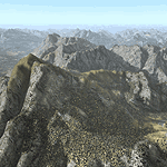
Yet another terrain mesh package of the European Alps? Well, this one is different in that it is NOT primarily based on the Shuttle Radar (SRTM) data with their incomplete coverage of prominent peaks and ridges. Instead, most of the source data for this project were developed over many months by Jonathan de Ferranti using detailed topographic maps. While Jonathan's work is unrelated to flight simulation he kindly gave me permission to compile his data for use in FS. The result is a wonderful improvement in detail and accuracy over any existing SRTM- or DTED-based mesh file, freeware or commercial (a link to an extensive set of screenshot comparisons is included in the read-me file).
I've compiled the source data at LOD10 (38-m) grid resolution because the coverage area is smaller than most existing mesh files. Thus, anyone can use these files without having to first uninstall their current mesh set. Also included are LOD9 and LO8 buffer mesh files. Note: if you own Austria Professional 2004 with its 1:50,000 scale terrain mesh then you don't need this package!
| Filename: | Alps_LOD10_Topo_Mesh__Austria_and_Italy.zip |
| License: | Freeware, limited distribution |
| Added: | 30th May 2010, 09:46:58 |
| Downloads: | 62,978 |
| Author: | Holger Sandmann, Jonathan de Ferranti |
| Size: | 73.32 MB |
| Category: Flight Simulator 2004 - Scenery | |
| Alps LOD10 Topo Mesh - Switzerland and France |
|
Images related to this file:
File Description:
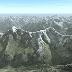
Yet another terrain mesh package of the European Alps? Well, this one is different in that it is NOT primarily based on the Shuttle Radar (SRTM) data with their incomplete coverage of prominent peaks and ridges. Instead, most of the source data for this project were developed over many months by Jonathan de Ferranti using detailed topographic maps. While Jonathan's work is unrelated to flight simulation he kindly gave me permission to compile his data for use in FS. The result is a wonderful improvement in detail and accuracy over any existing SRTM- or DTED-based mesh file, freeware or commercial (a link to an extensive set of screenshot comparisons is included in the read-me file).
I've compiled the source data at LOD10 (38-m) grid resolution because the coverage area is smaller than most existing mesh files. Thus, anyone can use these files without having to first uninstall their current mesh set. Also included are LOD9 and LO8 buffer mesh files. Note: if you own Switzerland Professional with its high-resolution terrain mesh then you don't need this package, at least not the Switzerland files!
| Filename: | Alps_LOD10_Topo_Mesh__Switzerland_and_France.zip |
| License: | Freeware, limited distribution |
| Added: | 30th May 2010, 09:51:03 |
| Downloads: | 59,020 |
| Author: | Holger Sandmann, Jonathan de Ferranti |
| Size: | 50.03 MB |
| Category: Flight Simulator 2004 - Scenery | |
| South Africa (Johannesburg(Transvaal)/Swasiland/Lesotho/Orange Freestate- 76M SRTM TERRAIN MESH) Part 2 |
|
File Description:
This mesh of South Africa includes beautiful areas of Transvaal(Johannesburg), Swasiland, Orange Freestate and Lesotho.It comes in 3 files. Part 2 of 3.
All the 3 files cover the area from S25 E26(!) to S30 E31.
| Filename: | South_Africa_JohannesburgTransvaalSwasilandLesotho.zip |
| License: | Freeware, limited distribution |
| Added: | 24th April 2004, 02:25:21 |
| Downloads: | 4,209 |
| Author: | Michael Speck |
| Size: | 15.87 MB |
| Category: Flight Simulator 2004 - Scenery | |
| South Africa (Johannesburg(Transvaal)/Swasiland/Lesotho/Orange Freestate- 76M SRTM TERRAIN MESH) Part 1 |
|
File Description:
This mesh of South Africa includes beautiful areas of Transvaal(Johannesburg), Swasiland, Orange Freestate and Lesotho.It comes in 3 files. Part 1 of 3.
All the 3 files cover the area from S25 E31 to S30 E31.
| Filename: | South_Africa_JohannesburgTransvaalSwasilandLesotho.zip |
| License: | Freeware, limited distribution |
| Added: | 24th April 2004, 02:06:43 |
| Downloads: | 5,026 |
| Author: | Michael Speck |
| Size: | 4.84 MB |
| Category: Flight Simulator 2004 - Scenery | |
| Scenery Fuerstenfeldbruck - Airbase ETSF (Germany) Vers. 2 |
|
File Description:
This is the second version of the also by general aviation used Airbase ETSF "Fürsty" in southern Germany.
This new version includes:
» completely new designed hangars, some of them with controllable hangardoors.
» a new controll-tower.
» the buildings of the official school for the German Air Force.
» interactive air-marshallers.
» an improved airport-layout.
» the radio-tower of Schoengeising as a landmark for VFR-Flights.
» an exact landclassfile for the surroundings of the airbase.
It also includes some GA-AI-Traffic.
Compatible with MyWorld2004-Landclass and Werner Vogts "SRTM scenery mesh".
| Filename: | Scenery_Fuerstenfeldbruck__Airbase_ETSF_Germany_Ve.zip |
| License: | Freeware, limited distribution |
| Added: | 11th June 2004, 19:54:39 |
| Downloads: | 7,686 |
| Author: | Johannes Oelmaier |
| Size: | 2.53 MB |
| Category: Flight Simulator 2004 - Scenery | |
| Reservoirs and Lakes of Lesotho and Western Natal, South Africa |
|
File Description:
Replacement files for water bodies of eastern South Africa, in and near the Drakensberg Range (S28.1-29.5 E28.3-30.0). Natural and man-made lakes are now in their accurate position and elevation. Includes the Katse Dam reservoir in Lesotho as well as about 100 smaller lakes in Lesotho and western Natal not present in the FS default scenery. Based on a watermask derived from Landsat 7 ETM+ satellite data and compiled with a beta version of Jim Keir's "Slartibartfast" utility. Meant to be used with the Aeroworx SRTM LOD9 South Africa mesh.
| Filename: | Reservoirs_and_Lakes_of_Lesotho_and_Western_Natal_.zip |
| License: | Freeware, limited distribution |
| Added: | 8th May 2004, 02:43:38 |
| Downloads: | 6,207 |
| Author: | Holger Sandmann, Aeroworx |
| Size: | 464.27 KB |
| Category: Flight Simulator 2004 - Scenery | |
| Scenery Enhancements for the Innsbruck (LOWI), Austria |
|
File Description:
New roads, railroads, streams, river, landclass, and waterclass for the Innsbruck area, Austrian Alps. Based on 30-m and 10-m satellite imagery. Not a finished product but rather a "Sunday afternoon" project :-) to illustrate the visual improvements that can be achieved with a few hours of time commitment and the help of the wonderful Ground2K4 by Christian Fumey. The scenery looks best with one of the SRTM-based add-on meshes. I have included my Ground2K4 source code so that interested users can improve on and expand the project area (requires a separate download of my pre-processed satellite imagery).
| Filename: | Scenery_Enhancements_for_the_Innsbruck_LOWI_Austri.zip |
| License: | Freeware, limited distribution |
| Added: | 1st March 2004, 14:17:27 |
| Downloads: | 21,782 |
| Author: | Holger Sandmann |
| Size: | 1.3 MB |


© 2001-2026 AVSIM Online
All Rights Reserved
Privacy Policy |