
Where Flight Simulation Enthusiasts Gather from Around the World!
AVSIM Library - Search Results

| Category: Flight Simulator 2004 - Scenery | |
| FALL - Lydenburg Airfield, South Africa |

|
Images related to this file:
File Description:
A Gmax representation of Lydenburg Airfield (FALL), Lydenburg, Mpumalanga, South Africa with photoreal textures and seasonal ground textures. There is also a new Landclass file included to add the town of Lydenburg to the East of the airfield and the township of Mashishing directly to the North of the airfield which you pass over on final approach to runway 22. Extra "hand-placed" autogen buildings were also added to make this approach a bit more "realistic".
Lydenburg airfield is a small airfield with two grass runways and only 6 hangars. The airfield is shared with the model-aircraft pilots who has their own area and two smaller runways.
| Filename: | FALL__Lydenburg_Airfield_South_Africa.zip |
| License: | Freeware, limited distribution |
| Added: | 9th May 2014, 10:07:30 |
| Downloads: | 449 |
| Author: | Kobus van Wyk, Aeroworx |
| Size: | 2.43 MB |
| Category: Flight Simulator 2004 - Scenery | |
| Whati CEM3 in the Northwest Territories, Canada |
|
Images related to this file:
File Description:
Whati is a village at the southern end of Lac La Martre, a smaller lake (only by Canadian standards, at over 40 miles long) halfway between the Great Slave Lake and the Great Bear Lake and around 100 miles north of Yellowknife. The North West Company established a trading post there in 1793, and this was the centre for local trading in the area for 100 years until a post was opened by the Hudson Bay Company on the Great Slave Lake. The current population is in the region of 520. There is no graded road access and access is by boat or air. The main local economy revolves around hunting and fishing, with efforts being made to increase tourism amid the wilderness and the wildlife. The airfield is just over a mile east of the village, with a runway of around 3,400 feet of gravel aligned 09-27 as of 2010, with PAPI at both ends and lit. There are scheduled flights from Yellowknife by Air Tindi, included in the AI, and some GA. The terminal building is similar to that of Lutselk'e, but with a different colour scheme and with solar panels on the roof. It appears that they repaint the sign on the front of the building with a different wording every time; the one I have used is one of three that have existed in the last few years. The photos I had originally were taken in the winter, with snow. Seeing it in the summer I discovered that my version of the building is not at the right level above the ground by about a foot, or 30cm. I was too lazy to make it again, which was the only way to get it right and still have it throw a shadow on the ground. This scenery modifies the lake shore, corrects levels for land and lake, and adds the village and a connecting road in addition to the airport. A note here about my scenery making. There will not be many more to follow this as I am almost at the end of the photos I either took or found for scenery purposes, plus I expect to move on from FS9 at some point during next year.
| Filename: | Whati_CEM3_in_the_Northwest_Territories_Canada.zip |
| License: | Freeware, limited distribution |
| Added: | 15th December 2019, 19:18:29 |
| Downloads: | 148 |
| Author: | Roger Wensley |
| Size: | 4.25 MB |
| Category: Flight Simulator 2004 - Scenery | |
| Juneau, Alaska |
|
File Description:
A complete redesign of the airport for Juneau, Alaska (JNU, PAJN).
Version 1.0
This is a GPS position accurate layout of the runways (land and water), taxiways and signs, ramp, roads, buildings and nearby navaids.
The buildings are very close to accurate scale with close to accurate color.
There's parking spaces for small, medium and large general aviation aircraft, military cargo aircraft (Coast Guard C-130's and AK-NG aircraft park here), parking at the terminal for 737 and MD80 size aircraft and helicopter landing pads.
Also included is a terrain BGL for the immediate area. This is by far the largest file in the download, but is critical to accurately depict the surrounding terrain (see EORold and EORnew for a comparison).
Many details are yet to be added, but this is a good starting point.
| Filename: | Juneau_Alaska.zip |
| License: | Freeware, limited distribution |
| Added: | 17th August 2006, 13:48:08 |
| Downloads: | 6,030 |
| Author: | Russ Pagenkopf |
| Size: | 2.98 MB |
| Category: Flight Simulator 2004 - Scenery | |
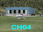
| Landsberg Airbase Updated |
|
Images related to this file:
File Description:
The "AI_Landsberg-Airbase_FS9" package from AVSIM is the SECOND part of this airbase. The package by Klaus Jone installs several AI planes, a Traffic File and an AFCAD. All the AI models are also included. This is a COMPLETE package.
I have included TWO files which create a more exact airbase polygon for ETSA Landsberg. Just compare the screenshots...BEFORE and AFTER the installation of my two VTP files...
The alteration is obvious immediately when you switch to TOP-DOWN view of the airbase. Or go for a flight round the area.
I designed these two files for my own enjoyment of Landsberg. However, it is now my turn to offer something back to all flightsimmers. Little though it may be.
Credit for this ETSA Landsberg Airbase belongs to Klaus Jone and Stefan Deiters. Without a doubt!!
| Filename: | Landsberg_Airbase_Updated.zip |
| License: | Freeware |
| Added: | 14th April 2011, 16:59:11 |
| Downloads: | 800 |
| Author: | Ronald Falzon |
| Size: | 1.63 MB |
| Category: Flight Simulator 2004 - Scenery | |
| Ubon Ratchathani, Thailand (VTUU) |
|
File Description:
This is updated scenery for Ubon Ratchathani airport in Thailand. Ubon was developed during the Vietnam war as an airbase for the USAF. After the war, the Thai Air Force continued to use it as a base, but it also came to be used by commercial airlines to service the Northeastern parts of the country. A new, modern terminal has been built, and international flights are expected in the future. A landclass and AFCAD2 file are included.
| Filename: | Ubon_Ratchathani_Thailand_VTUU.zip |
| License: | Freeware, limited distribution |
| Added: | 18th January 2004, 19:56:33 |
| Downloads: | 5,175 |
| Author: | Martin Strong |
| Size: | 2.84 MB |
| Category: Flight Simulator 2004 - Scenery | |
| Mt Rainier Fishing Strip |
|
File Description:
Mt Rainier Fishing Strip, a nice little fictional 600 foot grass strip leading upto a Lake at the foot of Mt Rainier, WA State, USA.
Has Cabins for weekend stopovers with night textures for those fishing and hunting trips.
Uses custom and default textures. Recommend using Gerrish Trees with this scenery and autogen set at Max for good forest coverage. Includes a Map Image for Destination Ref from Ranger Creek to aid location of the strip.
| Filename: | Mt_Rainier_Fishing_Strip.zip |
| License: | Freeware |
| Added: | 27th October 2003, 17:33:52 |
| Downloads: | 990 |
| Author: | Jeffrey Stanyer |
| Size: | 405.88 KB |
| Category: Flight Simulator 2004 - Scenery | |
| Courtelary Update for Suisse 2004 |
|
Images related to this file:
File Description:
A small update of Courtelary Airfield (LSZJ) to add the new hangar. The old one was damaged by the hurricane Lothar in December 1999. In 2004 the construction of a new hangar begun. 2005 the new hangar is ready. In FS, you will see the 3 different hangars, depending the year : before 2000, the old one, between 2000 and 2004, the old was a little unusable, and from 2005, the new blue one. WORKS FOR FS2002 TOO. Re-upload.
| Filename: | Courtelary_Update_for_Suisse_2004.zip |
| License: | Freeware |
| Added: | 10th June 2010, 09:18:41 |
| Downloads: | 2,318 |
| Author: | Daniel Gauthier |
| Size: | 542.27 KB |
| Category: Flight Simulator 2004 - Scenery | |
| Liverpool Xtreme |
|
Images related to this file:
File Description:
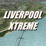
Liverpool John Lennon Airport (UK) is a busy Low fares airline hub for Easyjet and Ryanair, it
also has a large GA area. This scenery captures the airport in all its glory.Includes detailed images of the real Liverpool airport, it has a high resolution 25cm base image, animation, effects, nearly all the buidlings, extremely detailed ground markings, interactive service fleet and stunning night effects.
DEMO VERSION ONLY, functional but has 'demo signs' Full price is GBP14.99
| Filename: | Liverpool_Xtreme.zip |
| License: | Commercial demo |
| Added: | 7th May 2011, 03:47:40 |
| Downloads: | 908 |
| Author: | Gary Summons/UK2000 Scenery |
| Size: | 76.56 MB |
| Category: Flight Simulator 2004 - Scenery | |
| Whakatane Airport, New Zealand. NZWK. V2 UPDATE |
|
File Description:
Welcome to Whakatane, a small regional domestic airport south-east of Tauranga City, on the east coast of the North Island of New Zealand.
This is an UPDATE to my previous Whakatane Airport Scenery, and REQUIRES my previous scenery to be installed FIRST. (available from avsim.com, filename...... whakatane_airport_nzwk.zip ).
This update places a custom terminal building at the airport, and a few other small detail changes.
Requires some EZ Scenery Object Sets (see INSTALL instructions for details).
| Filename: | Whakatane_Airport_New_Zealand_NZWK_V2_UPDATE.zip |
| License: | Freeware, limited distribution |
| Added: | 11th October 2008, 08:50:48 |
| Downloads: | 708 |
| Author: | Lawrie Roache / Godfrey Tier |
| Size: | 1.46 MB |
| Category: Flight Simulator 2004 - Scenery | |
| Little Port Walter for Holger Sandmann's Tongass Fjords scenery |
|
Images related to this file:
File Description:
This is a second fish farm at the southern end of Baranof Island and Chatham Strait in southern Alaska. Big Port Walter is named on the chart of the area, and there is a section of the chart included here. Little Port Walter is a much smaller offshoot bay, sheltered from the weather and ideal for a fish farm. This scenery is designed specifically for use in the Tongass Fjord scenery. I may have incorrectly identified Tongass Fjords as being required for Hawk Logging when Glacier Bay is needed. Ah well, it is one or the other of them. The fish farm (or hatchery, the description varies) has an identifying code so it will show up on a gps as PWL. There is no interaction with atc as there are no designated water runways, so PWL on the gps just acts as a waypoint. There will be further posts for use with Tongass Fjords, Misty Fjords, and Glacier Bay, and I still find these scenery areas by Holger and his crew the most satisfying in FS9.
| Filename: | Little_Port_Walter_for_Holger_Sandmanns_Tongass_Fj.zip |
| License: | Freeware, limited distribution |
| Added: | 23rd November 2014, 01:33:12 |
| Downloads: | 233 |
| Author: | Roger Wensley |
| Size: | 3.38 MB |
© 2001-2026 AVSIM Online
All Rights Reserved
Privacy Policy |