
Where Flight Simulation Enthusiasts Gather from Around the World!
AVSIM Library - Search Results

| Category: Flight Simulator 2004 - Scenery | |
| Wunstorf AB - Germany |

|
Images related to this file:
File Description:
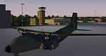
Wunstorf Air Base was originally opened in 1936 for the National Socialist Luftwaffe. Like most German airfields it did arduous duty during the Second World War. When the allies finally concluded their occupation the field was eventually returned to German control and hosted it's first German transport unit flying the Nord Atlas. This aircraft was replaced in 1971 with the current Transall 160 aircraft. With the recent adoption of the Airbus A400M by the Luftwaffe, Wunstorf is undergoing some significant remodeling including lengthening of runway 8-26 as well as construction of two new modern hangars and associated support buildings. This scenery is intended to be used with the great Transall 160 package by Ray Parker (available at Avsim.net as (gaf_c-160_transall.zip) but will of course accomodate any aircraft and is in itself a complete scenery package.
| Filename: | Wunstorf_AB__Germany.zip |
| License: | Freeware, limited distribution |
| Added: | 13th April 2014, 14:08:22 |
| Downloads: | 1,507 |
| Author: | John Stinstrom |
| Size: | 6.58 MB |
| Category: Flight Simulator 2004 - Scenery | |
| Rockcliffe CYRO update in Ontario, Canada |
|
Images related to this file:
File Description:
This is Rockcliffe in late 2011, on the day before the old clubhouse was demolished. It is based on the original scenery by Flight Ontario and follows on from my previous updates, but this is a new version rather than an update and REPLACES the previous versions. The difference is in the bespoke detail: runway and taxiway lighting (the taxiway lighting is limited, as in real life, to taxiway C); signage throughout including runways, taxiways, refuelling, and parking; refuelling tanks and pumps; fence visibility strips; updated ground markings for the Rockcliffe Flying Club apron and the runway; revised apron texture in front of the new hangar; smaller items such as trash cans and external electrical distribution box for heating cables. There are also, from previous updates, the new clubhouse, the new maintenance hangar, and from the original scenery the Museum complex.
| Filename: | Rockcliffe_CYRO_update_in_Ontario_Canada.zip |
| License: | Freeware, limited distribution |
| Added: | 28th February 2012, 13:13:33 |
| Downloads: | 564 |
| Author: | Roger Wensley |
| Size: | 5.01 MB |
| Category: Flight Simulator 2004 - Scenery | |
| EZ Scenery Cass Field (00CO) |
|
File Description:
FS2004 EZ Scenery CASS FIELD (00CO)
Briggsdale Colorado and surrounding parts of Eastern Co are well known for seeds. Seeds of almost any
kind imaginable like flowers, potatoes, bird seed and the list goes on and on. It is most always windy for there are no trees to slow the flow. Hot & windy in summer, cold and windy in winter and no natural enviromnent to harm plant growth. You can see the mountains to the west and more desolation to the east. A lonely place to drive through but rich in good people and seeds harvested for the world.
Area outside of airport's default flatten area require FS Global or Abasus extreme landscapes for elevation data. Download FREE library of RWY12 - EZ scenery objects (available on FlightSim.com or AVSIM) for objects. Ultimate Terrain USA for detailed landclass. FSX compatable.
Instructions inside.
jimmy R martin
| Filename: | EZ_Scenery_Cass_Field_00CO.zip |
| License: | Freeware |
| Added: | 6th June 2006, 01:54:47 |
| Downloads: | 619 |
| Author: | jimmy R martin |
| Size: | 255.55 KB |
| Category: Flight Simulator 2004 - Scenery | |
| Pontiac Airpark CPC7 in Quebec Canada |
|
Images related to this file:
File Description:
Pontiac Airpark is in Quebec on the north bank of the Ottawa River, some 20 miles northwest of Ottawa in Canada. It is a new airfield and in fact is still under construction, though the east-west runway has been in use since late last year. This east-west runway is 3,400 feet long and gravel, though it will later be lighted, and then asphalted. The second runway will be just under 2,000 feet and unlighted gravel, and at its southern end there are docks for float planes. The float base is already in use; CPC7 is the ICAO code for the float base. There are lots for sale, and the idea is to build your house right on the airfield so there is no driving necessary between house and plane, thus leaving more time for what is important. There will be updates as things progress.
| Filename: | Pontiac_Airpark_CPC7_in_Quebec_Canada.zip |
| License: | Freeware, limited distribution |
| Added: | 1st May 2010, 00:33:40 |
| Downloads: | 339 |
| Author: | Roger Wensley |
| Size: | 7.06 MB |
| Category: Flight Simulator 2004 - Scenery | |
| BAe Dunsfold |
|
Images related to this file:
File Description:

Opened as a fighter station for the Royal Canadian Air Force during World War 2, Dunsfold was eventually taken over by Hawker aircraft for developement of the Hunter aircraft. It also provided refurbishment for F-86 Sabres, Sea Hawks and Sea Furies. In 1960, it began developement and testing of the P.1127 - the prototype that led to the Harrier.
It was here that Harrier and Hawk aircraft were finally put together from parts that came from all over the country. Hawk final assembly moved to Warton in 1988, and the final Sea Harrier construction ended in 1998. BAe Systems sold the site in 2002, and it is now well-known as the test track for the BBC TV series Top Gear.
The scenery has been constructed using objects mainly from MAIW sceneries, which will need to be installed in order to gain the full visual experience.
| Filename: | BAe_Dunsfold.zip |
| License: | Freeware, limited distribution |
| Added: | 21st June 2013, 21:26:20 |
| Downloads: | 1,050 |
| Author: | Brian Clarke, Daryl Payne |
| Size: | 1.36 MB |
| Category: Flight Simulator 2004 - Scenery | |
| Omni Aviation School and PhilipinesAirlines Flight Trianning Center AFCAD and Scenery |
|
File Description:
Manny Aquino for the acacia and acacia tree textures
OMNI AVIATION- www.omni-aviation.com
Tonet, Mike B and Pecorino for identifying the trees in front of the omni barracks and for identifying a missing taxiway. :-)
My cousin Spike Acenas for taking pictures of the airport.
Ina Patrimonio for taking some of the PFSGers up in an aerial tour around Clark last Feb 17 2002. :-)
Dennis T. for more OMNI pics.
Capt's: Ina Patrimonio, Joy Roa, Jessica Horne & Rene Mapua.
Installation:
Copy the OMNI folder to your FS2002/scenery/ folder and activate the scenery in FS2002.
Happy flying!
Clark Intl Airport AFCAD with Omni Aviation School and Philipines Airlines Flight Trianning Center.They also use Clark Tower to make Communication when their Aircraft wanna take off and landing. Its Pattern is on Right Hand Side at 700ft and their Parking Ramps are just for Cessna,Piper or Beech Craft!
| Filename: | Omni_Aviation_School_and_PhilipinesAirlines_Flight.zip |
| License: | Freeware |
| Added: | 15th November 2003, 05:28:34 |
| Downloads: | 962 |
| Author: | Peter Binamira(Scenery) and Cadmus Lee( AFCAD ) |
| Size: | 1.14 MB |
| Category: Flight Simulator 2004 - Scenery | |
| Bethel Terminal Building correction |
|
Images related to this file:
File Description:
This is the correct substitute terminal building for Bethel PABE. Somehow, and I cannot now remember how it could possibly have happened, the wrong terminal building was included with the posting of an updated version of Bethel. I wrote at the time that the actual Bethel terminal building could not be made as it was too complicated to be made with the little information that was available. I then modified the Alaska terminal building from a previous scenery at Nome and included it in the Bethel scenery, as shown in the screenshots that were included with the posting of Bethel. But, somehow, the terminal from Barrow was wrongly included in the posting that is currently available. If you have the wrong terminal building (see the "wrong" screenshot) then substitute the attached bgl's for your existing ones and get the "correct" terminal as shown in the pic here.
| Filename: | Bethel_Terminal_Building_correction.zip |
| License: | Freeware, limited distribution |
| Added: | 30th July 2021, 04:29:00 |
| Downloads: | 132 |
| Author: | Roger Wensley |
| Size: | 2.16 MB |
| Category: Flight Simulator 2004 - Scenery | |
| Talkeetna Village AK44 in Alaska, REVISED |
|
Images related to this file:
File Description:
The town of Talkeetna is around 75 miles north of Anchorage in Alaska, on the east shore of the Susitna River where the Susitna, Talkeetna, and Chulitna rivers join. The town is where Don Sheldon started Talkeetna Air Services. His story is told in "Wager With The Wind" by James Greinar and is well worth reading for the descriptions of mountain flying. There are two airfields at Talkeetna, PATK with its long asphalt runway and Talkeetna Village AK44 in the town. This is AK44; measuring the space left for the runway between the river bank in the south and the curve in the road that marks the north end of the field there is just enough space for the 900 feet of runway that is described in the book. The result is a step back in time to 1973, when the second hangar was built. Neither hangar has survived to today.
| Filename: | Talkeetna_Village_AK44_in_Alaska_REVISED.zip |
| License: | Freeware, limited distribution |
| Added: | 18th April 2010, 09:52:26 |
| Downloads: | 869 |
| Author: | Roger Wensley |
| Size: | 3.47 MB |
| Category: Flight Simulator 2004 - Scenery | |
| PGUA - Andersen AFB, Guam (V3) **UPDATE** |
|
Images related to this file:
File Description:

FS2004 scenery for Andersen AFB on the island of Guam. Andersen AFB started life as one of many airfields constructed in 1944 for the final aerial assault on the Japanese islands. Originally designed as a long range bomber base, Andersen has grown in scale to keep pace with the newest U.S. Air Force ships. Andersen remained busy during the Korean and Vietnamese conflicts hosting the 19th Bomb Wing as well as various SAC units for combat, refueling, and logistical/material support. The base is hosted by the 36th Wing and provides support services for all visiting and transient aircraft from numerous allied nations. This scenery contains all-new custom objects for Andersen AFB as well as photo-realistic ground cover for the airfield. MY SINCERE APOLOGIES TO ALL WHO HAVE PREVIOUSLY DOWNLOADED THIS SCENERY. PLEASE DELETE ANY EXISTING INSTALLATION AND REPLACE WITH THIS FINAL VERSION 3.
| Filename: | PGUA__Andersen_AFB_Guam_V3_UPDATE.zip |
| License: | Freeware, limited distribution |
| Added: | 27th April 2013, 22:29:34 |
| Downloads: | 2,309 |
| Author: | John Stinstrom |
| Size: | 2.58 MB |
| Category: Flight Simulator 2004 - Scenery | |
| Tokyo Bay 2005 |
|
Images related to this file:
File Description:
FS2004 Scenery Tokyo Bay Scenery 2005 Ver. 5.0
This add-on scenery improves specific scenerys (Tokyo Bay, Japan) of FS2004.
There are a lot of reclaimed land in Tokyo Bay.
They form an artificial peculiar coastline. This scenery reproduces these coastlines precisely.
And, this scenery reproduces the Keihin industrial area and the Keiyo industrial area in Tokyo Bay located west and east. In this scenery design, the coastline was reproduced as exactly as possible, following the specification of FS2004.
Moreover, 90m mesh geographical data is reproduced by using SRTM 3arc/sec.
The range of detailed coastline and 90m digital elevation data is as follows:
** [detailed coastline] N33:45 E138:45 to N36:55 E141:05 (included Izu Islands)
** [90m digital elevation data] N33:00 E138:00 to N37:00 E141:00 --
The Tokyo Wan AquaLine is arranged in the exact location. By Kazuo Kawamura
| Filename: | Tokyo_Bay_2005.zip |
| License: | Freeware, limited distribution |
| Added: | 3rd December 2011, 23:51:31 |
| Downloads: | 11,790 |
| Author: | Kazuo Kawamura |
| Size: | 9.74 MB |
© 2001-2026 AVSIM Online
All Rights Reserved
Privacy Policy |