
Where Flight Simulation Enthusiasts Gather from Around the World!
AVSIM Library - Search Results

| Category: Flight Simulator 2004 - Scenery | |
| VVCR Cam Ranh Airport, Vietnam - Additional Files |

|
Images related to this file:
File Description:
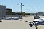
This zip file contains additional files for my original scenery of Cam Ranh Airport, released under the file name VVCRv1.zip. To use these files you should download and install VVCRv1.zip first.
Users of the add-on mesh for Indochina by Rolf Keibel, created for Combat Flight Simulator 2, will find that much of the runway is not visible. The replacement file will cure this problem.
Whichever mesh you use, the long bridge just south of the airport will appear to be broken (it looks like a drawbridge its east end!). This is an error within Microsoft's scenery - a file to correct this is included.
Unfortunately, some of the optional scenery objects referred to in my scenery, which I advised could be downloaded as tl_rwy12.zip have been withdrawn. The necessary scenery items for my scenery are included here.
[File re-uploaded at request of AVSIM]
| Filename: | VVCR_Cam_Ranh_Airport_Vietnam__Additional_Files.zip |
| License: | Freeware |
| Added: | 7th May 2010, 11:00:46 |
| Downloads: | 3,463 |
| Author: | John Hinson & Todd Lucas |
| Size: | 3.19 MB |
| Category: Flight Simulator 2004 - Scenery | |
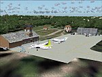
| EDCP Military Airfield Peenemunde (New Version) |
|
Images related to this file:
File Description:
The airfield Peenemunede is the one field of a row of military airfield sceneries of the former NVA. In the scenery are included the airfield and the technical supplies.
The airfield was put into operation in 1961 in duty of the NVA (National People's Army). It accommodated the 9th fighter wing with Mig-21 and MiG-23 aircraft.
New Version News: new seasonal textures, 2 new military bases (Navy, airforce), reworked ground layout, reworked airfield layout, new 3D objects (old powerplant etc.), new night lighting, static MiG-23, reworked isles of Ruden and Oi.
Peenemünde Airfield (IATA: PEF, ICAO: EDCP) is an airfield along the Baltic Sea north of Peenemünde, Germany. Today round trips in light aircraft take place from here and bus tours are also available. Because of its long runway the airfield is also a popular location for flight schools.
| Filename: | EDCP_Military_Airfield_Peenemunde_New_Version.zip |
| License: | Freeware |
| Added: | 4th May 2012, 15:38:21 |
| Downloads: | 1,793 |
| Author: | Volker Loew, Frithjof Koch |
| Size: | 10.77 MB |
| Category: Flight Simulator 2004 - Scenery | |
| PADK - Adak - Aleutians, Alaska - USA |
|
Images related to this file:
File Description:
Adak is near the western end of the Aleutian chain of islands in Alaska. The closed naval air base buildings are mostly still there and once housed over 6,000; the population is now much reduced to around 320, involved in fishing and a fish processing plant, organising caribou hunts for the tourism industry, running the airport, etc. The runways are long and wide (both are over 7,000 feet) and aligned 23-05 (with an ils) and 18-36. There are flights from Anchorage on Thursdays and Sundays by Alaska Airlines (a 737) and occasional charters from Dutch Harbor by Grant Aviation, 445 miles east of Adak. The Ai included here contains these flights. There are revisions included for Dutch Harbor PADU which provide parking for more Grant planes, as Grant are now also running flights to Akun Island, east of Dutch Harbor; more Aleutian posts to follow.
| Filename: | PADK__Adak__Aleutians_Alaska__USA.zip |
| License: | Freeware, limited distribution |
| Added: | 13th January 2015, 23:32:44 |
| Downloads: | 557 |
| Author: | Roger Wensley |
| Size: | 7.59 MB |
| Category: Flight Simulator 2004 - Scenery | |
| BFU Brooks |
|
File Description:
With BFU Brooks, BFU enters the faraway bush country of northern Alaska. Located at Coldfoot in the southern foothills of the Brooks mountains, this base will cater to the needs of visitors to the area, and of sportsmen who indulge in hunting and fishing. This scenery package consists of three sceneries: our new northern base BFU Brooks, Moose Camp and Moose Lodge. The camp sits in the mountains on a small lake, whereas the lodge is situated on the shore of a large lake. Visitors are flown into Coldfoot from Fairbanks, then on to the camp or lodge as desired. Moose Camp and Moose Lodge will not show on the GPS, and of course do not have an NDB or similar to guide you. You'd better start in the camp/lodge, and fly toward Coldfoot to get to know the area. The sceneries have only been tested with the default mesh.
| Filename: | BFU_Brooks.zip |
| License: | Freeware |
| Added: | 30th September 2003, 15:17:31 |
| Downloads: | 5,314 |
| Author: | Naji Chehabeddine |
| Size: | 2.96 MB |
| Category: Flight Simulator 2004 - Scenery | |
| FS9 Fort St John CYXJ in BC Canada |
|
File Description:
Fort St John is close to the border between British Columbia and Alberta, around 40 miles north-northwest of Dawson Creek. The airport was originally a Royal Canadian Air Force base, associated with the wartime construction of the Alaska Highway. The airfield was part of this construction effort and the wartime ferrying of planes to Russia. It is currently named "North Peace Regional Airport", or "North Peace Airport"; apparently there has been no final decision?
The date for this scenery is around 2006. I was given an old video tape cassette which was filmed on an uncertain date, but which had to be before the terminal building was renovated in 2007 and totally changed in appearance. The only way to view the video was to play it in the camera and watch it on a small screen. After I had completed everything except the buildings I started to view the video to establish the building appearances and within an hour or so the camera died. It was so old there was no way to repair it, so I then made some new buildings from memory of the video and what was available online. I also used some that I had already made for other scenery but which were similar. I may replace the terminal building that is in this version with a build of the new one, as I know this one is not a very accurate reproduction. The replacement, if I do it, will be towards the end of this year.
The AI included here is for GA, Air Canada Jazz, and two helicopter companies that were (and still are?) based there. One is at the western end of the apron and the other is at the eastern end but separated from the apron. To gain access to the taxiways and runways (so that all airport users follow the same procedures, for safety reasons) the eastern end helicopters just taxi across the grass. The helicopters are used for maintenance trips to the oil and gas fields in the surrounding area. My screenshots show Westjet at the terminal; this is because I have later Canadian AI installed, while the AI included here is only for the time around 2000 to 2010, when Westjet were not flying to Fort St John.
The airport is square in plan, with the apron running along the northern side and two runways forming diagonals. The two runways are 11-29 (6,882 feet long and 200 feet wide, with ILS at the 29 end and PAPI at the other) and 02-20 (6,684 feet long and 200 feet wide, and with PAPI at each end). The eastern side taxiway that runs north-south is not used. The western side taxiway is in use but only as a race track for cars.
Please email me if you find faults, such as a plane without textures.
| Filename: | FS9_Fort_St_John_CYXJ_in_BC_Canada.zip |
| License: | Freeware, limited distribution |
| Added: | 10th October 2022, 14:03:38 |
| Downloads: | 211 |
| Author: | Roger Wensley |
| Size: | 37.49 MB |
| Category: Flight Simulator 2004 - Scenery | |
| CYKF - Kitchener, Regional Muni of Waterloo - Ontario Canada |
|
Images related to this file:
File Description:
The town of Kitchener is in southern Ontario, 40 miles southwest of Toronto. The population is just over half a million, including the adjoining Cambridge and Waterloo which are known locally as the Tri Cities. The Kitchener name was adopted in 1916, replacing the former "City of Berlin".
The airport is on the northeastern side of the town, with the main runway aligned 08-26 and just over 7,000 feet of asphalt 150 feet wide, lit, with PAPI at both ends and approach lighting and ILS on 26. The second runway is aligned 14-32 and is 4,100 feet long, lit and with PAPI at both ends; right hand circuits for 32. The airport is being steadily enlarged and improved, with new hangars for rental, operators, and maintenance companies. The largest and most visible presence is the training operation located just off the southwest end of taxiway A, where there are 14 Cessna 172, 2 Cessna 152, 2 Piper Seminole, and others. These are represented in the AI. There are morning and evening scheduled flights by Westjet to Calgary and American Eagle to Chicago, also in the AI. To the southwest, past taxiway C, there is GA parking; request taxi to what is named here "southwest parking" where there are spaces on both grass and asphalt. To the southeast, along a taxiway off the southeast corner of the main apron, are mainly operators and maintenance facilities. This version of CYKF includes the new(ish) terminal, the first of the new central rental hangars alongside the new taxiway and access road, and the very new large hangar off taxiway C, but not the new airport services building (fire and snow clearance) that is off to the southeast of taxiway A, and not the new car park to the south of the airport access road. So an uncertain and possibly historically innacurate date, but with the correct taxiway lighting and signage, and building textures from photographs.
| Filename: | CYKF__Kitchener_Regional_Muni_of_Waterloo__Ontario.zip |
| License: | Freeware, limited distribution |
| Added: | 7th May 2016, 21:13:28 |
| Downloads: | 547 |
| Author: | Roger Wensley |
| Size: | 28.69 MB |
| Category: Flight Simulator 2004 - Scenery | |
| Edson CYET in Alberta, Canada |
|
Images related to this file:
File Description:
Edson is 120 miles west of Edmonton in Alberta, on Highway 16. It was originally named Heatherwood, but that was changed to honour the vice president of the Grand Trunk Pacific Railway when it was made the local railway centre. It thrived, and when Highway 16 was upgraded it thrived even more. Coal mining and industry connected with timber are the main employers of a population of around 8,500. The airport is at the western edge of the town at 3,041 feet asl, with a single lit runway 6,000 feet long and 100 feet wide aligned 07-25, with displaced thresholds and VASI at each end. The two joined aprons are at the eastern end of the airfield, with fire fighting chemical tanks beside the western one which is reserved in the summer months for the Lockheed Electra Air Spray planes; these are included in the AI. The eastern apron is for visiting charters and GA planes, next to a small terminal building. There is further parking on the grass for resident planes next to a large gravel car parking area and clubhouse. As the Air Spray planes would not be fighting fires in the winter there are in fact two editions of the AI, one for the summer fire fighting season and the other for the winter freeze. Use whichever one is appropriate for your flight time; I never strayed far from Ottawa in the winter so for me it is the summer one only. While making this I came across something new in the shape of some incorrectly installed edge lights in the stock fs9 version that refused to be deleted. There is still an "Edson TOP" folder which would normally be used to delete all unwanted taxiway edge lights, but in this case it deletes only some of them. Apologies, but there is nothing more that I can do and so I suggest you use this in daylight only.
| Filename: | Edson_CYET_in_Alberta_Canada.zip |
| License: | Freeware, limited distribution |
| Added: | 10th February 2019, 23:59:04 |
| Downloads: | 148 |
| Author: | Roger Wensley |
| Size: | 7.14 MB |
| Category: Flight Simulator 2004 - Scenery | |
| Abruzzo Gran Sasso Italy |
|
File Description:
Abruzzo & Molise, Italy, Photoreal Scenery (26 june 2007).
Freeware scenery for FS2004. Author: Angelo Lanzillotta
This photoreal scenery is based on aerial photos grabbed at the resolution of 5 meters per pixel (the same used in FS2004). I worked hardly on these photos to obtain a final product with the real colours and the real positions for all parts of the landscape: if you have any comments or suggests, feel free to email me.
Every single part of this scenery can be used also as a standalone product, so it's not necessary to download all 4 parts of my big scenery.
However i strongly suggest to use all parts in order to obtain a complete photoreal look of this beautiful italian landscape, with famous mountains like Gran Sasso and Maiella.
For best results, use this scenery in association with Pietro Mauri Italymesh2004.
DISCLAIMER
This scenery is released as freeware, so nobody can make money with it.
You cannot include this scenery in any software collection or web site without written permission of author.
You can add objects and autogen (i had no time to work on them).
This software can be used only as FSX/FS2004/FS2002 scenery: no other use is allowed.
I accept absolutely no responsibility for your use of this software.
Re uploaded in oct. 2012 by Roberto
| Filename: | Abruzzo_Gran_Sasso_Italy.zip |
| License: | Freeware |
| Added: | 4th October 2012, 17:08:09 |
| Downloads: | 1,175 |
| Author: | Angelo Lanzillotta |
| Size: | 72.13 MB |
| Category: Flight Simulator 2004 - Scenery | |
| EVVA Ventspils International, Latvia |
|
Images related to this file:
File Description:
Googly scenery for Ventspils International - Latvia's third largest commercial airport
(try not to laugh!) although no facilities other than a runway are provided in Flight
Simulator 2004. These scenery files add taxiways, aprons, buildings and other airport
features, so that you and your "AI" traffic can land, taxi, park and take off in a
realistic manner.
The airport serves the city of Ventspils in northwest Latvia and opened as recently
as 1975. Owing to changes in the political situation, operations ceased in 1983 but
it re-opened in 2000. At present, it is unclear which operators serve the airport
- Air Baltic is the claimed contender but there is no evidence in their advertised
schedules. It is believed that occasional flights are operated to St Petersburg and
Moscow by Russian operators but information is hard to come by. Nevertheless, the
airport's own web site (http://www.airport.ventspils.lv/) has figures showing the
increasing numbers of passengers passing through the airport, so something must
call here! The airport also sees a respectable amount of General Aviation activity
and AVGAS has recently been made available.
The scenery does not purport to be ultra-accurate. Based on high-detail satellite
imagery from Google Earth, the layout is proportionally correct but the added
airport features, such as buildings, are built from default Microsoft objects
and add-on libraries so will not look like the real thing. [File re-uploaded at request of AVSIM]
| Filename: | EVVA_Ventspils_International_Latvia.zip |
| License: | Freeware |
| Added: | 15th June 2010, 00:59:50 |
| Downloads: | 1,596 |
| Author: | John Hinson |
| Size: | 89.79 KB |
| Category: Flight Simulator 2004 - Scenery | |
| Ulukhaktok (Holman) CYHI in the Northwest Territories, Canada |
|
Images related to this file:
File Description:
Ulukhaktok (Holman) is an airfield on the west side of Victoria Island, off the northern coast of Canada. It is 320 miles west of Cambridge Bay (and you should download and install the recent post of CYCB by Sid and Pete, as I use it for the AI included in this post) and around 400 miles east of Inuvik (my post of a few months ago). It has been officially called Ulukhaktok since 2006, and before that it's name was Holman.
The village of Ulukhaktok has been placed around the bay and is approximately the right shape; it houses some 460 people who used to rely solely on hunting and fishing. The village is close to 71 degrees north, and there are only four months of the year when the average high is above zero centigrade. The photograph with snow (and of course a frozen sea) is typical; for the frozen sea download my Frozen Rivers & Lakes post which will provide this. The buildings on the field have been modelled specifically for this scenery, and as in real life there is only JetA available. The AI visiting aircraft are an Aklak Air DC3 (based in Inuvik and operated by Kenn Borek Air) and a Canadian North Dash 8-100. Note that the runways are signed as "true" headings instead of magnetic; in the Canadian Northern Domestic Airspace all headings are given as true. Unfortunately FS9 doesn't accommodate this in ATC.
| Filename: | Ulukhaktok_Holman_CYHI_in_the_Northwest_Territorie.zip |
| License: | Freeware, limited distribution |
| Added: | 24th May 2011, 20:05:47 |
| Downloads: | 452 |
| Author: | Roger Wensley |
| Size: | 2.3 MB |
© 2001-2026 AVSIM Online
All Rights Reserved
Privacy Policy |