
Where Flight Simulation Enthusiasts Gather from Around the World!
AVSIM Library - Search Results

| Category: Flight Simulator 2004 - Scenery | |
| Milano Malpensa Area (ISD) 2013 |

|
Images related to this file:
File Description:
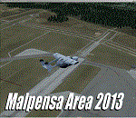
Dear Friends simmer, as always taking advantage of the beautiful objects bgl Gianluca Giovannini, I tried to improve with a symmetric pairing of autogen trees / towns / industrial buildings, the urban area near the international airport of Milano Malpensa, in the best ever scenery by the ISD project.
With the current integration I have created the village of Casenuove, Cardano al Campo, Cascina Costa, Femo, part of the small towns near the attached industrial buildings and new parking in 3D for both terminals. I paid particular attention to the impact of the approach in view of the Ticino Park with a significant density of trees near the runway. Inside you will also find the file on the grass in 3D previously published by me, so if you have already installed, you can deactivate maintaining this.
Warning Very Important: the scenery "is not complete" and to get the best result, you must install ISD LIMC 2009 (limc2009v1.1.zip) - available HERE.
| Filename: | Milano_Malpensa_Area_ISD_2013.zip |
| License: | Freeware |
| Added: | 22nd February 2013, 17:15:22 |
| Downloads: | 4,749 |
| Author: | Fabio Ferrari "fafo air" |
| Size: | 4.51 MB |
| Category: Flight Simulator 2004 - Scenery | |
| KNUQ - Moffett Federal Airfield - Mountain View - California (USA) |
|
Images related to this file:
File Description:
Known originally as Naval Air Station Sunnyvale after its christening in 1933, Moffett Field was renamed in 1942 in honor of Rear Admiral W.A. Moffett a founder of the Navy's Lighter than air program. By this time the LTA program had been reduced to the use of smaller dirigibles for scouting and anti-submarine work but the airfield remained immensely important as a fixed-wing facility due to it's strategic location between Seattle and San Diego. The Ames Research Center established before the war also blossomed into a major post-war aeronautical research and development center due in part to its highly advanced wind tunnel facilities. After the Second World War, Moffett Field developed into a West Coast hub for Patrol and ASW operations against encroaching Soviet missile boats. The NASA presence at Moffett began as early as 1939 with the establishment of the Aames Research Facility and evolving into the sophisticated R&D complex it is today. This particular scenery package attempts to represent the base more or less as it is today.
| Filename: | KNUQ__Moffett_Federal_Airfield__Mountain_View__Cal.zip |
| License: | Freeware |
| Added: | 21st August 2014, 10:41:53 |
| Downloads: | 1,349 |
| Author: | John Stinstrom |
| Size: | 12.36 MB |
| Category: Flight Simulator 2004 - Scenery | |
| Saglek CYSV in northern Labrador, Newfoundland Canada |
|
Images related to this file:
File Description:
Kangiqsualujjuaq is in northern Quebec on the east side of Ungava Bay, and the rocky coastline stretches north from there for 130 miles before turning sharply to head south as the Atlantic shore of Labrador. On this shore and 120 miles almost due east of Kangiqsualujjuaq is Saglek, once a US radar base as part of the DEW line, and then a Canadian base with a Long Range Radar sited 1,200 feet above the airstrip on the top of the vertical cliff. The airstrip is still in use today as an access to the Torngat Mountains Canadian National Park area further north, with organised summer camps and walks etc and helicopter relays from airstrip to campsites. Saglek closes the gap between my post of Kangiqsualujjuaq and the string of airfields further south on the Labrador coast, such as Nain, Davis Inlet, Hopedale, Makkovik, and Postville etc. These have all been made by Flight Ontario and posted along with the Goose Bay Air Base, which also functions as a civil airport.
| Filename: | Saglek_CYSV_in_northern_Labrador_Newfoundland_Cana.zip |
| License: | Freeware, limited distribution |
| Added: | 17th August 2017, 17:11:29 |
| Downloads: | 162 |
| Author: | Roger Wensley |
| Size: | 3.86 MB |
| Category: Flight Simulator 2004 - Scenery | |
| CYYH - Taloyoak - Nunavut, Canada |
|
Images related to this file:
File Description:
Taloyoak is on the coast of northern mainland Canada, on the west of the Boothia Peninsula, where it is at it's narrowest. Gjoa Haven is 80 miles southwest, and Hall Beach is 300 miles to the east. Taloyoak was established around a Hudson Bay trading post that was relocated from Fort Ross in 1948 because of poor ice conditions. There is now a clinic, school, church, recreation centre, two markets, two small hotels, and housing for the population of around 900. The airfield is to the west of the village on higher ground at 92 feet asl, and the 4,020 feet of 100 feet wide gravel runway is aligned 151T/331T where T stands for "true" as opposed to magnetic in the Northern Domestic Airspace. Only JETA-1 is available, unless there is some 100LL in drums. There are flights by First Air and Canadian North and the AI includes a daily flight of each, plus an afternoon cargo visit by a Buffalo C46; the closest large city is Yellowknife, 750 miles southwest.
| Filename: | CYYH__Taloyoak__Nunavut_Canada.zip |
| License: | Freeware, limited distribution |
| Added: | 18th November 2012, 09:23:20 |
| Downloads: | 374 |
| Author: | Roger Wensley |
| Size: | 3 MB |
| Category: Flight Simulator 2004 - Scenery | |
| CYXD - Edmonton City Centre - Alberta, Canada V1 |
|
Images related to this file:
File Description:
Edmonton is in central Alberta, Canada. The City Centre airport has had other names (Edmonton Municipal, Blatchford Field) and was the first licensed airfield in Canada, in 1929. The history of aviation in northern Canada would not be complete if Edmonton was not included as a chapter in its own right. Unfortunately progress takes little notice of past glory and CYXD has now been closed and will be "redeveloped", in sharp contrast to the thriving City Centre airport in Toronto. This version for FS9 includes in the AI a 737 of Western Pacific, an airline that became Canadian Airlines in a merger in 1987. So this CYXD is maybe in the middle eighties, or perhaps the middle nineties with a vintage 737 being used for short haul to Calgary for sentimental reasons. Scheduled flights were in fact stopped in 1995, with the field being used for GA, charter flights, and medical evacuations etc since then. I have included many of the surrounding buildings, as the "City Centre Airport" really is surrounded by and part of the neighbourhood.
| Filename: | CYXD__Edmonton_City_Centre__Alberta_Canada_V1.zip |
| License: | Freeware, limited distribution |
| Added: | 14th September 2014, 21:13:01 |
| Downloads: | 1,632 |
| Author: | Roger Wensley |
| Size: | 54.85 MB |
| Category: Flight Simulator 2004 - Scenery | |
| Grafton District Airport - NSW Australia |
|
File Description:
A delighful small airport approximately 80 nautical miles from Coffs Harbour and a slightly shorter distance to Ballina and Lismore. This makes a good stopover for hopping down the east coast of Australia.
The size of the airport has allowed me to put in that extra detail which makes to terminal and surrounds very much "as in real life". Photographic textures are used throughout for the buildings and even the trees are hand made macros from photographs at the airport.
AFCAD and Traffic Tools files are included to add extra AI traffic. For that reason and because of limited apron space no static planes have been used.
The scenery concentrates on adding a realistic terminal to the airport whilst leaving much of the default runway detail unchanged. Changes which have been made to the runway include tidying up the taxi way fillets so the markings do not appear to be on the grass and the windsocks have been replaced with macros designed to resemble the Grafton windsocks. Other than that the airport merges into the default scenery without the usual "green oasis" effect.
| Filename: | Grafton_District_Airport__NSW_Australia.zip |
| License: | Freeware, limited distribution |
| Added: | 5th December 2003, 04:29:01 |
| Downloads: | 2,546 |
| Author: | John Ross |
| Size: | 2.1 MB |
| Category: Flight Simulator 2004 - Scenery | |
| CZFM - Fort McPherson - Northwest Territories, Canada |
|
Images related to this file:
File Description:
This is the first of a series of airfields that follow (approximately) that early access route to the Canadian northern shore, the Mackenzie River. At the far northern end of the river and on the eastern side of the delta there is Tuktoyaktuk, then 80 miles south is Inuvik (both already posted). 70 miles south of Inuvik is Fort McPherson, on the east bank of the Peel River, 20 miles west of the junction with the Mackenzie and on the Dempster Highway. The town has a population of around 830, and (as usual in the north!) was the site of a Hudson Bay trading post, the main post for the Mackenzie delta area for over 50 years. The airport is less than 2 miles to the south of the town, and has 3,500 feet of gravel runway. AI is two ga flights and a Buffalo Airways delivery trip that hops north and south from field to field; this will change with further posts. There is no fuel available.
| Filename: | CZFM__Fort_McPherson__Northwest_Territories_Canada.zip |
| License: | Freeware, limited distribution |
| Added: | 4th July 2014, 05:33:03 |
| Downloads: | 288 |
| Author: | Roger Wensley |
| Size: | 2.3 MB |
| Category: Flight Simulator 2004 - Scenery | |
| PANC / ANC Ted Stevens Anchorage International Airport, Alaska - Version 6.0 |
|
Images related to this file:
File Description:

This is a major rebuild of Ted Stevens International airport. All terminals have been heavily upgraded from the default form. Terminals A & B have been resized and relocated to be more accurately placed. Terminal C, the newest terminal, has been rebuilt from scratch, and the cargo ramps received special treatment as well. As usual, there is plenty of eye candy placed around the airport including plenty of static general aviation aircraft. The included AFCAD has been extensively reworked, and all gates are laid out per the ANC website and sat photos.
Update: Version 6 contains various changes to the scenery which make it more accurate. There are jetway updates, afcad changes, and various structure changes. Airline parking assignments have also been updated as well as a missing taxiway. The connecting walkway between the international terminal and terminal C has been added. The cargo ramps near terminal C have been expanded and made more accurate to real life. The jetways on terminal A have been removed, and the jetways on Terminal C have also been modified for accuracy.
| Filename: | PANC__ANC_Ted_Stevens_Anchorage_International_Airp.zip |
| License: | Freeware |
| Added: | 29th December 2012, 20:34:30 |
| Downloads: | 18,403 |
| Author: | FRFStudio.net, William Morgan |
| Size: | 6.13 MB |
| Category: Flight Simulator 2004 - Scenery | |
| Airports of Iran V1.1 |
|
Images related to this file:
File Description:

This package creates a simple basic scenery of airports of Iran and it is purposed to have the maximum technical match with the reality, not necessarily the exact scenery textures. The most of Iranian airports in FS2004 have a very poor, out of date and incomplete design, some are only a runway and some do not even exist! No model design has been performed using for this package and all the scenery objects are the available free-ware objects on the online libraries. The main purpose of PERSIAN-SIM | Airports of Iran is to create a maximum match of the airports technical elements with the reality, e.g. the size and location of the buildings, dimensions and distances of runways, taxiways, aprons, stands, gates etc. and also airports lighting systems and NAVAIDs. The technical information including Comm. Frequencies, navigation systems, NAVAIDs, TWYs and RWYs characteristics and dimensions are designed and updated using Iran AIP and other valid up-to-date aviation resources. Special thanks to John Stinstrom and Sidney Schwartz for their permission and helps.
| Filename: | Airports_of_Iran_V11.zip |
| License: | Freeware, limited distribution |
| Added: | 15th January 2013, 17:27:17 |
| Downloads: | 2,606 |
| Author: | Behnam Zamani / PERSIAN-SIM |
| Size: | 25.88 MB |
| Category: Flight Simulator 2004 - Scenery | |
| St. Kitts International Airport (Bradshaw), Caribbean |
|
File Description:
This scenery depicts the Robert L. Bradshaw International airport on the Island of St. Kitts in the Caribbean. It contains the modern new terminal, along with the distinctive green glass tower, and outer buildings. It is a small airport which is located in a valley between two mountain ranges near the southern end of the Island. The scenery has been updated to work in FS2004 by changing the location slightly, removing the hills which are no longer necessary, since FS has now done a great job with the new terrain. The tarmac area is now more representational of the airport, since the scenery tarmacs now override the default FS tarmacs, taxiways, and lines. The airport now has a cleaner layout, and the taxiway extending to the runway end now fits in perfectly. More trees have been added to prevent the stark look of the old scenery. This airport needs an afcad, since there are some A1 aircraft which park in the middle of the taxiway. This scenery will not work in FS2002.
| Filename: | St_Kitts_International_Airport_Bradshaw_Caribbean.zip |
| License: | Freeware |
| Added: | 23rd August 2003, 15:27:31 |
| Downloads: | 4,299 |
| Author: | Bill Melichar |
| Size: | 3.57 MB |
© 2001-2026 AVSIM Online
All Rights Reserved
Privacy Policy |