
Where Flight Simulation Enthusiasts Gather from Around the World!
AVSIM Library - Search Results

| Category: Flight Simulator 2004 - Scenery | |
| "City of Manila" Philippines (Version 2) |

|
File Description:
Upon the permission of the author, this scenery enhancement is released as a separate download compatible for RPLL v8 or later. Please see Installation readme for details.
| Filename: | City_of_Manila_Philippines_Version_2.zip |
| License: | Freeware, limited distribution |
| Added: | 22nd November 2011, 08:21:35 |
| Downloads: | 3,639 |
| Author: | Lowil Espada for Nestor D'Angelo |
| Size: | 5.18 MB |
| Category: Flight Simulator 2004 - Scenery | |
| Constantine DABC Airport Mohamed Boudiaf |
|
Images related to this file:
File Description:
FS2004 Scenery Constantine Mohamed Boudiaf Airport in Algeria, Africa.
Constantine is a small regional airport in North Africa.
Version 1.01 with ILS 34 include.
By Riad Ghenim
| Filename: | Constantine_DABC_Airport_Mohamed_Boudiaf.zip |
| License: | Freeware |
| Added: | 3rd June 2011, 22:31:53 |
| Downloads: | 1,238 |
| Author: | Riad Ghenim |
| Size: | 1.6 MB |
| Category: Flight Simulator 2004 - Scenery | |
| EINN Shannon 1954 2nd edition |
|
File Description:
Before the development of long range passenger jets Shannon was a crucial stop on the route across the North Atlantic. This scenery recreates it in its heyday.
| Filename: | EINN_Shannon_1954_2nd_edition.zip |
| License: | Freeware |
| Added: | 13th February 2023, 17:34:08 |
| Downloads: | 136 |
| Author: | Ken Lawson Wolfgang Gersch |
| Size: | 8.66 MB |
| Category: Flight Simulator 2004 - Scenery | |
| LIRE - Pratica di Mare airporrt |
|
Images related to this file:
File Description:
This is a representation of Pratica di Mare airport (LIRE), created with ADE9 and SBuilder.
As per my other jobs, you need to donwload some other files.
| Filename: | LIRE__Pratica_di_Mare_airporrt.zip |
| License: | Freeware |
| Added: | 9th September 2012, 13:28:28 |
| Downloads: | 834 |
| Author: | Giorgio Perotti |
| Size: | 979.79 KB |
| Category: Flight Simulator 2004 - Scenery | |
| Montreal, Quebec - Pierre Elliott Trudeau Intl- CYUL |
|
File Description:
The default scenery is a lack of insufficient parking for general aviation and commercial jetliners. The default scenery is outdated. I created scenery has more improvement details.
| Filename: | Montreal_Quebec__Pierre_Elliott_Trudeau_Intl_CYUL.zip |
| License: | Freeware |
| Added: | 15th March 2022, 03:18:02 |
| Downloads: | 401 |
| Author: | Stuart John Gilbert II |
| Size: | 4.11 MB |
| Category: Flight Simulator 2004 - Scenery | |
| SLRQ - Fix |
|
File Description:
These .bgl files fix the position of SLLJ airport. Default scenary places the airport on a big hole. This fix places the airport at the right position.
| Filename: | SLRQ__Fix.zip |
| License: | Freeware |
| Added: | 21st June 2008, 10:59:25 |
| Downloads: | 747 |
| Author: | Mauro Celestini |
| Size: | 4.58 KB |
| Category: Flight Simulator 2004 - Scenery | |
| New York La Guardia Airport (KLGA) |
|
File Description:
Detailed scenery of the smallest of the three main New York area airports. This is a complete GMAX remake of the previous FS2002 release of this scenery.
| Filename: | New_York_La_Guardia_Airport_KLGA.zip |
| License: | Freeware, limited distribution |
| Added: | 29th November 2003, 04:52:28 |
| Downloads: | 42,558 |
| Author: | Shehryar Ansari |
| Size: | 1.84 MB |
| Category: Flight Simulator 2004 - Scenery | |
| Fisantekraal Airport, South Africa |
|
File Description:
Fisantekraal (FAFK) Airport, South Africa. This airport is situated close to Cape Town. A highly detailed airport for FS2004, containing photo realistic ground textures, hangars and buildings.
| Filename: | Fisantekraal_Airport_South_Africa.zip |
| License: | Freeware, limited distribution |
| Added: | 1st July 2010, 02:44:26 |
| Downloads: | 1,205 |
| Author: | Aeroworx |
| Size: | 2.78 MB |
| Category: Flight Simulator 2004 - Scenery | |
| Fort Liard CYJF in the Northwest Territories, Canada |
|
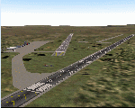
Images related to this file:
File Description:
Fort Liard is the seventh in a series of airfields that follow (approximately) the Mackenzie River. At the far northern end of the river there is Tuktoyaktuk, then Inuvik, Fort McPherson, Fort Good Hope, Deline, Wrigley, and then Fort Simpson Island and Fort Simpson, all posted. Fort Liard is at 708 feet asl and on the east bank of the the Liard River, around 130 miles south of Fort Simpson where the Liard and Mackenzie join, and about 25 miles from the borders with both British Columbia and the Yukon. The town has a population of about 560 folks.
The airport is next to the town, and has almost 3,000 feet of gravel runway. I have no information regarding when it was built but it may be from the WW2 time; the cleared and grassed area is long enough for a runway 0f 6,000 feet. There are no scheduled flights but North Cariboo Air have a base at the airport for local charters to support survey teams etc. and are almost an on-demand-scheduled airline. I have also added a Buffalo DC3 and GA. There is fuel available, but only by prior arrangement with North Cariboo. Right hand circuits for runway 20.
| Filename: | Fort_Liard_CYJF_in_the_Northwest_Territories_Canad.zip |
| License: | Freeware, limited distribution |
| Added: | 11th July 2014, 13:38:49 |
| Downloads: | 301 |
| Author: | Roger Wensley |
| Size: | 10.07 MB |
| Category: Flight Simulator 2004 - Scenery | |
| Mary River CMR2 on Baffin Island in Nunavut Canada |
|
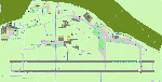
Images related to this file:
File Description:
This is a very early version of an airfield in Nunavut built to serve an iron ore mine some 100 miles south of Pond Inlet on Baffin Island. In 2004 the airstrip was just being built, with a very basic camp set up for the construction crew who then went on to develop the roads etc in the immediate area. The original plan was for an opencast mine, with ore being transported south on a new (and expensive) railroad link to a new port on the south shore of Baffin Island. This plan was later changed to a (much cheaper) road to Milne Inlet, north of Mary River. And there my story rests, as although production has now started I have no further information about the operating mine. Nolinor currently flies regular supply flights into the camp; the AI here is for the early days. The gravel runway is 4,800 feet long and 150 feet wide, aligned 124T-304T as all runway headings in the north are given as true rather than the unreliable magnetic, which would be 12-30. Runway lighting and PAPI was installed early on and is included here; signage is not and the apron is the early version.
| Filename: | Mary_River_CMR2_on_Baffin_Island_in_Nunavut_Canada.zip |
| License: | Freeware, limited distribution |
| Added: | 18th August 2018, 02:57:19 |
| Downloads: | 134 |
| Author: | Roger Wensley |
| Size: | 4.82 MB |
© 2001-2026 AVSIM Online
All Rights Reserved
Privacy Policy |