
Where Flight Simulation Enthusiasts Gather from Around the World!
AVSIM Library - Search Results

| Category: Flight Simulator 2004 - Scenery | |
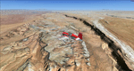
| Europe SRTM mesh part 10: Lower Danube |

|
File Description:
Europe SRTM LOD9 mesh part 10 of 13: Covers a wide area centered over the Danube valley from Novi Sad to the Black Sea (42°N-46°N, 19°E-30°E). Includes Balkans & Transylvanian moutain ranges, and parts of the following countries: Romania, Bulgaria, Serbia and Albania.
This Europe SRTM project was optimized for the lowest HDD space use: Each part macthing exactly the boundaries of its neighbors, you'll have a complete corevage of Europe without gap or overlapping scenery. Based on SRTM Data v1 and v2 (3 arcsec, 90m) and sampled to LOD9 resolution (76m). Each SRTM tile was carefully checked and repaired with Blackart v4.02: water areas are now flattened (lighter mesh), and SRTM voids were treated taking advantage of Blackart's sophisticated interpolation algorithm. When required, biggest voids were patched with oversampled SRTM 30 arcsec data and/or manual input.
| Filename: | eur_srtm_10.zip |
| License: | Freeware, limited distribution |
| Added: | 19th October 2005, 17:55:10 |
| Downloads: | 11,704 |
| Author: | Yohann Baptiste |
| Size: | 39.14 MB |
| Category: Flight Simulator 2004 - Scenery | |
| Comb Ridge, Rock Point (49AZ), Utah/Arizona, Photo-Scenery |
|
Images related to this file:
File Description:
Comb Ridge, Rock Point (49AZ), Utah/Arizona, Photo-Scenery (FS9 & FSX)
This scenery extends my Monument Valley scenery to the east. It covers the area between the San Juan River in the north down to Rock Point, AZ (49AZ). Most of the scenery lies on the Navajo Nation Reservation. It completes the southeastern corner of Utah and paves our way into Colorado.
High resolution versions of this scenery for FS9 and FSX (much sharper, but larger and multiple downloads) are available at www.blueskyscenery.com/CNY_South3West6.html . The screenies are taken from the high-res versions, so expect this version to be slightly more blurry. Thanks to Joop Mak for providing custom AFCADs that correct airport layouts so that they align with the photo-textures! They are available at www.blueskyscenery.com/AFCADs.html . YourDonation@Work: Dedicated to Olivier, Kevin and Ruben.
| Filename: | cny_south3_2010_lr.zip |
| License: | Freeware, limited distribution |
| Added: | 9th April 2010, 21:57:41 |
| Downloads: | 1,344 |
| Author: | Gottfried Razek, blueskyscenery.com |
| Size: | 90.99 MB |
| Category: Flight Simulator 2004 - Scenery | |
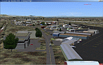
| Mahlon Sweet Field - Eugene, Oregon (KEUG) |
|
File Description:
KEUG - Mahlon Sweet Field - Eugene, Oregon. Eugene, home of University of Oregon, is located at the South end of the Willamette Valley, at the confluence of the McKenzie and Willamette rivers, about 60 miles (100 km) East of the Oregon Coast. The airport is the fifth largest airport in the Pacific Northwest, providing commercial air service to a six-county region in mid-Oregon. This package is a modest enhancement of KEUG based on the Afcad originally created by Reiley McKendrick. Included are minor corrections to his afcad, excludes which remove objects from the taxiway area leading to the NEW 34R/16L runway and numbered jetways at the main terminal. All required files and textures are included. This enhancement is designed to work with the default FS2004 scenery and is offered as a basis for further enhancement. Please unzip (using folders option) to a temporary folder and follow the simple installation instructions. Compiled for your flying enjoyment by David "Opa" Marshall.
| Filename: | Mahlon_Sweet_Field__Eugene_Oregon_KEUG.zip |
| License: | Freeware |
| Added: | 18th December 2006, 01:07:05 |
| Downloads: | 1,017 |
| Author: | David "Opa" Marshall |
| Size: | 465.02 KB |
| Category: Flight Simulator 2004 - Scenery | |
| Cache Creek CAZ5 in British Columbia Canada |
|
Images related to this file:
File Description:
Cache Creek is a small village of around 1,000 folks on the eastern side of the Coast Mountains of British Columbia, around 70 miles northeast of Pemberton and 40 miles west of Kamloops. The village is in a valley bottom and recently suffered from severe flooding due to the overflow of the river. The airfield is high above the town, with a runway aligned 15-33 and 3,280 feet of asphalt, without runway or taxiway lighting; hence "airfield" as opposed to "airport". I have posted it as Cache Creek CAZ5, but I suggest that you revise the name to perhaps "BC airfields" and just load my future airfield posts into the same scenery and texture folders to avoid the inevitable doubling up of common textures etc. Plus that way you will have just one FS9 library post to do and new airfields will not need yet another posting. Up to you. If you find a defect, email me.
| Filename: | cache_creek_bc.zip |
| License: | Freeware, limited distribution |
| Added: | 18th November 2020, 01:21:22 |
| Downloads: | 82 |
| Author: | Roger Wensley |
| Size: | 9.28 MB |
| Category: Flight Simulator 2004 - Scenery | |
| Nursery Corner Farm Field CF13 near Ottawa in Ontario, Canada |
|
Images related to this file:
File Description:
Nursery Corner is a tree nursery around 12 miles southwest of Rideau Valley Airpark CPL3 (which did not appear in FS9, probably because it was then mainly used by gliders, but is a post of mine and downloadable) and 6 miles south of Hicks Farm, a recent post. CPL3 is 15 miles south of Ottawa Airport, tucked into a right angle bend of the Rideau River. Ultimate Terrain puts the river into place and I am not sure how CPL3 works without UT as the river is close by. Fly west from CPL3 along the river and Hicks Farm will be on the south side; fly south parallel to the roads, cross a small river, and in an area which has place names like Hutchins Corners and Pattersons Corners will be the farm field with two grass runways at right angles among the nursery rows of trees. The runways are 36/18 1,700 feet and 27/09 2,000 feet. The single T hangar houses what looked like a Citabria.
| Filename: | nursery_corner.zip |
| License: | Freeware, limited distribution |
| Added: | 11th February 2010, 00:53:28 |
| Downloads: | 246 |
| Author: | Roger Wensley |
| Size: | 14.14 MB |
| Category: Flight Simulator 2004 - Scenery | |
| St. Kitts International Airport (Bradshaw), Caribbean |
|
File Description:
This scenery depicts the Robert L. Bradshaw International airport on the Island of St. Kitts in the Caribbean. It contains the modern new terminal, along with the distinctive green glass tower, and outer buildings. It is a small airport which is located in a valley between two mountain ranges near the southern end of the Island. The scenery has been updated to work in FS2004 by changing the location slightly, removing the hills which are no longer necessary, since FS has now done a great job with the new terrain. The tarmac area is now more representational of the airport, since the scenery tarmacs now override the default FS tarmacs, taxiways, and lines. The airport now has a cleaner layout, and the taxiway extending to the runway end now fits in perfectly. More trees have been added to prevent the stark look of the old scenery. This airport needs an afcad, since there are some A1 aircraft which park in the middle of the taxiway. This scenery will not work in FS2002.
| Filename: | skit04.zip |
| License: | Freeware |
| Added: | 23rd August 2003, 15:27:31 |
| Downloads: | 4,284 |
| Author: | Bill Melichar |
| Size: | 3.59 MB |
| Category: Flight Simulator 2004 - Scenery | |
| Anaktuvuk Pass PAKP in Alaska |
|
Images related to this file:
File Description:
Anaktuvuk Pass is a village located 85 miles north of Bettles and just north of the Brooks Range, in a valley that is a route between north and south. The inhabitants are mainly Numamiut, a section of the Inupiat that existed in history (and until today) away from the coastal food supply of fish etc. The current population is around 350. The airport has one gravel runway, aligned 1-19 with PAPI at both ends, and 5,500 feet long as there is no connection to the outside world other than the runway for all necessities that are not available on the tundra. There are two aprons, with light planes and passengers at the northern end of the runway and the Everts cargo flights unloading at the mid runway apron. A note here about my scenery making. There will not be many more to follow this as I am almost at the end of the photos I either took or found for scenery purposes, plus I expect to move on from FS9 at some point during next year.
| Filename: | anaktuvuk_pass.zip |
| License: | Freeware, limited distribution |
| Added: | 25th November 2019, 17:51:38 |
| Downloads: | 225 |
| Author: | Roger Wensley |
| Size: | 8.96 MB |
| Category: Flight Simulator 2004 - Scenery | |
| CYYD - Smithers Regional Airport - Smithers, British Columbia, Canada |
|
Images related to this file:
File Description:
Smithers is in northwest BC, 60 miles east and a bit north of Terrace (my previous post) and directly east of the southern border of Alaska, 430 miles north of Vancouver on the Yellowhead highway. The town has a population of 5,500 and is set in a north-south valley between mountains, the most impressive of which is Hudson Bay Mountain to the west. The airport is to the north of the town and has a single runway of 7,544 feet, aligned 33-15. The main user is Central Mountain Air, who are headquartered in Smithers and have a large maintenance hangar there next to the terminal building. The airport has scheduled flights by Central Mountain Air, Jazz, and Hawk Air, which are in the AI along with a Lockheed Electra of Conair (who are the largest operator of fire fighting planes in BC and have re-fill tanks in Smithers) and also a HS 748 of Air North, which is actually for an upcoming post of Old Crow CYOC.
| Filename: | smithers_325361.zip |
| License: | Freeware, limited distribution |
| Added: | 30th November 2014, 13:53:46 |
| Downloads: | 700 |
| Author: | Roger Wensley |
| Size: | 8.34 MB |
| Category: Flight Simulator 2004 - Scenery | |
| Kogd-Ogden,Utah |
|
Images related to this file:
File Description:
KOGD-Ogden,Ut Take your sailboat to the Great Salt Lake inland sea or hike the many mountains and enjoy the vistas offered atop the lofty peaks. Visit the quiet mountain valley town of Eden to the east of KOGD with its annual balloon festival and summer fun on Pineview dam or spend the day shopping the shops of Brigham City to the north or Salt Lake City to the south. Fly over the Great Salt Lake to the west. See the Ogden airport come alive with this must have add-on. With the help of Google Earth and FS Earth I have recreated the Ogden airport, with its new taxiway A (from a site visit), and the surrounding cities and towns to look as real as possible. Made with Ultimate Terrain, but the airport should be ok with default FS9. (No guarantee though ;-) The scenery enhancements were made with Ultimate Terrain in place. I modified the landclass to look more like the real thing. The airport is very close to a exact replica of KOGD! The crane by the tower was there when I took the pictures so I included it.
| Filename: | kogd_ogden,utah_266249.zip |
| License: | Freeware |
| Added: | 15th December 2009, 00:45:07 |
| Downloads: | 719 |
| Author: | Alan C. Heiner |
| Size: | 15.59 MB |
| Category: Flight Simulator 2004 - Scenery | |
| Hicks Farm Field CF12 near Ottawa in Ontario, Canada |
|
Images related to this file:
File Description:
Hicks Farm is in Ontario and around 8 miles west of Rideau Valley Airpark CPL3 (which did not appear in FS9, probably because it was then mainly used by gliders, but is a post of mine). CPL3 is 15 miles south of Ottawa Airport, tucked into a right angle bend of the Rideau River. Ultimate Terrain puts the river into place, and I am not sure of how or if either CPL3 or CF12 work without UT, maybe somebody can let me know. Fly west from CPL3 along the river and Hicks Farm will be on the south side. It has a (mainly) grass runway 34/16 with a section of asphalt and totals some 5,500 feet overall. Alan, the owner of Hicks Farm, is in his mid 80's and was told last year that his insurance company no longer felt comfortable with him flying his Lear off a farm strip. The result of his enforced retirement from flying his Lear is that the grass has been allowed to take over somewhat, though there is still sufficient space to land most single engine light aircraft.
| Filename: | hicks_farm.zip |
| License: | Freeware, limited distribution |
| Added: | 11th February 2010, 00:50:23 |
| Downloads: | 268 |
| Author: | Roger Wensley |
| Size: | 1.5 MB |
© 2001-2025 AVSIM Online
All Rights Reserved