
Where Flight Simulation Enthusiasts Gather from Around the World!
AVSIM Library - Search Results

| Category: Flight Simulator 2004 - Scenery | |
| Hope Field near Ottawa Ontario, Canada |

|
Images related to this file:
File Description:
The field is newly included in the Canada Flight Supplement. Unusually for a grass field the runway has the numbers marked out in white; given that this is a private airfield that does not invite unexpected guests and has only one plane based there, and presuming that the owner can remember his own runway headings, it is unlikely that these will still be there in a year's time. There is no hangar as yet. To the west is highway 416 and to the east is the Rideau River, both of which run north-south. Lke Rockcliffe (which is to the north) the airfield is right on the edge of the Ottawa control zone, so you should already be below 1,500 feet ASL when approaching from the south and talking to Ottawa tower when arriving from the north. The runway is 07/25 and 2,800 feet long, which should be enough for almost anybody, and the field is at 315 feet ASL. Manotick is a mile to the north east on the Rideau River and the Rideau Valley Airpark CPL3 is six miles south in the bend of the Rideau where it turns west.
| Filename: | hopefieldontario.zip |
| License: | Freeware, limited distribution |
| Added: | 10th July 2010, 19:34:51 |
| Downloads: | 198 |
| Author: | Roger Wensley |
| Size: | 3.23 MB |
| Category: Flight Simulator 2004 - Scenery | |
| Kogd-Ogden,Utah |
|
Images related to this file:
File Description:
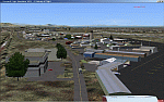
KOGD-Ogden,Ut
Take your sailboat to the Great Salt Lake inland sea or hike the many mountains and enjoy the vistas offered atop the lofty peaks. Visit the quiet mountain valley town of Eden to the east of KOGD with its annual balloon festival and summer fun on Pineview dam or spend the day shopping the shops of Brigham City to the north or Salt Lake City to the south. Fly over the Great Salt Lake to the west.
See the Ogden airport come alive with this must have add-on. With the help of Google Earth and FS Earth I have recreated the Ogden airport, with its new taxiway A (from a site visit), and the surrounding cities and towns to look as real as possible.
Made with Ultimate Terrain, but the airport should be ok with default FS9. (No guarantee though ;-)
The scenery enhancements were made with Ultimate Terrain in place. I modified the landclass to look more like the real thing. The airport is very close to a exact replica of KOGD! The crane by the tower was there when I took the pictures so I included it.
| Filename: | kogd_ogden,utah.zip |
| License: | Freeware |
| Added: | 20th January 2009, 13:42:09 |
| Downloads: | 1,335 |
| Author: | Alan C. Heiner |
| Size: | 15.59 MB |
| Category: Flight Simulator 2004 - Scenery | |
| Kangiqsualujjuaq CYLU in northern Quebec, Canada |
|
Images related to this file:
File Description:
Kangiqsualujjuaq is in northern Quebec on the east side of Ungava Bay, which is to the east of Hudson Bay and around 150 miles wide and 120 miles deep. Kuujjuaq, the administrative capital of northern Quebec, is 100 miles to the southwest. The town is on the bank of the George River, and has also been known as Fort George River, George River, etc. There was a Hudson Bay trading post at the town's location as early as 1838, though it was closed and reopened more than once and the town did not grow because of the trading post; the Inuit lived on the coast during the summer but moved 30 miles inland in winter for trapping. A cooperative was formed in 1959 to market fish, and this was the creative force that brought about establishment of the town; a school was built in 1963.
The airport is to the north of the town in a valley between the surrounding hills at 215 feet ASL. The gravel runway is just over 3,500 feet long and aligned 16/34; there is no PAPI, but there is fuel available, both 100LL and JetA. There are flights by Air Inuit and a warning of caribou on the runway during October and November.
| Filename: | kangiqsualujjuaq.zip |
| License: | Freeware, limited distribution |
| Added: | 1st February 2013, 21:24:55 |
| Downloads: | 274 |
| Author: | Roger Wensley |
| Size: | 2.88 MB |
| Category: Flight Simulator 2004 - Scenery | |
| Trail CAD4 in British Columbia, Canada |
|
Images related to this file:
File Description:
Trail is in the valley carved out by the Columbia River, around 7 miles north of the Canada-US border and on both banks of the river. The town has a population of just under 8,000 and the main industry is mining. The airport is around 3 miles south-east of the town and on the east bank, with the runway parallel to the river and aligned 16-34, 75 feet wide and asphalt. There are currently no runway or taxiway lights, though there is an overall improvement programme in place to cope with increasing passenger demand. A new terminal building was recently completed, along with alterations to road access and parking; as I have no information regarding these road changes I have left the original "terminal" building in place and in use by Pacific Coastal, the only airline to fly to Trail. There is a Youtube video which gives a very good idea of the basic facilities, and of the surrounding hilly terrain which is similar to that at Bella Cooola at the far side of Pacific Coastal's coverage area. The original position of the airport in FS9 before I corrected it was best described as "in a hole". The hole remains nearby as there is no easy way to deal with it.
| Filename: | trail.zip |
| License: | Freeware, limited distribution |
| Added: | 23rd December 2018, 17:27:38 |
| Downloads: | 128 |
| Author: | Roger Wensley |
| Size: | 12.44 MB |
| Category: Flight Simulator 2004 - Scenery | |
| Backcountry airfields for 19m terrain mesh in Idaho USA series 2 |
|
Images related to this file:
File Description:
These backcountry fields are for use with the FSGenesis 19m mesh of Idaho; they almost certainly do not work without it. The six airfields are a follow-on series to the previous four, ranging from Stanley that has a village and airfield buildings of one sort or another and even a length of asphalt runway, to Bruce Meadows that has two bathrooms. The full list from northwest to southeast is Bruce Meadows U63, Garden Valley U88, Warm Springs Creek 0U1, Stanley 2U7, Graham U45, and Smiley Creek U87. These airfields compensate for the loss of airfield flattens after the removal of AF917150 and AF917160, but there remain some now-unflattened airfields I have not included here, whether for reason of the impossibility of realistically creating it (as in the case of Flying B) or just a total lack of anything interesting about it. There may be some more follow-on fields that are new, to the north of the original four; these six are all to the south. The landclass files either change forested areas, as in Bruce Meadows, or add a village, as in Stanley. Although these are stand-alone, the presumption is that you have already installed the original four for use with the FS Genesis 19m terrain mesh, and there is a correction for Big Creek where I missed spotting a lack of flatten in one area.
| Filename: | idaho_backcountry_no._2.zip |
| License: | Freeware, limited distribution |
| Added: | 29th May 2017, 04:20:10 |
| Downloads: | 102 |
| Author: | Roger Wensley |
| Size: | 9.28 MB |
| Category: Flight Simulator 2004 - Scenery | |
| RAF Chivenor 1979-1992 |
|
Images related to this file:
File Description:

Originally a civil airfield opened in the 1930s, the site was taken over by the Royal Air Force in May 1940 for use as a Coastal Command Station, and was known as RAF Chivenor. After the Second World War, the station was largely used for training, particularly weapons training. During the 1960s, one of the RAF's Tactical Weapons Units (TWU) used Hawker Hunter aircraft for training. In 1974 the station was left on "care and maintenance", though No. 624 Volunteer Gliding Squadron continued to fly from there. The TWU returned, flying BAE Hawks, in 1979 and 1981. In 1994, the TWU left Chivenor, merging with No. 4 Flying Training School at RAF Valley, and the airfield was handed over to the Royal Marines.
This scenery includes all the Hawk aircraft of 2 TWU in both camouflage and air defence grey schemes, depending on your preferred choice. There are flightplans included, which are representative only, but enables the aircraft to fly to bases and checkpoints around the country.
The scenery has been constructed using objects mainly from MAIW sceneries, which will need to be installed in order to gain the full visual experience. With BIG thanks to Nick Black for the use of his superb AI Hawk, and to Chris A. Brown for paintin' 'em!
| Filename: | RAF_Chivenor_19791992.zip |
| License: | Freeware, limited distribution |
| Added: | 21st June 2013, 21:28:56 |
| Downloads: | 1,161 |
| Author: | Brian Clarke, Stewart Pearson, Daryl Payne, Chris A. Brown |
| Size: | 22.67 MB |
| Category: Flight Simulator 2004 - Scenery | |
| Smithers CYYD in British Columbia, Canada, Updated |
|
Images related to this file:
File Description:
Made in December 2018 as an update of the original post of 2014, to correct the apron markings, revise the AI, increase the number of GA parking spots, and most importantly to correct the runway lighting by adding the missing approach lights. This scenery is complete and can be installed as-is without first installing the 2014 version. Smithers is in northwest BC, 60 miles east and a bit north of Terrace, and directly east of the southern border of Alaska. The town has a population of 5,500 and is set in a north-south valley between mountains, the most impressive of which is Hudson Bay Mountain to the west. The airport is to the north of the town and has a single runway of 7,544 feet, aligned 33-15. The main user is Central Mountain Air, who are headquartered in Smithers and have a large maintenance hangar there next to the terminal building. The airport has scheduled flights by Central Mountain Air, Jazz, and Hawk Air, which are in the AI. The AI provided here is a new CYYD traffic bgl; in total the AI also includes a Dawson Creek traffic bgl (recently revised and posted) plus a Terrace traffic bgl (which will shortly be revised and posted). An Electra of Conair (who are the largest operator of fire fighting planes in BC, and have re-fill tanks in Smithers) is included and also a HS 748 of Air North.
| Filename: | smithers_cyyd_updated.zip |
| License: | Freeware, limited distribution |
| Added: | 4th January 2019, 18:08:03 |
| Downloads: | 202 |
| Author: | Roger Wensley |
| Size: | 14.46 MB |
| Category: Flight Simulator 2004 - Scenery | |
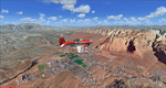
| Steamboat Springs (KSBS), Flat Tops Wilderness Area, Colorado - Photo-Scenery |
|
Images related to this file:
File Description:

Steamboat Springs (KSBS), Flat Tops Wilderness Area, Colorado, Photo-Scenery (FS9 & FSX)
The Flat Tops Wilderness Area, which is the second largest wilderness area in Colorado, is named for its many flat topped mountains that are clearly visible from the sky. Trappers Lake, located in the north of the area inspired Arthur Carhart, a US Forest Service official, to initiate a plea for Wilderness preservation as early as 1919. Finally in 1975, three years before his death in 1978, the Flat Tops were designated a wilderness area. No wonder he found the area so entrancing: Behind Trappers Lake loom majestic volcanic cliffs, and beyond them a vast subalpine terrain reluctantly yields to alpine tundra with an average elevation of about 10.000 feet. More than 100 lakes dot the country above and below numerous flat-topped cliffs. Steamboat Springs is an internationally known winter resort destination.
To explore the scenery depart from Steamboat Springs Airport (KSBS) or Yampa Valley Airport (KHDN) and head south. High resolution versions of this scenery for FS9 and FSX (much sharper, but larger and multiple downloads) are available at www.blueskyscenery.com/GNB_West2.html . The screenies are taken from the high-res versions, so expect this version to be slightly more blurry. Thanks to Joop Mak for providing custom AFCADs that correct airport layouts so that they align with the photo-textures! They are available at www.blueskyscenery.com/AFCADs.html . YourDonation@Work: Dedicated to James.
| Filename: | Steamboat_Springs_KSBS_Flat_Tops_Wilderness_Area_C.zip |
| License: | Freeware, limited distribution |
| Added: | 26th April 2010, 17:53:25 |
| Downloads: | 1,293 |
| Author: | Gottfried Razek - blueskyscenery.com |
| Size: | 91.57 MB |
| Category: Flight Simulator 2004 - Scenery | |
| St. George (KSGU) / Mesquite (67L), Utah/Nevada, Photo-Scenery (FS9 & FSX) |
|
Images related to this file:
File Description:
Covers the area between St. George, Utah and Mesquite, Nevada. To the north of St. George
the Pine Valley Mountains with their foothills of scenic red sandstone loom over the city.
St. George Municipal Airport (KSGU) is mostly used for general aviation but is also served by SkyWest Airlines
on behalf of Delta Connection. Because of it's location on a mesa this airport can't be expanded and so a new
airport is currently being built southeast of the city at the site of an abandoned airfield. The opening
is expected in 2011. To the south of the city make sure, you don't miss the Virgin River Gorge where the
Virgin River winds thru a long winding canyon in the transition zone between the red rocks of southern Utahs
Colorado Plateau and Nevadas Mojave Desert. Shortly afterwards you reach Mesquite which is situated just
west of the Arizona stateline. Like nearly all Nevada cities near the stateline Mesquite is home to several
Casinos. Mesquite Airport (67L) lies just north of the city.
High resolution versions of this scenery for FS9 and FSX (much sharper, but larger and multiple downloads)
are available at www.blueskyscenery.com/CNY_South3West6.html . The screenies are taken from the high-res versions,
so expect this version to be slightly more blurry. Thanks to Joop Mak for providing custom AFCADs that
correct airport layouts so that they align with the photo-textures! They are available at www.blueskyscenery.com/AFCADs.html .
YourDonation@Work: Dedicated to Werner, Ralf-Peter and Nels.
| Filename: | cny_south3west6_2010_lr.zip |
| License: | Freeware, limited distribution |
| Added: | 24th March 2010, 19:41:43 |
| Downloads: | 1,634 |
| Author: | Gottfried Razek - blueskyscenery.com |
| Size: | 95.58 MB |
| Category: Flight Simulator 2004 - Scenery | |
| Anahim Lake CAJ4 in British Columbia, Canada |
|
Images related to this file:
File Description:
Anahim Lake is around 55 miles east of Bella Coola by air, and clear of the deep and rugged valley that connects the two with a road that is over 75 miles long. The two are also linked by a daily Pacific Coastal flight. A further 150 miles east is Williams Lake (200 miles by road). The town of Anahim Lake is small, but renowned for numerous surrounding fishing lodges on the lakes and the enjoyment of "nature" in what is known as the Chilcotin Wilderness. The Anahim Lake airport is an odd one. It appears to have fallen into disuse over a period of years, but is now in the process of being upgraded, with some new hangars (though oddly situated, and with only dirt track taxiway access) and a recently completed terminal building. There is also a plan to upgrade the runway (lights etc, there are currently no runway or taxiway lights) and in general to greatly improve the facilities on offer. The only current airline to fly there is Pacific Coastal. The runway is just under 4,000 feet of asphalt aligned 13-31 and 75 feet wide. There used to be another runway which is still visible but is now unusable, gravel that has not been maintained for several years. The notes for Anahim Lake airfield in the Nav Canada manual warn of "Extensive float plane activity at Nimpo Lake to the south" and of "possible large animals within the airport perimeter". Nimpo Lake activity will follow in further posts.
| Filename: | anahim_lake_372251.zip |
| License: | Freeware, limited distribution |
| Added: | 29th November 2018, 19:21:59 |
| Downloads: | 147 |
| Author: | Roger Wensley |
| Size: | 5.94 MB |
© 2001-2025 AVSIM Online
All Rights Reserved