
Where Flight Simulation Enthusiasts Gather from Around the World!
AVSIM Library - Search Results

| Category: Flight Simulator 2004 - Scenery | |
| Retro Scenery for NAS Chase Field, Texas, U.S.A. |

|
Images related to this file:
File Description:

Originally opened as Beeville Municipal Airport, the land was leased from the Navy in 1943 for the construction of Chase Field, a training base for Naval Air Cadets and was one of three satellite airfields for Corpus Christi NAS. At the end of WWII the station was closed and re-purposed for various educational and local civic uses only to be reopened with the commencement of the Korean War in 1953. This resulted in a significant expansion of the original facilities and by the early 1980s Chase Field had a complement of 2,500, along with over 160 aircraft. Finally BRAC-ed in 1991 the field was finally closed in 1993. Scenery contains custom objects as well as photo-realistic ground cover with provisions for appropriate aircraft.
| Filename: | Retro_Scenery_for_NAS_Chase_Field_Texas_USA.zip |
| License: | Freeware, limited distribution |
| Added: | 27th April 2014, 21:31:40 |
| Downloads: | 670 |
| Author: | John Stinstrom |
| Size: | 2.58 MB |
| Category: Flight Simulator 2004 - Scenery | |
| CYXN - Whale Cove - Hudson Bay, Nunavut, Canada, Version v2 modified 1 July 2014 |
|
Images related to this file:
File Description:
This revised version deletes stock FS9 taxiway lights and replaces them. It also modifies and corrects the PAPI positioning, and removes a visible hold short that should have been invisible on the gravel. This is a complete version and does not require you to have installed the old version. Whale Cove is a small village with 300 or so inhabitants at N62 W92 on the west shore of Hudson Bay, 40 miles south of the large airport at Rankin Inlet. The runway is just under 4,000 feet and aligned 330T-150T, these being true and not magnetic bearings. The AI is included with the post of Chesterfield Inlet V1 and the earlier version is omitted from this post to avoid confusion.
| Filename: | CYXN__Whale_Cove__Hudson_Bay_Nunavut_Canada_Versio.zip |
| License: | Freeware, limited distribution |
| Added: | 23rd August 2014, 11:24:44 |
| Downloads: | 274 |
| Author: | Roger Wensley |
| Size: | 1.73 MB |
| Category: Flight Simulator 2004 - Scenery | |
| PASD - Sand Point - Aleutians Alaska USA |
|
Images related to this file:
File Description:
Sand Point is in the eastern third of the Aleutian chain of islands in Alaska, around 85 miles east of Cold Bay on Popof Island. The town has a population of around 1,000 and it's economy is solidly based on fishing. There is, in the town, a fish processing plant owned by Trident (their largest plant is in Akutan, east of Dutch Harbor) and the area close to the airport is used for crab pot storage etc. The single runway is aligned 13-31 (with right hand circuits on 13) and 6,000 feet long. There are scheduled flights by Grant Aviation to neighbouring local airfields and flights to and from Anchorage by Peninsula Air (included in the AI posted with Adak). The Coastguard also make occasional visits.
| Filename: | PASD__Sand_Point__Aleutians_Alaska_USA.zip |
| License: | Freeware, limited distribution |
| Added: | 22nd January 2015, 23:59:35 |
| Downloads: | 366 |
| Author: | Roger Wensley |
| Size: | 6.38 MB |
| Category: Flight Simulator 2004 - Scenery | |
| PHNL - Honolulu Intl - Hawaii, USA |
|
Images related to this file:
File Description:
This is a total remake of the Honolulu Intl airport except for the Hickham AFB side. Parking is included for the military side but no buildings at the present time. That is for a later project. All buildings were were designed using Instant Object Studio and using ADE9 for the layout. Would like to thank Sidney Schwartz for allowing me to use his textures and buildings with this scenery. Also, the other scenery designers, Lars Hoyer, Steve Ziegler, Dennis Waggoner, Kevin Wynn, Matthew Tomkins for their libraries used to make this scenery. Plus any others I may not have mentioned. See the readme file for additional libraries needed to complete the scenery. This is my first scenery to build for upload so hopefully everyone will enjoy.
| Filename: | PHNL__Honolulu_Intl__Hawaii_USA.zip |
| License: | Freeware |
| Added: | 13th October 2014, 16:20:15 |
| Downloads: | 4,025 |
| Author: | Johnny Alford |
| Size: | 18.97 MB |
| Category: Flight Simulator 2004 - Aircraft Repaints, Textures and Modifications | |
| Braniff International Boeing 727-227 (N403BN) |
|
Images related to this file:
File Description:
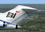
2004/FSX - TDS Boeing 727-227 Braniff International (N403BN). Famous for its colorful paint schemes, Braniff International brightened every airport it operated from. This decal provides the markings for the Boeing 727-227 for the "Jellybean" scheme of the 1960s. Only the first three aircraft (N401BN, N402BN and N403BN) were delivered in this scheme, before the "Flying Colors" scheme was adopted.
Most of the fuselage was painted a solid bright color with the extreme lower belly and rear fuselage left bare metal. N401BN was bright red, N402BN was orange, and N403BN was bright blue. Model design by Hiroshi Igami. Flight dynamics design by Nick Wilkinson and David Biggar. Master textures by Kyle Schurb. Requires base model tdsx_b727-200.zip for FSX and tds_b727-200.zip for 2004.
| Filename: | Braniff_International_Boeing_727227_N403BN.zip |
| License: | Freeware |
| Added: | 1st April 2018, 18:12:10 |
| Downloads: | 143 |
| Author: | Danny Cummings |
| Size: | 11.2 MB |
| Category: Flight Simulator 2004 - Scenery | |
| Beaver Creek CYXQ in Yukon Territory, Canada |
|
Images related to this file:
File Description:
Beaver Creek is located at mile 1202 of the Alaska Highway, just east of the Alaska/Yukon border. The populaton is around 100 and the main employment is with the Border Agency, the White River First Nation, or with local tourist lodges. The airfield is a mile north of the town and close to the Canadian border post, which is included in the scenery. It was built by Jack Stalberg in the 1960's, and I have no further information beyond the fact that he loved to fly. The airport serves as an "airport of entry", though it is restricted in hours of opening and in the size of aircraft that it can handle; up to a maximum of only 15 seats. The single runway is 3,745 feet long and 100 feet wide, gravel, aligned 13-31 in FS9, lit, and with vasi at both ends. Righthand circuits for runway 13. There is a 340 feet threshold displacement to runway 31, which is of course unmarked on a gravel runway. The terminal building was recently reclad; I don't like it, but they didn't consult me. The ai reflects the sort of traffic the airfield gets; ie brief paperwork stopovers for GA or small charter flights into Canada from Alaska, usually in the mornings.I have adjusted the local scenery terrain levels to remove adjacent hills that I believe do not exist in real life but are part of the Northern Canada terrain mesh that I have installed. If you do not have this mesh you may find that the scenery works fine for you without the API flatten that is included here. The airfield is at 2,129 feet ASL.
| Filename: | Beaver_Creek_CYXQ_in_Yukon_Territory_Canada.zip |
| License: | Freeware, limited distribution |
| Added: | 28th January 2019, 06:19:20 |
| Downloads: | 174 |
| Author: | Roger Wensley |
| Size: | 4.68 MB |
| Category: Flight Simulator 2004 - AI Aircraft | |
| AI Lineas Aereas Azteca Faib Boeing 737-700 Fleet Pack |
|
Images related to this file:
File Description:
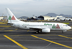
Those are the aircrafts of the extinct mexican airline "Lineas Aereas Azteca", the Boeing 737-700 fleet pack contain the next aircrafts with the registrations: N160CK, N815PG, N966PG, XA-AEP (With Website included), XA-AEQ (With Website included), XA-TWF (With Website included). LÃneas Aéreas Azteca was an airline based in Mexico City, Mexico. It operated domestic scheduled services and international services to the USA. Its main base was Mexico City International Airport, with a hub at General Abelardo L. RodrÃguez International Airport, Tijuana. The airline was established on 9 May 2000 and started operations on 1 June 2000, operating domestic services with Boeing 737 aircraft. It started up after TAESA closed down and some of the staff and assets were taken over. The airline's operations were suspended by the government in March 2007 due to safety problems, and in October 2007 the Mexican government permanently revoked its air operator's certificate because the company hadn't solved those problems. On 10 October 2007, the General Civil Aeronautics Directorship (DGAC) of Mexico's Communications and Transport Secretariat permanently revoked LÃneas Aéreas Azteca's air operator's certificate, because the airline did not have a sound financial statement after the previous suspension. The fleet consisted in 6 Boeing 737-300 (XA-AAU, XA-AAV, XA-CAS, XA-TWG, XA-UCL, XA-UCP), 3 Boeing 737-700 (XA-AEP, XA-AEQ, XA-TWF), and 1 Bombardier Learjet 31 (XA-OLE). The models of this traffic are FSX AI BUREAU (FAIB) Boeing 737-700. This is my website: https://el-mundo-de-los-aviones-ai-traffic.jimdosite.com I hope you enjoy it!
| Filename: | AI_Lineas_Aereas_Azteca_Faib_Boeing_737700_Fleet_P.zip |
| License: | Freeware |
| Added: | 22nd May 2023, 17:11:39 |
| Downloads: | 40 |
| Author: | Jesus Gibran Soriano Solleiro |
| Size: | 45.58 MB |
| Category: Flight Simulator 2004 - Scenery | |
| Fort Nelson CYYE in British Columbia, Canada |
|
Images related to this file:
File Description:
Fort Nelson is close to the Peace River in the northeast corner of British Columbia, around 70 miles from the northern border, 90 from the eastern border, and 80 miles east of the Rockies. The wartime construction of the Alaska Highway actually started from Fort Nelson, as there was already a road from Fort St John (which is close to Dawson Creek) north to Fort Nelson. The airfield was part of this construction effort and after the wartime ferrying of planes to Russia it was used by the US Army Air Force and then by the Canadian Air Force. Fort Nelson flourished with the oil and gas exploration of the 1950's and the following years, and this continued to grow until the collapse of the oil price in 2014.
The town of Fort Nelson became the capital of the Northern Rockies Regional District when it was founded in 2009, and as a result the official name of the Fort Nelson airport is the Northern Rockies Regional Airport. The date for this scenery is around 2016, by which time the economic fortunes of the town were in decline. Five times per day flights by Central Mountain Air were starting to be reduced in number to the current (in 2022) one per day and none on Sunday; in the AI included here there are two flights per day. The main resident users of the airport are four helicopter companies, the helicopters presumably used for maintenance trips to whatever parts of the oil and gas fields that are still in use in the surrounding area.
There are two runways, the main one is aligned 03-21, 6,400 feet long and 200 feet wide, with ILS at the southern end and PAPI at the northern. The second runway (a narrower rebuild on a previously existing runway) is aligned 07-25 and 77 feet wide, and is without any lights. These are the alignments as per the original build of FS9 and not as per the approximate 2016 date of the buildings; I had a problem at a very late stage in making this scenery which prevented me from continuing with some final details.
On YouTube there is a series of posts by Angle of Attack showing the preparation and then the flight of an old Cessna 172 from Homer to Oshkosh for the installation of modern instruments. Interesting for me as they visit or fly over airfields I have made (Homer, Merrill, Tok Junction, Burwash, Silver City, Haines Junction, Watson Lake, Fort Nelson, and Grande Prairie) but in the winter so it all looks very different.
| Filename: | Fort_Nelson_CYYE_in_British_Columbia_Canada.zip |
| License: | Freeware, limited distribution |
| Added: | 23rd January 2022, 20:11:18 |
| Downloads: | 187 |
| Author: | Roger Wensley |
| Size: | 28.35 MB |
| Category: Flight Simulator 2004 - AFCAD Files | |
| LGSA Chania Souda |
|
File Description:
This file makes FS2004 use the correct taxiways and gates at the freeware scenery of Chania Souda by Emmanuel Stefanakis and Milos airport with the FS9 default scenery.
It keeps the AI Aircraft from taxiing cross country. It was created with AFCAD 2.11.
It contains enough parkings for:
-enough parkings for small and medium and prop airliners and seperate military Cargo and fighter parkings at Chania Souda (LGSA),
-one GA parking and one ATR-class parking (used by Olympic and Aegean Airlines) for Milos (LGML) with the default scenery. Adds turn pads and hold short nodes here. This will also satisfy those with many many military fighter and and military cargo flightplans but also those with many civil chatrter flightplans as there are more than enough parkings for everey category.
| Filename: | LGSA_Chania_Souda.zip |
| License: | Freeware |
| Added: | 2nd December 2003, 01:05:10 |
| Downloads: | 1,357 |
| Author: | Felix Hippmann |
| Size: | 6.34 KB |
| Category: Flight Simulator 2004 - Aircraft Repaints, Textures and Modifications | |
| Iran Air 'Fars' (EP-IAC) Boeing 747 SP |
|
File Description:
This is a repaint of FSPainter 747 SP in the old national colorscheme of Iran Air EP-IAC. This aircraft has recently had an emergency landing at Beijing Airport resulting in the collapse of the nose
gear(though some reports say it landed without any nose gear due to hydraulic system failure) making her sliding on the runway with her nose touching the ground. Poor Fars! At least she was fortunate
enough to have a truely experienced pilot to save her and her passengers. EP-IAC is one of the 4 IR SP's operated en route from Tehran to New York before the revolution. Sure she was depressed enough
for not seeing NY anymore to collapse on the ground(Don't you agree that aircrafts have their own feelings?)! Do hope to see her flying again.
| Filename: | Iran_Air_Fars_EPIAC_Boeing_747_SP.zip |
| License: | Freeware |
| Added: | 19th January 2004, 15:43:15 |
| Downloads: | 1,882 |
| Author: | Pantee Farhangi / FSPainter |
| Size: | 392.11 KB |


© 2001-2026 AVSIM Online
All Rights Reserved
Privacy Policy |