
Where Flight Simulation Enthusiasts Gather from Around the World!
AVSIM Library - Search Results

| Category: Flight Simulator 2004 - Aircraft Repaints, Textures and Modifications | |
| Wizz Air A320 (Budapest) |

|
Images related to this file:
File Description:

Wizz Air, the largest low cost airline in Central and Eastern Europe, in partnership with Budapest Airport and the Budapest 2024 Olympic and Paralympic Bid, revealed the livery of its Budapest aircraft. As part of its sponsorship towards the Budapest 2024 Olympic and Paralympic bid, Wizz Air has decorated one Airbus A321 and one Airbus A320 aircraft of its Budapest fleet with unique livery carrying Budapest 2024 design elements. The elements reflect the waves of the Danube River that flows through the heart of the city, as well as the historic monument of the Statue of Liberty located on one of the highest hills of the Hungarian capital. Texture only. Please visit www.ktrachosim.org for more texture, and Facebook: Ktrachosim
| Filename: | Wizz_Air_A320__Budapest.zip |
| License: | Freeware |
| Added: | 25th December 2016, 17:58:07 |
| Downloads: | 406 |
| Author: | Luis Flores | Ktrachosim |
| Size: | 7.97 MB |
| Category: Flight Simulator 2004 - Scenery | |
| Guangdong Pearl River Delta Landclass - China |
|
File Description:
These are landclass files of the Pearl River Delta area, located in the south of China's Guangdong province.
This area is one of the biggest metropolitan areas (or megacity) in the world today, and as it was poorly represented in FS2004, I decided to 'map' it using EZ-landclass and images from Google Maps.
The area that was mapped stretches as far north as the New Bayiun Airport, all the way to the islands south of Hong Kong, and to the mountain ranges east and west of the Delta; with big cities included being: Guangzhou, Foshan, Dongguan, Jiangmen, Huizhou, Shenzen, Zhongshan, Zuhai, Macau & Hong Kong.
Only tested in FS9 but should work in FSX as well.
| Filename: | Guangdong_Pearl_River_Delta_Landclass__China.zip |
| License: | Freeware |
| Added: | 17th April 2016, 19:11:40 |
| Downloads: | 488 |
| Author: | Leonardo Santos |
| Size: | 6.92 KB |
| Category: Flight Simulator 2004 - Scenery | |
| Surge Narrows CAG9 in British Columbia, Canada |
|
Images related to this file:
File Description:
Surge Narrows is a float base serving a small village on Read Island, one of the many islands squeezed between Vancouver Island and the mainland at this northern end. At this island passengers are delivered by amphibious Grumman Goose from Port Hardy, the main airport of the northern half of Vancouver Island with daily scheduled flights onward to and from Vancouver International. The AI was included with the post of Port Hardy. Regrettably, the amphibious Goose behaves as if it is on land and moves on the water with it's wheels extended; there is no way around this. This scenery is a modification of a post made some years ago that did nor support AI.
| Filename: | Surge_Narrows_CAG9_in_British_Columbia_Canada.zip |
| License: | Freeware, limited distribution |
| Added: | 28th November 2018, 22:43:57 |
| Downloads: | 104 |
| Author: | Roger Wensley |
| Size: | 931.04 KB |
| Category: Flight Simulator 2004 - Scenery | |
| KDTW Detroit North Terminal Version 0.9 |
|
Images related to this file:
File Description:

This is a simple addon which updates Imaginesim's Legacy Scenery for Detroit Metro Airport
by adding the new North Terminal completed and operational which is shown in "under construction" form in the original Imaginesim scenery.
You must have Imaginesim's scenery installed and active for this addon to work correctly. This addon will exclude parts of Imaginesim's scenery
and partially rebuild some of those parts so that they reflect DTW in its current state. This scenery was built using Flight1's Instant Scenery
program.
Version History:
Version 0.9:
This version is released without gate numbering on the ground or on top of each jetway. These will be added in the near future once appropriate
objects are made available.
| Filename: | KDTW_Detroit_North_Terminal___Version_09.zip |
| License: | Freeware |
| Added: | 14th May 2013, 15:16:30 |
| Downloads: | 2,171 |
| Author: | FRFStudio.net / William Morgan |
| Size: | 3.28 MB |
| Category: Flight Simulator 2004 - Scenery | |
| PABR - Barrow - Alaska, USA |
|
Images related to this file:
File Description:
The town of Barrow is in the far north of Alaska, and is best known in flying circles as the place where Wiley Post crashed his floatplane on takeoff and killed himself and Will Rogers. The crash was some 15 miles south of Barrow and was "assisted" by the mismatched fuselage, wings, and floats that had been assembled to create the floatplane. The Barrow population is largely Inupiat and totals some 4,400. The downtown area of Barrow is immediately north of the airport. The second and largest part of Barrow is further north past a string of lagoons and is locally called Browerville. To the northeast along the coast is the smallest part around what used to be the Naval Arctic Research Lab, and is now a college. To the east of this are the DEW buildings, plus two large navy hangars and the gravel runway that was used to serve the DEW station. The PABR runway is aligned 06-24 in FS9 and is 7,100 feet long and 150 feet wide, built on top of a gravel base and surround that copes with the underlying permafrost. There is PAPI at both ends and an ILS and approach lights on 06; 06 circuits are to the right. The airport notes include a warning that the apron is not a standard width and that large planes that are enroute to the far end of the runway will not be able to taxi past a plane parked at the gate and should use the runway as a taxiway, then turn and takeoff. FS9 AI cannot cope with that, so the apron here is wider. There are, in real life and the AI, daily flights by Air Alaska (three at least) and Era (several, and which is now called Ravn, hence the new hangar door motif) and air cargo flights by Northern Air Cargo and Everts, plus GA. The buildings have been made with photographic textures or textures made from reference photos. I decided that while 500+ scenery objects was probably ok for most people the required 900+ to "make" the town of Barrow would likely not be. The auto-generated FS9 town objects could not be left as Barrow with trees would not look at all like reality; I have "faded" the density of the town buildings into the distance from the airport.
| Filename: | PABR__Barrow__Alaska_USA.zip |
| License: | Freeware, limited distribution |
| Added: | 17th May 2016, 09:32:36 |
| Downloads: | 973 |
| Author: | Roger Wensley |
| Size: | 15.12 MB |
| Category: Flight Simulator 2004 - Scenery | |
| Zion National Park North, Cedar Breaks National Monument, Cedar City (KCDC), Utah, Photo-Scenery (FS9 & FSX) |
|
Images related to this file:
File Description:
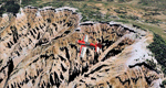
Cedar Breaks National Monument is a large amphitheater cliff in bright colors of red, orange and purple.
It lies east of Cedar City in the northern region of the scenery. The cliff was formed by erosion thru wind,
water and ice. Today erosion continues with a pace of about 2 inches every 5 years. Although it is called
Cedar Breaks, there are no cedars growing there but juniper trees. For a scenic flight to Cedar Breaks
National Monument best depart from Cedar City Regional Airport (KCDC) and head east. The scenery extends
south to Zion National Park and covers a large part of Zion Canyon and the Kolob Canyons area.
Zion National Park is another place where erosion of the Colorado Plateau formed the most beautiful colorful
stone formations of unique and wonderful shapes. There are nine different layers of stone visible in the park.
Most of them consist of sandstone. But there is also limestone, gypsum, siltstone, shale, clay and mudstone.
The Virgin River cut a spectacular and famous canyon thru Zion Park that is as narrow as 20ft and up to 2000ft tall.
High resolution versions of this scenery for FS9 and FSX (much sharper, but larger and multiple downloads)
are available at www.blueskyscenery.com/CNY_South2West5.html . The screenies are taken from the high-res versions,
so expect this version to be slightly more blurry.
Thanks to Joop Mak for providing a custom AFCADs that correct airport layouts so that they align with the photo-textures!
They are available here: www.blueskyscenery.com/AFCADs.html . YourDonation@Work: Dedicated to Richard, P.J. and Felix.
| Filename: | Zion_National_Park_North_Cedar_Breaks_National_Mon.zip |
| License: | Freeware, limited distribution |
| Added: | 14th March 2010, 00:30:28 |
| Downloads: | 1,564 |
| Author: | Gottfried Razek - blueskyscenery.com |
| Size: | 97.13 MB |
| Category: Flight Simulator 2004 - Scenery | |
| CNZ3 - Chatham-Kent - Ontario, Canada V1 |
|
Images related to this file:
File Description:
This is partly part of the Small Ontario Fields series. The airport ICAO was changed from CNZ3 to CYCK in November 2012; I have left it as it was. The runway too remains as it was a few years ago. Chatham is located 50 miles east of Detroit and 150 miles southwest of Toronto, between Lake St. Clair and Lake Erie, and the airfield is southeast of the town. There is a single asphalt runway 5,000 feet long and 75 feet wide, aligned 05/23 in FS9 but in fact in real life now 06/24 due to the wandering magnetic north. The apron is on the northern side of the runway at the eastern end, with added taxiways to cater for newer hangars wearing identical colour schemes. There is fuel, runway lighting, some taxiway lights, visitor parking on the grass, and plane maintenance in the large hangar beside the small terminal building on the north side of the apron. There is a train station in the middle of the town, and no scheduled flights to the airport that is 8 miles away; these two facts may be connected. Ditches along the road and around much of the airfield provide separation, which is why the fences are not continuous. If you are on the runway and find your path to the apron blocked by another plane that is stationary at the hold short, continue past the first turnoff to the threshold markers and turn off the runway and wait. The AI plane will then taxi out and you will have a clear path.
| Filename: | CNZ3__ChathamKent__Ontario_Canada_V1.zip |
| License: | Freeware, limited distribution |
| Added: | 27th August 2015, 21:02:59 |
| Downloads: | 341 |
| Author: | Roger Wensley |
| Size: | 9.89 MB |
| Category: Flight Simulator 2004 - Scenery | |
| Anahim Lake CAJ4 in British Columbia, Canada |
|
Images related to this file:
File Description:
Anahim Lake is around 55 miles east of Bella Coola by air, and clear of the deep and rugged valley that connects the two with a road that is over 75 miles long. The two are also linked by a daily Pacific Coastal flight. A further 150 miles east is Williams Lake (200 miles by road). The town of Anahim Lake is small, but renowned for numerous surrounding fishing lodges on the lakes and the enjoyment of "nature" in what is known as the Chilcotin Wilderness. The Anahim Lake airport is an odd one. It appears to have fallen into disuse over a period of years, but is now in the process of being upgraded, with some new hangars (though oddly situated, and with only dirt track taxiway access) and a recently completed terminal building. There is also a plan to upgrade the runway (lights etc, there are currently no runway or taxiway lights) and in general to greatly improve the facilities on offer. The only current airline to fly there is Pacific Coastal. The runway is just under 4,000 feet of asphalt aligned 13-31 and 75 feet wide. There used to be another runway which is still visible but is now unusable, gravel that has not been maintained for several years. The notes for Anahim Lake airfield in the Nav Canada manual warn of "Extensive float plane activity at Nimpo Lake to the south" and of "possible large animals within the airport perimeter". Nimpo Lake activity will follow in further posts.
| Filename: | Anahim_Lake_CAJ4_in_British_Columbia_Canada.zip |
| License: | Freeware, limited distribution |
| Added: | 29th November 2018, 19:21:59 |
| Downloads: | 153 |
| Author: | Roger Wensley |
| Size: | 5.72 MB |
| Category: Flight Simulator 2004 - AFCAD Files | |
| Central America |
|
File Description:
Gate and facilities data for Central America as well as a reissue of the airports in my Part 1 release. In this set we have all of the major airports in Central America as well as updates to the airports in my first release. I did as good a job as possible to make it realistic. Granted, it won't be 100% perfect since the ramp and terminal areas MS designed may not match the real airport completely so some airports didn't have the physical space in the sim to provide room for all the real gates but for the most part it is very accurate down to gate numbers. Airports include GCM, PAP, PLS, BZE, GUA, CUN, SAP, TGU, SAL, MGA, LIR, SJO and PTY.
| Filename: | Central_America.zip |
| License: | Freeware |
| Added: | 2nd November 2003, 22:13:32 |
| Downloads: | 1,573 |
| Author: | Jason Diaz |
| Size: | 257.81 KB |
| Category: Flight Simulator 2004 - Utilities | |
| METAR Update Of The METAR Weather Program |
|
File Description:
Update of the Free METAR program with new features and bug's corrected.
New features:
1. I improved the temperature aloft settings. This also should give better cloud settings, esp. the cloud high is now computed out of temperature and other data.
2. No more 'weather update' messages
3. If the needed stations files not there, the program shouldn't crash anymore
4. The .reg file shouldn't be needed anymore
5. Both free METAR and WindsAloft Servers are used. To save time, the Server with the smaller files is used first. Only if this server failed the other is used.
6. The choice to get METAR text message of the nearest airport in FS9 is implemented. The message is updated every time the FS2k4METAR program updates the weather.
| Filename: | METAR_Update_Of_The_METAR_Weather_Program.zip |
| License: | Freeware |
| Added: | 23rd November 2003, 23:21:41 |
| Downloads: | 5,922 |
| Author: | Markus Brunner |
| Size: | 291.59 KB |


© 2001-2026 AVSIM Online
All Rights Reserved
Privacy Policy |