
Where Flight Simulation Enthusiasts Gather from Around the World!
AVSIM Library - Search Results

| Category: Flight Simulator 2004 - AI Aircraft | |
| Ameristar Air Cargo OC DC-9-15F N785TW |

|
Images related to this file:
File Description:

Ameristar Air Cargo OC DC-9-15F N785TW - AIG_DC-9-10 //
Ameristar Air Cargo, Inc. is an American passenger and cargo airline based in Dallas, Texas, USA. It operates passengers and cargo services in the Americas, as well as acting as a broker to other cargo carriers. Its main base is Addison Airport in north Dallas, with hubs at Willow Run Airport, and El Paso International Airport. Source Wiki. //
Flight plans may be available on AVSIM/Flightsim.com.
This works for both FS9 and FSX. Tested in FSX. FS9 model used.
For FSX users make sure you have UNCHECKED "Aircraft casts shadows on the ground" under the Aircraft - Exterior Settings in FSX to make any FS9-based model visible during the day!
Texture quality; FSX Native: DDS DXT5 with alpha. FS9 Native: BMP DXT3 with alpha.
FSX Light Fix included in the DDS night texture.
Custom Light Map. Custom Shadows, Highs, Weathering as usual...
Included repaint is for the following model; AIG_DC-9-10 from Alpha India Group
Model is available on AVSIM, FlightSim.com or on the author/developers site.
You need the basekit for this to work!!
Do make sure you copy the texture folder(s) in the respective folder.
| Filename: | Ameristar_Air_Cargo_OC_DC915F_N785TW.zip |
| License: | Freeware, limited distribution |
| Added: | 26th August 2012, 14:31:01 |
| Downloads: | 314 |
| Author: | Stephan Faessler / ImpulseAI |
| Size: | 1.37 MB |
| Category: Flight Simulator 2004 - Scenery | |
| CNZ3 - Chatham-Kent - Ontario, Canada V1 |
|
Images related to this file:
File Description:
This is partly part of the Small Ontario Fields series. The airport ICAO was changed from CNZ3 to CYCK in November 2012; I have left it as it was. The runway too remains as it was a few years ago. Chatham is located 50 miles east of Detroit and 150 miles southwest of Toronto, between Lake St. Clair and Lake Erie, and the airfield is southeast of the town. There is a single asphalt runway 5,000 feet long and 75 feet wide, aligned 05/23 in FS9 but in fact in real life now 06/24 due to the wandering magnetic north. The apron is on the northern side of the runway at the eastern end, with added taxiways to cater for newer hangars wearing identical colour schemes. There is fuel, runway lighting, some taxiway lights, visitor parking on the grass, and plane maintenance in the large hangar beside the small terminal building on the north side of the apron. There is a train station in the middle of the town, and no scheduled flights to the airport that is 8 miles away; these two facts may be connected. Ditches along the road and around much of the airfield provide separation, which is why the fences are not continuous. If you are on the runway and find your path to the apron blocked by another plane that is stationary at the hold short, continue past the first turnoff to the threshold markers and turn off the runway and wait. The AI plane will then taxi out and you will have a clear path.
| Filename: | CNZ3__ChathamKent__Ontario_Canada_V1.zip |
| License: | Freeware, limited distribution |
| Added: | 27th August 2015, 21:02:59 |
| Downloads: | 341 |
| Author: | Roger Wensley |
| Size: | 9.89 MB |
| Category: Flight Simulator 2004 - Scenery | |
| CYQS - St Thomas - Ontario, Canada *V1* |
|
Images related to this file:
File Description:
St Thomas is a town in Ontario around 12 miles south of London and less than 10 miles from the north shore of Lake Erie, with a population of just under 40,000. The airport (actually more of an airfield, as there are no scheduled flights) has three runways typical of an ex-military field, with one remaining hangar from RCAF flight training times in the 1940's, and the east-west runway now extended to just over 5,000 feet. The main presence at CYQS is a company in the crop seeding and spraying business over a wide area of Ontario; as a result there are several AT-802 planes based there which are included here as AI planes and also as parked scenery objects. To the west of the original apron area there are added taxiways to cater for a herd of new individual hangars wearing orange and white uniforms. There is fuel, runway lighting on 09-27, taxiway lights, visitor parking on the edge of the apron, and maintenance companies in the large hangars, plus a flight training group. A small terminal building sits quietly between hangars, waiting. Ditches along the road and around much of the airfield provide separation, which is why the fences are not continuous. I presume that the warning balls on the electricity cables were found to be necessary to persuade pilots not to land there; probably ski planes in winter, they tend to land anywhere so long as it has snow on it. This V1 version includes previous updates.
| Filename: | CYQS__St_Thomas__Ontario_Canada_V1.zip |
| License: | Freeware, limited distribution |
| Added: | 30th August 2015, 02:35:28 |
| Downloads: | 265 |
| Author: | Roger Wensley |
| Size: | 11.13 MB |
| Category: Flight Simulator 2004 - Scenery | |
| Iloilo Airport ,Iloilo City, Philippines |
|
File Description:
Iloilo Airport is located in Iloilo City, Panay Island, Philippines. This local visayan airport is served by the following major domestic airlines: Philippine Airlines, Cebu Pacific and Air Philippines. This scenery features the most realistic replica of buildings located in the airport area such as the Main Terminal buildings, Control Tower, Crash and Fire Rescue Station, Philippine Air Force building, private hangars, shops, and commercial buildings including the SM City-Iloilo right in front of the airport area. SM City's parking area is generally filled with vehicles everyday that they are very visible at the ramp area of the airport at daytime and most especially visible glittering at nighttime.
This scenery also features the different commercial vessels serving Iloilo City such as WG&A Superferry, Sulpicio Lines, Negros Navigation, and Philippine Fastferry Corporation's Supercat and SeaAngels. These vessels are visible when flying from Iloilo to Bacolod City passing through the Guimaras Channel.
This scenery is designed with the combined efforts of Ver Walter Gulfan of Cebu City, Philippines and Manny Aquino of Surabaya, Indonesia. For suggestions or comments, please visit our Philippine Flightsimmers Group website at www.philskies.net or you may join our forum at www.philskies.net/forum.
RPVI AFCAD file included with aircrafts taking off at the middle of the runway!
| Filename: | Iloilo_Airport_Iloilo_City_Philippines.zip |
| License: | Freeware |
| Added: | 29th August 2003, 21:38:49 |
| Downloads: | 5,813 |
| Author: | Ver Walter Gulfan/Manny Aquino,Jr. |
| Size: | 5.83 MB |
| Category: Flight Simulator 2004 - Utilities | |
| Active Camera 2004 Version 1.1 |
|
File Description:
(Shareware, non time limited and fully functional - limited to the Seattle area). FS2004 Active Camera 2004. This version replaces Active Camera 2004 1.0 (ac2004.zip). With this module you can enable additional views in Microsoft Flight Simulator 2004 - A Century of Flight. Several new camera views are selectable from the FS2004 - Options menu. When activated this module replaces the original tower and virtual cockpit views of FS2004. Features: Fly by, approach and spotter view, mouse driven spot plane view, allows mouse panning, zooming and clicking, discover spectacular effects like head latency, pre-stall buffeting, ground turbulence, thanks to FS2004 interactive virtual cockpits it is easy to move the mouse, pan and click, so allowing a more realistic way of flying, the virtual pilot can walk in the cabin (ability to create passenger and wing views) and outside of the aircraft, ability to save and call up to 10 views presets per aircraft, either in the VC or in external view, and this for an unlimited number of aircraft, ambient sounds like steps, wind and aircraft stress sounds, main features can be called through keyboard shortcuts, built-in TCAS that allows AI traffic tracking view (dynamic padlock like in combat simulators).
| Filename: | Active_Camera_2004_Version_11.zip |
| License: | Commercial demo |
| Added: | 1st October 2003, 15:22:54 |
| Downloads: | 40,035 |
| Author: | Serge Baye, Guillaume Darier |
| Size: | 3.17 MB |
| Category: Flight Simulator 2004 - Scenery | |
| Cape Verde Islands Domestic Airports |
|
Images related to this file:
File Description:
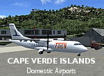
Googlyafcads and simple scenery for five airports in the Cape Verde Islands, all
of which are served by regular domestic flights of TACV - Transportes Aereos de
Cabo Verde. Each of these has been "overlooked" by Microsoft in Flight Simulator
2004 and are provided with nothing other than a runway. These scenery files add
aprons, taxiways, buildings and other airport features to Flight Simulator's bland
representation and allow you and "AI" traffic to land, taxi, park and take off
in a realistic manner.
The airports represented are: GVBA Rabil, GVMA Maio, GVSF Sao Filipe, GVSN Preguica and GVSV Sao Pedro.
The scenery does not purport to be ultra-accurate. Based on high-detail satellite
imagery from Google Earth (except Sao Filipe), the layout is proportianally correct
but the added airport features, such as buildings, are built from default Microsoft
objects and add-on libraries so will not look like the real thing. Sao Filipe is
largely imaginary owing to poor quality of the satellite image, but has been created
to be similar to other airports of like size.
You are not obliged to download and install any additional scenery libraries,
but to enjoy this scenery in its entirety, you may wish to. It will work fine,
with or without.
[File re-uploaded at request of AVSIM]
| Filename: | Cape_Verde_Islands_Domestic_Airports.zip |
| License: | Freeware |
| Added: | 15th June 2010, 01:00:46 |
| Downloads: | 6,999 |
| Author: | John Hinson |
| Size: | 84.1 KB |
| Category: Flight Simulator 2004 - Scenery | |
| SSJA Joaçaba, Brazil |
|
Images related to this file:
File Description:
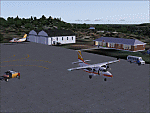
Googly scenery for SSJA Joaçaba - a small domestic airport
in the state of Santa Caterina, Brazil, that is poorly provided for in Flight
Simulator 2004. These scenery files add taxiways, aprons, buildings and other
airport features, so that you and your "AI" traffic can land, taxi, park and
take off in a realistic manner.
The small but prosperous city of Joaçaba was originally established in 1917 as
Cruzeiro and later known as Limeira and Cruzeiro do Sol, but in 1943 adopted
the current name following the introduction of legislation prohibiting cities
in Brazil using the same name - not a bad idea really. Joaçaba has a high
quality medical centre serving the state of Santa Caterina and a renowned
university which both bring traffic to the airport which is served by mainly
by LET410 aircraft of local airline NHT Linhas Aéreas.
The scenery does not purport to be ultra-accurate. Based on high-detail satellite
imagery from Google Earth, the layout is proportionally correct but the added
airport features, such as buildings, are built from default Microsoft objects
and add-on libraries so will not look exactly like the real thing.
[File re-uploaded at request of AVSIM]
| Filename: | SSJA_Joaccedilaba_Brazil.zip |
| License: | Freeware |
| Added: | 14th May 2010, 04:47:22 |
| Downloads: | 1,263 |
| Author: | John Hinson |
| Size: | 65.83 KB |
| Category: Flight Simulator 2004 - Scenery | |
| VGEG Chittagong/Shah Amanat International, Bangladesh |
|
Images related to this file:
File Description:

Googly scenery for VGEG Chittagong/Shah Amanat International (known as M A
Hannan until 2005) - an important airport in Bangladesh that is poorly provided
for in Flight Simulator 2004. These scenery files add taxiways, aprons,
buildings and other airport features, including the military area at the north
end and the general aviation ramps, so that you and your "AI" traffic can land,
taxi, park and take off in a realistic manner.
The city of Chittagong and its port are served regularly by jets ranging in size
from the Fokker 28 to the Douglas DC10 from operators like Air Arabia, Air Asia,
Biman Bangladesh Airlines, Oman Air, Thai Airways International, and turboprops of
GMG Airlines, United Airways and Zoom Airways.
The scenery does not purport to be ultra-accurate. Based on high-detail satellite
imagery from Google Earth, the layout is proportionally correct but the added
airport features, such as buildings, are built from default Microsoft objects
and add-on libraries so will not look like the real thing.
You are not obliged to download and install any additional scenery libraries,
but to enjoy this scenery in its entirety, you may wish to. It will work fine,
with or without.
[File re-uploaded at request of AVSIM]
| Filename: | VGEG_ChittagongShah_Amanat_International_Banglades.zip |
| License: | Freeware |
| Added: | 14th May 2010, 05:10:02 |
| Downloads: | 3,079 |
| Author: | John Hinson |
| Size: | 71.7 KB |
| Category: Flight Simulator 2004 - Scenery | |
| Frozen rivers and lakes (and sea) for Alaska's winter |
|
Images related to this file:
File Description:
This "freezes" all lakes and rivers (and some sea) for winter flying and means they can be landed on with skis or wheels; it is meant for low level flying rather than high level jet flights. This edition covers all of Alaska, except for the Aleutian Islands, as the worst area to do this for is a string of islands. Terrible. Fiddly. It is reversible with an "untick" in the FS scenery library. I have spent some time making sure that the sea and the larger inlets along the southern coast do not get frozen too as they stay ice-free in winter. Along the north shore I went for the peak of the winter with sea ice all the way to the permanent polar cap; this is not totally realistic as there is usually a partially open lead along the coast, but anything else would be ...... fiddly. This is really for use with Ultimate Terrain, though it will work without it. But as UT is what gets all the lakes and rivers there and in the right place it would be a shame not to be using UT. There is a blurry transition between southern Alaska and Canada so you may need the recent Canada post too.
| Filename: | Frozen_rivers_and_lakes_and_sea_for_Alaskas_winter.zip |
| License: | Freeware, limited distribution |
| Added: | 8th September 2011, 11:53:51 |
| Downloads: | 681 |
| Author: | Roger Wensley |
| Size: | 493.23 KB |
| Category: Flight Simulator 2004 - Scenery | |
| HCMI Berbera, Somalia |
|
Images related to this file:
File Description:
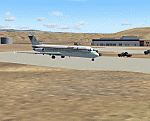
Googly scenery for HCMI Berbera, Somalia - an airport largely overlooked in
Flight Simulator 2004 with just a runway and tower provided at what is actually
the country's largest airport. At one time it had two active runways and a
strong military presence but today activity is limited to occasional
civilian flights. These scenery files add taxiways, aprons, buildings and
other airport features (and remove the non-existent tower that Microsoft
put there) so that you and your "AI" traffic can land, taxi, park and take
off in a realistic manner. This desert-surrounded airport is served three times per week by Douglas DC-9 jets of Kenyan airline African Express Airways.
The scenery does not purport to be ultra-accurate. Based on high-detail satellite
imagery from Google Earth, the layout is proportionally correct but the added
airport features, such as buildings, are built from default Microsoft objects
and add-on libraries so will not look like the real thing.
You are not obliged to download and install any additional scenery libraries,
but to enjoy this scenery in its entirety, you may wish to. It will work fine,
with or without. [File re-uploaded at request of AVSIM]
| Filename: | HCMI_Berbera_Somalia.zip |
| License: | Freeware |
| Added: | 29th May 2010, 09:26:33 |
| Downloads: | 1,317 |
| Author: | John Hinson |
| Size: | 62.07 KB |


© 2001-2026 AVSIM Online
All Rights Reserved
Privacy Policy |