
Where Flight Simulation Enthusiasts Gather from Around the World!
AVSIM Library - Search Results

| Category: Flight Simulator 2004 - Scenery | |
| New Terrain Mesh of the Province of Quebec in LOD09 (4/4) |

|
File Description:
The files in this package contain terrain mesh files of the province of Quebec (N45 to N53) to be used with my Quebec enhanced sceneries for FS2004 (Scenes_du_Quebec_2k4.zip). The public data sources are the Shuttle Radar Topography Mission (SRTM-3, 90m) and the Canadian Digital Elevation Data (CDED - 0.75s/arc - 23m). (QC09_2k4a.zip to QC09_2k4d.zip - 4 parts)
***********************
Les fichiers de ces archives contiennent les donnees d'elevation de terrain (mesh files - lod09), pour FS2004, du territoire de la province de Quebec sous le 53ieme degre de latitude nord. Ils ont ete crees pour etre utilises avec mes nouvelles scenes du Quebec contenues dans Scenes_du_Quebec_2k4.zip. Les donnees sources sont du domaine public et proviennent de la Shuttle Radar Topography Mission (SRTM-3, 90m) et des donnees numerique d'elevation du Canada (DNEC - 0.75s/arc -23 m). (QC09_2k4a.zip to QC09_2k4d.zip - 4 parties)
| Filename: | New_Terrain_Mesh_of_the_Province_of_Quebec_in_LOD0.zip |
| License: | Freeware, limited distribution |
| Added: | 27th January 2010, 18:17:08 |
| Downloads: | 7,855 |
| Author: | Gilles Gauthier |
| Size: | 20.94 MB |
| Category: Flight Simulator 2004 - Scenery | |
| New Terrain Mesh of the Province of Quebec in LOD09 (2/4) |
|
File Description:
The files in this package contain terrain mesh files of the province of Quebec (N45 to N53) to be used with my Quebec enhanced sceneries for FS2004 (Scenes_du_Quebec_2k4.zip). The public data sources are the Shuttle Radar Topography Mission (SRTM-3, 90m) and the Canadian Digital Elevation Data (CDED - 0.75s/arc - 23m). (QC09_2k4a.zip to QC09_2k4d.zip - 4 parts)
***********************
Les fichiers de ces archives contiennent les donnees d'elevation de terrain (mesh files - lod09), pour FS2004, du territoire de la province de Quebec sous le 53ieme degre de latitude nord. Ils ont ete crees pour etre utilises avec mes nouvelles scenes du Quebec contenues dans Scenes_du_Quebec_2k4.zip. Les donnees sources sont du domaine public et proviennent de la Shuttle Radar Topography Mission (SRTM-3, 90m) et des donnees numerique d'elevation du Canada (DNEC - 0.75s/arc -23 m). (QC09_2k4a.zip to QC09_2k4d.zip - 4 parties)
| Filename: | New_Terrain_Mesh_of_the_Province_of_Quebec_in_LOD0.zip |
| License: | Freeware, limited distribution |
| Added: | 1st November 2009, 06:47:09 |
| Downloads: | 4,628 |
| Author: | Gilles Gauthier |
| Size: | 27.78 MB |
| Category: Flight Simulator 2004 - Scenery | |
| Igloolik CYGT update (to FSGenesis 76m North Canada Terrain Mesh revision) |
|
Images related to this file:
File Description:
These are replacement bgl's and textures to correct the already posted Igloolik CYGT for use with the FSGenesis 76m terrain mesh for northern Canada. I noticed after posting that the PAPI were incorrectly positioned, and after fixing that I went on and updated the windsocks, added the wheeled roller/snow clearer that all gravel fields need in the north, and updated the signage to give the true headings for the runway. This is not stand-alone, and the presumption is that you have already downloaded and installed the previously posted scenery. Installation consists solely of replacing the existing scenery bgl's with the new, and adding the new signage textures.Any comments regarding further corrections that are required would be welcomed.
| Filename: | Igloolik_CYGT_update_to_FSGenesis_76m_North_Canada.zip |
| License: | Freeware, limited distribution |
| Added: | 30th September 2017, 20:11:03 |
| Downloads: | 84 |
| Author: | Roger Wensley |
| Size: | 1.03 MB |
| Category: Flight Simulator 2004 - Scenery | |
| Backcountry airfields for 19m terrain mesh in Idaho USA series 2 |
|
Images related to this file:
File Description:
These backcountry fields are for use with the FSGenesis 19m mesh of Idaho; they almost certainly do not work without it. The six airfields are a follow-on series to the previous four, ranging from Stanley that has a village and airfield buildings of one sort or another and even a length of asphalt runway, to Bruce Meadows that has two bathrooms. The full list from northwest to southeast is Bruce Meadows U63, Garden Valley U88, Warm Springs Creek 0U1, Stanley 2U7, Graham U45, and Smiley Creek U87. These airfields compensate for the loss of airfield flattens after the removal of AF917150 and AF917160, but there remain some now-unflattened airfields I have not included here, whether for reason of the impossibility of realistically creating it (as in the case of Flying B) or just a total lack of anything interesting about it. There may be some more follow-on fields that are new, to the north of the original four; these six are all to the south. The landclass files either change forested areas, as in Bruce Meadows, or add a village, as in Stanley. Although these are stand-alone, the presumption is that you have already installed the original four for use with the FS Genesis 19m terrain mesh, and there is a correction for Big Creek where I missed spotting a lack of flatten in one area.
| Filename: | Backcountry_airfields_for_19m_terrain_mesh_in_Idah.zip |
| License: | Freeware, limited distribution |
| Added: | 29th May 2017, 04:20:10 |
| Downloads: | 111 |
| Author: | Roger Wensley |
| Size: | 9.09 MB |
| Category: Flight Simulator 2004 - Scenery | |
| Vance W. Amory International Airport, St Kitss and Nevis (TKPN), Update to version 1.1 |
|
Images related to this file:
File Description:
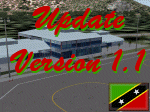
This zip-file contains a update to version 1.1 of my scenery for the Vance W. Amory International Airport in St. Kitts and Nevis. Original version 1.0 is required. Update contains:
- Removed flatten-area which conflicted with default FS9 mesh terrain settings.
- Corrected AFCAD file
- Fixed some small bugs
- New displaced threshold markings
- Modified windsocks
- Added working marshalers on parking spot 1 & 2 (front of the terminal)
| Filename: | Vance_W_Amory_International_Airport_St_Kitss_and_N.zip |
| License: | Freeware, limited distribution |
| Added: | 2nd April 2010, 01:24:50 |
| Downloads: | 1,828 |
| Author: | Marcel Ritzema |
| Size: | 57.77 KB |
| Category: Flight Simulator 2004 - Miscellaneous Files | |
| Johannesburg - Cape Town - Johannesburg for Level-D Sim 767 |
|
File Description:
This are two flightplans for the Level-D Sim 767. Flightplans for Johannesburg (FAJS) to Cape Town (FACT) and return. I recommend the sceneries from Aeroworx, there are many files in the library, for example a very good J'Burg and Cape Town scenery. There is also a mesh scenery package, which makes the trip a real sight seeing flight. Flightime is about two hours.
| Filename: | Johannesburg__Cape_Town__Johannesburg_for_LevelD_S.zip |
| License: | Freeware |
| Added: | 21st March 2005, 13:25:33 |
| Downloads: | 524 |
| Author: | Peter Andrew Marten |
| Size: | 1.47 KB |
| Category: Flight Simulator 2004 - Scenery | |
| GRANADA (SPAIN), Part 3: Granada city and The Alhambra |
|
File Description:
FS2004 GRANADA (SPAIN), Part 3: Granada city and The Alhambra.
3D Object Scenery with Buildings, Monuments and Trees.
Monuments specially designed: The Alhambra, the Cathedral and
other important Churches and houses.
An scenery for view near and flight slowly.
Powerful computer is required.
Thanks to Gerrish Gray for his freeware Trees Library.
Looks best with a mesh scenery and parts 1+2.
By Valentin Casares Garzón.
| Filename: | GRANADA_SPAIN_Part_3_Granada_city_and_The_Alhambra.zip |
| License: | Freeware |
| Added: | 24th April 2006, 19:44:48 |
| Downloads: | 6,853 |
| Author: | Valentin Casares |
| Size: | 11.32 MB |
| Category: Flight Simulator 2004 - Scenery | |
| Fertiliser Works - Awatoto, Napier |
|
File Description:
Situated on the coast, just south of Napier - a familiar sight to pilots around Hawke's Bay, New Zealand.
An updated version from my original scenery object - textures also updated.
Smoke from chimneys affected by wind.
This scenery is located for Christian Stock's NZ mesh in the form of "Mountains of New Zealand" and topo in the form of "Lakes and Rivers of New Zealand".
| Filename: | Fertiliser_Works__Awatoto_Napier.zip |
| License: | Freeware |
| Added: | 28th October 2008, 14:20:16 |
| Downloads: | 376 |
| Author: | Godfrey Tier |
| Size: | 134.6 KB |
| Category: Flight Simulator 2004 - Scenery | |
| Hauraki Gulf v4 |
|
File Description:
This replaces all my previous Pakatoa Island and Hauraki Gulf sceneries.You must have Christian Stock's NZ mesh in the form of "Mountains of New Zealand" and topo in the form of "Lakes and Rivers of New Zealand". Includes all previous scenery candy. New in this pack...RANGITOTO ISLAND: Rangitoto Lighthouse; Rangitoto Wharf, public conveniences and baches; Islington Bay Wharf with toilets, telephone and information stand.
| Filename: | Hauraki_Gulf_v4.zip |
| License: | Freeware |
| Added: | 9th November 2008, 08:12:31 |
| Downloads: | 298 |
| Author: | Godfrey Tier |
| Size: | 6 MB |
| Category: Flight Simulator 2004 - Scenery | |
| Hauraki Gulf v5 |
|
File Description:
This replaces all my previous Pakatoa Island and Hauraki Gulf sceneries.You must have Christian Stock's NZ mesh in the form of "Mountains of New Zealand" and topo in the form of "Lakes and Rivers of New Zealand". Includes all previous scenery candy. New in this version: MOTUTAPU ISLAND: Home Bay Wharf; WW2 Observation Hut, Billy Goat Point; Motutapu Outdoor Education Camp Trust, Administration Bay.
| Filename: | Hauraki_Gulf_v5.zip |
| License: | Freeware |
| Added: | 13th November 2008, 02:24:13 |
| Downloads: | 513 |
| Author: | Godfrey Tier |
| Size: | 6.4 MB |


© 2001-2026 AVSIM Online
All Rights Reserved
Privacy Policy |