
Where Flight Simulation Enthusiasts Gather from Around the World!
AVSIM Library - Search Results

| Category: Flight Simulator 2004 - Utilities | |
| FSPause Utility |

|
File Description:
FSPause is a small utility to set pause in FS on conditions like latitude,longitude,altitude,speed or distance to a waypoint.
Can be used on another computer with widefs.
| Filename: | FSPause_Utility.zip |
| License: | Freeware |
| Added: | 15th June 2005, 00:40:16 |
| Downloads: | 814 |
| Author: | Patrick Fabre |
| Size: | 1.38 MB |
| Category: Flight Simulator 2004 - Utilities | |
| Route Editor Ver2 |
|
File Description:
This is an updated version of my Route Editor program,
following requests from other users.
This program enables you to edit a FS2004 GPS Route file ('.PLN').
You can edit existing PLN files or create your own from new.
The previous version only edited 'VFR Direct GPS' routes.
This program now saves Routes as either VFR or IFR and you
are able to select Routing as Direct GPS, Low Altitude Airways, High Altitude Airways or VOR to VOR
| Filename: | Route_Editor_Ver2.zip |
| License: | Freeware, limited distribution |
| Added: | 13th June 2006, 15:11:42 |
| Downloads: | 3,154 |
| Author: | Jim Cooper |
| Size: | 110.33 KB |
| Category: Flight Simulator 2004 - Gauges | |
| Autopilot Input Pad |
|
File Description:
This input/storage pad allows both altitude and heading values to be entered into the autopilot in an accurate and convenient fashion by simply pressing keys on the gauge. The gauge contains two memories for storing heading or altitude values. Numeric pad, Enter keys, Clear and Backspace buttons work in similar way as pocket calculators. Can be installed on panel or inside separate window. Makes IFR easy as pie by reducing stress-induced errors during hectic approaches.
| Filename: | Autopilot_Input_Pad.zip |
| License: | Freeware |
| Added: | 11th February 2006, 01:00:47 |
| Downloads: | 3,612 |
| Author: | Glenn Copeland |
| Size: | 306.31 KB |
| Category: Flight Simulator 2004 - Original Aircraft | |
| Supermarine Spitfire Mk. IX (Full package) |
|
File Description:
This is the high-altitude, high-performance version of this classic World War II fighter. It includes full animation, panel, sound pack, smoke system and two paint schemes with reflective textures
| Filename: | Supermarine_Spitfire_Mk_IX_Full_package.zip |
| License: | Freeware |
| Added: | 17th June 2005, 23:15:53 |
| Downloads: | 5,568 |
| Author: | The GV Aircraft Co. |
| Size: | 6.87 MB |
| Category: Flight Simulator 2004 - Utilities | |
| ApproachCalc |
|
File Description:
ApproachCalc is a small application that allows you to quickly calculate at what altitude you should start your final approach to any airport. All you need to know is the field elevation.
| Filename: | ApproachCalc.zip |
| License: | Freeware |
| Added: | 9th August 2005, 18:54:46 |
| Downloads: | 5,966 |
| Author: | Brian Wilber and Tim Brier |
| Size: | 5.78 KB |
| Category: Flight Simulator 2004 - Panels | |
| Douglas DC-7 panel update |
|
File Description:
This is an update to my FS2004 Douglas DC-7 panel,
adds a switches magneto and a throttle and mix quadrant,
in order to set the best fuel mix in higher altitude
| Filename: | Douglas_DC7_panel_update.zip |
| License: | Freeware |
| Added: | 1st May 2008, 22:54:40 |
| Downloads: | 725 |
| Author: | Francisco Silva |
| Size: | 6.74 MB |
| Category: Flight Simulator 2004 - Scenery | |
| KEGE - Eagle Regional Airport - Colorado, USA |
|
Images related to this file:
File Description:
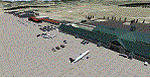
Eagle Regional Airport (KEGE) has an approach through mountainous terrain and challenging departure procedures. It is Home for the Vail Valley Jet Center, the Colorado National Guard High Altitude Training Center and the Army. Because of it's high altitude, it is a very dangerous airport for take-off and landings. This scenery is updated with the new 109,75 ILS, the new Army and National Guard area on the opposite side of the airfield and many trees in the surrounding area.
| Filename: | KEGE__Eagle_Regional_Airport__Colorado_USA.zip |
| License: | Freeware |
| Added: | 7th September 2016, 21:58:26 |
| Downloads: | 778 |
| Author: | David Kolas |
| Size: | 8.55 MB |
| Category: Flight Simulator 2004 - Utilities | |
| DesCalc 1.2 |
|
File Description:
DesCalc is a free CLI programme that helps you find the exact distance before a certain point at which you want to be at a certain altitude you need to start your descent.
| Filename: | DesCalc_12.zip |
| License: | Freeware |
| Added: | 17th January 2009, 14:20:36 |
| Downloads: | 746 |
| Author: | Achilleas Moraitis |
| Size: | 385.89 KB |
| Category: Flight Simulator 2004 - Original Aircraft | |
| FS2004. Bristol Type 138A |
|
File Description:
FS2004. Bristol Type 138A
A High Altitude Research aircraft
for the Royal Aircraft Establishment
at Farnborough. The first flight was
at Filton on 11/5/1936.
v1 By Edward Cook. 01/05/18.
| Filename: | FS2004____Bristol_Type_138A.zip |
| License: | Freeware |
| Added: | 11th September 2020, 19:33:57 |
| Downloads: | 106 |
| Author: | Edward Cook |
| Size: | 11.18 MB |
| Category: Flight Simulator 2004 - Scenery | |
| SKBS - Jose Celestino Mutis - Bahia Solano, Colombia *Fix* |
|
File Description:
I just noticed that I forgot to mention that you probably need to put the attached file "SKBS_ADE9_DJR_ALT.BGL" into your FS9/scenery/world/scenery folder to make the altitude correction of the airport work.
| Filename: | SKBS__Jose_Celestino_Mutis__Bahia_Solano_Colombia_.zip |
| License: | Freeware |
| Added: | 9th July 2013, 01:37:37 |
| Downloads: | 329 |
| Author: | Detlev J. Rohmer |
| Size: | 1.28 KB |


© 2001-2026 AVSIM Online
All Rights Reserved
Privacy Policy |