
Where Flight Simulation Enthusiasts Gather from Around the World!
AVSIM Library - Search Results

| Category: Flight Simulator X - AFCAD Files | |
| SAWH-Ushuaia International Airport-Argentina |

|
File Description:
Ushuaia International Airport (Spanish: Aeropuerto Internacional de Ushuaia) (IATA: USH, ICAO: SAWH) is located 4 km (2.5 mi) south[1] of the center of Ushuaia, a city on the island of Tierra del Fuego in the Tierra del Fuego
Province of Argentina.Ushuaia International Airport is fit to receive airplanes as large as the Boeing 747. Tower Air used to operate such types into the airport, and AeroliÂneas Argentinas operated 747-400s into the airport
during events of high passenger numbers (such as entire cruise-ship passenger payloads) until retiring this aircraft type in February, 2012. Two chartered Air France Concordes also visited in the past: F-BTSD arriving from
Buenos Aires and continuing to Santiago, Chile, in early 1999; the second arriving from Easter Island, Chile and continuing to Buenos Aires prior to the cessation of most Concorde charter flights on July 25, 2000. Condor and
LTU also offered charter flights from Germany and First Choice Airways from the United Kingdom. It also offers charter flights to Maputo, Mozambique.
This work is dedicate to Tiziano Fiori who lives in Trelew.
| Filename: | SAWHUshuaia_International_AirportArgentina.zip |
| License: | Freeware |
| Added: | 27th September 2012, 23:55:23 |
| Downloads: | 794 |
| Author: | Anwar Gonzalez |
| Size: | 58.72 KB |
| Category: Flight Simulator 2004 - Scenery | |
| PASY - Shemya (Eareckson Air Station) - Alaska, USA |
|
Images related to this file:
File Description:
Shemya is pretty well AT the western end of the Aleutian chain of islands in Alaska, around 240 miles west of Amchitka. There is no town on Shemya and the whole island is occupied (and owned) by the Air Force. There are three runways, two of which are from the 1940's and are now unused; in fact one of them has been partly ploughed up and also used for outdoor storage. The single in-use runway is aligned 10-28 and is 10,000 feet of 150 feet wide asphalt with an ils on 28, the runway that is used 99% of the time. The base is now not active but is maintained as a refuelling facility, so for landing and takeoff purposes it is open. The older and now unused areas are those where the hangers are slowly rusting away and the asphalt is turning green with encroaching and well-watered wildlife plants. The tower is now closed, so there is no atc and you just announce your intentions. Read the history of Shemya, a lot happened there.
| Filename: | PASY__Shemya_Eareckson_Air_Station__Alaska_USA.zip |
| License: | Freeware, limited distribution |
| Added: | 18th February 2015, 19:52:36 |
| Downloads: | 453 |
| Author: | Roger Wensley |
| Size: | 8.81 MB |
| Category: Flight Simulator X - Scenery | |
| RAF Hilbaldstow - Lincolnshire, England |
|
File Description:
RAF Hibaldstow is a former Royal Air Force satellite airfield located south of Hibaldstow in Lincolnshire and 8.3 miles (13.4 km) south east of Scunthorpe, Lincolnshire, England. The airfield was built with greater things in mind, but it only became a satellite airfield for RAF Kirton-in-Lindsey in 1941. When the runways were constructed, some of the hardcore was made from material taken from demolished bungalows on the site.
The airfield was commissioned on 12 May 1941 when No. 255 Squadron RAF took up residence with their Boulton Paul Defiant night fighters. These planes had been drawn from RAF Kirton-in-Lindsey and made one 'kill': an He 111 which was shot down near Louth on 5 June 1941.
On 6 August 1947 the station finally closed and during 1960-61 it was sold off for use as agricultural land. It was also used for Sunday markets, as a skid-pan by Lincolnshire Police and by a local parachute club. The control tower was converted to a two-storey house in 1976.
| Filename: | RAF_Hilbaldstow__Lincolnshire_England.zip |
| License: | Freeware |
| Added: | 24th October 2015, 22:00:30 |
| Downloads: | 202 |
| Author: | Terry Boissel |
| Size: | 24.85 KB |
| Category: Flight Simulator X - Scenery | |
| RAF Hutton Cranswick |
|
File Description:
RAF Hutton Cranswick opened in January 1942 as a fighter airfield within No. 12 Group RAF. Unusually for the time its three runways were concrete "from new", many airfields (particularly fighter airfields) were initially built with grass runways which were later upgraded to concrete.
Many squadrons rotated through the airfield including 610, 19, 308 (City of Kraków), 316 (City of Warsaw), 195, 306 (City of Torun), 302 (City of Poznan), 315 (City of Deblin), 234, 168 and No. 170 Squadron RAF. From December 1943, the Anti-Aircraft Co-operation 291 Squadron was formed at the airfield for target towing and similar uses.
Whilst in use by 291 other fighter squadrons continued to rotate through including 401, 403, 412, 441, 442, 443 (all flying Supermarine Spitfires) and 439 using Hawker Typhoons. The final unit to operate from Hutton Cranswick was No. 124 Squadron RAF using Spitfire IXs.
The station closed in 1946 and has reverted back to farm land, an industrial site now stands were the tech site was situated and the tower became a house.
Source:Wikipedia
| Filename: | RAF_Hutton_Cranswick.zip |
| License: | Freeware |
| Added: | 27th February 2017, 15:12:55 |
| Downloads: | 126 |
| Author: | Terry Boissel |
| Size: | 4.95 MB |
| Category: Prepar3D V1-4 - Scenery | |
| Loreto Marche Italy N 43.26.27 E 13.36.36 |
|
File Description:
Loreto Marche Italy (N 43.26.27 E 13.36.36) Loreto is an Italian town in the province of Ancona in the Marche region
and is famous for being the headquarters of the Basilica of the Santa Casa, one of the most important and ancient places
of Marian pilgrimage in the Catholic world. The city rises on the top of a gentle hill, with a wide countryside around
characterized by the cultivation of the olive tree. The shape of the dome and the bell tower of the Basilica, whose
top is the figure of the Madonna, stands out for its height and majesty. The Basilica houses the famous relic of the
"Holy House" of Nazareth where, according to tradition, the Virgin Mary was born and lived where he received the
announcement of the miraculous birth of Jesus. The panorama that can be enjoyed ranges from the Adriatic Sea to Monte
Conero, up to the Umbrian-Marche Apennines. Important VFR point for approaching airport Ancona Falconara. Within the
downloaded package you will find readme files for scenery installation. Good fly VFR. Pasquale Marrulli.
| Filename: | Loreto_Marche_Italy_N_432627_E_133636.zip |
| License: | Freeware |
| Added: | 4th May 2018, 04:42:54 |
| Downloads: | 165 |
| Author: | Pasquale Marrulli |
| Size: | 19.22 KB |
| Category: Flight Simulator X - Scenery | |
| FSX Portland International Airport KPDX |
|
Images related to this file:
File Description:
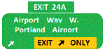
Welcome to Portland International Airport for FSX!
The City of Roses is in the process of revamping KPDX. Many of us have spent time on Concourse A
waiting for our Horizon flight. Many have utilized the ground level walkways on Concourse E to
get to their United Express flight. Both are things of the past.
KPDX is now a primary Alaska Airlines hub. This summer British Airways will start service to London
Heathrow.
The runways have been adjusted to their current length. The taxiways have been corrected (this is
particularly important at the juncture of 10L and 21 which used to overlap). A copy of the current
airport diagram is included.
All the buildings (with the exception of the tower) are custom. Airport vehicles use
the proper vehicle paths and do not use taxiways.To achieve this I had to add a vehicle path that crosses
10R and another that crosses 03.
Three scenery complexity levels are used (normal,dense, and very dense). More eye candy appears with each
increase.
| Filename: | FSX_Portland_International_Airport__KPDX.zip |
| License: | Freeware, limited distribution |
| Added: | 15th January 2020, 05:01:47 |
| Downloads: | 1,802 |
| Author: | Brett Delana |
| Size: | 12.18 MB |
| Category: Flight Simulator 2004 - Scenery | |
| The Greater Toronto Area Part 1 |
|
File Description:
Part 1 of Flight Ontario's scenery for the Greater Toronto Area and Southern Ontario.
Over a year in the making, this scenery for Fs 2002 and Fs 2004 is bounded by Detroit in the west, Kingston in the east, Huntsville in the north and Buffalo in the south and features:
* all-season scenery
* custom water textures
* completely modelled Toronto Airports...CYTZ (Toronto Island) and CYZD
(Downsview-home to Bombardier Aerospace and the Canadair Regional Jet
and Dash-8, and the Toronto Aerospace Museum)
* custom autogen for the GTA
* Custom landclass for southern Ontario
* custom shorelines (western Lake Ontario, Kingston area, Lake
Couchiching...Severn River...Sparrow Lake area, and the Muskoka Lake
area)
* prominent features around Hamilton include the Burlington Skyway and
Lift Bridge and steel mills
* the Welland Canal is featured with lift bridges, bascule bridge and
fixed link bridge from Pt Weller to Pt Colborne
* the Niagara area includes the Minolta Tower, and 3 hydro generating
plants with reservoirs
* compatibility with SimFlyers CYYZ
This scenery is downloadable in two parts and both parts are essential
| Filename: | The_Greater_Toronto_Area__Part_1.zip |
| License: | Freeware |
| Added: | 9th April 2004, 12:40:02 |
| Downloads: | 37,186 |
| Author: | Flight Ontario |
| Size: | 62.09 MB |
| Category: Flight Simulator 2004 - AFCAD Files | |
| Metro Oakland Int'l (KOAK) with Active Crosswind Runways |
|
File Description:
A high spec AFCAD2 for the default FS2004 Metro Oakland Int'l Airport (KOAK). This afcad has been built from scratch using FAA Charts, various aerial photographs and information from the Airport Website. All runways feature real life lengths/widths and include overrun areas. All taxiways are named and all aprons are reworked to be as real as possible according to photos. All gates are named and have airlines assigned to them. As per real life, only Southwest Airlines will use Terminal 2, all other airlines being allocated to Terminal 1. The Fedex and UPS aprons are represented and can accomodate up to 20 cargo aircraft. The final parking area is random GA parking to the north of the airport. Overflow parking is also available for rush hour periods. This airport now features a tower view and also upgraded night and approach lighting. Finally, by using the crosswind runway technique, runways 9L/27R, 9R/27L and 11/29 can all be used simultaniously for take-off and landing. Runway 15/33 is closed as it is not used in real life. Enjoy!!
| Filename: | Metro_Oakland_Intl_KOAK_with_Active_Crosswind_Runw.zip |
| License: | Freeware, limited distribution |
| Added: | 30th July 2005, 06:15:21 |
| Downloads: | 2,529 |
| Author: | Lee Brompton |
| Size: | 80.4 KB |
| Category: Flight Simulator 2004 - Scenery | |
| St. Kitts International Airport (Bradshaw), Caribbean |
|
File Description:
This scenery depicts the Robert L. Bradshaw International airport on the Island of St. Kitts in the Caribbean. It contains the modern new terminal, along with the distinctive green glass tower, and outer buildings. It is a small airport which is located in a valley between two mountain ranges near the southern end of the Island. The scenery has been updated to work in FS2004 by changing the location slightly, removing the hills which are no longer necessary, since FS has now done a great job with the new terrain. The tarmac area is now more representational of the airport, since the scenery tarmacs now override the default FS tarmacs, taxiways, and lines. The airport now has a cleaner layout, and the taxiway extending to the runway end now fits in perfectly. More trees have been added to prevent the stark look of the old scenery. This airport needs an afcad, since there are some A1 aircraft which park in the middle of the taxiway. This scenery will not work in FS2002.
| Filename: | St_Kitts_International_Airport_Bradshaw_Caribbean.zip |
| License: | Freeware |
| Added: | 23rd August 2003, 15:27:31 |
| Downloads: | 4,299 |
| Author: | Bill Melichar |
| Size: | 3.57 MB |
| Category: Flight Simulator X - Scenery | |
| Gold Coast Airport (YBCG) |
|
File Description:
The Gold Coast Airport (formerly known as Coolangatta) is a busy international airport located some 100 ks south of Brisbane and 850 ks north of Sydney. This scenery contains and accurate depiction of the terminal, control tower, hangers and the very distinctive lighthouse at Coolangatta (with beacon) plus night lighting of the apron. In addition many buildings have been added to Coolangatta and Surfers some of which are original but many are stock buildings. The scenery has been reduced in complexity to attempt to be reasonably frame rate friendly. All models are GMAX or FSDS3.0. Extensive coastline changes has added beaches as far south as Byron Bay and the canal network behind Surfers Paradise, Bond Uni, Currumbin and Coolangatta. Recent upgrades of the airport to a 2500 metre runway have been reflected as well as a widened apron. Therefore it may look a little different from the current Google Earth image but it is accurate. The airport will now handle direct flights from Asia and typical planes landing might include Airbus 343 or similar wide bodied aircraft.
| Filename: | Gold_Coast_Airport_YBCG.zip |
| License: | Freeware |
| Added: | 12th July 2007, 15:08:44 |
| Downloads: | 6,178 |
| Author: | John Ross |
| Size: | 12.16 MB |


© 2001-2026 AVSIM Online
All Rights Reserved
Privacy Policy |