
Where Flight Simulation Enthusiasts Gather from Around the World!
AVSIM Library - Search Results

| Category: Flight Simulator 2002 - AFCAD Files | |
| Cork Airport File 1.0 |

|
File Description:
This is the first file of a few files I will be releasing for Cork Airport Ireland {EICK} in FS2002. This is just a small, basic Afcad file to correct the parking at Cork airport. This Afcad file will make all the aircraft at Cork airport {including your aircraft}, park sideways against the building as in real life at Cork airport, instead of parking facing the building. All the starting points will also change to a sideways heading of 166. This will also change the gate numbers and will stop the atc using the term 'parking' all the time. It will change gate 1 to medium, gate 2 to heavy, gate 3 to small, gate 4 to medium {cargo}, parking 5 to ramp GA small, parking 6 to ramp GA small, and parking 7 to ramp GA small. All runways {17/35,07/25}, taxiways, traffic, and atc have been left alone. Parking and buildings are a mess at Cork airport in FS2002, therefore, the file is not perfect. I plan to release further traffic and scenery files for Cork airport in the future. This file requires AFCAD by Lee Swordy. Details of where to get it within download.
The progressive taxi instructions will also not change, neither will the pink line on the taxiways. The pink line will not turn sideways at the gates, but you must turn and park sideways at a heading of around 166 to park properly.
| Filename: | Cork_Airport_File_10.zip |
| License: | Check within download |
| Added: | 27th November 2002, 12:59:02 |
| Downloads: | 486 |
| Author: | Michael O'Sullivan |
| Size: | 200.19 KB |
| Category: Flight Simulator 2004 - Aircraft Repaints, Textures and Modifications | |
| Air Berlin "Discover America" Airbus A320-214 (D-ABNB) |
|
Images related to this file:
File Description:

Air Berlin is Germany's second largest airline, after Lufthansa, and Europe's seventh largest airline in terms of passengers carried. Air Berlin operates an extensive network from a total of 17 German cities, including some European metropolitan and several leisure destinations in the Mediterranean region, Madeira, the Canary Islands and North Africa as well as intercontinental destinations in Southeast Asia, the Caribbean and the Americas. Its hubs are Berlin Tegel Airport and Dusseldorf Airport. The airline is a member of the Oneworld alliance and owns the subsdiaries NIKI in Austria and Belair in Switzerland. Etihad Airways owns 29.21% of Air Berlin.
Air Berlin - AirBerlin Group livery is painted on Project Airbus's Airbus A320-214 model (not included). The textures are saved in 32bit format for quality graphics. Textures are also characterized by HD (High Definition). Its features are idle-reverser animation, animated pack vents and pressurisation outflow valve, detailed textures, accurate paint, dynamic shine & effects, dynamic flexing wings that respond to turbulence, fully independent suspension, trim animation, gear steering, accurate flight dynamics, spoiler animation, reflective cockpit windows, improved wingflex code with input from several new parameters including ground spoilers, fuel load, and angle of attack, transparent navigation light lenses and many more.
Visit our Facebook page "Sky Level Textures" for news, updates and previews on our future repaint projects. Thanks for downloading & Happy flying.
HD GAMING EXPERIENCE inside. https://www.facebook.com/SkyLevelTextures
| Filename: | Air_Berlin_Discover_America_Airbus_A320214_DABNB.zip |
| License: | Freeware |
| Added: | 18th November 2014, 15:13:18 |
| Downloads: | 1,268 |
| Author: | Giacomo Tomasini | Sky Level Textures | Project Airbus |
| Size: | 14 MB |
| Category: Flight Simulator 2004 - Scenery | |
| Maurice Bishop TGPY on Grenada in the Caribbean |
|
Images related to this file:
File Description:
Grenada island is 17 miles south of the southernmost island of the Grenadines, Carriacou; there are some smaller islands between the two. Grenada is 18 miles long and around 8 miles wide, has an estimated population of 110,000, and produces a very large part of the world's annual nutmeg harvest. The capital, St Georges, is by far the largest town and is at the southern end of the island, with the airport close by.
The airport is now called Maurice Bishop, but for some years was called Point Salines. The runway is just over 9,000 feet long and oriented 10/28. Point Salines replaced Pearl Airport, which is on the east coast 12 miles northeast of St Georges and was difficult to expand as the runway had mountains at one end and the sea at the other. Pearl is now closed; it is included here but only as a visual landmark with "closed" markings. There are regular international flights from North America and Europe, some of which are seasonal only (Air Canada for instance) and local connecting flights by LIAT and SVG. I retained the default control tower as it is some distance away. In real life it is also some distance away and on a hill northwest of the terminal. Which is why I did not take photos from which I would have made the real one. The hill does not feature in FS9.
| Filename: | Maurice_Bishop_TGPY_on_Grenada_in_the_Caribbean.zip |
| License: | Freeware, limited distribution |
| Added: | 11th June 2013, 23:28:17 |
| Downloads: | 825 |
| Author: | Roger Wensley |
| Size: | 7.38 MB |
| Category: Flight Simulator X - Scenery | |
| GABS Bamako Senou International Airport |
|
File Description:
Bamako Senou International Airport (IATA: BKO, ICAO: GABS) is Malis main airport approximately 15 km south of downtown Bamako, the capital of Mali in West Africa. It is managed by Aeroports du Mali (ADM). Its operations are overseen
by the Malian Ministry of Equipment and Transports. Senou Airport was opened to traffic in 1974. The airport was upgraded between 2007 and 2012 in a 181 million US dollar project funded by the Millennium Challenge Corporation, a United
States foreign aid agency. Passenger traffic steadily increased in the early 2000s. Government figures show 403,380 passengers in 1999, 423,506 in 2003, 486,526 in 2004, and 516,000 in 2005. It is predicted to reach over 900,000 by 2015
under a low (4%) yearly growth rate scenario.
To date this growth rate has been surpassed. Total air traffic at BKO increased by 12.4% in 2007 and 14% in 2008. Most of this increase came in passenger transport, with the number of passengers served increasing by 20% in 2007 and 17%
in 2008. Twenty-seven airline carriers operated weekly or better at BKO in the 2007-2008 period. This continued growth was offset by cargo flights decline of 16.75% in 2007, and 3.93% in 2008.
The highest frequency route is on the Bamako-Dakar sector with 29 weekly non-stop connections. Domestic flights also serve Mali's regional capitals Kayes, Mopti, Timbuktu, Sikasso, Gao, and Kidal.
This work is dedicated to West Wind Airlines.
| Filename: | GABS_Bamako_Senou_International_Airport.zip |
| License: | Freeware |
| Added: | 27th March 2013, 01:12:43 |
| Downloads: | 3,396 |
| Author: | Anwar Gonzalez |
| Size: | 915.65 KB |
| Category: Flight Simulator X - Scenery | |
| Santa Cruz de la Sierra - Bolivia |
|
File Description:
Scenery Photoreal: Santa Cruz de la Sierra, Bolivia
Santa Cruz de la Sierra: (English: Holy Cross of the Mountain Range), commonly known as Santa Cruz, is the
capital of the Santa Cruz department in eastern Bolivia (17 45', South, 63 14', West)at 416 m above sea level.
The city of Santa Cruz is located not far from the easternmost extent of the Andes Mountains and they are
visible from some parts of the city its Situated too on the Pirai River.
The city of Santa Cruz and its metropolitan area are home to over 70% of the population of the department and
it is one of the fastest-growing cities in the world.
Airports: (NOT included in this package, just Scenery Photoreal of the city)
Viru Viru International Airport (IATA: VVI, ICAO: SLVR) in Santa Cruz de la Sierra, Bolivia is Bolivia's largest
international airport. Viru Viru handles domestic, regional, and international flights from Bolivia to
North America, South America and Europe and is the hub for Bolivia's biggest airline Boliviana de Aviacion (BoA).
The airport is able to handle the largest commercial jets.
El Trompillo Airport (IATA: SRZ, ICAO: SLET) is located in the south part of Santa Cruz, Bolivia, about 2 km
(1.25 miles) away from the central plaza. Airport type:(Public / Military).
Compatible with both FSX and P3D.
| Filename: | Santa_Cruz_de_la_Sierra__Bolivia.zip |
| License: | Freeware |
| Added: | 23rd June 2015, 17:09:33 |
| Downloads: | 1,713 |
| Author: | Marcos A. Rivas Torrez |
| Size: | 69.85 MB |
| Category: Flight Simulator 2004 - Scenery | |
| Alaska South Slope 10; Port Clarence KPC |
|
Images related to this file:
File Description:
There are four main northwestern Alaska towns which are serviced by Alaska Airlines, and from which local flights spread out. The northernmost is Barrow. Southwest of Barrow is Kotzebue, then Nome, and the furthest south is Bethel (not yet made). This is the third in a series for local flights from Nome, and it is on the coast around 40 miles east of Wales, and 65 miles northwest of Nome. There are two other airfields around a large lagoon that is almost totally enclosed from the sea, and Port Clarence is on the end of the enclosing spit. Port Clarence was, until the LORAN navigation system went out of use, a Coastguard Station that had a LORAN transmitter, with an impressive mast that was 1,350 feet tall. It "was" as the mast was demolished in 2010, after the LORAN systems had been closed down in stages (LORAN-A in 1980 in the US, LORAN-C in 2010). In the meantime the runway had been lengthened to around 8,500 feet, and continued to be used by the Coastguard. Port Clarence has a population of 24, in theory, though presumably the census information refers to Coastguard personnel in the buildings of the LORAN station. The date for this scenery is anytime you like so long as it is before 2010 as the mast is still there. The AI includes Coastguard C-130 Hercules and helicopter flights, plus a weekly fuel delivery by Everts Air Fuel in a fancy colour scheme (Wednesday) and a daily visit by Bering so Coast Guards can go to civilisation in Nome.
| Filename: | Alaska_South_Slope_10_Port_Clarence_KPC.zip |
| License: | Freeware, limited distribution |
| Added: | 23rd October 2016, 18:53:14 |
| Downloads: | 232 |
| Author: | Roger Wensley |
| Size: | 3.05 MB |
| Category: Flight Simulator 2004 - Gauges | |
| FS2004 GPS Map View Gauge v3.0 |
|
File Description:
The ultimate gauge. The Map will show: Airports details (Runways ID's, length & ILS), VOR's and NDB's frequencies,
Intersections and waypoints, Airspaces, Approaches and flight routes. You can toggle the view
you require for your flight. Also you can zoom in/out to see the nearest airports, vor's and
ndb's. The map will indicate A/C heading flightplan title and waypoints ID's.
Version 3 includes more enhancements such as the ability to input the ICAO code or name of any airport and the map will
show all the frequencies of that airport including ATIS, ILS, AND COM. In addition, the map will show the active
runway designations, length and width.
You can also input ICAO code of any VOR/NDB and the map will show their frequencies.
There was a bug in v2.0, in which if you enter ( click on ENT )the ICAO code of an airport, you will lose the flight
plan loaded. Now you can go back to the flight plan and with the NEXT/PREV buttons you have the choice of where to start
your FP.
The gauge will show Flight Plan Title, originating and destination airports, active waypoint, waypoint index and FP
crusing altitude.
I addition, the gauge will show various useful information, such as, Runway IDs, lenght, width and approach magnetic heading,
Airport name, city, and type. NAV1/2 names, codes, distances and ETA's, ADF1/2 names and codes.
Finally, the gaugee will show other information, such as, magvar, indicated airspeed, mach, ground velocity, ambient
wind velocity and direction, bank angle , and a/c altitude ( radio height ).
All the information above and much more on a single gauge window.
| Filename: | FS2004_GPS_Map_View_Gauge_v30.zip |
| License: | Freeware, limited distribution |
| Added: | 14th September 2005, 14:19:46 |
| Downloads: | 10,841 |
| Author: | Talal Alhaj |
| Size: | 710.05 KB |
| Category: Flight Simulator 2004 - Aircraft Repaints, Textures and Modifications | |
| StefAvia VA Boeing 747-830 (D-ATLA) |
|
Images related to this file:
File Description:

This is a repaint of the excellent SkySpirit2011 Boeing 747-8I model, in StefAvia (my new VA paint) livery, D-ATLA. Model included. The textures are saved in 32bit format for quality graphics. Shine effect. Model developed by SkySpirit, features high resolution textures, dynamic flexing wings, nose gear steering, rudder lock, ground spoilers, low speed aileron locks at high speed, fully animated control surfaces, fully independent suspension, trim animation, opening passenger doors, rolling wheels, animated thrust reverse with reverser block doors, detailed textures, full night lighting, ground service vehicles and more. Model design by Hiroshi Igami. Flight dynamics design by Warren C. Daniel, Brandon D. Henry. Master textures and paint kit by Corey Ford, Yosuke Ube. For support visit SkySpirit Facebook page: http://www.facebook.com/#!/home.php?sk=group_198674293492769&ap=1
| Filename: | StefAvia_VA_Boeing_747830_DATLA.zip |
| License: | Freeware |
| Added: | 6th November 2014, 01:33:29 |
| Downloads: | 303 |
| Author: | Stefan Bree / FSRepaintsGroup, SkySpirit2011 |
| Size: | 17.87 MB |
| Category: Microsoft Flight Simulator (2020) - Aircraft Repaints, Textures and Modifications | |
| Grumman Goose (ZK-ENY) Sea Bee Air |
|
Images related to this file:
File Description:

This folder contains a repaint for the Grumman Goose for MSFS2020, available at sim-outhouse.com, in the colors of Grumman Goose ZK-ENY (c/n 1145), one of the Gooses that flew with Sea Bee Air from Mechanics Bay, Auckland, New Zealand, connecting Waiheke Island with Auckland between 1976 and 1988, when the company had to close its doors. Originally with the Royal Navy as FP495, it also flew with the NYPD as N1200V, went to Canada as CF-RQI and back to the US before arriving in New Zealand. It was sold to Australia in 1989 as VH-ENY and continued to Thailand as HS-TOM. It is currently in Germany, and has been under restauration for years now. Repaint by Jan Kees Blom, based on the paintkit by the OZx team.
| Filename: | Grumman_Goose_ZKENY_Sea_Bee_Air.zip |
| License: | Freeware |
| Added: | 2nd January 2021, 18:56:13 |
| Downloads: | 89 |
| Author: | Jan Kees Blom |
| Size: | 51.71 MB |
| Category: Flight Simulator 2004 - Aircraft Repaints, Textures and Modifications | |
| British Airways "Lake Windermere" Boeing 747-136 (G-AWNC) |
|
Images related to this file:
File Description:
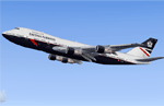
Project Opensky 747-100 V4, With reflective textures. Model Features include fully animated control surfaces, fully independent suspension, main gear steering, trim animation, opening passenger doors, opening cargo doors, dynamic flexing wings, animated tilting boogies, rolling wheels, animated thrust reverser's, fully reflective textures (each part has different degree of reflection based on material), accurate flight dynamics (accurate FDE with full profiles for wheels, tires, struts, leading/trailing struts, engine types ... Tested by real pilots.), newly re-defined individual part damage profiles, accurate spoiler animation, detailed textures, full night lighting, visible landing lights from the cockpit, reflective cockpit windows, crash effects, transparent nav light lenses, newly re-defined individual part damage profiles. Model Designer Hiroshi Igami. Flight Dynamics Designer Warren C. Daniel. Tested by Project Open Sky Members. Master textures by Corey Ford.
| Filename: | British_Airways_Lake_Windermere_Boeing_747136_GAWN.zip |
| License: | Freeware, limited distribution |
| Added: | 2nd January 2014, 20:58:18 |
| Downloads: | 622 |
| Author: | Stephen Groom | Project Opensky |
| Size: | 10.48 MB |


© 2001-2026 AVSIM Online
All Rights Reserved
Privacy Policy |