
Where Flight Simulation Enthusiasts Gather from Around the World!
AVSIM Library - Search Results

| Category: Flight Simulator 2004 - Scenery | |
| "Himalayan Peaks" LOD10 Mesh, Volume 8 - Tirich Mir and Pamir |

|
Images related to this file:
File Description:
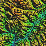
Highly detailed terrain mesh of the Tirich Mir and Pamir areas, N36-39 E71-74. The files in this package are based on Shuttle Radar (SRTM) Version 2 data but with many of the void areas, especially the most significant sections, filled with elevation data generated from topographic maps by Jonathan de Ferranti. While Jonathan's work is unrelated to flight simulation he kindly gave me permission to compile his data for use in FS. The result is a wonderful improvement in detail and accuracy over any existing mesh file, freeware or commercial, based on SRTM or DTED data alone.
Due to the large area of the Himalayas I've compiled the source data as two separate series: the "Himalayan Peaks" series covers prominent mountains and ranges in higher detail and locally overrides any existing LOD9 terrain mesh. In addition, a LOD9 "base mesh" series covering the entire Himalayas will be available for those who do not yet have an add-on terrain mesh of these beautiful mountains.
| Filename: | Himalayan_Peaks_LOD10_Mesh_Volume_8__Tirich_Mir_an.zip |
| License: | Freeware, limited distribution |
| Added: | 29th May 2010, 08:52:47 |
| Downloads: | 9,105 |
| Author: | Holger Sandmann, Jonathan de Ferranti |
| Size: | 47.94 MB |
| Category: Flight Simulator 2004 - Scenery | |
| Himalayas LOD9 Base Mesh, Volume 5 - Hindu Kush and Pamir |
|
Images related to this file:
File Description:
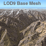
Detailed terrain mesh of the Hindu Kush and Pamir Ranges, N32-40 E70-76. The files in this package are based on Shuttle Radar (SRTM) Version 2 data but with many of the void areas, especially the most significant sections, filled with elevation data generated from topographic maps by Jonathan de Ferranti. While Jonathan's work is unrelated to flight simulation he kindly gave me permission to compile his data for use in FS. The result is a wonderful improvement in detail and accuracy over any existing mesh file, freeware or commercial, based on SRTM or DTED data alone.
Due to the large area of the Himalayas I've compiled the source data as two separate series: the "Himalayan Peaks" series covers prominent mountains and ranges in higher detail and locally overrides any existing LOD9 terrain mesh. In addition, the LOD9 "base mesh" series, with LOD8 and LOD7 "buffer" mesh files, covering the entire Himalayas, is meant for those who do not yet have an add-on terrain mesh of these beautiful mountains.
| Filename: | Himalayas_LOD9_Base_Mesh_Volume_5__Hindu_Kush_and_.zip |
| License: | Freeware, limited distribution |
| Added: | 29th May 2010, 08:57:29 |
| Downloads: | 7,604 |
| Author: | Holger Sandmann, Jonathan de Ferranti |
| Size: | 85.72 MB |
| Category: Flight Simulator 2004 - Scenery | |
| Himalayas LOD9 Base Mesh, Volume 1 - Southeastern Ranges |
|
Images related to this file:
File Description:
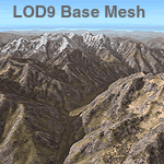
Detailed terrain mesh of the Southeastern Himalayan Ranges, N26-32 E90-98. The files in this package are based on Shuttle Radar (SRTM) Version 2 data but with many of the void areas, especially the most significant sections, filled with elevation data generated from topographic maps by Jonathan de Ferranti. While Jonathan's work is unrelated to flight simulation he kindly gave me permission to compile his data for use in FS. The result is a wonderful improvement in detail and accuracy over any existing mesh file, freeware or commercial, based on SRTM or DTED data alone.
Due to the large area of the Himalayas I've compiled the source data as two separate series: the "Himalayan Peaks" series covers prominent mountains and ranges in higher detail and locally overrides any existing LOD9 terrain mesh. In addition, a LOD9 "base mesh" series, with LOD8 and LOD7 "buffer" mesh files, covering the entire Himalayas, is meant for those who do not yet have an add-on terrain mesh of these beautiful mountains.
| Filename: | Himalayas_LOD9_Base_Mesh_Volume_1__Southeastern_Ra.zip |
| License: | Freeware, limited distribution |
| Added: | 29th May 2010, 09:01:26 |
| Downloads: | 10,299 |
| Author: | Holger Sandmann, Jonathan de Ferranti |
| Size: | 71.82 MB |
| Category: Flight Simulator 2004 - Scenery | |
| Himalayas LOD9 Base Mesh, Volume 3 - Southwestern Ranges |
|
Images related to this file:
File Description:
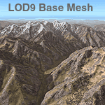
Detailed terrain mesh of the Southwestern Himalayan Ranges, N28-37 E78-82. The files in this package are based on Shuttle Radar (SRTM) Version 2 data but with many of the void areas, especially the most significant sections, filled with elevation data generated from topographic maps by Jonathan de Ferranti. While Jonathan's work is unrelated to flight simulation he kindly gave me permission to compile his data for use in FS. The result is a wonderful improvement in detail and accuracy over any existing mesh file, freeware or commercial, based on SRTM or DTED data alone.
Due to the large area of the Himalayas I've compiled the source data as two separate series: the "Himalayan Peaks" series covers prominent mountains and ranges in higher detail and locally overrides any existing LOD9 terrain mesh. In addition, the LOD9 "base mesh" series, with LOD8 and LOD7 "buffer" mesh files, covering the entire Himalayas, is meant for those who do not yet have an add-on terrain mesh of these beautiful mountains.
| Filename: | Himalayas_LOD9_Base_Mesh_Volume_3__Southwestern_Ra.zip |
| License: | Freeware, limited distribution |
| Added: | 30th May 2010, 10:00:26 |
| Downloads: | 155,808 |
| Author: | Holger Sandmann, Jonathan de Ferranti |
| Size: | 62.16 MB |
| Category: Flight Simulator 2004 - Aircraft Repaints, Textures and Modifications | |
| Bahamasair NC Boeing 737-275/Adv (C6-BGK) |
|
Images related to this file:
File Description:
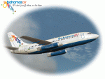
For all of you "Pilots of the Caribbean" out there, I am proud to present this realistic, detailed repaint of Bahamasair's Boeing 737-275, registration C6-BGK. This is one of 2 Boeing 737's operated by Bahamasair. This aircraft makes regular runs to and from MYNN (Nassau, Bahamas) to Ft. Lauderdale/Hollywood (KFLL), Miami (KMIA) and Orlando (KMCO). This repaint has a hand rendered 'Bahamasair' logo as well as a hand-painted tail logo. They are crisp and sharp. Although the Tinmouse paint kit has a nice weathering and dirt layer in it, I made the grime a tad more realistic as this bird regularly shows her wear. If you want to light up your 'mouse' at night, I recommend Matthew Lue's Tinmouse II lighting effects (AVSIM DLID 89742).
This is a textures only package; you must have the Tinmouse 737-200adv v2 base package and updates available here at AVSIM (tinmouse_ii_v1_25.zip). The textures in this repaint are 32-bit with no mips. NOTE: This is a re-upload due to the AVSIM site compromise.
| Filename: | Bahamasair_NC_Boeing_737275Adv_C6BGK.zip |
| License: | Freeware, limited distribution |
| Added: | 7th June 2010, 09:24:55 |
| Downloads: | 1,534 |
| Author: | Jeffrey S. Bryner, Tinmouse II Project |
| Size: | 8.36 MB |
| Category: Flight Simulator X - AFCAD Files | |
| Fla-Net Airport (0NJ5), NJ |
|
File Description:
This another weird airport entry in the FSX database. The real 0NJ5 is the Meadowlands Sports Complex Heliport #2, and this just shows up as a random turf strip up near Netcong/Flanders in northern NJ. I could not find any specific information regarding the airport online, and while it does appear to once harbour the room and terrain for a grass strip, it's largely overgrown, even in the current MegaScenery Earth textures. So I've removed the strip entirely. There is still a start at the northwest end of where the strip used to be if you want to travel there, but that's it.
Scenery constructed with use of satellite images/streetview, the author has not been there in person.
This scenery is meant to be used in conjunction with MegaScenery Earth New York 005. It is not required, but apron use is minimized to allow satellite scenery to show through as much as possible, and objects are placed based on the MSE textures - lack of it may make scenery look out of place.
| Filename: | FlaNet_Airport_0NJ5_NJ.zip |
| License: | Freeware |
| Added: | 21st October 2010, 23:23:44 |
| Downloads: | 188 |
| Author: | Drew Sikora |
| Size: | 199.2 KB |
| Category: Flight Simulator X - Panels | |
| General Dynamics F-111 PIG HUD PROJECT |
|
Images related to this file:
File Description:
FSX F-111 PIG HUD PROJECT - Navigation/Situation awareness cockpit.
REVISION 6.UPGRADE. MUST already have fxpiggb5.zip installed.
New features:In cockpit Pave Tack Display with full control allows views
in all directions, pitch,zoom and altitude, Terrain shading added to 2 GPS
displays, Virtual Cockpit layout improved, Flt Pln leg toggle SW,Precision
airspeed capable,Revised 56 pge Flight Manual includes new TFR procedures.
Adds to what is already an extreme capability panel and package packed
with custom instruments and concepts not available in other aircraft.
All instruments and text are sized to be clearly and easily readable.
Includes enhanced HUD, multiple radars,GPS units,MFDs,and effects,TFR,
autopilot/autothrottle, is Carrier and Air to Air capable,ICAO entry and
day/night/IFR/VFR navigation with constant current position awareness.
HUD available in all views including the 10 Camera views. This package sets
the benchmark for the amount, type of data provided and its presentation.
Possibly the best pilot friendly military aircraft available.
By Karol Chlebowski.
| Filename: | General_Dynamics_F111_PIG_HUD_PROJECT.zip |
| License: | Check within download |
| Added: | 17th September 2010, 23:53:26 |
| Downloads: | 409 |
| Author: | Karol Chlebowski |
| Size: | 14.7 MB |
| Category: Flight Simulator X - Aircraft Repaints, Textures and Modifications | |
| General Dynamics F-16D Block 52 Egyptian Air Force (Peace Vectors Tail) |
|
Images related to this file:
File Description:

This is a repaint of the Kirk Ollson F-16D Model, texture created, modified and enhanced to form the F-16D Block 52 of the EAF
The repaint is an Egyptian Air Force F-16D 2 seater fighting falcon, It is a falcon of the 25th anviersary
of the Peace Vectors program, in which Egypt first aquired F-16's and continues to do so at this moment.
The tail has a Peace Vectors stamp or sticker on it with high readable quality.
The repaint and tail is photorealistic with many photos used to create the repaint.
if you have any comments or questions, please visit my website at: http://www.projecthighsky.110mb.com
The original model is made by Kirk Ollson
Repaint made by Joseph Botros
This is an FSX-Only repaint (textures were updated to work with FSX only, it may work in FS9, though not
tested, install to FS9 at your own risk. 100% compatible with FSX.
You need "f16d_X.zip" for this repaint. Can be found at FS-freeware.com
| Filename: | General_Dynamics_F16D_Block_52_Egyptian_Air_Force_.zip |
| License: | Freeware |
| Added: | 17th July 2010, 23:33:07 |
| Downloads: | 304 |
| Author: | Joseph Botros (Kirk Ollson) |
| Size: | 3.42 MB |
| Category: Flight Simulator X - Gauges | |
| TCAS and Traffic Display Gauge V1.0 |
|
Images related to this file:
File Description:
This TCAS and Traffic Display Gauge Version 1.0 has been developed for the FSX Flight Simulator SP1/2. It should also work with Acceleration. The functionality for the TCAS part is based on general specs for commercial aircrafts. It does not provide in detail the function for a specific aircraft model. It is a generic gauge, and can be simply added to any aircraft as a standalone pop-up window.
In addition the gauge provides a AI traffic display in the ranges of 10,20, and 40 miles.
Within this display mode, no TCAS rules are valid, which means all AI aircraft are displayed independent of any altitude or distance.
For installation and functional description look at the doc inside the Zip.
CREDIT goes to:
Stefan Schneider for his support on special XML issues and TCAS functionality.
Bob Familton for his review of the documentation and testing for SP1 FSX.
Doug Dawson for his dsd-XML-sound interface in order to generate the sounds.
| Filename: | TCAS_and_Traffic_Display_Gauge_V10.zip |
| License: | Freeware |
| Added: | 13th September 2010, 12:58:33 |
| Downloads: | 1,727 |
| Author: | Dietmar Loleit |
| Size: | 979.49 KB |
| Category: Flight Simulator X - Gauges | |
| PFD for Flight Instrument Panel |
|
Images related to this file:
File Description:
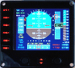
For Saitek Pro Flight Instrument Panel.
This Primary Flight Display (PFD) Glass type gauge provides following utilities:
1. Artificial horizon with sliding bug (yellow).
2. Moving tapes for: Air speed, Altitude, Heading.
3. Detail window for altitude.
4. Needle for vertical speed.
5. Glide slope and Localizer bars, they appear when in range of ILS only.
6. Digital values for: Total Air Temperature (TAT), QNH, Mach number, VOR 1 selected course, VOR 1 bearing, DME 1 range, Radio height altitude up to 2000 feet, above a bar go through the window, vertical speed, a minus sign appears when vertical speed is negative.
7. Autopilot bugs for: Selected altitude, Selected speed, Selected heading. Rmk: Bugs appear only when autopilot ALT, SPD or HDG functions are selected.
8. Display Autopilot functions with Text acronysm in yellow: AP, Autopilot Master On, THR, auto throttle mode engaged, SPD, air speed mode selected, HDG, heading mode selected, NAV, navigation mode selected (VOR 1), APR, approach mode selected, BC, back course mode selected.
9. Knobs functions: Right, allows to change QNH value. Left, allows to move VOR 1 course.
| Filename: | PFD_for_Flight_Instrument_Panel.zip |
| License: | Freeware |
| Added: | 23rd May 2011, 22:37:18 |
| Downloads: | 1,096 |
| Author: | Philippe Verhaege |
| Size: | 249.48 KB |


© 2001-2026 AVSIM Online
All Rights Reserved
Privacy Policy |