
Where Flight Simulation Enthusiasts Gather from Around the World!
AVSIM Library - Search Results

| Category: Flight Simulator X - Scenery | |
| Honduras Islands v3 |

|
Images related to this file:
File Description:

Version 3 includes all previous patches and updates. This version also restructures the file system to be fully compatible with the ORBX "FTX Global openLC North America" product as well as adding functionality for default FSX users. Additionally, water class scenery is updated to appear more realistic, MHRO is updated to reflect the newly expanded apron, and SRTMGL1 (30m) mesh is included. All landclass polygons and coastlines were meticulously hand-drawn directly from satellite imagery to provide the most detailed and accurate scenery available for this region.
This project rebuilds the islands of Roatán, Barbareta, Guanaja, and Utila, and adds Cayos Cochinos and the numerous cays associated with the "Islas de la Bahia" (Islands of the Bay). Roatán (MHRO), Guanaja (GJAJ/MHNJ) and Puerto Lempira (MHPL) are completely overhauled and positioning is corrected. New and fully functioning AI airports are added for Utila (MHUT), Fort Cay (MHFC) and Cochino Pequeño (MHCP) of the Cayos Cochinos chain, and La Ceiba (MHLC) is modified to accommodate more AI traffic. Accurate coastlines, lakes, road and river data, as well as corrected landclass are provided based on the latest available satellite imagery. GA flight plans are provided to add or enhance service to the smaller islands. Updates were created or rebuilt in a manner which carefully aligned airport data with current satellite imagery, when available. Scenery was created using Airport Design Editor X v1.70.6042, SBuilderX 3.13, and the FSX Object Placement Tool. Scenery objects were added and modified from stock FSX scenery to resemble as closely as possible the actual airports.
| Filename: | Honduras_Islands_v3.zip |
| License: | Freeware |
| Added: | 23rd December 2016, 08:17:26 |
| Downloads: | 1,614 |
| Author: | Carlyle Sharpe |
| Size: | 17.35 MB |
| Category: Flight Simulator X - Aircraft Repaints, Textures and Modifications | |
| Airbus A318 FD Special Version V2 |
|
Images related to this file:
File Description:
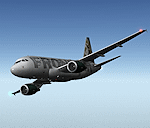
After my initial work on the Project airbus A318 (V1.2) and on the project Airbus A319 (A319 Special Version V2), I present my special version of the Project Airbus A318 Version 2, which includes many improvements and new features.
The instrument panel has been adapted of the Stefan Liebe work, on which I have added many changes. I created a vertical navigation gauge (VNAV gauge) which manages automatically the climb of the aircraft like a FMC (it can be work in several stage), with pre-programmed data according the weight of the aircraft and the altitude. The autopilot is constant MACH, with a transition altitude of 25000ft, thus avoiding the risk of overspeed. The ND will display information page in real time on the flight plan, an information page on the destination airport and display the radar map of the terrain, with AI traffic in real time.
All instruments are active in the VC and 2D panel. The instruments were completed by a multitude of small details. I have improved the autolanding function, with a soft landing (rounded). There is a complete operating manual in PDF format, in English and in French. Of course, TOGA mode and Autobrake mode works. Only compatible with FSX SP2 or Acceleration. See the readme file and the user manual for information and copyright. This version is also a big upgrade on the A318 special version 1.0 and 1.2. This is not an update, but a new aircraft. Francois Dore.
| Filename: | Airbus_A318_FD_Special_Version_V2.zip |
| License: | Freeware, limited distribution |
| Added: | 6th April 2012, 19:59:27 |
| Downloads: | 11,992 |
| Author: | Francois Dore, Project Airbus, Stefan Liebe |
| Size: | 134.71 MB |
| Category: Flight Simulator 2004 - Scenery | |
| Dixie A05 Forest Service airfield in Idaho USA |
|
Images related to this file:
File Description:
This airfield is in the mountains of Idaho, the first in a series. There are not many mountain airfields that can be succesfully modelled in FS9 because the FS9 terrain does not always match reality; no creek for instance, or the valley too small. There are others where the grass strip is all there is, so there is nothing to model apart from resizing the cleared area. Some are well known, well maintained, have clean shower facilities, and are well used for a weekend by small planes with two people and a tent on board, for instance Johnson Creek. Others are less well known but still in good condition, such as Dixie or Big Creek. And there are also some with cabin rental facilities, such as Sulphur Creek Ranch. Other names come to mind, such as Flying B and Pistol Creek, but unfortunately for one reason or another these could not be made. The other difficulty involving hills is succesful AI landings and take offs. At Johnson Creek, for instance, the wind should be from the south to make AI landings more likely to succeed. Dixie is south of the village of the same name, and not to be confused with the dirt strip that is just beside the village. The runway is at 5,148 feet ASL, just over 4,000 feet long and aligned 18-36, and the parking area is at the northern end, opposite the Forest Service buildings. There is a chart of the area included, and to the south of Dixie is the next in the series, Big Creek U60.
| Filename: | Dixie_A05_Forest_Service_airfield_in_Idaho_USA.zip |
| License: | Freeware, limited distribution |
| Added: | 25th May 2017, 17:53:48 |
| Downloads: | 154 |
| Author: | Roger Wensley |
| Size: | 8.69 MB |
| Category: Flight Simulator 2004 - Scenery | |
| Big Creek U60 public use airfield in Idaho USA |
|
File Description:
This airfield is in the mountains of Idaho, 30 miles south of Dixie A05, which was the first in the series to be posted. Big Creek is now regularly used for picnic fly-ins and overnight camping, or for just a day of fishing in the creek; the creek does not appear in FS9 as it is not exactly huge, and within the Ultimate Terrain USA settings I have in fact turned streams off as in some cases they cross the grass or (in conjunction with the roads) left insufficient runway space. The U60 runway is at 5,743 feet ASl, 3,550 feet long, aligned 01-19, and in good condition. At the southern end there is the new replica of the old original Big Creek Lodge which was built in 1935. This burned down in 2008, and is now being rebuilt by a group of pilots, pilots having formed a large part of the early clientel courtesy of the grass strip. It is shown here as still under construction. There are also Forest Service buildings on the west side of the runway. All of this is located in the Frank Church Wilderness area and the Payette National Forest. The AI is increased at the weekends, reflecting reality, and also revised to use Boise as one of the starting places. Dixie is also reissued here with a revised positioning to fit with the roads. I had concluded that the roads were wrong, while in fact the position of the airstrip was at fault.
| Filename: | Big_Creek_U60_public_use_airfield_in_Idaho_USA.zip |
| License: | Freeware, limited distribution |
| Added: | 25th May 2017, 17:53:58 |
| Downloads: | 132 |
| Author: | Roger Wensley |
| Size: | 11.06 MB |
| Category: Flight Simulator 2004 - Miscellaneous Files | |
| Nick's Prop Dust v2.0 with Nick's ALL WET for Watercraft! |
|
File Description:
This package is an all new release of my original prop dust FX. This gauge/effects package automatically senses the terrain the aircraft is in contact with or flying over and changes the prop dust and water FX for the aircrafts prop/rotor wash based on dirt, dry mud or clay, snow, rain, water, ice, sand, gravel and short grass. In addition the real time surface conditions are also sensed. In example: a dry asphalt or concrete runway will produce no prop dust/wash; however, the same runway with snow/rain conditions present will automatically produce a throttle controlled snow/rain blowing effect. FX files and gauges are included for large and small, single engine, multi-engine, amphibians, helicopters, seaplanes and massive scale military and commercial land/water transports. This package requires manually editing/adding lines in the aircraft.cfg and panel.cfg files. The README files include very complete and comprehensive instructions with a quick and easy copy/paste file for all the Microsoft prop aircraft and 13 other popular aircraft. I have also provided a QUICK REFERENCE file for current Nicks Prop Dust users for the new seaplane gauge and new FX location formulas. Nick's ALL WET is wild splashing and spraying bow/skid water FX designed for amphibians, seaplanes and boats which includes water droplets on the 2D and VC windshield as the plane barrels through the water on takeoff and landing. There is an option to install Nick's ALL WET without the main dust FX package. ENJOY! from Nick Needham
| Filename: | Nicks_Prop_Dust_v20_with_Nicks_ALL_WET_for_Watercr.zip |
| License: | Freeware, limited distribution |
| Added: | 1st October 2005, 05:22:11 |
| Downloads: | 8,447 |
| Author: | Nick Needham |
| Size: | 2.88 MB |
| Category: Flight Simulator X - Scenery | |
| Toulouse Blagnac (LFBO) v1 |
|
File Description:
This is an addon scenery for FSX of the Toulouse Blagnac Airport LFBO. It has been made using the excellent freeware tool Airport Design Editor for the layout. I have used Sketchup from Google and Model Converter X to design the buildings of the airport.
You will find all the terminals of LFBO and the control tower, as well as the Airbus facilities of the A380 Lagardere plant North East of LFBO, the A380 delivery center Henry Ziegler North West of LFBO, and some buildings of the Airbus facilities in Blagnac, West of LFBO. All buildings have photo textures, most of them taking with my camera, as I am working in the area. All buildings include night textures. You have two landing pads for helicopters like in reality South East of LFBO.
I used google earth for some items position, but the current view not being up to date, I used my knowledge of the area to correctly position the taxiways, parkings, gates and building position.
I used the FSX generic buildings for the other missing buildings, however they have the size and position which corresponds as far as possible to the position of the real buildings. The surroundings of the airport not being too realistic with Ultimate Terrain X or with FSX, I have modified the landclass of the surroundings to make them look more in accordance with reality. I have changed the parking assignment to make sure that the usual traffic will park on the parkings E, F D AB, V and U.
| Filename: | Toulouse_Blagnac_LFBO_v1.zip |
| License: | Freeware |
| Added: | 21st December 2011, 13:09:29 |
| Downloads: | 23,277 |
| Author: | Jose Mauriz |
| Size: | 34.72 MB |
| Category: Flight Simulator X - Aircraft Repaints, Textures and Modifications | |
| Agusta Westland EH-101 v2 - Updated |
|
Images related to this file:
File Description:
FSX Agusta Westland EH 101 v2 Updated. The EH101 one of the world's best helicopters, but Microsoft did not put much effort into this model and it lacked a lot of stuff. The helicopter has been reworked to make it more like the real world aircraft. Reworked the aircraft configuration flight dynamics to stabilize the engine surging that occurs with the default aircraft. Reworked the air file to make the aircraft handle more realistically. Added a couple of landing lights on the rear struts found on the Asian and S.O.P. operators of aircraft. Added heat and exhaust effects to all three engines. Added new reflective strobes that double flash off body of aircraft. Added two working radars that will track aircraft. First the pilot's radar has tracking for aircraft only. Second the co-pilot's Radar has tracking for airports, land mass terrain following, aircraft, NDBs, VORs, airport ID. Added radar controls for both systems within the VC. Added easy to read MFD and PFD screens. Moved engine read gauges to lower level. Added Helmet Mount Display (HMD or HmountD) with mouse clickable switches with ground speed that will read in negative (reverse) flight and useable timer. Added radios (default Extra 300). Added pop-up GPS. Added pop-up door control gauge, for quick access to aircraft. Added pop-up light switch. Added switch-able vocal ground proximity warning system with fire alert, rotor low / high alert, under carriage alert, altitude alert Added auto-hover gauge. Added pop-up radar control for ground track system.
| Filename: | Agusta_Westland_EH101_v2__Updated.zip |
| License: | Freeware |
| Added: | 22nd August 2013, 22:49:01 |
| Downloads: | 1,693 |
| Author: | David Robles |
| Size: | 118.15 MB |
| Category: Flight Simulator 2004 - Scenery | |
| VFR of Lario, Area E2 - Como Lake, Italy (Update) |
|
Images related to this file:
File Description:
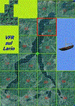
This 8th scenery covers approximately an area of 7.5x6 km, from S.Gregorio/Dongo (NW) to Colico (NE), and S.Siro (SW) to Tremenico/Aveno (SE) and includes six NLC piers: Dervio, Piona, Colico, Dongo, Musso, Pianello del Lario, in addition to the disused Cremia's one; a lot of dedicated buildings are included, as S.Tommaso of Canterbury church and fortification (Corenno), Cistercian abbey (Piona), pier and dock (Colico), S.Stefano church, factory buildings and airpollution control machinery (Dongo), Rezzonico's castle (S.Siro).
This VFR on Lario scenery includes several Dervio's details, and fully revises the previous Dervio scenery; Are included: Boldona's park office and stand, railway station, NLC shiphard, Pontile piers with Concordia steamer, dock bay with small floating pier and compass of the lake, S. Peter and Paul church and houses front of lake, hydro power station, Municipality and some other buildings, Castello's tower, windsurf school, windsurfers and kitesurfers on the lake, cross and Madonna on top of Legnoncino mountain. There are also included two viaducts between the tunnels of the freeway 36, with moted traffic. Catamarans Citta di Como and Tivano at Colico/Dongo piers together with other minor boats and docks alongside the lake coast; a moted regata with catamarans is placed in the lake between Pianello and Dervio.
This scenery SUPERSEDES AND CANCELS the previous "dervio_v2a" one, removed from the library. This is the eighth scenery of the "VFR of Lario" project, made with photorealistic terrain (multiseason & night) and with some 3D GMax realistic objects.
| Filename: | VFR_of_Lario_Area_E2__Como_Lake_Italy_Update.zip |
| License: | Freeware |
| Added: | 25th November 2012, 20:54:39 |
| Downloads: | 1,668 |
| Author: | Aldo Della Vedova, Daniele Lanfranchi, Gian Mario Verga |
| Size: | 39.39 MB |
| Category: Flight Simulator 2004 - AFCAD Files | |
| Airports used by MATVA |
|
File Description:
The MATVA Group offer you another package of Af2 files to replace the default ones for those airfields they visit, they do not have allocated gates. The 55 airfields in this package are in: Mongolia; (ZMUB) Ulaanbaatar, (ZMBN) Bulgan, (ZMMN) Moron, (ZMBH) Bayanhongor, (ZMAT) Altay, (ZMUL) Olgiy and (ZMCD) Choybalsan. Canada; (CYOA) Ekati, (CYHY) Hay River, (CYQT) Thunder Bay and (CYZF) Yellowknife. China; (ZHCC) Zhengzhou, (ZBHH) Hohhot and (ZHHH) Wuhan. Japan (RJNK) Komatsu and (RJOM) Matsuyama. S. Korea; (RKJJ) Gwangju, (RKNN) Gangneung , (RKNY) Yangyang, (RKPK) Pusan, (RKPU) Ulsan, (RKSS) Seoul/Gimpo and (RKTN) Daegu. Russia; (UIBB) Bratsk, (ULAA) Arkhangel'sk, (UMMS) Minsk2, (UNOO) Omsk, (URWA) Astrakhan, (URWW) Volgograd, (USSS) Yekaterinburg, (UUDD) Moscow/Domededovo, (UWGG) Nizhny Novgorod and (UWWW) Samara. (UKBB) Kiev, Ukraine. (ZKPY) Pyongyang, N. Korea. (ROAH) Naha, Okinawa. (RPVM) Cebu, Philippines. (EETN) Talinn, Estonia. (EGHH) Bournemouth, UK. (EVRA) Riga(LKPR) Prague. (OOMS) Muscat, Oman. (PTRO) Koror, Micronesia. (SLLP) La Paz, Bolivia. (VGZR) Dhaka, Bangladesh. (VYYY) Yangon, Myanmar. (WBSB) Brunei. (LIBD) Bari, Italy. (ESGG) Goteburg, Sweden. Also included are reworks of our previously released (EGPE) Inverness, (EIDW) Dublin, (OIII) Tehran, (ZSPD) Shanghai, (ULLI) St. Petersburg, and (SVMI) Maiquetia, Venezuela. These AFCADS are in no way intended to resemble their real world counterparts. They have been created to allow AI and flyable aircraft to do their thing, any problems get in touch at www.matva.org.uk :O) enjoy!!!!
| Filename: | Airports_used_by_MATVA.zip |
| License: | Freeware, limited distribution |
| Added: | 3rd January 2007, 00:59:49 |
| Downloads: | 8,586 |
| Author: | Louie Maclennan MATVA |
| Size: | 232.02 KB |
| Category: Flight Simulator 2004 - AI Aircraft | |
| United Express Air Wisconsin OC BAe 146-100 N463AP |
|
Images related to this file:
File Description:

United Express Air Wisconsin OC FMAI BAe 146-100 N463AP //
Air Wisconsin Airlines Corporation is an airline based at Outagamie County Regional Airport in the town of Greenville, Wisconsin, United States, near Appleton. Air Wisconsin is the largest privately held regional airline in the United States. It operates regional jet flights as US Airways Express under contract to US Airways, serving 69 cities in the US and Canada with hubs at Philadelphia International Airport and Ronald Reagan Washington National Airport. The airline is also a ground-handler for United Express at over 30 locations. Source Wiki. //
Flightplans may be available on AVSIM/Flightsim.com.
This works for both FS9 and FSX. Tested in FSX. FS9 model used.
For FSX users make sure you have UNCHECKED "Aircraft casts shadows on the ground" under the Aircraft - Exterior Settings in FSX to make any FS9-based model visible during the day!
Texture quality; FSX Native: DDS DXT5 with alpha. FS9 Native: BMP DXT3 with alpha.
FSX Light Fix included in the DDS night texture.
Custom Light Map. Custom Shadows, Highs, Weathering as usual...
Included repaint is for the following model; BAe 146-100 from FMAI
Model is available on AVSIM, FlightSim.com or on the author/developers site.
You need the basekit for this to work!!
Do make sure you copy the texture folder(s) in the respective folder.
| Filename: | United_Express_Air_Wisconsin_OC_BAe_146100_N463AP.zip |
| License: | Freeware, limited distribution |
| Added: | 5th August 2012, 13:45:16 |
| Downloads: | 401 |
| Author: | Stephan Faessler / ImpulseAI |
| Size: | 1.55 MB |


© 2001-2026 AVSIM Online
All Rights Reserved
Privacy Policy |